United States » Oregon »
Lower Deschutes River (BLM)
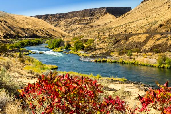
Lower Deschutes River, managed by the Bureau of Land Management (BLM), is a stunning natural wonder located in Oregon. The river flows through a deep canyon, offering breathtaking views of the surrounding landscape. The area is a popular destination for outdoor enthusiasts, including photographers, who come to capture the beauty of the river and its surroundings. There are several photography locations along the river, including the White River Falls State Park, which offers stunning views of the river and the surrounding cliffs. Other popular spots include the Maupin area, which is known for its scenic beauty and abundant wildlife, and the Warm Springs Reservation, which offers a unique cultural experience and stunning views of the river.

by Bonnie Moreland
The Deschutes (deh-Shoots) River is a major tributary of the Columbia River. The river provides much of the drainage on the eastern side of the Cascade Range in Oregon, gathering many of the tributaries that descend from the drier, eastern flank of the mountains. The Deschutes provided an important route to and from the Columbia for Native Americans for thousands of years, and then in the 19th century for pioneers on the Oregon Trail. The river flows mostly through rugged and arid country, and its valley provides a cultural heart for central Oregon.
Thanks to all Phoide contributors to Lower Deschutes River (BLM)!
Most notably Bonnie Moreland.