
Badwater Road
- Antoine Rivarol.
| facebook | 500px | ferpectshotz |
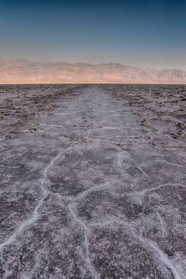
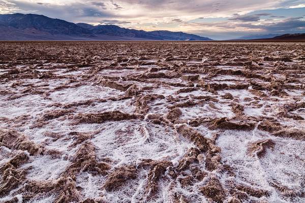
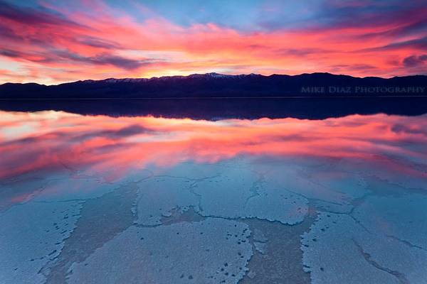
I took this shot at Badwater Basin, Death Valley National Park. At 282 feet below sea level it is the lowest point in all of North America, even more interesting is that Mt Whitney which is the highest peak in the lower 48 states is only 85 miles away. The basin was considered the lowest elevation in the Western Hemisphere until the discovery of Laguna del Carbón in Argentina at −344 ft (−105 m). At Badwater, significant rainstorms flood the valley bottom periodically, covering the salt pan with a thin sheet of standing water. Each newly-formed lake does not last long though, because the 1.9 in (48 mm) of average rainfall is overwhelmed by a 150 in (3,800 mm) annual evaporation rate.
We visited the place early in the morning as sun was lighting up the Panamint Range and saw many tourists approaching but none of them ventured out into the salt flats deciding to just observe from the platform. We decided to venture into the salt flats and were rewarded with spectacular hexagonal formations of the salt crust.
It was well worth the sight and I would love to return here and shoot the stars one day.
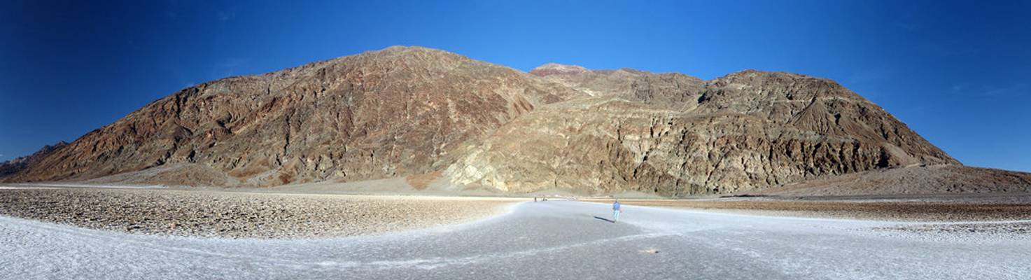
At 279.8 feet below sea level Badwater is one of the lowest points in the western hemisphere. The scale of this is pretty deceiving. What looks to...
![Resurrection [explored]](https://cdn.phoide.com/Thumbs/25171504773.jpg)
Wildflowers blooming in Death Valley National Park, California. This is an exceptional year for blooms in Death Valley, what they call a...
It was great making it back to Death Valley again, this time with a focus on photography. The desert is such a great place for photography, and...
Thanks to all Phoide contributors to Badwater Road!
Most notably Yi Jiang and Sandeep Thomas.