
Dorset
Dorset, located in the South West of England, is a picturesque county that boasts stunning landscapes and a rich history. With its rugged coastline, rolling hills, and charming villages, it's no wonder that Dorset has become a popular destination for photographers. From the iconic Durdle Door and Lulworth Cove to the historic Corfe Castle and the Jurassic Coast, there are plenty of photography locations to explore in Dorset.
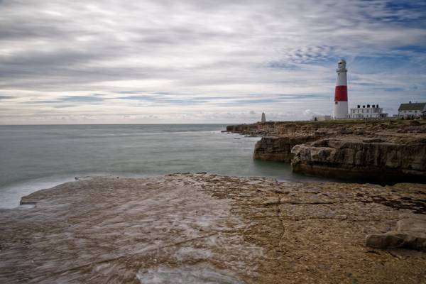
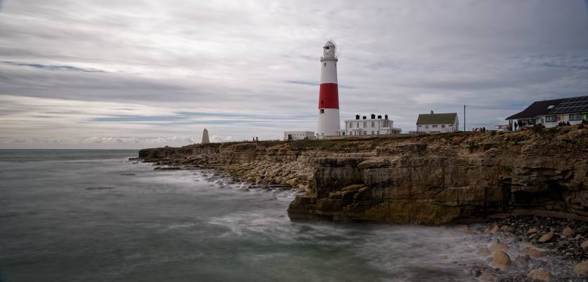
The name "Portland Bill" has its roots in "The Beel" as named on early maps. This derived from the beak shape of Portland Bill. From 1588 onwards, when the area was part of a crucial Armanda invasion-warning network, it was often named "The Beacon". Quarrying began at Portland Bill in the mid 19th century but remained a small scale operation into the early 20th century. Quarries were on the west side of the bill and stone was transported along a short tramway to a shipping quay, now the site of Red Crane. An area absorbed into the quarries was White Hole, where quarrymen cut away a natural arch to form Pulpit Rock in the 1870s. It was intentionally left as a quarrying relic and was formed with religious associations; the large slab of rock leaning against the main stack depicted an open bible leaning on a pulpit. Surrounding the rock is the rather charmingly-named Snail Shore, a surface containing snail, oyster and mollusc shells that once made up a Jurassic seabed thriving with marine life around 150 million years ago.
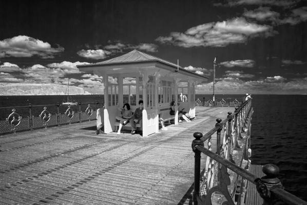
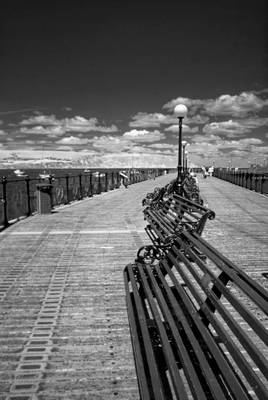
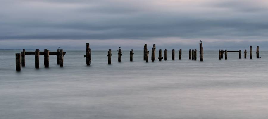
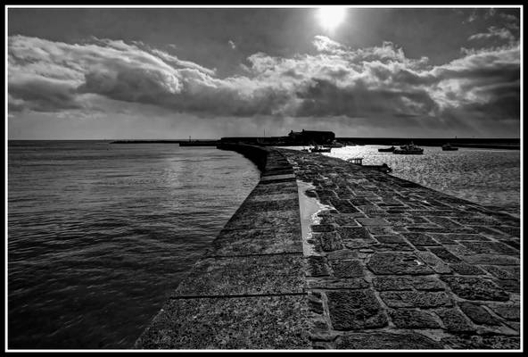
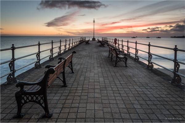
Swanage Pier is a Victorian pier which extends into the southern end of Swanage Bay near the town of Swanage, in the south-east of Dorset. The first Swanage Pier, which was 750 feet long, was built between 1859 and 1860 for use primarily by the local stone quarrying industry and included a tramway which ran the length of the pier and some way along the seafront. When local businessman George Burt introduced regular steamer services between Swanage and nearby towns Poole and Bournemouth in 1874, a need became apparent for a second pier to be built primarily for use by passenger steamers. Construction on the new pier began in 1895, and by 1896 was first used by a steamer. The pier was officially opened for traffic on 29 March 1897. While regular steamer services ran on the new pier up until 1966, the older original pier declined along with the stone industry it served some years earlier. Today all that remains of the old pier are some of the timber piles. After steamer services discontinued in 1966 the remaining pleasure pier also began to fall into disrepair. In 1976 Grade II listed status was awarded to the pier. After a failed attempt to restore the pier by a development firm in 1986, Swanage Pier Trust took over ownership of the pier in 1994.
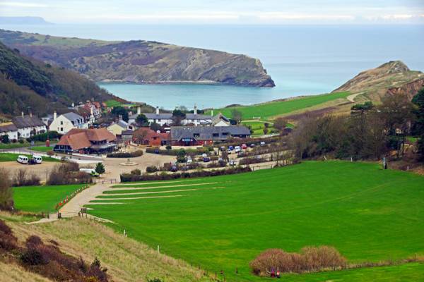
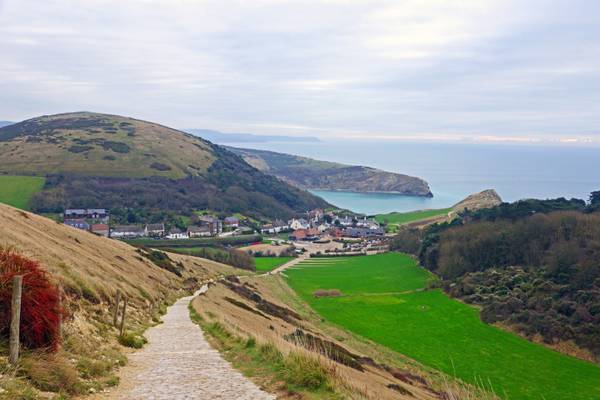
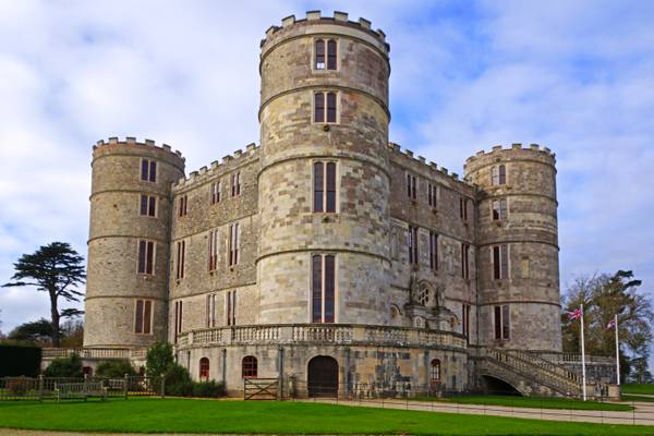
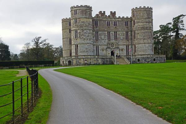
Isle of Purbeck, Dorset
Swanage Pier is a Victorian pier which extends into the southern end of Swanage Bay near the town of Swanage, in the south-east of Dorset. The first Swanage Pier, which was 750 feet long, was built between 1859 and 1860 for use primarily by the local stone quarrying industry and included a tramway which ran the length of the pier and some way along the seafront. When local businessman George Burt introduced regular steamer services between Swanage and nearby towns Poole and Bournemouth in 1874, a need became apparent for a second pier to be built primarily for use by passenger steamers. Construction on the new pier began in 1895, and by 1896 was first used by a steamer. The pier was officially opened for traffic on 29 March 1897. While regular steamer services ran on the new pier up until 1966, the older original pier declined along with the stone industry it served some years earlier. Today all that remains of the old pier are some of the timber piles. After steamer services discontinued in 1966 the remaining pleasure pier also began to fall into disrepair. In 1976 Grade II listed status was awarded to the pier. After a failed attempt to restore the pier by a development firm in 1986, Swanage Pier Trust took over ownership of the pier in 1994.
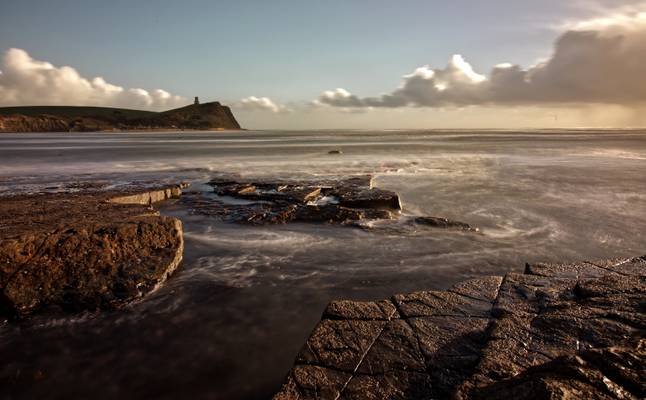
Kimmeridge Bay
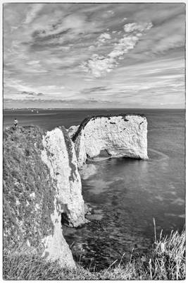
Standing tall on Handfast Point at the southern end of Studland Bay is one of the most famous landmarks on the South Coast – Old Harry. They are part of the Jurassic Coast World Heritage Site and are managed by the National Trust. The chalk formations are popularly known as Old Harry Rocks, but the name Old Harry actually refers to the single stack of chalk standing furthest out to sea. Until 1896 there was another stack known as Old Harry’s Wife, but erosion caused her to tumble into the sea, leaving just a stump. There are a number of theories about where Old Harry got its name. It is reputedly named after either a famous local pirate (Harry Paye) or the devil. The top of the cliff nearby is known as Old Nick’s Ground which is another name for the devil.
Info taken from Visit Dorset.com website
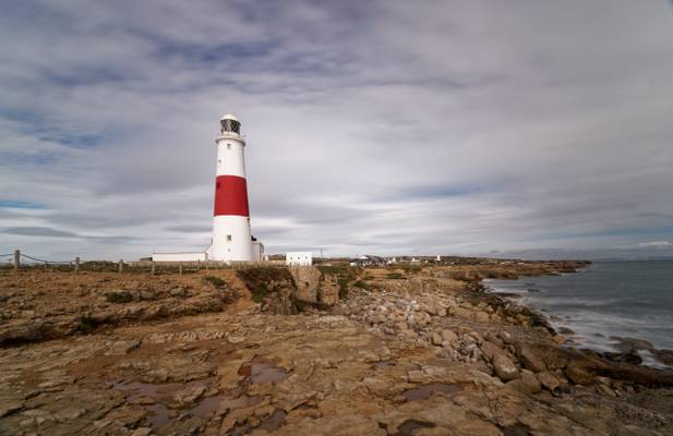
The name "Portland Bill" has its roots in "The Beel" as named on early maps. This derived from the beak shape of Portland Bill. From 1588 onwards, when the area was part of a crucial Armanda invasion-warning network, it was often named "The Beacon".
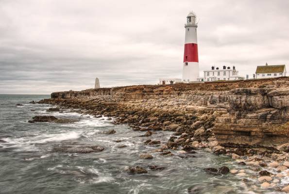
As Portland Bill's largest and most recent lighthouse, the Trinity House operated Portland Bill Lighthouse is distinctively white and red striped, standing at a height of 41 metres (135 ft). It was completed by 1906 and first shone out on 11 January 1906. The lighthouse guides passing vessels through the hazardous waters surrounding the Bill, while also acting as a way-mark for ships navigating the English Channel.
The name "Portland Bill" has its roots in "The Beel" as named on early maps. This derived from the beak shape of Portland Bill. From 1588 onwards, when the area was part of a crucial Armanda invasion-warning network, it was often named "The Beacon".
As Portland Bill's largest and most recent lighthouse, the Trinity House operated Portland Bill Lighthouse is distinctively white and red striped, standing at a height of 41 metres (135 ft). It was completed by 1906 and first shone out on 11 January 1906. The lighthouse guides passing vessels through the hazardous waters surrounding the Bill, while also acting as a way-mark for ships navigating the English Channel.
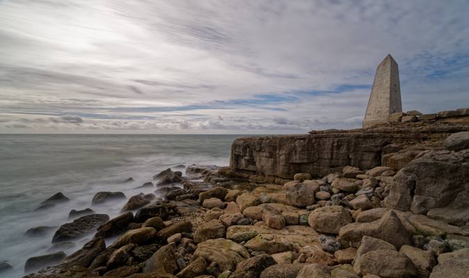
The name "Portland Bill" has its roots in "The Beel" as named on early maps. This derived from the beak shape of Portland Bill. From 1588 onwards, when the area was part of a crucial Armanda invasion-warning network, it was often named "The Beacon". The Trinity House Obelisk, also known as the Trinity House Landmark, is a 19th-century obelisk located at Portland Bill, on the Isle of Portland, Dorset, England. Built as a daymark, it has been Grade II Listed since 1978. The obelisk was built in 1844 to warn ships off the coast of Portland Bill. It stands at the southern tip of the Isle of Portland, acting as a warning of the low shelf of rock extending 30 metres south into the sea. The obelisk is made of Portland stone and is seven metres in height. It is inscribed "TH 1844" on its north face. The monument was saved from threatened demolition in 2002 after Trinity House deemed it too expensive to maintain
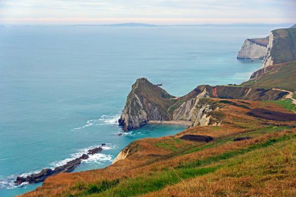
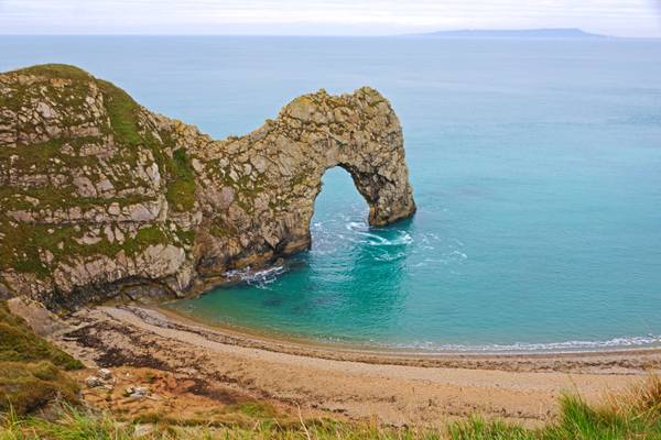
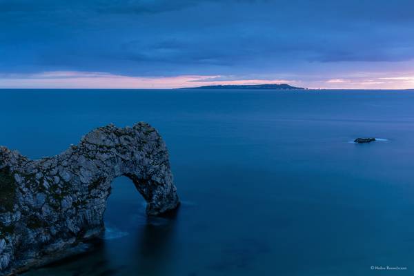
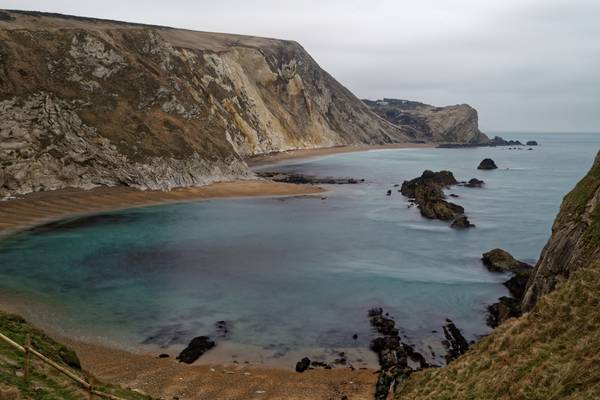
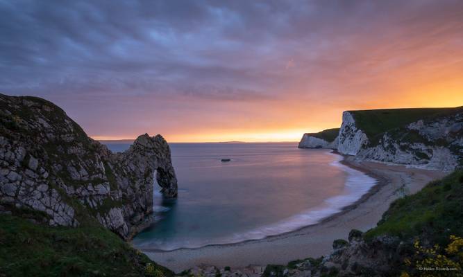
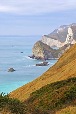
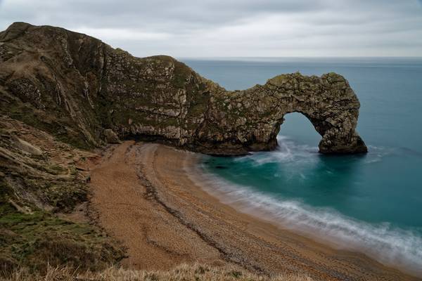
Bay and coastline next to Durdle Door
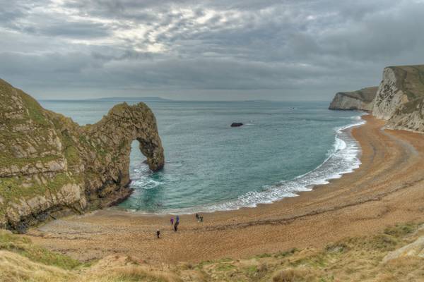
Jurassic Coast, Dorset
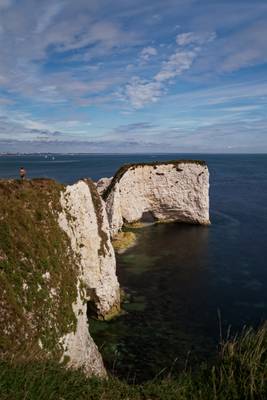
Isle of Purbeck, Dorset
Dorset
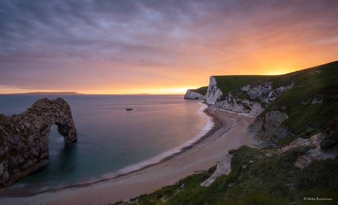
This is what I got at sunset after a grey and cloudy afternoon.
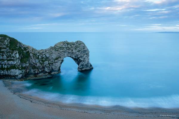
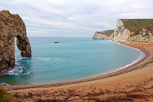
Durdle Door, Dorset
Thank you for looking! Your comments and/or awards are very much appreciated.
Standing tall on Handfast Point at the southern end of Studland Bay is one of the most famous landmarks on the South Coast – Old Harry. They are part of the Jurassic Coast World Heritage Site and are managed by the National Trust. The chalk formations are popularly known as Old Harry Rocks, but the name Old Harry actually refers to the single stack of chalk standing furthest out to sea. Until 1896 there was another stack known as Old Harry’s Wife, but erosion caused her to tumble into the sea, leaving just a stump. There are a number of theories about where Old Harry got its name. It is reputedly named after either a famous local pirate (Harry Paye) or the devil. The top of the cliff nearby is known as Old Nick’s Ground which is another name for the devil.
Info taken from Visit Dorset.com website
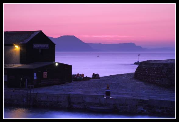
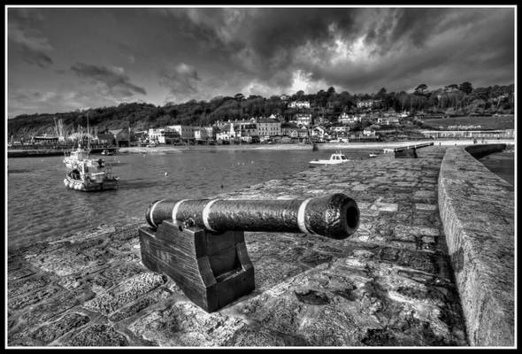
This was the setting that greeted our group of 'Westcountry Clickers' as we assembled on the Cobb at Lyme Regis.
Sunrise was due for 6.19am and as it happened, it was already very light at 5.45 when we arrived.
A solo photographer had lined himself up along the Cobb before we all arrived and seemed determined to hold his ground along the wall, so I decided to find an alternate composition nearby that did the early morning light justice.
It was a bit of a scramble to get set up before the light changed as the sun rose above the horizon.
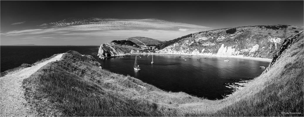
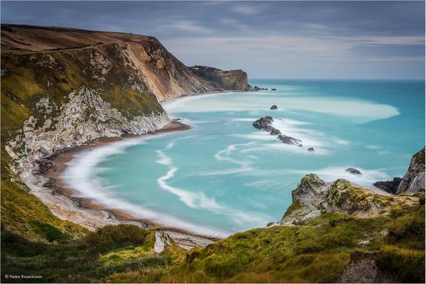
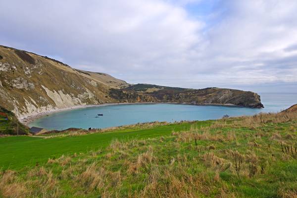
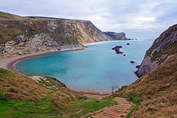
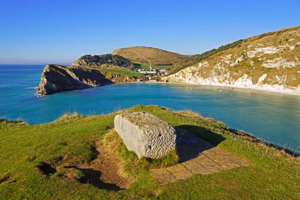
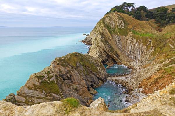
The horseshoe cove at Lulworth was formed approximately 10,000 years ago and is simply stunning.
Jurassic Coast, Dorset
The name "Portland Bill" has its roots in "The Beel" as named on early maps. This derived from the beak shape of Portland Bill. From 1588 onwards, when the area was part of a crucial Armanda invasion-warning network, it was often named "The Beacon".
As Portland Bill's largest and most recent lighthouse, the Trinity House operated Portland Bill Lighthouse is distinctively white and red striped, standing at a height of 41 metres (135 ft). It was completed by 1906 and first shone out on 11 January 1906. The lighthouse guides passing vessels through the hazardous waters surrounding the Bill, while also acting as a way-mark for ships navigating the English Channel.
My website: Deep Mono Photography
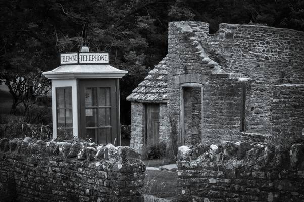
Tyneham got its first public telephone kiosk during the winter of 1929. Before this date the villagers would keep in touch with the outside world by telegram or later by using the telephone in the back room of the Post Office.
Tyneham Valley was evacuated during the second world war and for the next forty years the abandoned kiosk was left to its fate, hidden under the shade of self seeded trees and disappearing under the sea of undergrowth which had consumed most of the village.
In the early 1980's, prolonged protest and campaigning resulted in the public being granted increased access to the Army Ranges. In 1983 the kiosk was restored as part of a massive clear up programme but with the incorrect K1 roof decoration.
During the filming of "Comrades" in 1985 an accident resulted in the kiosk being completely destroyed.The K1 Mark 236 at Tyneham today is the replacement bought by the film company.
In 2012, eighty three years after a K1 was first erected on the site, the kiosk is having a complete makeover. Thanks to the invaluable help of ex-GPO engineer Ian Jolly the Tyneham K1 will soon boast authentic fittings and wartime notices and will look much as it did when the last villager left the valley on 19 December 1943. Tyneham and Worbarrow
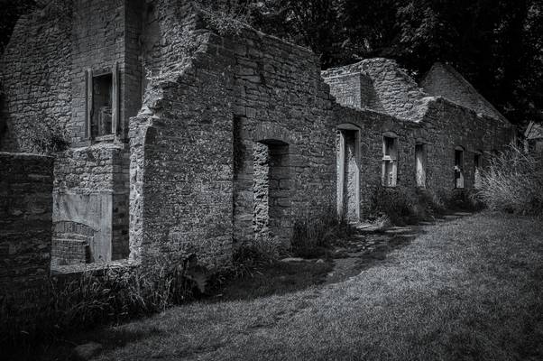
The "ghost village" of Tyneham, and 7,500 acres of surrounding heathland and chalk downland around the Purbeck Hills, were commandeered just before Christmas 1943 by the then War Office (now MoD) for use as firing ranges for training troops. 225 people were displaced, the last person leaving a notice on the church door:
"Please treat the church and houses with care; we have given up our homes where many of us lived for generations to help win the war to keep men free. We shall return one day and thank you for treating the village kindly."
This measure was supposed to be temporary for the duration of World War II, but in 1948 the Army placed a compulsory purchase order on the land and it has remained in use for military training ever since. Though littered with scrap used as targets, and subject to regular shelling, the land has become a haven for wildlife as it has been free from farming and development. In 1975, after complaints from tourists and locals, the Ministry of Defence began opening the village and footpaths across the ranges at weekends and throughout August. Many of the village buildings have fallen into disrepair or have been damaged by shelling and in 1967 the then Ministry of Works pulled down the Elizabethan manor house, though the church remains intact, and has a stained-glass window by Martin Travers. The church and school house have since been preserved as museums. In 2008, Tyneham Farm was reopened to the public and conservation work there is ongoing. Wikipedia
My website: Deep Mono Photography
The "ghost village" of Tyneham, and 7,500 acres of surrounding heathland and chalk downland around the Purbeck Hills, were commandeered just before Christmas 1943 by the then War Office (now MoD) for use as firing ranges for training troops. 225 people were displaced, the last person leaving a notice on the church door:
"Please treat the church and houses with care; we have given up our homes where many of us lived for generations to help win the war to keep men free. We shall return one day and thank you for treating the village kindly."
This measure was supposed to be temporary for the duration of World War II, but in 1948 the Army placed a compulsory purchase order on the land and it has remained in use for military training ever since. Though littered with scrap used as targets, and subject to regular shelling, the land has become a haven for wildlife as it has been free from farming and development. In 1975, after complaints from tourists and locals, the Ministry of Defence began opening the village and footpaths across the ranges at weekends and throughout August. Many of the village buildings have fallen into disrepair or have been damaged by shelling and in 1967 the then Ministry of Works pulled down the Elizabethan manor house, though the church remains intact, and has a stained-glass window by Martin Travers. The church and school house have since been preserved as museums. In 2008, Tyneham Farm was reopened to the public and conservation work there is ongoing.
Tyneham Valley was evacuated during the second world war and for the next forty years the abandoned kiosk was left to its fate, hidden under the shade of self seeded trees and disappearing under the sea of undergrowth which had consumed most of the village.
In the early 1980's, prolonged protest and campaigning resulted in the public being granted increased access to the Army Ranges. In 1983 the kiosk was restored as part of a massive clear up programme but with the incorrect K1 roof decor.
Kimmeridge Bay
The name "Portland Bill" has its roots in "The Beel" as named on early maps. This derived from the beak shape of Portland Bill. From 1588 onwards, when the area was part of a crucial Armanda invasion-warning network, it was often named "The Beacon". Quarrying began at Portland Bill in the mid 19th century but remained a small scale operation into the early 20th century. Quarries were on the west side of the bill and stone was transported along a short tramway to a shipping quay, now the site of Red Crane. An area absorbed into the quarries was White Hole, where quarrymen cut away a natural arch to form Pulpit Rock in the 1870s. It was intentionally left as a quarrying relic and was formed with religious associations; the large slab of rock leaning against the main stack depicted an open bible leaning on a pulpit. Surrounding the rock is the rather charmingly-named Snail Shore, a surface containing snail, oyster and mollusc shells that once made up a Jurassic seabed thriving with marine life around 150 million years ago.
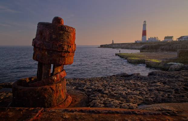
Portland Bill, Dorset
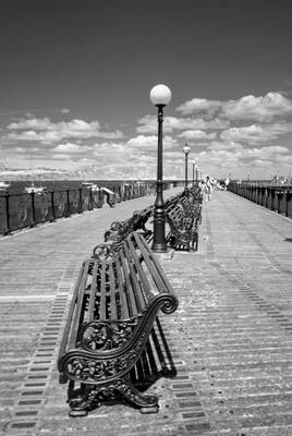
Swanage Pier is a Victorian pier which extends into the southern end of Swanage Bay near the town of Swanage, in the south-east of Dorset. The first Swanage Pier, which was 750 feet long, was built between 1859 and 1860 for use primarily by the local stone quarrying industry and included a tramway which ran the length of the pier and some way along the seafront. When local businessman George Burt introduced regular steamer services between Swanage and nearby towns Poole and Bournemouth in 1874, a need became apparent for a second pier to be built primarily for use by passenger steamers. Construction on the new pier began in 1895, and by 1896 was first used by a steamer. The pier was officially opened for traffic on 29 March 1897. While regular steamer services ran on the new pier up until 1966, the older original pier declined along with the stone industry it served some years earlier. Today all that remains of the old pier are some of the timber piles. After steamer services discontinued in 1966 the remaining pleasure pier also began to fall into disrepair. In 1976 Grade II listed status was awarded to the pier. After a failed attempt to restore the pier by a development firm in 1986, Swanage Pier Trust took over ownership of the pier in 1994.
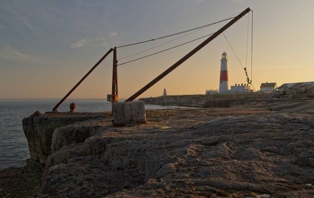
Framing the Portland Bill Lighthouse, the red crane is still used by local fisherman. Originally, the crane operated on a stone shipping quay for the now disused stone quarries.
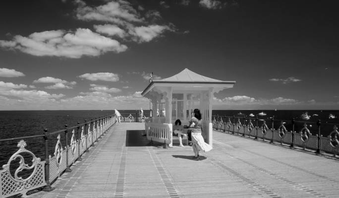
Swanage, Dorset
Swanage Pier is a Victorian pier which extends into the southern end of Swanage Bay near the town of Swanage, in the south-east of Dorset. The first Swanage Pier, which was 750 feet long, was built between 1859 and 1860 for use primarily by the local stone quarrying industry and included a tramway which ran the length of the pier and some way along the seafront. When local businessman George Burt introduced regular steamer services between Swanage and nearby towns Poole and Bournemouth in 1874, a need became apparent for a second pier to be built primarily for use by passenger steamers. Construction on the new pier began in 1895, and by 1896 was first used by a steamer. The pier was officially opened for traffic on 29 March 1897. While regular steamer services ran on the new pier up until 1966, the older original pier declined along with the stone industry it served some years earlier. Today all that remains of the old pier are some of the timber piles. After steamer services discontinued in 1966 the remaining pleasure pier also began to fall into disrepair. In 1976 Grade II listed status was awarded to the pier. After a failed attempt to restore the pier by a development firm in 1986, Swanage Pier Trust took over ownership of the pier in 1994.
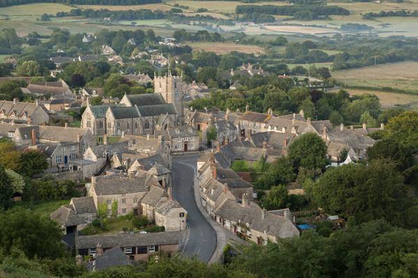
Early summer morning at the picturesque village of Corfe Castle, Dorset.
A last minute decision to stay overnight before going to Camp Bestival the following day.
I had set out to shoot Durdle Dor at night, but decided the 'blue' moon was too bright to do any worthwhile astro shoot with.
The bright full moon didn't do the castle justice either (I will return at some point to shoot some night images there without the full moon) but the village itself looked rather lovely in the soft light and summer greenery, later that morning.
I had a bit of a wander around looking for somewhere to go for a decent breakfast but there was nowhere open early morning, so headed off to Swanage for a full English.
*First upload with my new Canon 5D3. So far, I have to say I'm very impressed, especially with it's low light / high ISO capability. I wish I'd taken the plunge years ago.
Swanage, Dorset
Thanks to all Phoide contributors to Dorset!
Most notably jim stephenw, Andrey Sulitskiy, Heike Rosenbaum and Richard Down.