
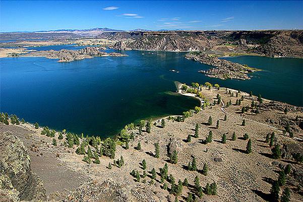
Grant County
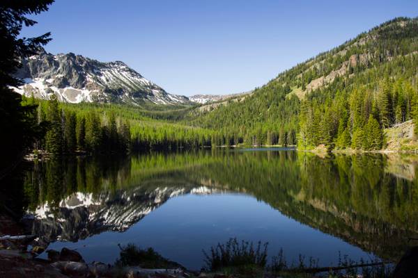
Strawberry Lake is a natural high-elevation body of water in the Strawberry Mountain Wilderness in the state of Oregon. Located about 10 miles (16 km) south of Prairie City in Grant County, the shallow lake covers about 36 acres (150,000 m2) surrounded by forest. Recreational activities in the lake basin include hiking, backpacking, skiing, and fishing. Strawberry Lake is the largest of the small glacial lakes found in the Strawberry Mountain Wilderness. The surface of the lake is more than 6,000 feet (1,800 m) above sea level. Despite water-quality problems stemming from recreational activity in the lake's drainage basin, the water remains transparent enough that the lake bottom is visible from the surface even at the lake's deepest point. Nathan W. Fisk homesteaded in the area in 1870 and named local features Strawberry Butte (now Strawberry Mountain) and Strawberry Creek for the abundance of wild strawberries in the area, and the name spread to encompass Strawberry Valley and Strawberry Lake.
One Bad Place To Be During an Earthquake:
East of the Cascade mountains, the climate is much drier and warmer in summer. This is the view from the...
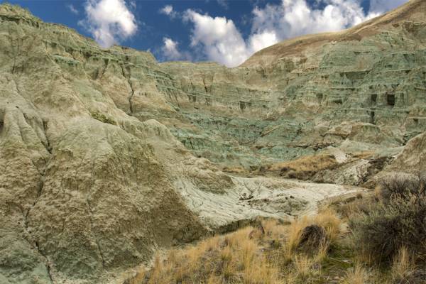
John Day Fossil Beds National Monument is a U.S. national monument. Located within the John Day River basin and managed by the National Park Service, the park is known for its well-preserved layers of fossil plants and mammals.
The monument consists of three geographically separate units: Sheep Rock, Painted Hills, and Clarno. The Sheep Rock Unit is located on Highway 19, between the towns of Kimberly and Dayville, Oregon. Prominant, non-fossil bearing rocks date back as far as 95 million years old. Fossils of plants and animals are found in a number of geological layers dating from 33-7 million years ago.
The predominant exposures of green rock seen on Sheep Rock are a multitude of reworked layers of volcanic ash. The rich green color of the claystone was caused by chemical weathering of a mineral called celadonite. This happened millions of years ago as water moved through the alkaline ash beds under high pressure.
The color really is more of what I would call a sea foam green or a light green blue. However, I have seen others photos of the area where it looked very blue. Not sure how that happens.
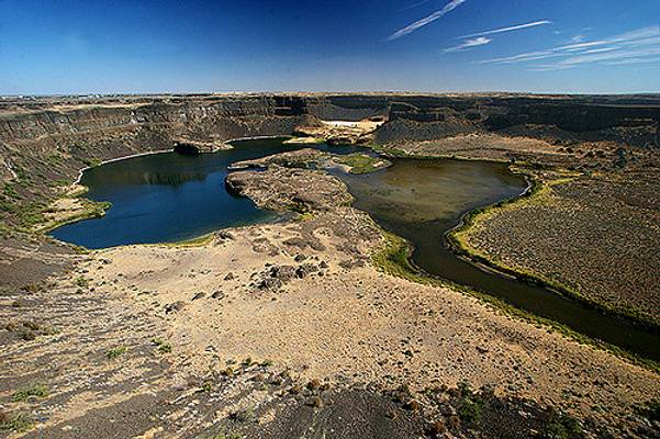
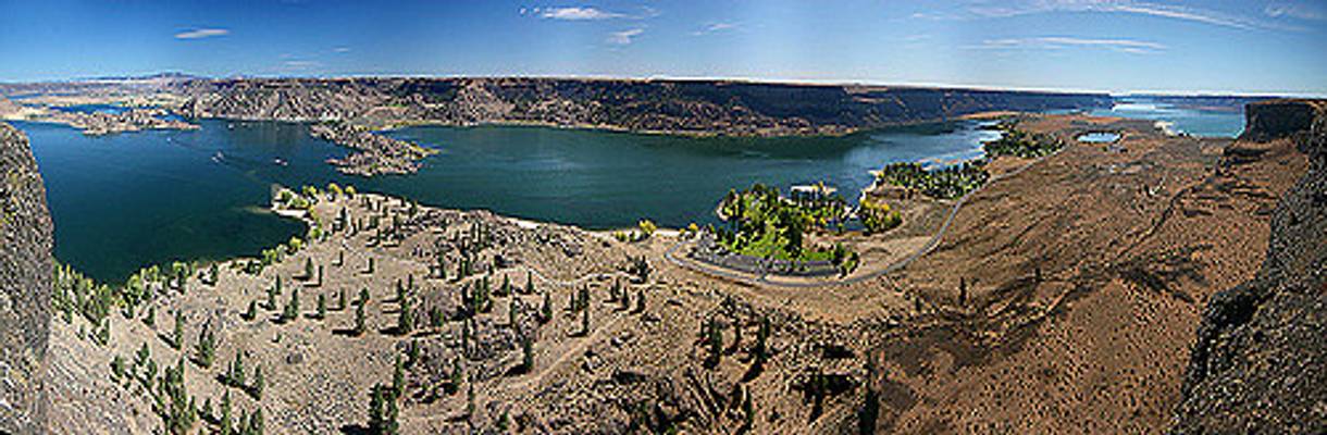
Dry Falls, east of the Cascade mountains in Washington State. The story behind it is quite interesting: ...
One Bad Place To Be During an Earthquake:
East of the Cascade mountains, the climate is much drier and warmer in summer. This is the view from the...
Thanks to all Phoide contributors to Grant County!
Most notably Bonnie Moreland.