
Lane County
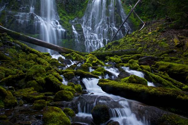
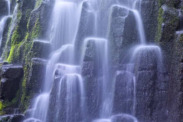
- Samuel Johnson | facebook | 500px | ferpectshotz | One more shot of the beautiful and massive Lower Proxy falls. For this shot I had this plan to get as close to some of the foreground cascades and to use them as foreground interest for framing the big waterfall. Unfortunately the water flow was simply too high and I was constantly getting sprayed by the mist. I am truly glad my gear is water resistant but trust me constantly having to wipe off your filter while taking a long exposure shot is not fun. This was not the composition I had in mind but this was the closest I got to what I initially planned. Hope you all enjoy the image.
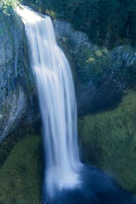
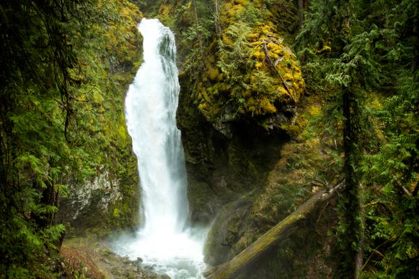
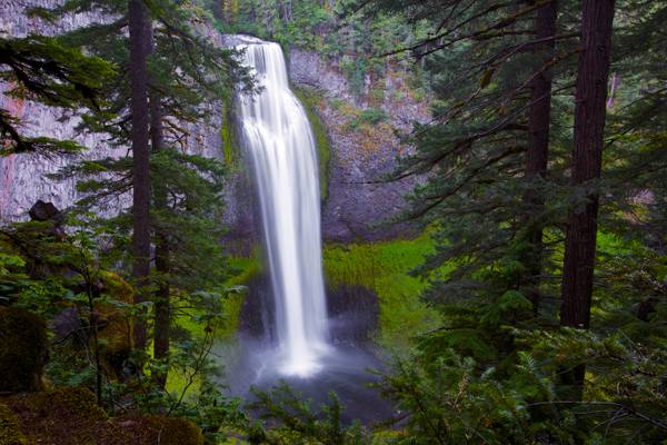
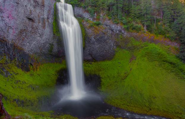
Salt Creek creates one of the most impressive waterfalls in Oregon as it hurtles 286 feet into a gaping canyon near Willamette Pass. The size of the falls isn't terribly notable in the area, but rather the process by which the falls were formed. Glaciers scoured the valley out during the last Ice Age, then following their retreat, lava flows filled in a portion of the valley, creating the narrow canyon walls composed of columnar basalt that are now seen at the falls. Views are afforded all along the canyon rim, from the brink of the falls to the base of the falls.
I know there are a thousand and one shots of this waterfall, and now I can add mine. To get the shot of the entire falls, you literally need to stand in the water. But that was okay because after the hike I was hot and it was refreshing.
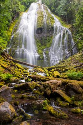
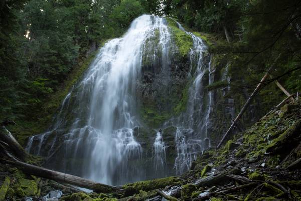
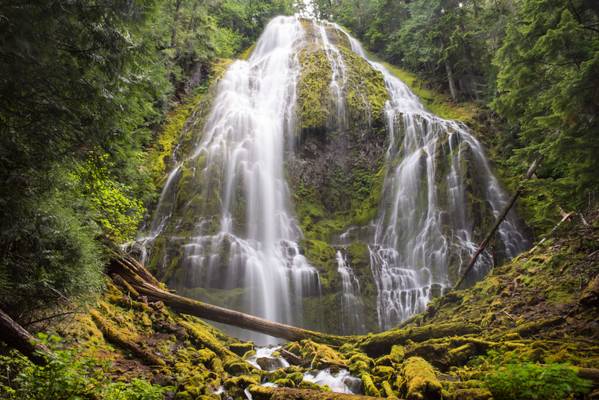
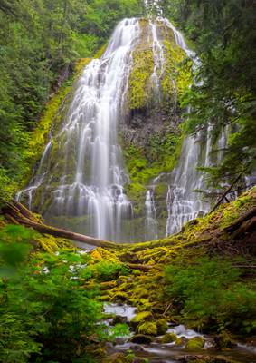
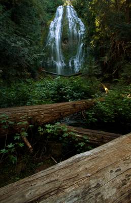
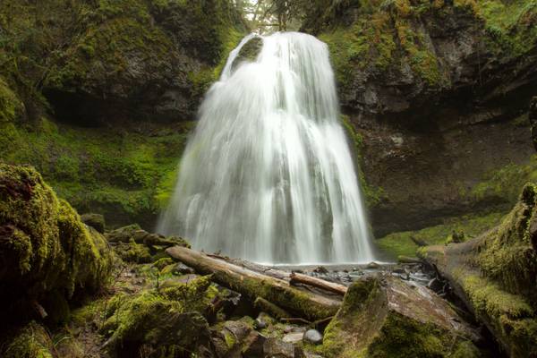
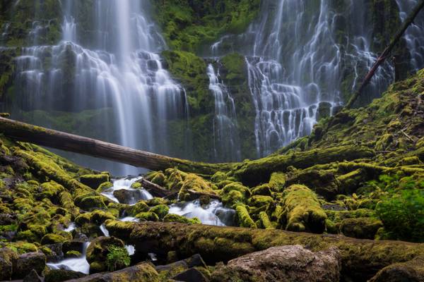
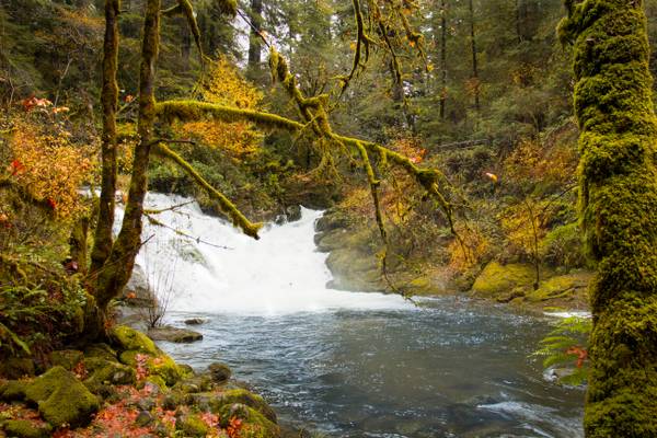
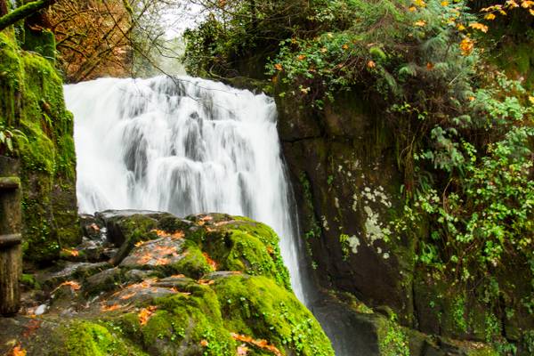
Proxy Falls, also known as Lower Proxy Falls, is a cascade and plunge waterfall from a collection of springs on the shoulder of North Sister, that plunges into a gaping canyon near McKenzie Pass in the Willamette National Forest, near Belknap Springs, Oregon. The waterfall is notable for its main drop of 226 feet (69 m) which makes it one of the highest plunge waterfalls in Oregon.
- Abraham Lincoln.
| facebook | 500px | ferpectshotz |
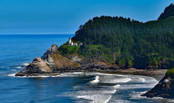
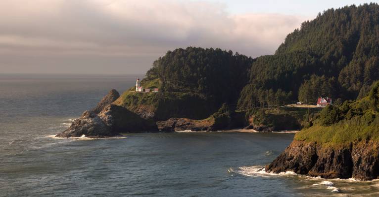
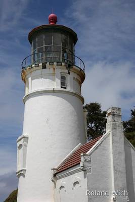
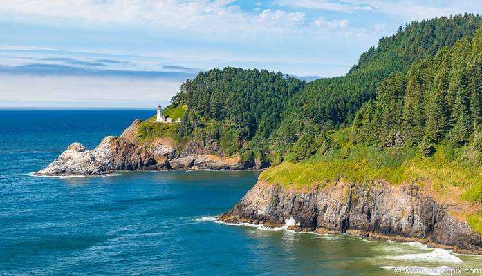
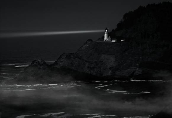
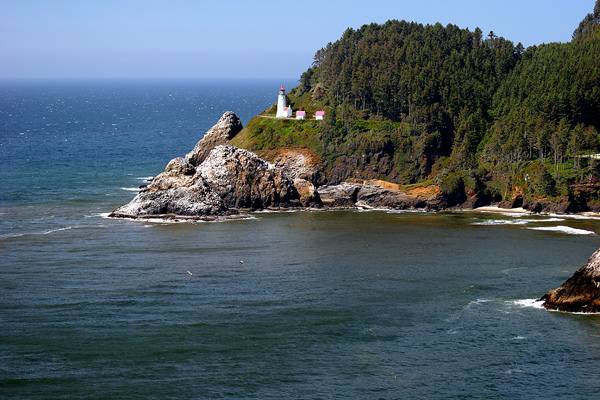
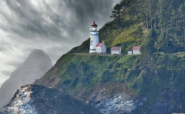
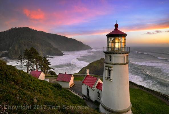
Another shot of the stunningly beautiful Heceta head lighthouse from Heceta headlands. This location from where I took this shot is actually quite far from the actual lighthouse and you are reliant of a 70-200 for composition here. We actually went all the way up to the lighthouse to check out some of the compositions around the lighthouse.
As you can see from the image, the lighthouse is perched on the slope of a pretty steep hill. There are hiking trails which zig zags its way on to the top of the hill but the dense vegetation makes it very difficult to find a good composition where you can frame the lighthouse along with the sprawling coastal land to the south. Moreover, there are signs posted on some areas requesting visitors to stay on the track while they are restoring some of the hillsides. If you trample on vegetation too much, they die off and expose the entire hillside to erosion and considering the amount of rain Oregon’s coast gets in a year, we decided to heed the instructions posted.
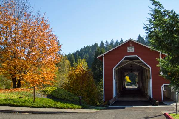
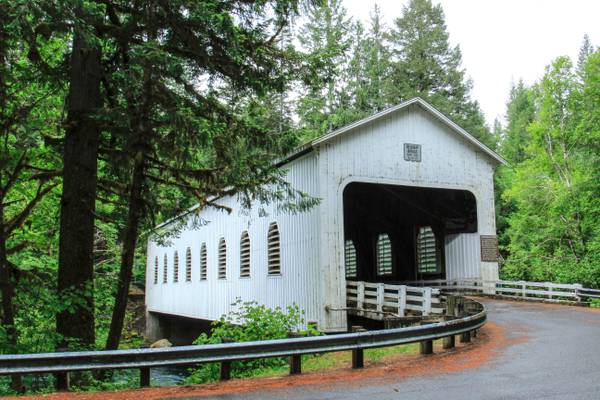
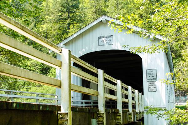
The Office Bridge (also called Westfir Covered Bridge) is a covered bridge in Westfir, Lane County, Oregon, U.S. crossing the North Fork Middle Fork Willamette River at the south end of the Aufderheide National Scenic Byway and edge of the Willamette National Forest. It is Oregon's longest covered bridge at 180 ft (55 m), and is one of only two in the state using triple Howe truss construction. It is the only covered bridge west of the Mississippi River which has a separate pedestrian walkway. Each Christmas season, the town decorates the bridge with lights. A firetruck driven by Santa turns the lights on the first week after Thanksgiving.
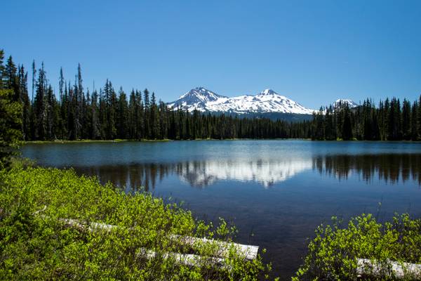
The Three Sisters Mountains in the background.
Scott Lake is truly a hidden gem off the McKenzie Pass Scenic Drive. Nestled right next to the Mt Washington Wilderness Area, the lake gives spectacular views over toward the Three Sisters to the South-East.
Catching the sunset and sunrise here is a must - the lake provides a perfect foreground for landscape photographs and it is by far the most beautiful time on the lake.
Found in Florence, Oregon, the river is at low tide here. This is nearly the end point of this river before it flows into the Pacific ocean.
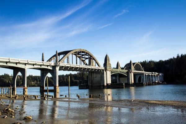
The Siuslaw River Bridge is a bascule bridge that spans the Siuslaw River on U.S. Route 101 in Florence, Oregon. It was designed by Conde McCullough, built by the Mercer-Fraser Company of Eureka, California, and funded by the Federal Emergency Administration of Public Works (later renamed the Public Works Administration). It opened in 1936.
The bridge's total length is 1,568 feet (478 m). When open, the 140-foot (43 m) double-leaf bascule provides 110 feet (34 m) of horizontal clearance for boat traffic. The bascule section is flanked by two 154-foot (47 m) reinforced concrete tied arches, identical to those used in the original Alsea Bay Bridge Four Art Deco-style obelisks house mechanical equipment as well as living quarters for the bridge operator. The total cost of the bridge was $527,000 (equivalent to $9.6 million in 2018).
Also know as the McKenzie River Bridge, is near Rainbow, Oregon
Exposure Northwest, Central Oregon Workshop, Proxy Falls.
This is from the workshop taught by Aaron and Zeb. Here I was taught to look at...
It was surprisingly tough to shoot this falls. This scene from the viewpoint above is just so all-encompassing. This was my first time visiting this...
This is another view of the Heceta Lighthouse, watching the sun go down with my Sis and Eric. There was no dramatic clouds in the sky, but I got me...
- Lucius Annaeus Seneca.
| facebook | 500px | ferpectshotz |
After visiting Smith Rock for sunrise we headed back to the Three Sisters wilderness to see Lower Proxy Falls. This waterfall is often regarded as one of the most picturesque in Oregon. The hike to the falls is quite long and leads up to a view point through a very narrow path. But the elevation gain is only slight and most part of the hike is covered. Once you reach the viewpoint you will have to scramble through a steep slope to get to the base of the falls. Once you get to the base of the falls it’s difficult not to get impressed by the sheer size of this beautiful waterfall with its 226 ft vertical drop.
We spent quite a bit of time here enjoying the amazing falls and vivid greens of the forest. This is another must visit location for any waterfall lover.
- Johann Wolfgang von Goethe.
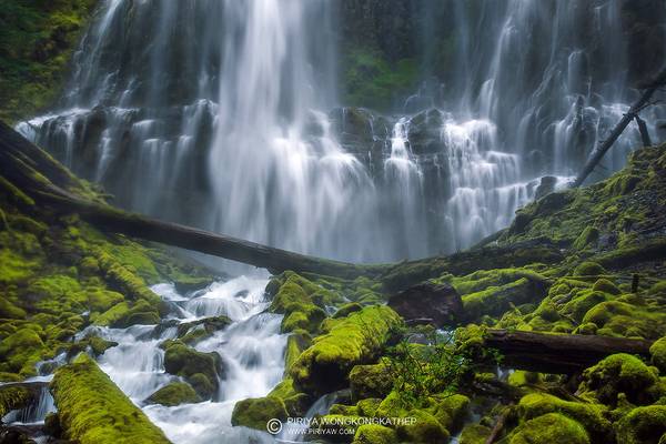
When I first saw an image of the stunning lower proxy falls, I did not fully understand its size. I knew it was a giant waterfall but was not prepared for the size of it. We also visited a waterfall called fairy falls on that trip, which has a similar form, near Portland, which was way smaller than I imagined at around 20 feet. So I think visiting the fairy falls might have biased my sense of scale.
Once we reached the base of lower proxy falls, we realized its massiveness at 226 feet. The water spray from the falls was quite intense that day, and I had trouble keeping my front element and filters clean. I had forgotten to pack the little microfiber wipes in my haste and learned that they are indeed worth their weight in gold, especially near a waterfall. While we had some technical challenges, what a refreshing break this hike and waterfall turned out to be. We reached the trailhead around noon after some much-needed sleeping in and a pretty heavy breakfast. The 2-mile-long trail along lava fields and dense woodland was the perfect way to enjoy a beautiful day.
- Alexander Smith.
| facebook | 500px | ferpectshotz |
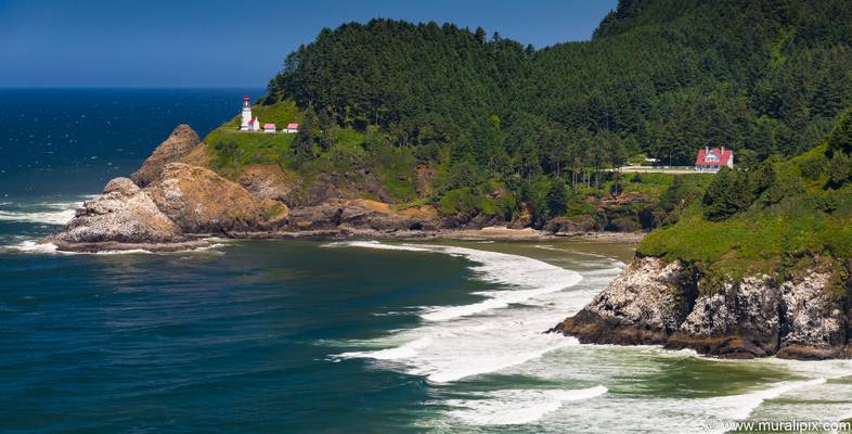
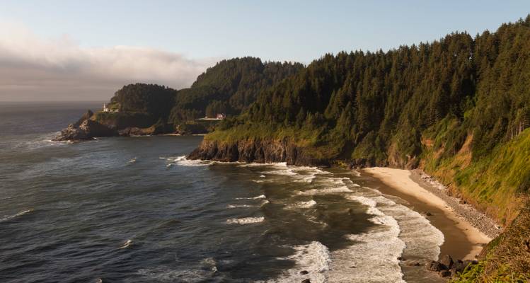
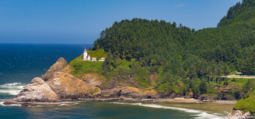
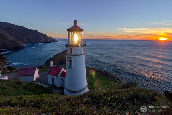
Another shot of the beautiful Oregon coast, this time from the outlook point overlooking Haceta head lighthouse. I missed this little beauty on our last trip but this was one of my must see places for this trip.
Here is a bit of history as per the Wikipedia page; Heceta Head is named after the Spanish explorer Bruno de Heceta, who explored the Pacific Northwest during the late 18th century. Before him, Heceta Head was a spot of frequent fishing and hunting by the Native American tribes that populated the area. Heceta Head is part of the Siuslaw Indians' traditional land. They hunted sea lions in the area and gathered sea bird eggs from the offshore rocks. In 1888, white settlers moved into the area and claimed 164 acres (66 ha) of the surrounding land. That same year, the U.S. Lighthouse Service approved the building of the lighthouse, and the government bought 19 acres (7.7 ha), out of the 164 acres (66 ha) previously purchased, for the lighthouse structures.
I wish I'd soon be able to come back here during storm season and get some nice sunset shots.
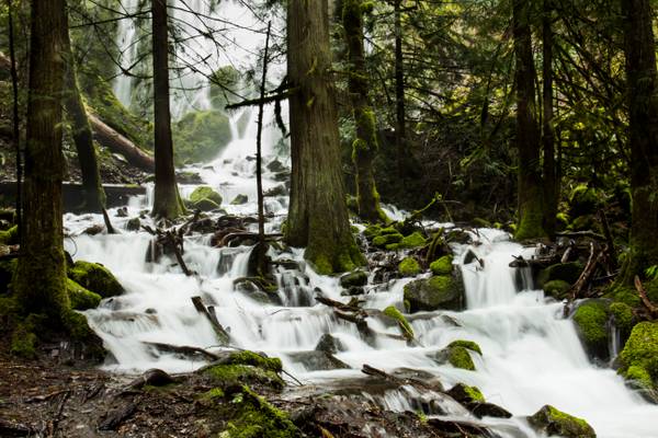
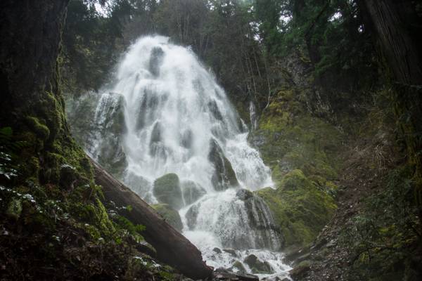
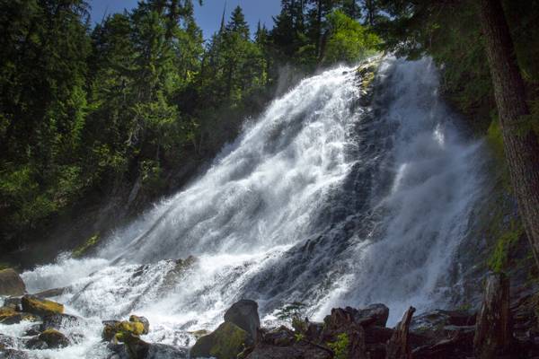
Heavy snow melt has made this waterfall overflow its normal flow area. It has spilled out over the banks and is encompassing the surrounding trees. The actual waterfall is seen as that veil of white behind the trees, but I thought this part was more interesting.
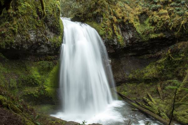
Presumably the largest waterfall along Alex Creek, Moon Falls is an exceptional waterfall, veiling about 100 feet over a sharp wall of jagged basalt - a stark contrast to the smoothly rounded cliff at its downstream sibling, Spirit Falls. Moon Falls suffers from a bad case of foreshortening due to the slightly less than vertical pitch near the top of the falls - and a few trees at the bottom of the falls don't help the situation either. Late in the year, Alex Creek loses much of its volume at this point in its course, so the falls may not be as impressive.
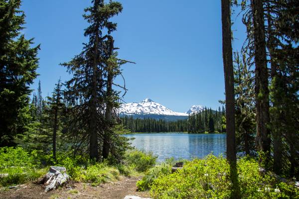
Scott Lake is truly a hidden gem off the McKenzie Pass Scenic Drive. Nestled right next to the Mt Washington Wilderness Area, the lake gives spectacular views over toward the Three Sisters to the South-East.
Catching the sunset and sunrise here is a must - the lake provides a perfect foreground for landscape photographs and it is by far the most beautiful time on the lake.
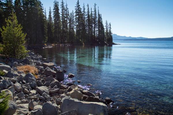
Waldo Lake is a natural alpine lake in the Cascade Mountains of Oregon. It is the second largest natural non-alkali lake in Oregon with just under 10 square miles (26 km2) of water surface and a maximum depth of 420 feet (130 m). The lake is named after Oregon politician, judge, and conservationist John B. Waldo.
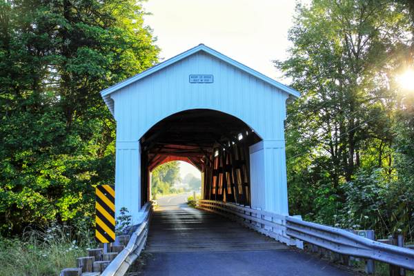
Also known as Layng Bridge, is outside of Cottage Grove, Oregon
Exposure Northwest, Central Oregon Workshop, Proxy Falls.
I went on another one of the workshops taught by Aaron and Zeb. This time, we explored...
Lighthouse at Heceta Head, Oregon.
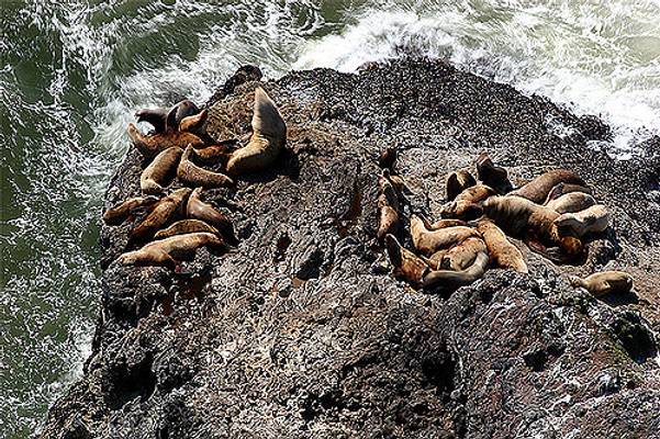
Sea lions below Heceta Head viewpoint, central Oregon Coast, I selected a longer exposure to get some blur in the waves, unfortunately the sea lions...
- Jules Verne.
| facebook | 500px | ferpectshotz |
This one was taken during our last summer road trip to Oregon. This is the base of the beautiful Lower Proxy falls in the three sister wilderness area. The hike up to this fall is pretty easy but long and you will have to scramble over some fallen trees and walkthrough some old lava beds and the last few feet to this falls is extremely hard to get to the bottom of a steep hillside. It would be wise to take some time and chart out a path down the hillside before venturing down.
I wanted really to get down and include some smaller cascades as a foreground interest but the wind was quite heavy and there was a lot of water spray ruining those shots. So stayed back and zoomed in to get this shot. Thanks for visiting hope you all like it.
Beaver Creek Falls, is a small waterfall located at the confluence of Beaver and Sweet Creeks in Lane County, in Oregon. The waterfall is known for joining of the two creeks becoming one intertwined waterfall.
It is a 20 foot fall in a wide cascade and is the centerpiece attraction of the Beaver Creek Falls Trail trailhead and Recreation Site.
This fall can be photographed from above, as is shown here, and from a different trail about 1/2mile downstream, where you can walk in and see from stream level.
Lower section of the falls.
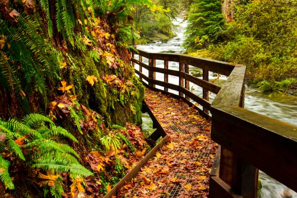
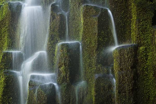
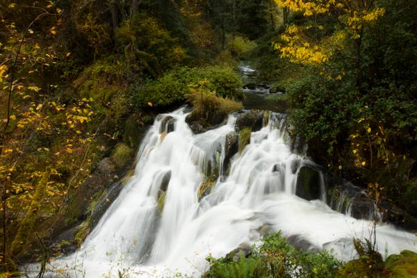
Sweet Creek Falls Trail contains a series of about a dozen waterfalls near Mapleton, Oregon that cascade down a lush green gorge providing one of the most easily accessible high concentration waterfall hikes in all of Western Oregon.
Sweet Creek got its name from the Sweet Family who settled in this area in 1876. Here they logged timber, fished, and farmed the land.
There are no boring moments on this sweet and easy trail, where you’ll pass 11 waterfalls in just 1.1 miles. Sweet Creek Trail is something of an engineering marvel, using catwalk-style bridges to allow hikers up-close views of a stream that drops like a slinky down basalt ledges in this narrow, mossy canyon.
One of the bridges along the Oregon coast.
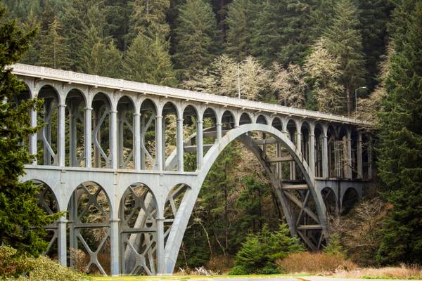
Cape Creek Bridge is an arch bridge that spans Cape Creek in Lane County, Oregon. The bridge carries U.S. Route 101. Opened in 1932, it was designed by noted bridge engineer Conde McCullough and built of reinforced concrete by John K. Holt. The total length of the bridge is 619 feet (188.6 m), with a main span of 220 feet (67 m). The bridge resembles a Roman aqueduct, with a single parabolic arch that spans half its length. It was listed as Cape Creek Bridge No. 01113 on the National Register of Historic Places in 2005, as part of the McCullough, C.B., Major Oregon Coast Highway Bridges MPS (Multiple Property Submission).
I went to Proxy Falls today. It was very hard to take photos because of lots of misty spray from the falls. I need to go back again later in late...
I took a business trip down to Roseburg last week, and aimed to hit a couple of new waterfalls on the way back. I printed directions for Moon Falls...
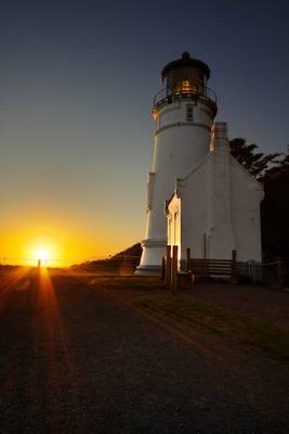
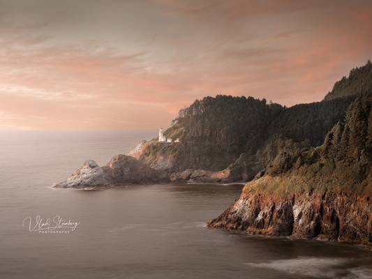
Sunset, Heceta Head Lighthouse, Florence, Oregon, USA.
A quick Sunday stop at this icon of Oregon. Polarizer, single exposure.
**This is a...
One of the most iconic and recognizable places on the Oregon Coast. It would have been a lifetime experience to be a lighthouse keeper here. Such...
Thanks to all Phoide contributors to Lane County!
Most notably Bonnie Moreland, Sandeep Thomas and Dominic Nessi.