
Linn County
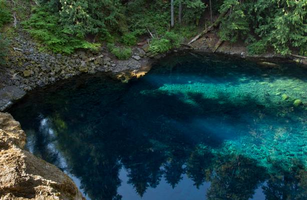
My husband is holding on to a tree with one hand and my backpack with the other as I am leaning out over the edge to get this shot. All the information about this pool is in the following image.
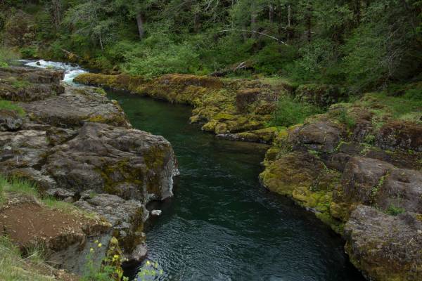
Blue Pool, also known as Tamolitch Pool, is where the McKenzie River seeps to the surface through underground lava fields that flowed across the landscape eons ago.
I have a photo of the Tamolitch waterfall in my waterfalls album. You only get to see the falls at certain times of the years. It was worth slogging through slush and snow to see the waterfall dropping into the pool.
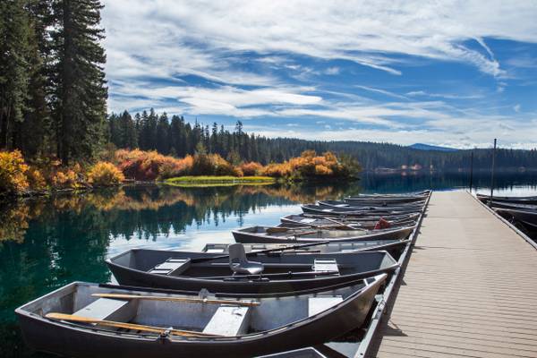
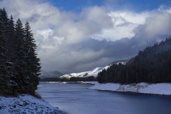
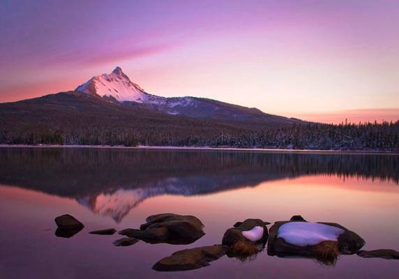
Clear Lake (Linn county) is the headwaters of the McKenzie River. The lake is primarily fed by snow runoff from nearby Mount Washington and the surrounding areas. The runoff filters through underground caverns for more than 20 years before emptying into Clear Lake. The lake is also fed by two small creeks, which may dry up seasonally, along with Great Spring, the source of the McKenzie River. Clear Lake is reported to be one of the most exceptional freshwater dive spots in Oregon. Submerged 100 feet (30 m) deep in the lake is a stand of upright trees that were killed approximately 3,000 years ago when volcanic activity created the lake. The trees are remarkably preserved due to the cold year-round water temperatures of between 35–43 °F (1.6–6 °C).
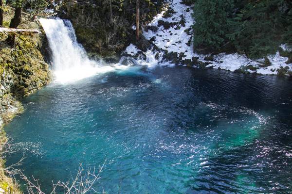
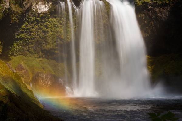
Once a majestic waterfall, the McKenzie River has changed course and gone underground a few miles up stream. The river only flows over the falls a few times a year, the rest of the time the water emerges from the rocks underwater in the basin of waterfall pool.
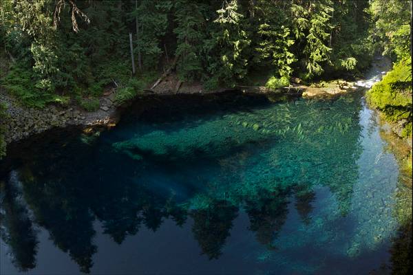
Blue Pool, also known as Tamolitch Pool, is where the McKenzie River seeps to the surface through underground lava fields that flowed across the landscape eons ago.
The water is so pure that it’s eerily deceptive. When water is that pure, the depth is often misjudged. For anyone who has visited Blue Pool will agree that the water only appears to be, at most, five feet deep. The rocks that rest on the bottom of the pool’s earthen floor seem to be so close that you can almost touch them by merely sticking your arm into the water. The true depth of Blue Pool is 30 feet!
The water from Blue Pool comes from underground where it has been purified by the rocks and sediment underneath the surface of the Earth. It’s constantly in circulation from its underground source. This also explains why the water is so cold; it comes fresh from underground. When water is that cold, it makes it difficult for organisms to survive.
The Tamolitch Falls, now a seasonal waterfall, once had a constant flow on the McKenzie River. In the 1960s, water was diverted for hydroelectric use from the stream above the falls; that section of the stream, as well as the falls, ceased to flow except during periods of heavy runoff or when water was diverted from the dams upstream. When this is not the case, the stream goes underground and now emerges below the falls. At the base of the former falls is the Tamolitch Blue Pool.
McDowell Creek Park
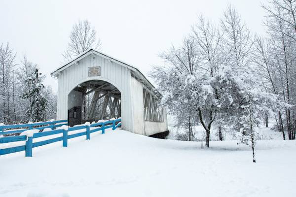
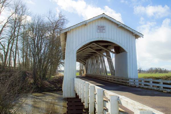
I added the blue to the fence because it was lost otherwise with white on white.
The Willamette Valley (will-AM-et) is a 150-mile (240 km) long valley in the Pacific Northwest region of the United States. The Willamette River flows the entire length of the valley, and it is surrounded by mountains on three sides – the Cascade Range to the east, the Oregon Coast Range to the west, and the Calapooya Mountains to the south. It forms the cultural and political heart of Oregon, and is home to approximately 70 percent of its population.
The valley's numerous waterways, particularly the Willamette River, are vital to the economy of Oregon, as they continuously deposit highly fertile alluvial soils across its broad, flat plain. A massively productive agricultural area, the valley was widely publicized in the 1820s as a "promised land of flowing milk and honey". Throughout the 19th century it was the destination of choice for the oxen-drawn wagon trains of emigrants who made the perilous journey along the Oregon Trail.
Today the valley is often considered synonymous with "Oregon Wine Country", as it contains more than 19,000 acres (7,700 ha) of vineyards and 500+ wineries.
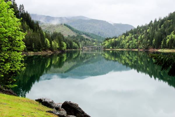
Green tree reflection in the lake.
Between Scio and Lyons Oregon
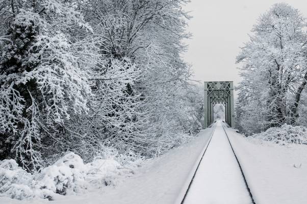
So the trick here was get myself out of bed right at first light and drive to this site to get the tracks untouched by the trains.
The Willamette Valley (will-AM-et) is a 150-mile (240 km) long valley in the Pacific Northwest region of the United States. The Willamette River flows the entire length of the valley, and it is surrounded by mountains on three sides – the Cascade Range to the east, the Oregon Coast Range to the west, and the Calapooya Mountains to the south. It forms the cultural and political heart of Oregon, and is home to approximately 70 percent of its population.
The valley's numerous waterways, particularly the Willamette River, are vital to the economy of Oregon, as they continuously deposit highly fertile alluvial soils across its broad, flat plain. A massively productive agricultural area, the valley was widely publicized in the 1820s as a "promised land of flowing milk and honey". Throughout the 19th century it was the destination of choice for the oxen-drawn wagon trains of emigrants who made the perilous journey along the Oregon Trail.
Today the valley is often considered synonymous with "Oregon Wine Country", as it contains more than 19,000 acres (7,700 ha) of vineyards and 500+ wineries.
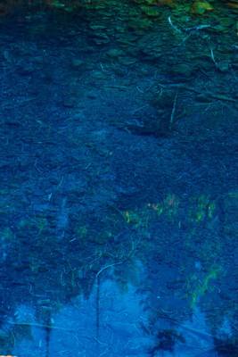
Tamolitch Pool, Tamolitch Falls, Willamette National Forest, Linn County, Oregon
This is the color of the deep pool in shade. Unfortunately, we...

I'm moving this up in my stream because it's responsible for me winning one of the four slots for the Aperture Nature Photography Workshop in...
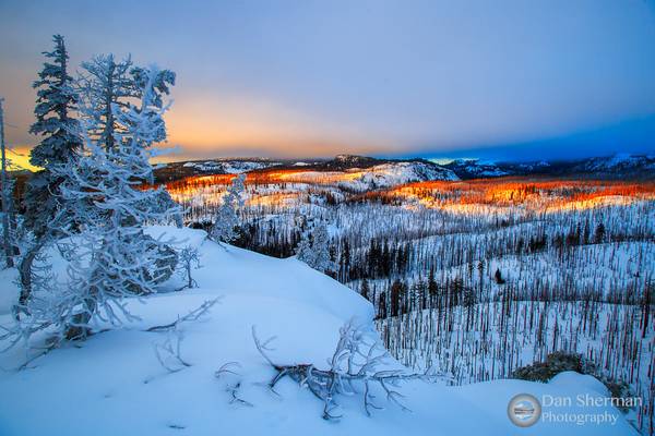
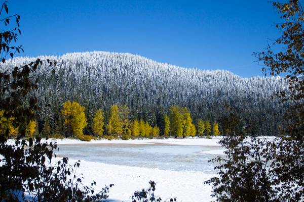
My first shot of 2016! I was finally able to get my snowshoes on after 2 years and take a short walk to this vista overlooking Willamette National...
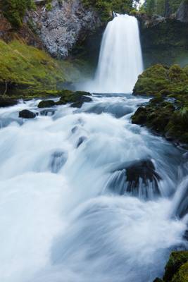
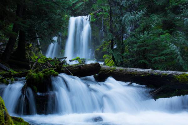
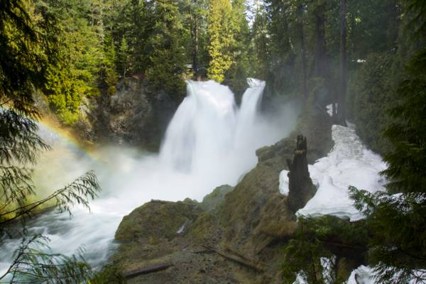
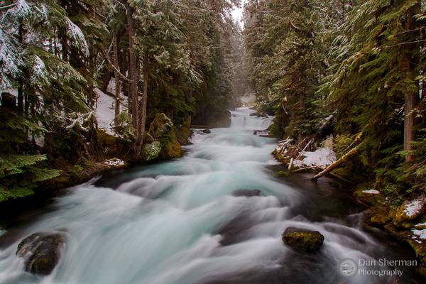
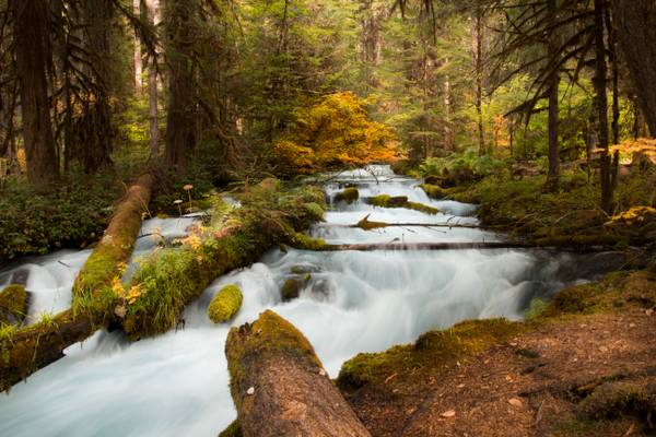
Sahalie Falls, McKenzie River, Willamette National Forest, Washington
The first stop of the morning with Sis and Zman was at the powerful 73...
McDowell Creek Park
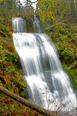
One of my favorite photos taken by my sister Lessa Clayton. The waterfall is in late summer and the flow had significantly reduced from the spring time photos to give this look.
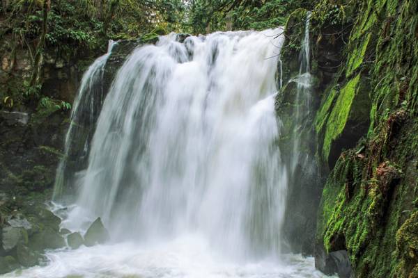
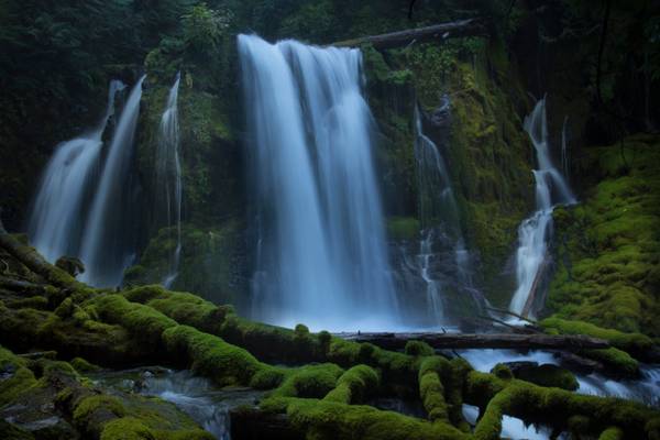
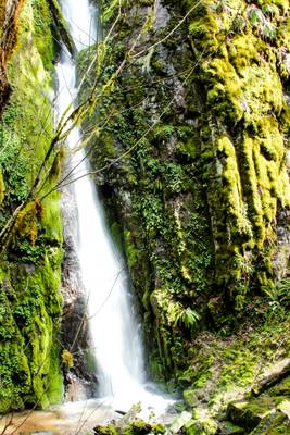
I took over 80 shots of this waterfall today. I narrowed it down to two I like. If you viewers would let me know your opinion as to the strongest I would be grateful.
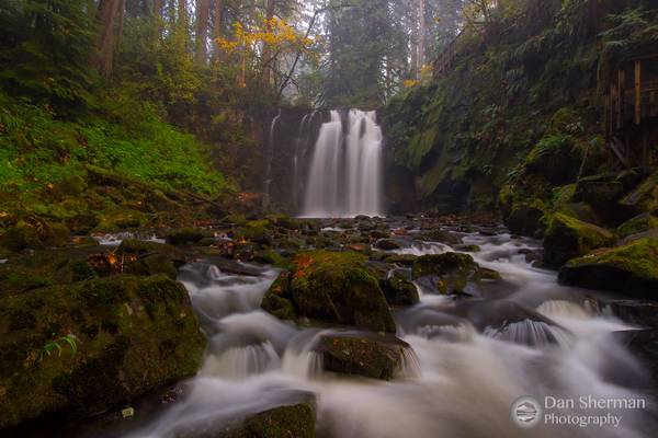
Downing Creek Falls is the second of at least three significant waterfalls known to occur along the stout length of spring-fueled Downing Creek. The falls drop 32 feet over a distinctly cube-shaped outcrop of basalt, pouring in three to four side-by-side channels (depending on how much extra snow melt water is present), with as many as a dozen small streams of water dribbling out of the adjacent cliff and falling parallel to the falls in tandem. Though the falls aren't terribly tall, the creek is large enough to produced a consistent cloud of mist at the base of the falls, which helps ensure the forest and cliffs all around the falls are liberally covered head to toe in a thick blanket of moss.
Downing Creek is a remarkably consistent stream with a deceivingly small drainage basin. The majority of the creek emerges from springs about one quarter mile upstream from the falls, and flows all year long with very little fluctuation as a result. Further upstream along the drainage is another waterfall which only flows during periods of prolonged snow melt in the spring months, but the upper section of the creek otherwise sinks into the porous ground and the upper falls dries out as a result.
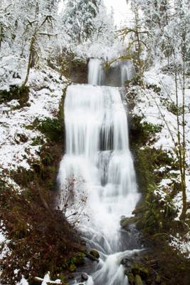
This is a pretty easy hike to this falls, there are two more in the same area but this was the only one I could get to with ease. I was surprised there was this much snow around the falls. It was a nice addition to the shot.
While not really the cornerstone of McDowell Creek Falls Park, Royal Terrace Falls is the best of the four waterfalls featured within. The falls occur where Fall Creek drops over the valley wall in an eye catching stair-step style fountain like display. Measurement of this falls has its drop to be 119 feet.
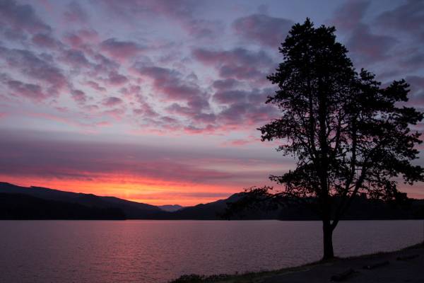
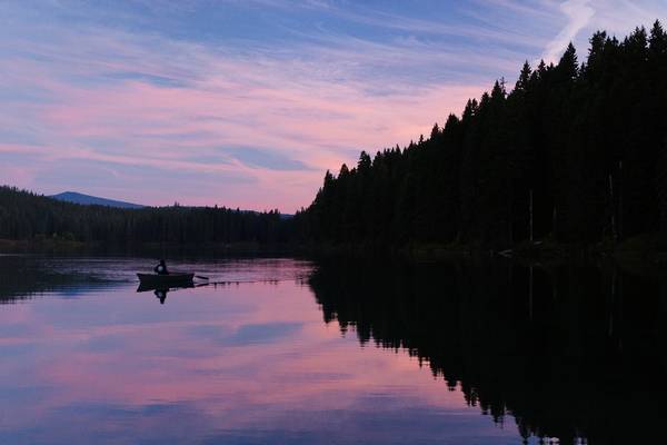
I was actually on my way to the Metolius to get some morning shooting done. But I just had to stop at Foster because I could just see the sunrise was going to be spectacular. It was worth the 15 minute delay.
Foster Lake ( Reservoir) is a reservoir created by Foster Dam on the South Santiam River in the city of Sweethome Foster, Oregon. The reservoir is approximately 5.6 km (3.5 mi) long and covers approximately 494 ha (1,220 acres) when full. Primary use of the reservoir is recreation and irrigation in the summer and flood control in the winter and spring,
Just off U.S. Highway 20 in Central Oregon there is a lake with a curious fate. Every winter the aptly-named Lost Lake fills up, before slowly draining through a hole, drying up and making way for a meadow.
The hole has been there as long as anyone can remember, Jude McHugh, spokeswoman with the Willamette National Forest, told The Bulletin. And while the hole may appear to be one of those oddest of mysteries that nobody can quite figure out, the explanation is rather simple. The volcanic landscape of the area gives way to a number of quirky geologic traits – the one responsible for swallowing the lake is a lava tube. The tunnel-like structure is formed when flowing lava hardens near the surface but continues to flow downwards, and the inner lava escapes before hardening. The result, a tube that opens to the surface and leads to the mysterious depths below.
McHugh says it’s unclear exactly where the water goes, but it possibly seeps into the porous subsurface underground, refilling the expansive aquifer that feeds springs on both sides of the Cascades.
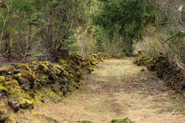
Quartzville Creek is a 28-mile (45 km) tributary of the Middle Santiam River in Linn County in Oregon. It is paralleled by the Quartzville Back Country Byway and used for recreation, including camping, fishing, hunting, kayaking, and gold panning. The lower 12 miles (19 km) of the creek, from the Willamette National Forest boundary to Green Peter Reservoir, was designated Wild and Scenic in 1988.
The creek received its name because of large quartz formations that have been found in this area. A 9.6-mile portion of the creek on a single lane paved roadway is the most famous for white water rafting, recreational mining, fishing, and swimming.
There are many safe pools for wading and swimming along the Quartzville Drive and the most of them are astonishingly beautiful. The bright green calm or rushing waters are surrounded by moss-covered rocks and cliff walls. The river water is always cold even in the peak summer season.
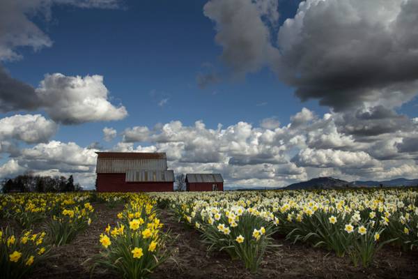
Anyone who has ever spent any time in the Pacific Northwest understands the phrase "sun break". It is the period of time usually between storm systems when the sun breaks through for 20 minutes to a couple of hours. The daffodil barn is on Hwy 34 east of Corvallis. It becomes a nice photographic spot in the spring. We were dodging rain drops and driving back and forth to find the breaks in the rain to grab some spring shots.
I've been to this waterfall more than any other. I grew up near here and started photographing the falls in this park when I was in high school...
Clear Lake, Willamette National Forest, Linn County, Oregon
I had a fun adventure this weekend with my Sis and Zman. We went non stop from...
Took a semi-impromptu day to myself Monday and drove up to Hoodoo for some skiing, but first I had to stop here and take some shots. I love this...
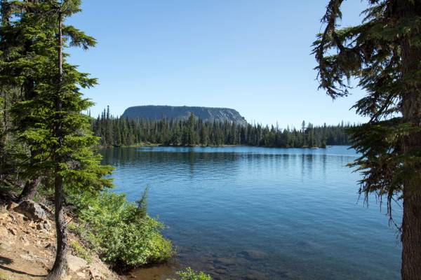
Haystack Butte in the background.
Nestled in the Willamette National Forest is a beautiful alpine lake simply known as “Big Lake”. About 47 miles northwest of Bend, this scenic lake is a popular recreational area for locals and visitors alike. During the summer you can enjoy camping, fishing, swimming, ATV riding, and water skiing at the lake. Hikers can explore the nearby Pacific Crest Trail from late spring to early fall. Winter recreation in the area includes skiing, snowmobiling, and snowshoeing. Big Lake boasts views of several peaks, including Mt. Washington, Hoodoo Butte, and Three Fingered Jack.
I took over 80 shots of this waterfall today. I narrowed it down to two I like. If you viewers would let me know your opinion as to the strongest I would be grateful.
Downing Creek Falls is the second of at least three significant waterfalls known to occur along the stout length of spring-fueled Downing Creek. The falls drop 32 feet over a distinctly cube-shaped outcrop of basalt, pouring in three to four side-by-side channels (depending on how much extra snow melt water is present), with as many as a dozen small streams of water dribbling out of the adjacent cliff and falling parallel to the falls in tandem. Though the falls aren't terribly tall, the creek is large enough to produced a consistent cloud of mist at the base of the falls, which helps ensure the forest and cliffs all around the falls are liberally covered head to toe in a thick blanket of moss.
Downing Creek is a remarkably consistent stream with a deceivingly small drainage basin. The majority of the creek emerges from springs about one quarter mile upstream from the falls, and flows all year long with very little fluctuation as a result. Further upstream along the drainage is another waterfall which only flows during periods of prolonged snow melt in the spring months, but the upper section of the creek otherwise sinks into the porous ground and the upper falls dries out as a result.
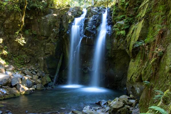
I actually had stopped to check my map, I looked up from my parking spot and saw this steam just tucked back up in the woods. A short walk and I found this vantage point. A completely unexpected find and now one of my favorite images of the year.
Olallie Creek is located in the midsection of the Cascades mountain range in western Oregon. The area is nicely shaded by Douglas fir, maple and alder. The Willamette National Forest stretches for 110 miles with varied landscapes of high mountains, narrow canyons, cascading streams, and wooded slopes. This creek sits right beside the McKenzie River and the McKenzie River Trail.
Olallie is a very popular name in Oregon. There are several Olallie areas, from this creek, to a nice lake, not associated with this creek to a nice hiking trail, not associated with creek or lake.
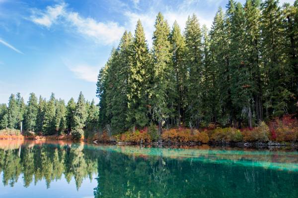
Clear Lake is the headwaters of the McKenzie River. The lake is primarily fed by snow runoff from nearby Mount Washington and the surrounding areas. The runoff filters through underground caverns for more than 20 years before emptying into Clear Lake. The lake is also fed by two small creeks, which may dry up seasonally, along with Great Spring, the source of the McKenzie River. Clear Lake is reported to be one of the most exceptional freshwater dive spots in Oregon. Submerged 100 feet (30 m) deep in the lake is a stand of upright trees that were killed approximately 3,000 years ago when volcanic activity created the lake. The trees are remarkably preserved due to the cold year-round water temperatures of between 35–43 °F (1.6–6 °C).
It is a shame that this image can't show you just how clear the water is, you can see the bottom clearly.
Green Peter Reservoir is a reservoir created by Green Peter Dam on the Middle Santiam River 11 miles (18 km) northeast of Sweet Home, Oregon, United States. The reservoir is approximately 10 miles (16 km) long and has a surface area of approximately 3,720 acres (1,510 ha) when full. The reservoir is used for hydropower, recreation, flood risk management, water quality, irrigation, and as a fish and wildlife habitat.
This large reservoir is within an easy drive of the Willamette Valley, primarily is best known as western Oregon’s premier kokanee fishing lake.
Green Peter is located at about 1,000 feet in elevation in the foothills of the Cascade Mountains.
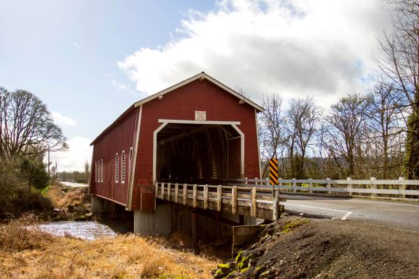
Outside of Scio Oregon
Cascadia State Park, Oregon
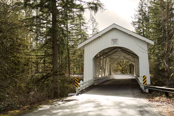
Gilkey Covered Bridge outside of Scio, Oregon
A beautiful evening spent in the marvelous company of Victor and Larry at Big Lake. This is a few minutes before or after different lighting in this...
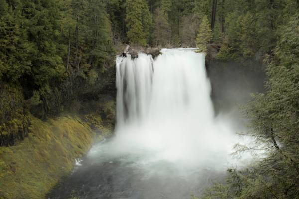
Koosah Falls, McKenzie River, Willamette National Forest, Linn County, Oregon
Just down the road from Sahalie Falls, is the mighty Koosah Falls....
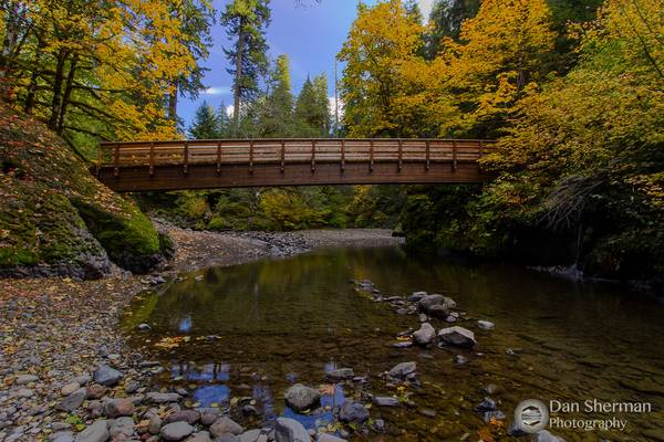
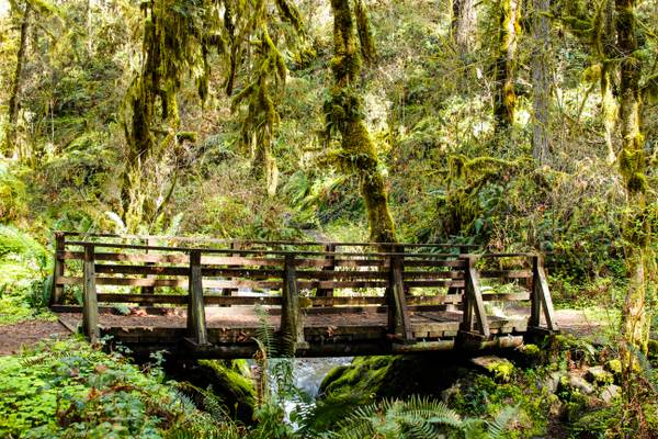
A footbridge on the trail to House Rock Falls in the foothills of the Cascade Mountains. This scene was just begging to have a shot made of it. The...
Thanks to all Phoide contributors to Linn County!
Most notably Bonnie Moreland.