
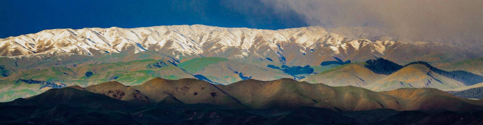
Manawatu-Whanganui
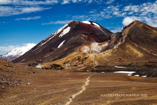
Mt Tongariro Red Crater (foreground), Mt Ngauruhoe (aka Mt Doom in the middle) and Mt Ruapehu (covered in snow) Tongariro Alpine Crossing Tongariro National Park (Dual World Heritage area) North Island, New Zealand
As you would guess by now, it is impossible to take a bad shot from this location :) There are an abundance of compositions to choose from! It is little wonder that it draws such a crowd!
The steep descent I mentioned in my previous post: "Emerald Lakes" is the ridgeline on the extreme right of the frame. This image gives a sense on the gradient and length of the path, filled with loose rocks that one must transverse down. Its probably the most demanding and dangerous part of the whole track. After that, there is really no reason to turn back.
This image was taken at the final ascent to blue pools. By now my thighs were experiencing sporadic cramps. God I am so unfit! I slowed down my pace to allow my muscles to recover and also to rehydrate. Reminding myself that there is no turning back! I also used the time to capture images such as this.
Slowly but surely, blue lake came into view. Looking at it up close, it was massive! Larger than all the Emerald Lakes combined. Making it impossible to fit it in one frame. I did not spend much time at blue lake as I was afraid that I would miss my pick up time. Subsequently, the path meandered downhill for a good 8 kms, below the alpine region, into a forest (where I mistook Lahar for a New Zealand man-eating predator after reading the sign "Listen out for Lahar, move quickly and do not stop") and ending at a carpark.
After reading/ listening to my accounts, some people would ask if I regreted going for the hike, putting myself in such unnecessary pain and danger. To which I reply: I would do it all over again in a heartbeat :)
1 exp shot, edited in Lightroom and Photoshop Comments and constructive criticisms are appreciated!
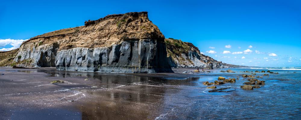
... a volcanic beach in Whanganui, North Island, New Zealand
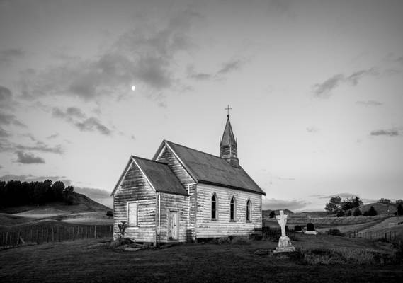
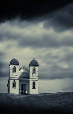
Opaea Church, Manawatu, New Zealand
I finally got around writing a blog for the first time in a while and this one is all about photographing the...
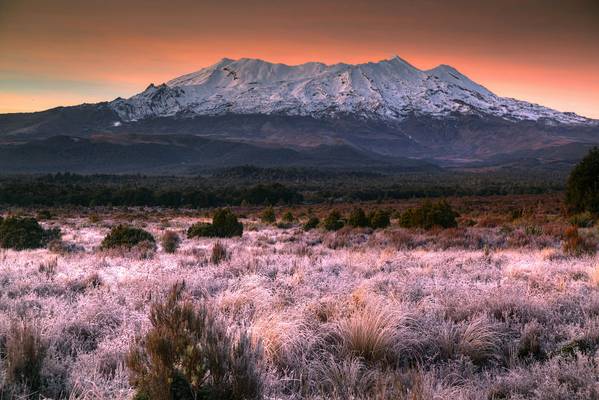
Mount Ruapehu before sunrise on a frosty winter morning, Tongariro National Park, highest point on North Island at 2797 m / 9,176 ft, New Zealand.
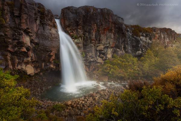
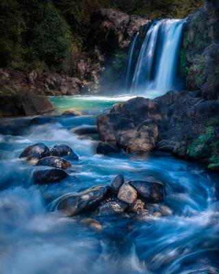
Taranaki Falls Tongariro National Park
This shot of Marianne's was taken while she was taking a battering from intermittent hail. The Whakapapa...
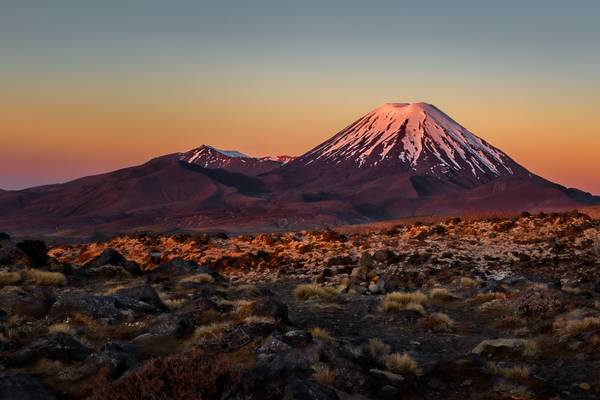
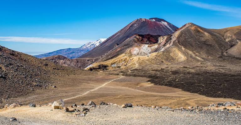
... or Mount Doom as it is better known. As seen while trekking the Tongariro Crossing, perhaps the best one day walk in the world.
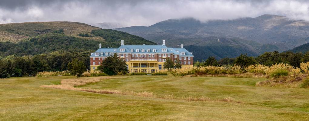
Chateau Tongariro pano... Tongariro National Park, Whakapapa, New Zealand
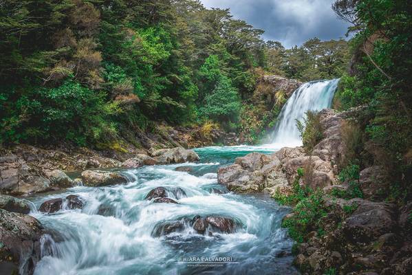
Tongariro National Park, New Zealand © www.chiarasalvadori.com
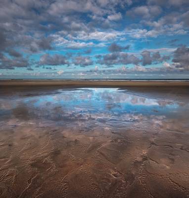
Taken at the reflective sand flats of Herbertville Beach.
See www.josbuurmans.nz/Blog/Visual-Stories/May-2020-A-trip-to... for the full...
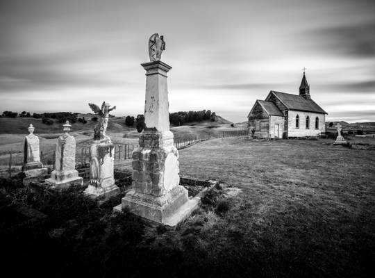
Opaea Church, Manawatu, New Zealand
Those who follow my work know that I am a fan of country churches, and after seeing a photo of this church by...
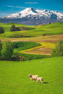
Tongariro National Park, New Zealand © www.chiarasalvadori.com
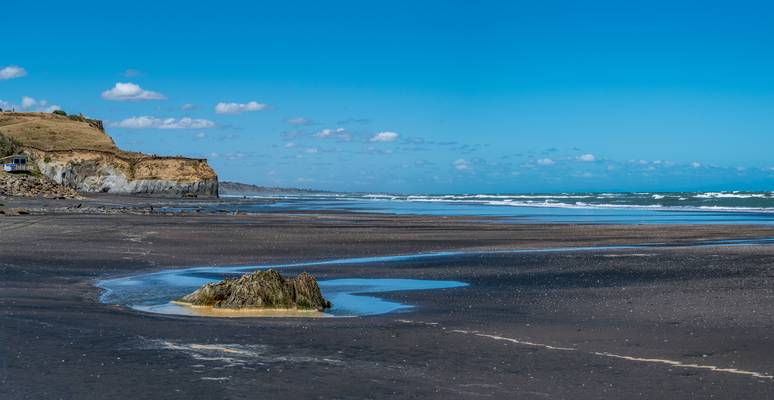
... not sure why the water in front of this beach boulder is so brown....
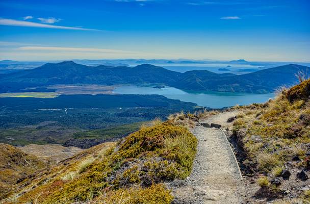
New Zealand's best one day hike!
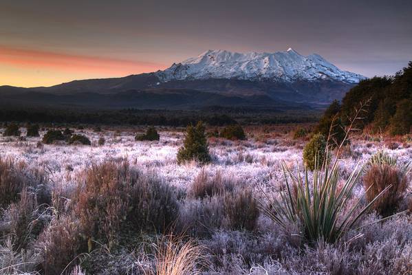
Mount Ruapehu before sunrise on a frosty winter morning, Tongariro National Park, highest point on North Island at 2797 m / 9,176 ft, New Zealand.
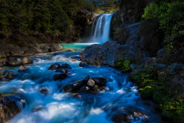
The Tawhai Falls tumble over the edge of an ancient lava flow which erupted from Ruapehu many thousands of years ago.
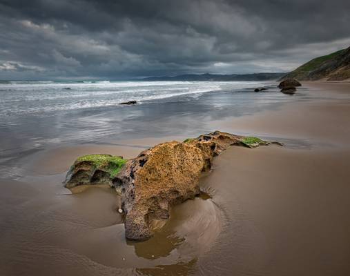
Sedimentary rock exposed on a cloud covered stretch of sandy beach at Herbertville.
See www.josbuurmans.nz/Blog/Visual-Stories/May-2020-A-trip-to......
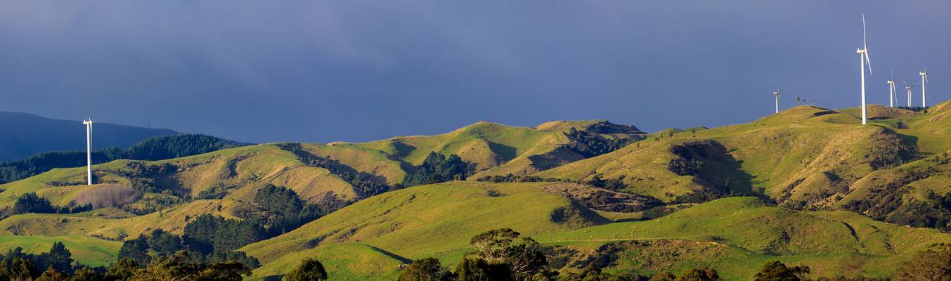
Wind turbines at the Te Apiti Wind Farm near Ashhurst.
Ratana Church, Raetihi, New Zealand
Fujifilm X-E2, ISO200, 60sec, 55mm, f8, Nisi 6 stop ND filter Processed in Lightroom and Photoshop
Thanks to all Phoide contributors to Manawatu-Whanganui!
Most notably David Hamments and J. Chea.