
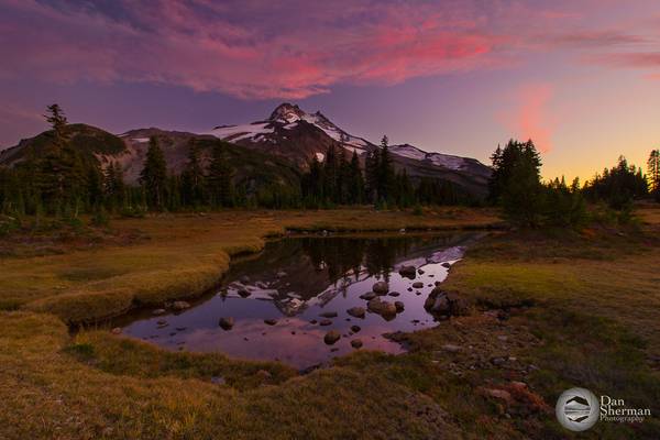
Marion County
- Helen Keller.
| facebook | 500px | ferpectshotz |
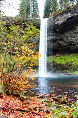
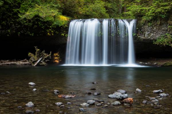
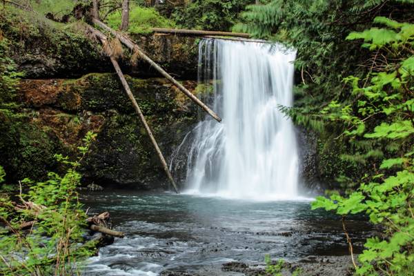
Another shot from the Silver Falls State Park located near Salem Oregon. This is one of those falls which is so huge you can walk underneath the falls completely dry if the wind is not messing with you. We did this short hike and left completely in awe of this stunning waterfall.
The trailhead said the whole trail contains more than 10 different waterfalls and I can’t wait to return to explore them all, hopefully one a less crowded day. Thanks for visiting and have a nice day.
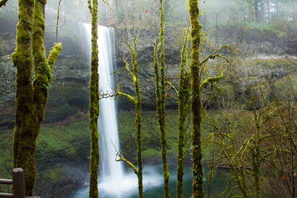
Taken on a misty day, the water is low at this time of the year, but come Spring it will be very full and lovely.
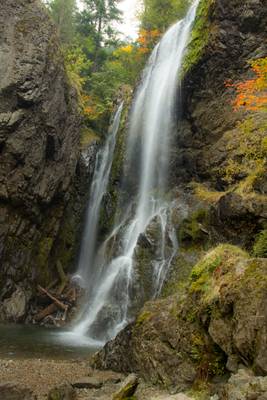
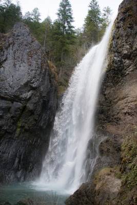
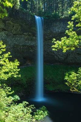
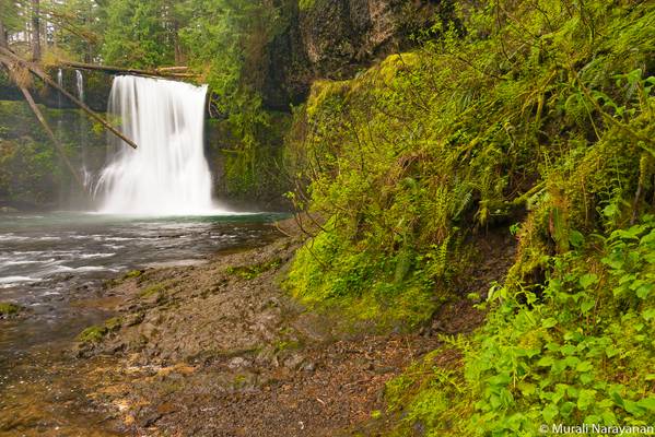
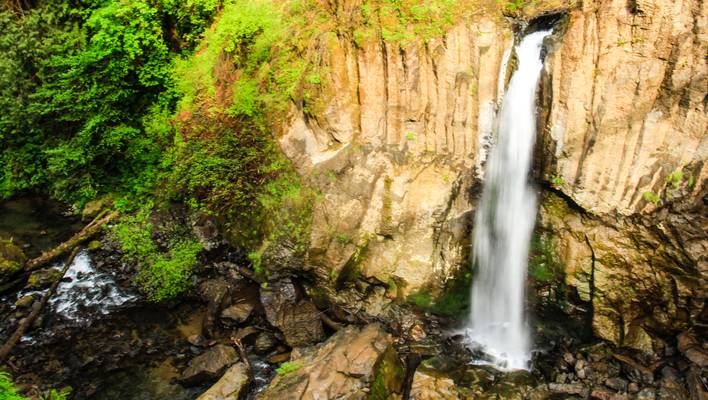
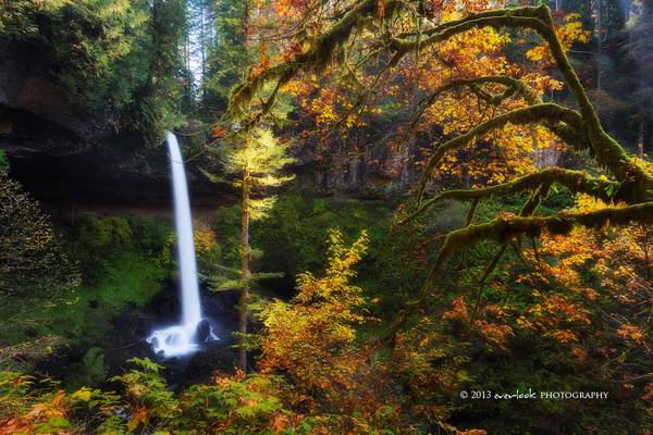
Henline Falls is a broad curtain type fall, dropping 126 feet over the side of a narrow alcove. During periods of lower water levels Henline Creek will split into two or three more distinct channels of water and spray into the cove in multiple distinct sheets of droplets.
Henline Falls was named after the creek, which was in turn named for a settler of the area who had come in search of the rich prospecting in the area. Immediately to the right of the base of the falls is the Silver King Mine. Remnants of a tramway leading from the mine are visible as the trail near the falls. The adit itself is dry, so exploration is possible, but do not enter the mine alone.
- Dalai Lama.
| facebook | 500px | ferpectshotz |
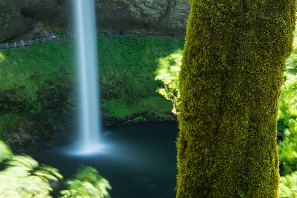
Another shot from silver falls state park. I have to confess that the idea for this shot came from my wife who was having a hard time getting her camera phone to expose the moss correctly. So I took this shot while showing her how a manually setup camera can easily do what confuses an auto mode.
Thanks for visiting
Silver Falls State Park, Oregon
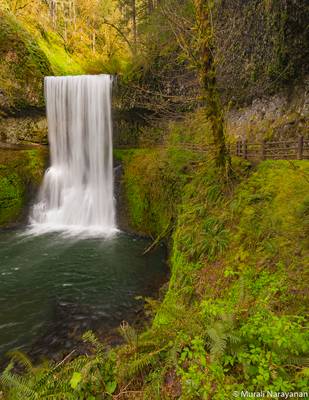
Lower South Falls is one of four waterfalls in Silver Falls State Park featuring a trail which passes behind the falling water. Unlike the other three, the confines of the overhang behind the falls are quite cramped, and as such the trail has been constructed bordered with a very tasteful stone wall that blends into the landscape quite unobtrusively, which gives the falls a bit of a rustic feel more typically associated with areas like the Columbia River Gorge.
While South Falls is unquestionably the most impressive waterfall in Silver Falls State Park, Lower South Falls is no slouch either. With a drop of 93 feet the falls are only the 5th tallest in the park, but still a waterfall of major significance.
This is one of the waterfalls you can walk behind, a nice groomed trail is maintained.
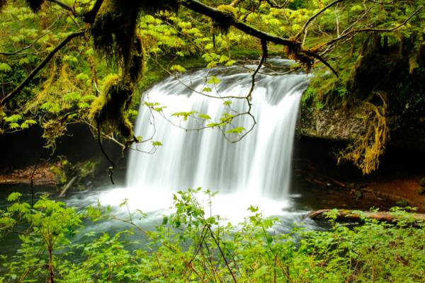
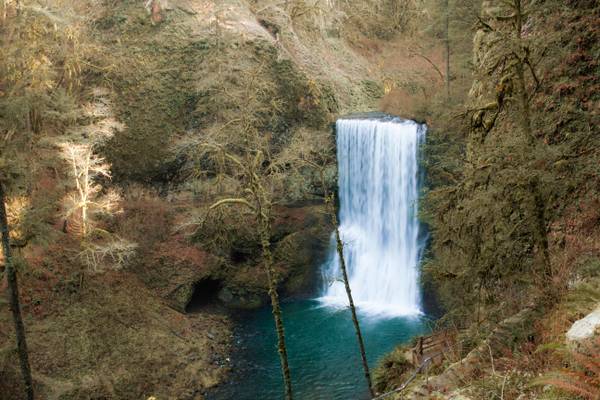
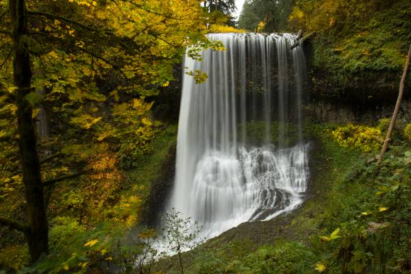
Shellburg Falls is the centerpiece waterfall in the small sliver of the Santiam State Forest along the Stout Creek canyon. The falls plunge 100 feet over a protruding basalt ledge which creates a large recess behind the falls - a surprisingly common feature for waterfalls in this area of Oregon - through which the trail traverses around the falls and then climbs to the top of the canyon. Because Shellburg Creek relies solely on rainfall to sustain its flow, it runs very low in the summer.
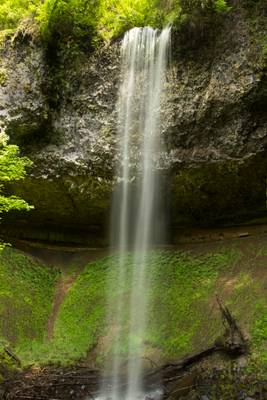
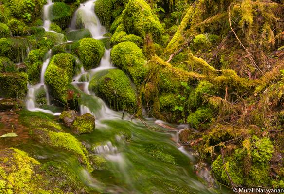
Now that the Spring snow has started to melt, if you can get to these falls, the cascades are impressive. These are one of the falls located in the Opal Creek Wilderness area. This image was one of several, I had to clean off my lens after each shot, so much spray!
Henline Falls is a broad curtain type fall, dropping 126 feet over the side of a narrow alcove. During periods of lower water levels Henline Creek will split into two or three more distinct channels of water and spray into the cove in multiple distinct sheets of droplets. This disconnect between the powerful falls seen during the wet season and the lacy, delicate falls encountered in the dry season will determine whether the entire falls can be viewed by visitors - at high water so much spray blasts out from the falls that attempting to cross the creek to where all-encompassing views are possible is treacherous (and photography is pretty much impossible).
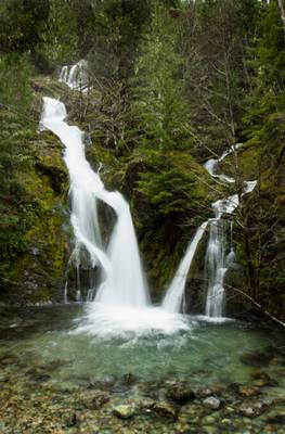
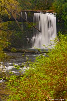
Sullivan Creek is the largest tributary of Cedar Creek, itself one of the larger feeders of the Little North Santiam River. As the creek drops to it's confluence with Cedar Creek, it cascades down this series of pretty and rather impressive falls. Some published accounts suggest the falls are between 40 and 60 feet tall, however on our most recent survey we measured the falls to stand 162 feet tall. This is likely not an accurate measurement of the entire falls either, as there are at least two more tiers just upstream which are not visible from the road, and this may bring the total height of the falls to over 200 feet.
Though the entire falls are not visible from below, absolutely zero effort is needed to enjoy this waterfall. The stream crashes down the final steps of the series of cascades into a pool immediately adjacent to the road, which offers a nice opportunity for wading and cooling off in the summer.
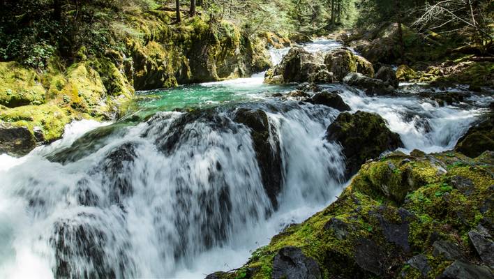
The Opal Creek Wilderness area has several phenomenal sights within its boundaries. Three Pools are an easily accessible swimming holes on the north fork of the Santiam River. There is the possibility to cliff jump from multiple locations.
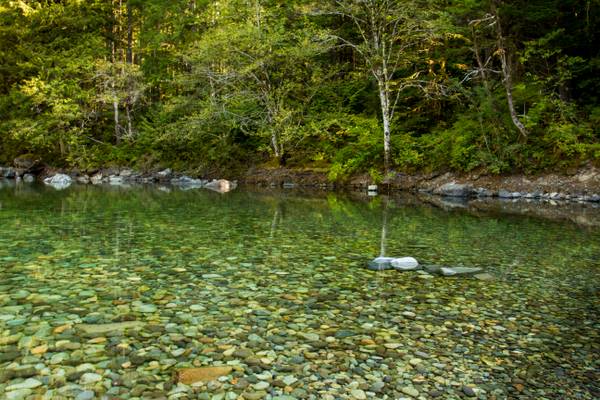
The quieter side of Three Pools is the south bank of the Little North Santiam. Which is what I have photographed here. Because the water is more shallow and runs slower you will find smaller children here during the summer months.
Nine months of the year, you can hike this trail and enjoy a pleasant experience. There's a craggy rock pillar in the middle of the river, and a marvelous grotto with two mouths in the cliffs near the pillar north of this spot.
Title for photo came from an engraved stone above the second floor door/window
Silver Falls State Park, Oregon
The Opal Creek Wilderness is a wilderness area located in the Willamette National Forest, on the border of the Mount Hood National Forest. It has the largest uncut watershed in Oregon.
Opal Creek and nearby Opal Lake were named for Opal Elliott, wife of early Forest Service ranger Roy Elliott.
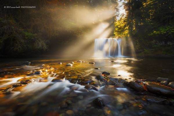
This was one of my favourite scenes for the recent trip . Late morning, slight breeze, bright sunshine through the mist of the falls - all perfect...
This sky was one of the most spectacular skies I had ever seen, and it was so unexpected! Jeff Barnhart, Alan Howe, my little brother and I all took...
If this be not love, it is madness, and then it is pardonable… -William Congreve
| facebook | 500px | ferpectshotz |
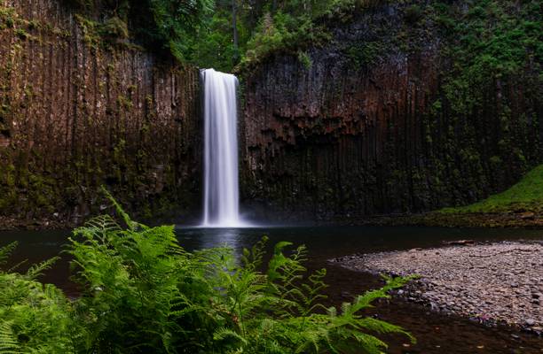
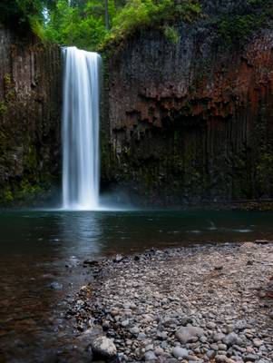
I first visited Oregon couple of years ago on a summer road trip along with my wife. We both enjoyed the state's natural beauty so much that we decided to head back up again this year when we had a chance. Last time we were there we spend a whole day searching for the illusive Abiqua falls but were unlucky in finding it. This time I was better prepared and had an idea about the approximate location of the trailhead. Plus we were lucky that we met some locals who directed us to the exact start point of the trail.
The trail is completely located within private property but the owners had allowed nature lovers to explore the area, which was totally awesome and I hope everyone to venture to this trail respect the instructions posted. You basically can drive up until you see a white metal fence blocking the road and the trail to the falls start to the left of the road. Once you start the hike, the trail immediately divides into three different paths and the left most one seems to be the shortest and the easiest. So that’s basically my tips for this hike, also make sure good hiking boots and some food as this hike is a bit hard without those.
Silver Falls State Park, Oregon
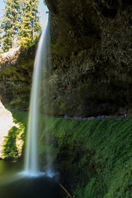
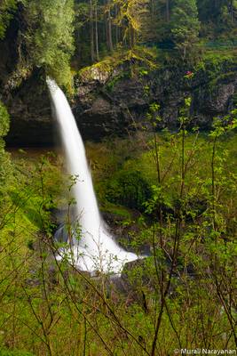
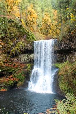
South Falls is the highlight of Silver Falls State Park, and due to its proximity to the city of Salem, is likely one of the most popular waterfalls in Oregon outside of the Columbia River Gorge. The falls are produced where South Silver Creek plunges 177 feet over a huge overhanging basalt cliff with a large pool occupying the bottom of the amphitheater. While South Silver Creek isn't nearly as voluminous as North Silver Creek, South Falls will still swell to impressive volumes during the wet season and is without question the most powerful waterfall in Silver Falls State Park during the high water season.
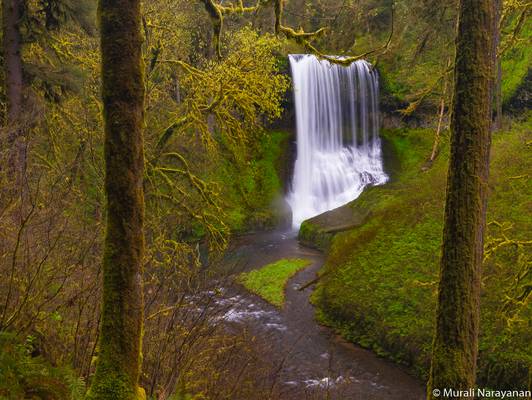
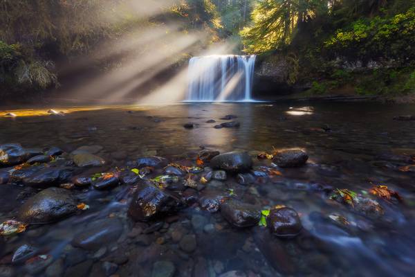
Like North Falls further upstream, Middle North Falls has certain characteristics which one could argue give it an edge when comparing it to the park's main attraction, South Falls. Despite being considerably shorter, Middle North Falls is a markedly amorphous waterfall which changes physical shape in a very dramatic way as the volume of water in North Silver Creek changes. The 106 foot tall falls take the form of a narrow column of water during the summer months, funneled to perhaps 5 feet wide at most by a narrow runnel in the bedrock. With greater stream flow in the winter and spring months however, North Silver Creek sheets out across the 60-foot wide creek bed and turns the falls into a broad curtain of water, with part of the falls impacting on a twisting chute of basalt which then slides to join the more volumnous half of the creek in the plunge pool.
Middle North Falls is one of four waterfalls in Silver Falls State Park which features a trail which traverses behind the falling water. Unlike the other three, the trail leading behind Middle North Falls is a dead-end, constructed purely to allow access to additional views of the falls.
- Robert Frost.
| facebook | 500px | ferpectshotz |
This shot was taken at the Silver Falls State Park, located in the foothills of Cascade Mountains, this park is a major tourist attraction. We made a mistake making this our destination on 4th of July weekend as the park was packed with visitors. There is a ten falls hiking trail which starts from here but we only got to see this one and at 177 ft this is an impressive falls in person. If you look carefully you could see people walking behind the falls and just get an idea about the enormity of this beautiful waterfall.
I hope to return here one day again and to do the ten falls hike. Thanks for visiting hope you like it.
- Mary Wollstonecraft.
| facebook | 500px | ferpectshotz |
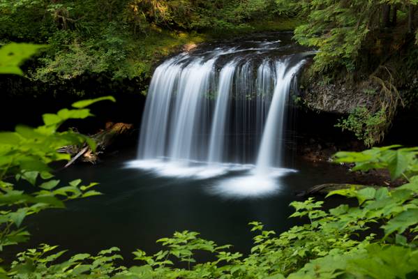
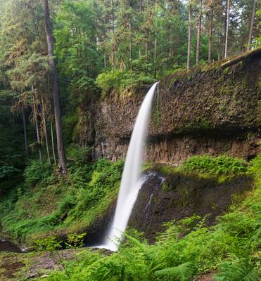
Let’s take a break from all the lighthouse pictures and start some of the awesome waterfalls in Oregon. We went for waterfalls on our third day and the Upper Butte Creek falls was our second stop of the day. Road to this falls in not paved and its quite a bone jarring ride to get here.
Once you park the car there is a loop trail about 1.1 miles long, going all the way to the fall. This falls provides an awesome view from the left side of the falls and then you can access a path to get to the base of the falls and actually even go behind the falls. The fall is about 20ft in height but stunningly beautiful.
If you are in the Salem, OR area please make this a must visit as this is totally worth it. Thanks for visiting hope you like this one.
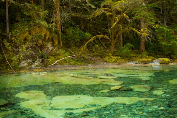
These falls run into the Opal Pool, a favorite swimming hole in the area.

This summertime swimming hole is a favorite for those in the know. Be forewarned it is always cold.
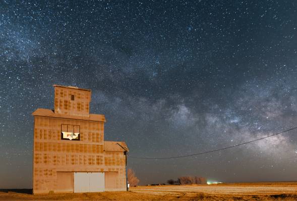
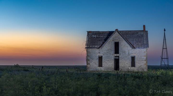
Bright yellow light a quarter to a half mile away made it a tough shot. Exposing for the sky, the elevator was overexposed
Silver Falls State Park
Light mist falling.
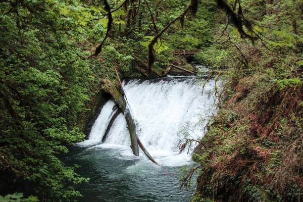
Salmon Falls is the largest waterfall along the Little North Santiam River, as well as the river's natural barrier to upstream fish migration. The falls drop 24 feet in a pair of side-by-side plunges with a fish ladder bypassing the falls on the far bank. Fortunately the ladder is more or less enclosed within the natural bedrock and only a small concrete structure is visible to indicate the presence of human interference. A small county park provides access to the falls as well as picnic facilities. As of November 2012 part of the short trail leading down to the river below the falls was heavily eroded.
Silver Falls State Park, Oregon
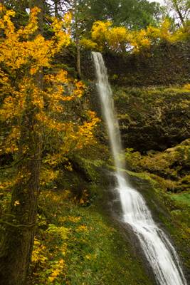
Officially, the 4th tallest waterfall in Silver Falls State Park. The falls drop 134 feet, plunging straight down before striking a steeply slanted protrusion of basalt which causes the stream to veiling the remaining distance to the floor of the canyon. As the name of the falls implies, Winter Creek only flows during the winter months, or in this case the wetter times of the year.
The waterfalls of Silver Falls State Park were discovered and named by local photographer June Drake in the late 1880's.
Butte Creek, Oregon, USA
Yes, it's pronounced beaut as in beauty not butt as in buttcrack. It finally dawned on me on the last trip when asking...
This is what Alan, Jeff, and I were met with the morning after an amazing sky. I opted to leave camp in the dark of early dawn to hike Park Ridge in...
- Arthur Young.
| facebook | 500px | ferpectshotz |
Here is another shot of the Upper Butte falls from our Oregon trip. This shot was taker directly from in front of the falls as I wanted to show the beautiful curtain form of the fall. This is one of the most memorable locations on our Oregon road trip and riding through a bone jarring stretch of forest road was totally worth it.
Hope everyone likes it..
- Marcus Aurelius
| facebook | 500px | ferpectshotz |
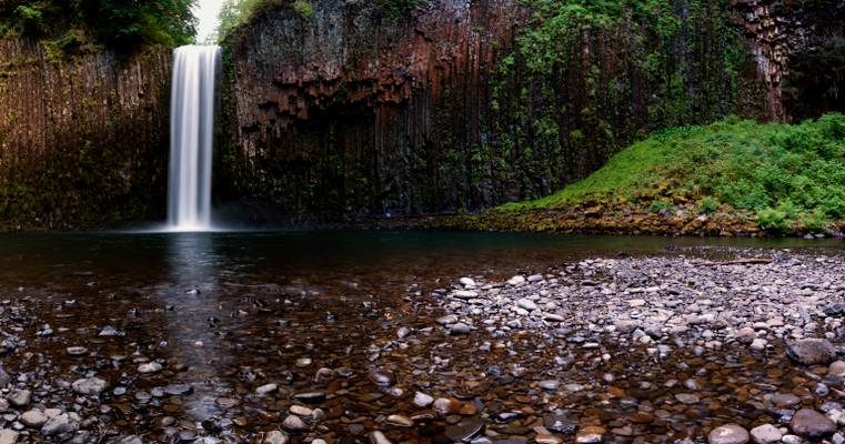
I sometimes still can’t believe that I was lucky enough to see the stunningly beautiful Abiqua waterfall after it eluded me twice. I am originally from a part of India where there are waterfalls everywhere and spend a lot of my teenage years venturing out to see some of the hidden waterfalls near my home as most of the popular ones were ruined by naked commercialization. So even if I had to make two trips and endure some pretty sketchy 4WD driving and some hiking, it really was nice to see a waterfall this famous maintaining its wilderness. This is one of those spots I want to return just for the sake of being there.
- Le Corbusier.
Staying on the composition theme, here is an image where careful composition adds to an already stunning location. Abiqua Falls near Silverton, Oregon, is a bit of a challenge to find but spectacular if you are willing to put in the effort. There is a classic composition at this spot, and after taking the obligatory shot, I was looking for unique compositional opportunities. I usually have a polarizing filter glued to my lens when I am shooting waterfalls, but I forgot to pack one into my hiking bag on this particular day.
As I was walking by the stream below, this curve in the banks caught my eye. It had an excellent shape that I could use as a leading line to the frame's brightest point, the waterfall itself. I had a 3-stop ND filter to slow the water down and positioned myself to get the waterfall lined up with the curve. Not having the polarizer, I could not get rid of the water's reflection, but I believe the reflected light works well for this image, bringing the viewer's attention to the frame's leading line.
- John Galsworthy.
| facebook | 500px | ferpectshotz |
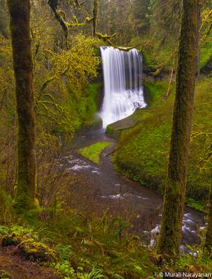
If uniqueness is used as the measuring parameter, the Middle North Falls or Marion County, Oregon will be in anyone’s top 10 list of waterfalls in the pacific northwest. During our first visit to Oregon, we got delayed getting to this fall and couldn’t even see the trailhead at night. So, when we planned a second trip to Oregon I was careful to allocate extra time and we reached the trailhead just as the sunset was about happening.
In our panic, we started hiking in the wrong direction and lost about 10-15 mins before realizing our mistake. After returning to the hike and finding the correct trail, we managed to reach the falls with some light still around.
Unfortunately, the standout feature of the waterfall, the wide curtain like span of the falls was not present. Later I find out that this fall has no prescribed shape and changes dramatically based on the volume of water in North Silver Creek. Plus, summer is not the best time for waterfall photography in Oregon, the best time is late spring or fall. Hopefully, I get to visit this beautiful place again.
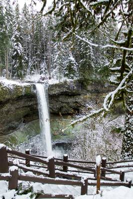
Silver Falls, North Falls, snow covered winter.
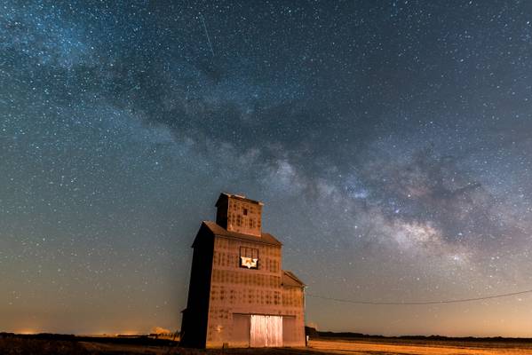
My first Milky Way shots of the year
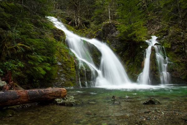
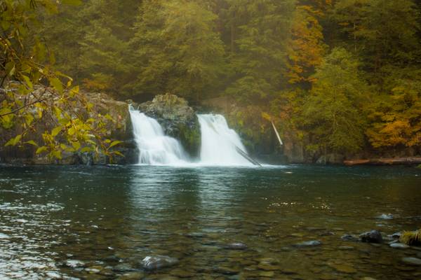
This fall is pretty in the summer but much more dramatic in the winter with the 3 - 4 different cascades of water coming down. In the summer you can easily wade into the pool for a nice dip.
Sullivan Creek is the largest tributary of Cedar Creek, itself one of the larger feeders of the Little North Santiam River. As the creek drops to it's confluence with Cedar Creek, it cascades down this series of pretty and rather impressive falls. Some published accounts suggest the falls are between 40 and 60 feet tall, however on a more recent survey the measurement of the falls was 162 feet tall. This is likely not an accurate measurement of the entire falls either, as there are at least two more tiers just upstream which are not visible from the road, and this may bring the total height of the falls to over 200 feet.
Though the entire falls are not visible from below, absolutely zero effort is needed to enjoy this waterfall. The stream crashes down the final steps of the series of cascades into a pool immediately adjacent to the road, which offers a nice opportunity for wading and cooling off in the summer.
Silver Falls State Park, Oregon
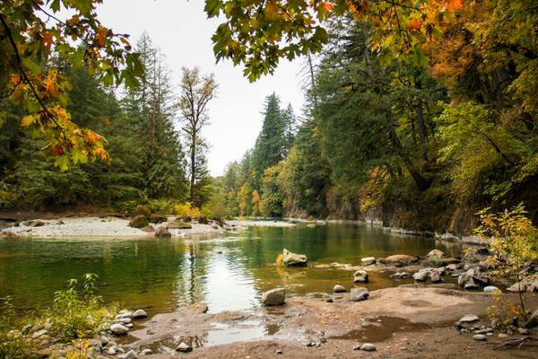
The Breitenbush River is a tributary of the North Santiam River in western Oregon in the United States. It drains a rugged, forested area of the Cascade Range east of Salem. The North and South forks flow west, joining 0.25 miles (400 m) east of the small community of Breitenbush. The combined stream flows generally west-southwest through the Willamette National Forest. It joins the North Santiam at Detroit.
The water is very high and fast right now. Later in the year these falls become lazier.
Silver Falls State Park Oregon
This is one waterfall Mecca I will not forget in a hurry. With Charlotte on my back, we managed to get to 6 of the 10...
Thanks to all Phoide contributors to Marion County!
Most notably Bonnie Moreland, Sandeep Thomas and MURALI NARAYANAN.