
Oberland administrative region
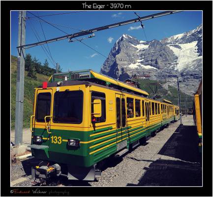
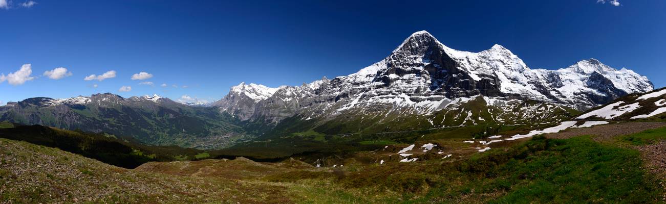
The Eiger is a 3970 metres (13,020 ft) mountain in the Bernese Alps in Switzerland. It is the easternmost peak of a ridge crest that extends across the Mönch to the Jungfrau at 4,158 m. The northern side of the mountain rises about 3,000 m (9,800 ft) above Grindelwald and other inhabited valleys of the Bernese Oberland, and the southern side faces the deeply glaciated region of the Jungfrau-Aletsch, covered by some of the largest glaciers in the Alps.
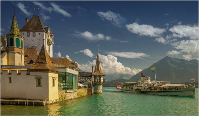
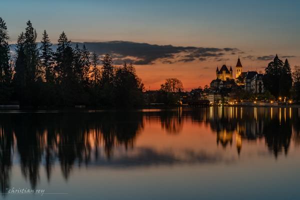
The paddle steamboat "Blümlisalp" reaches the Oberhofen Port on schedule.
Sony ILCE-6000 Samyang 12mm 1/200sec. f: 8 ISO 100
Sony ILCE-6000 Samyang 12mm f: 8 ISO 100
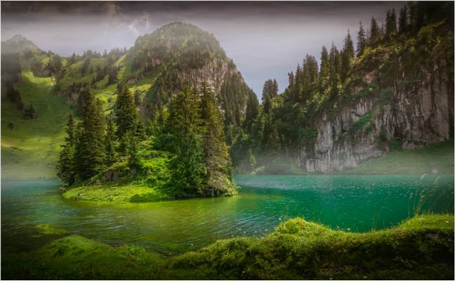
Splendide réserve naturellle. Petit parking près du Lac (mais toujours complet à la bonne saison). Se parquer dans le village de Lauenen, pui soit onter à pied aur un sentier de randonnée, soit prendre le bus postal. Arrivé au lac, prendre le sentier qui fait tout le tour du lac.
My images are for sale either as art prints, for paper print (magazines) or for internet use. Art print can be delivered internationally. See examples in my album: flic.kr/s/aHskJyXpCJ If you're interested in any of my images please contact me by email at stephanna.guertler@hotmail.com.
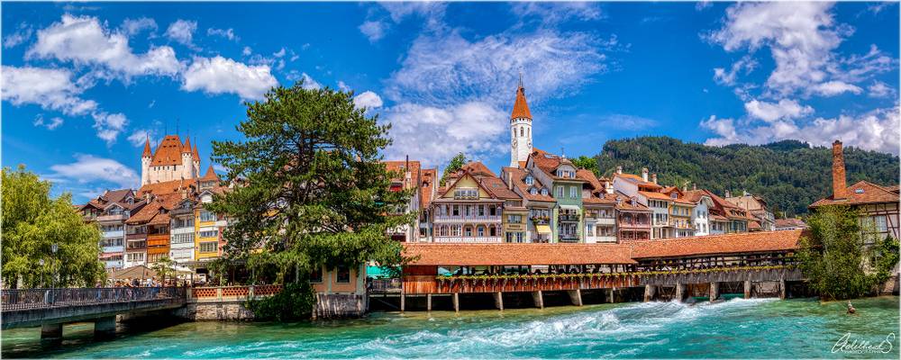
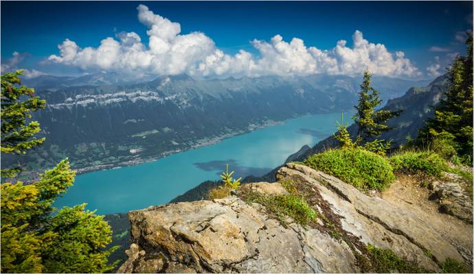
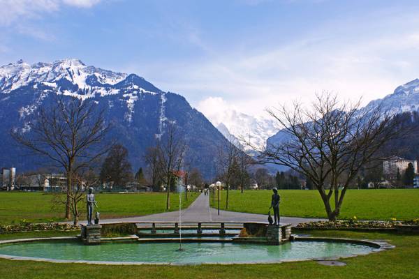
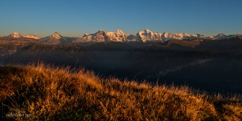
Something different, a sunny and colourful daytime panorama of the pretty town of Thun. It was actually quite a challenge to piece together four images without too much geometric distortion, and I know I haven't succeeded in correcting it all. But I like the way the colours turned out, and also I felt sorry for my oneother Swiss photo sitting alone in the Switzerland album ☺.
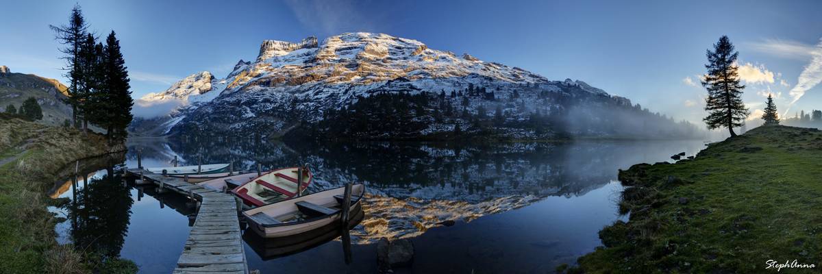
Une belle matinée à l'Engstlenalp.
Assemblage de photos verticales prises à 46mm.
Entre quelques bouffés de brumes qui passaient devant les alpes Uranaises j'ai pu entrevoir les rayons du coucher de soleil sur le Wendenstöcke. Le bateau et l'encadrement par les sapins ajoutaient à la beauté du moment.
My images are for sale either as art prints, for paper print (magazines) or for internet use. Art print can be delivered internationally. See examples in my album: flic.kr/s/aHskJyXpCJ If you're interested in any of my images please contact me by email at stephanna.guertler@hotmail.com.
Panorama of Grindelwald, Eiger, Mönch & Jungfrau, Kleine Scheidegg - Männlichen Walk, Berner Oberland, Switzerland
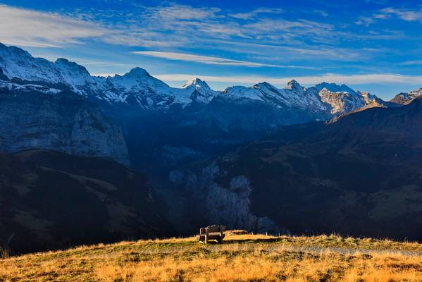
The lonely bench in front of the Lauterbrunnen Valley .Sunrise time. Canton of Bern, Switzerland.2019:10:23 09:20:21.No. 550.
Thank You for your inspiration ü!
Vue depuis la Kleine Scheidegg Pano composé de 8 images, 70mm, 1/125s, f/3.5, ISO 100
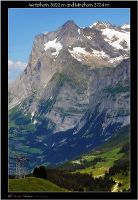
The Wetterhorn (3,692 m) is a mountain in the Swiss Alps towering above the village of Grindelwald. Formerly known as Hasle Jungfrau, it is one of three summits of a mountain named Wetterhorn sensu lato, or the "Wetterhörner", the highest summit of which is the Mittelhorn (3,704 m) and the most distant the Rosenhorn (3,689 m). The Mittelhorn and Rosenhorn are mostly hidden from view from Grindelwald.
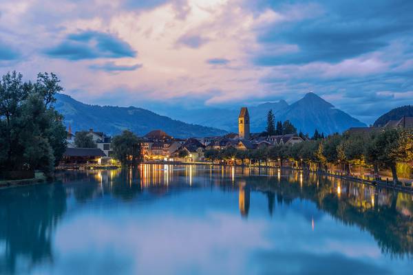
Depuis les berges de l'Aar, une belle vue s'offre sur la veille ville dominée par son château et son église. Photo prise le soir à 65mm.
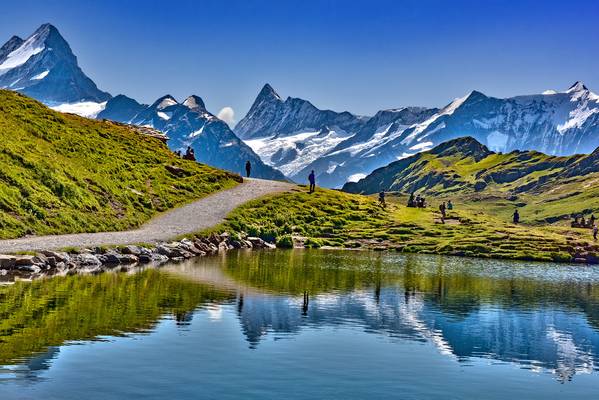
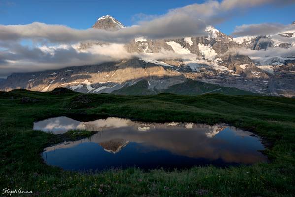
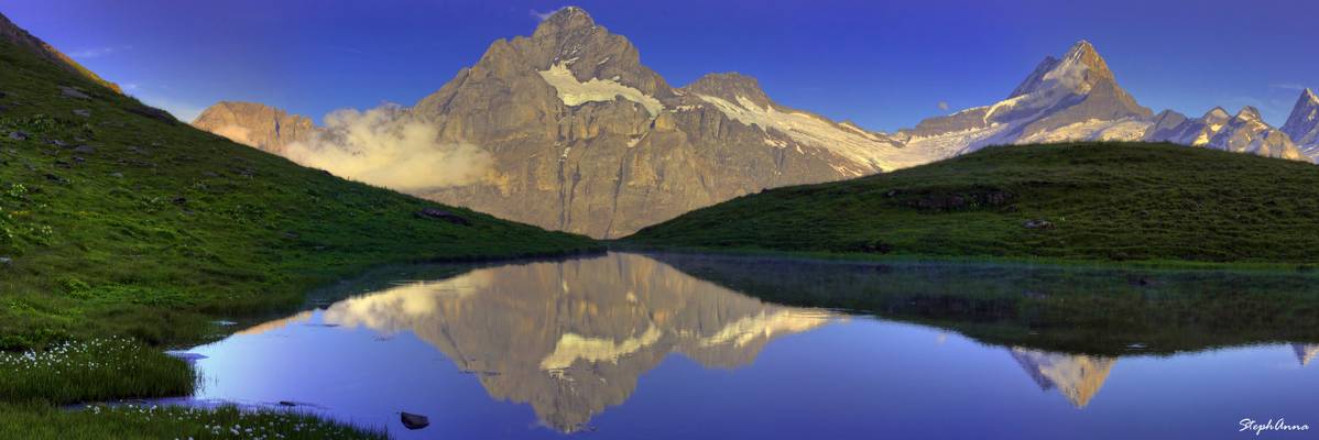
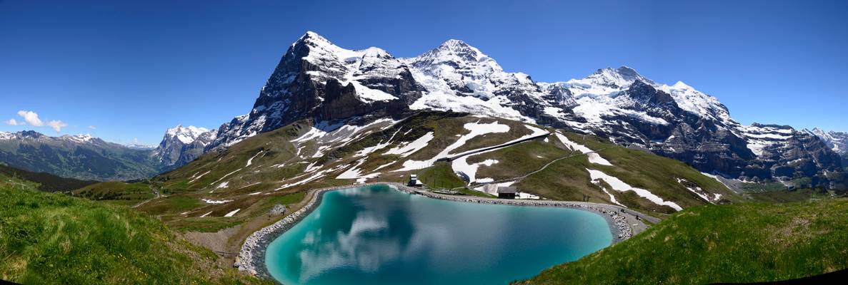
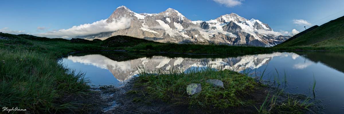
Let's go see an Alpine Paradise. The Bachalpsee panorama. Grindelwald, Canton of Bern, Switzerland.26.08.19, 13:03:17. No. 91.
My admiration to the amazing Anita Rachvelishvili - Mezzo Soprano .
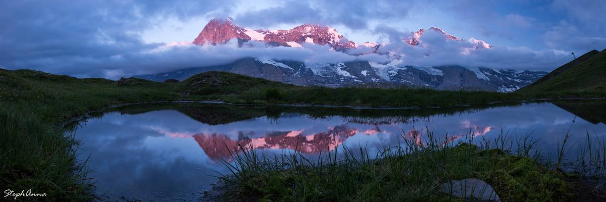
"It's impossible to imagine the Swiss mountain world as more idyllic than the area surrounding Lake Bachalpsee. The snow-covered peaks of the Alps are reflected in the crystal clear blue water.
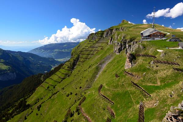
First is the starting point for hikes and it offers action: An adrenaline rush and speed thrills are guaranteed on the First Flyer, trottibike scooters or bikes. Children can have fun on the 700-m² playground at the Bort intermediate station."
Trois étapes vous seront nécessaires pour débarquer en toute tranquillité dans cet écrin de nature montagnarde paradisiaque. A 2200 mètres d'altitude, le First offre des panoramas étourdissants, notamment une vue imprenable sur sept 4000 des Alpes bernoises.
En une petite heure de marche à travers pâturages et chemins pédestres bucoliques, vous atteignez le superbe lac Bachalpsee et ses eaux cristallines. De tous les côtés, des points de vue pittoresques. Inoubliable ascension. Pour un peu de culture, passez donc la nuit au Berghotel Faulhorn, le plus ancien hôtel de montagne de Suisse!
Der First ist eine Verflachung des Südwest-Rückens zum Widderfeldgrätli (2'632 m ü. M.) im Berner Oberland nördlich oberhalb von Grindelwald. Er ist über eine Gondelbahn oder zu Fuss erreichbar. Die obere Bergstation heisst ebenfalls First (2'167 m ü. M.) und steht den Besuchern im Winter und im Sommer mit einem gut ausgebauten Ski- und Wandergebiet zur Verfügung.
Besonders beliebt ist die Wanderung zum Bachalpsee und weiter zum Faulhorn, die ein spektakuläres Panorama mit Blick auf den oberen Grindelwaldgletscher sowie Eiger, Mönch und Jungfrau bietet. Eine weitere interessante Wanderung führt auf das Schwarzhorn. Östlich von First liegt 5,6 Kilometer zu Fuss entfernt die Grosse Scheidegg.
Der First ist ein Startort für Paraglider und Deltasegler sowie Ausgangspunkt für zahlreiche Mountainbiketouren. Station First bietet auch einen imposanten kurvenreichen Schlittenweg, welcher bei guten Schneeverhältnissen direkt nach Grindelwald führt.
This information was found in Swiss tourism and Wikipédia.
My images are for sale either as art prints, for paper print (magazines) or for internet use. Art print can be delivered internationally. See examples in my album: flic.kr/s/aHskJyXpCJ If you're interested in any of my images please contact me by email at stephanna.guertler@hotmail.com.
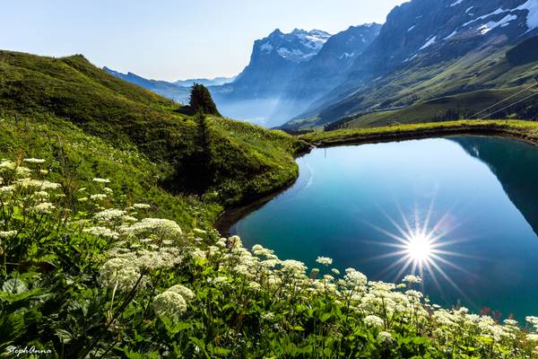
Le même lac artificiel que la photo précédente, mais avec un soleil qui tombe dans un angle différent. La couleur est réel et je n'ai rien saturée. J'ai juste utilisé un filtre polarisant.
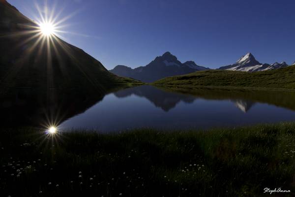
Belle Bernoises vu depuis le Bachalpsee
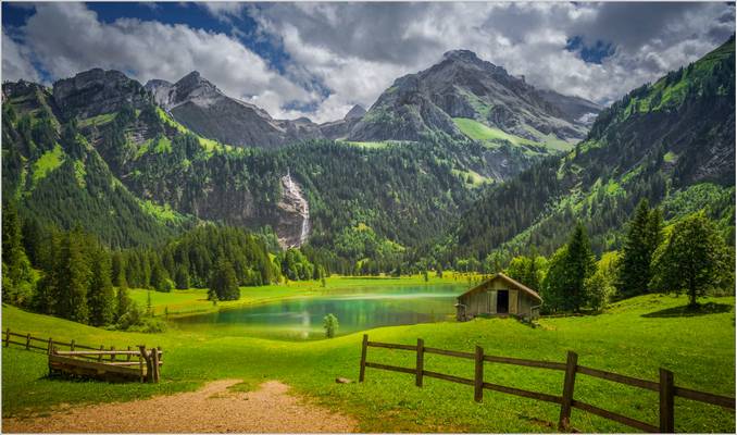
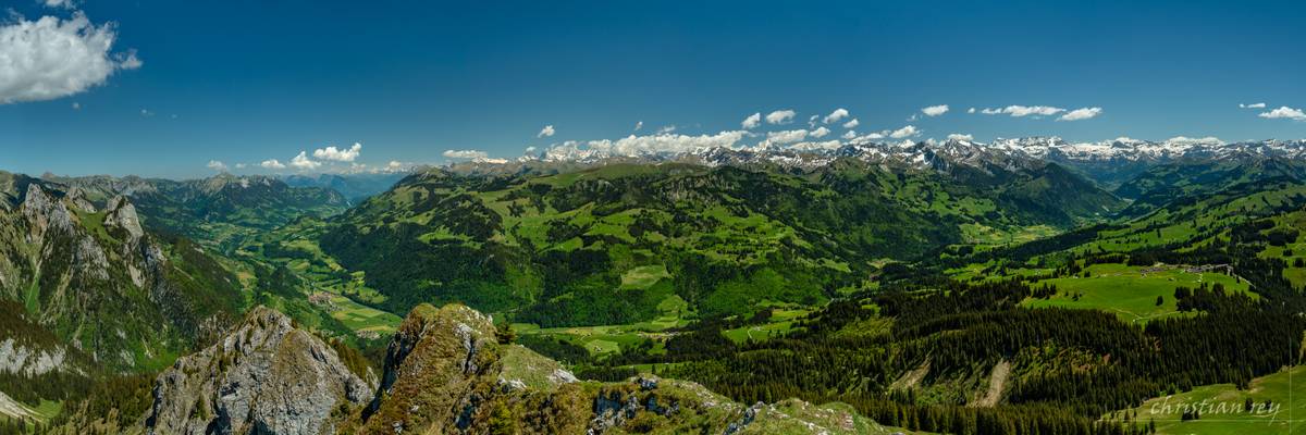
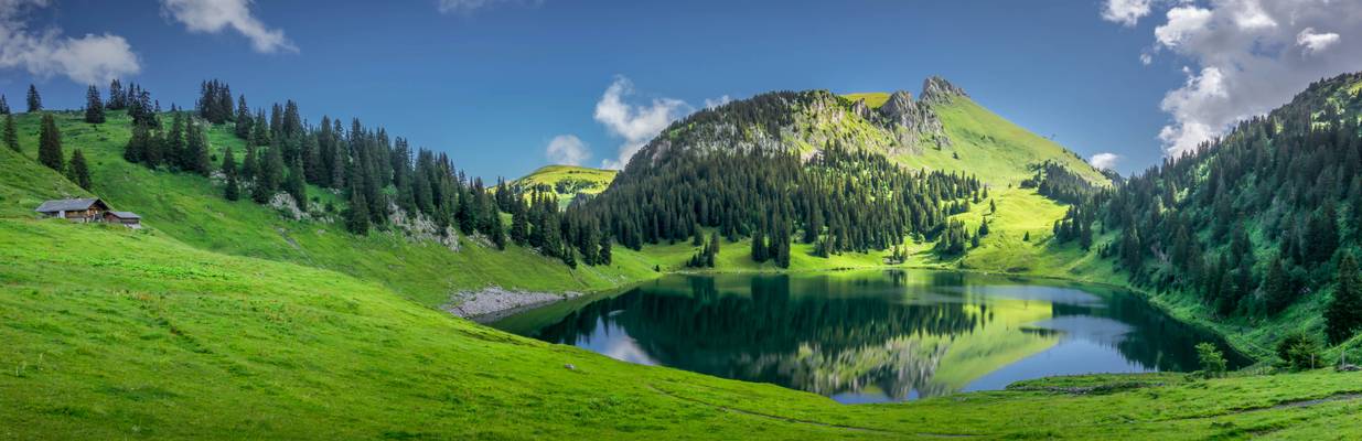
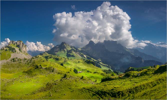
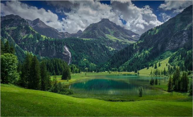
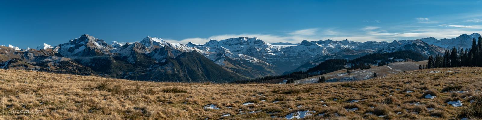
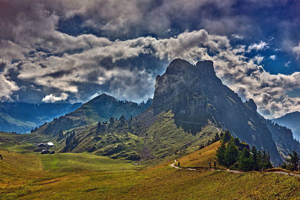
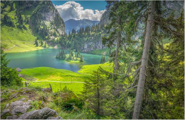
A worth seeing destination during a fascinating hike in the Gstaad region.
Sony ILCE-6000 Samyang 12mm
Männlichen, Berner Oberland, Switzerland
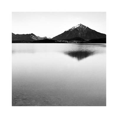
The Stockhorn is a mountain of the Bernese Alps, overlooking the region of Lake Thun in the Bernese Oberland. It is located north of the town of Erlenbach in the Simmental.
The Stockhorn is 2,190 m (7,190 ft) high and is accessible via cable car from Erlenbach. It has a restaurant at the top and is a good starting point for many hikes. There is good fishing in the two lakes right below the Stockhorn, the Oberstockensee (around 1,650 m [5,410 ft] high) and the Hinterstockensee (around 1,550 m [5,090 ft] high). There is a subterranean water connection between the two lakes.
From the top the view includes many of the surrounding Alps; the Eiger, Mönch, Jungfrau, Schreckhorn, along with the valley of the Aare river, Thun and Lake Thun, Interlaken and the Jura Mountains. (Wikipedia)
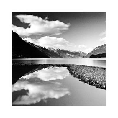
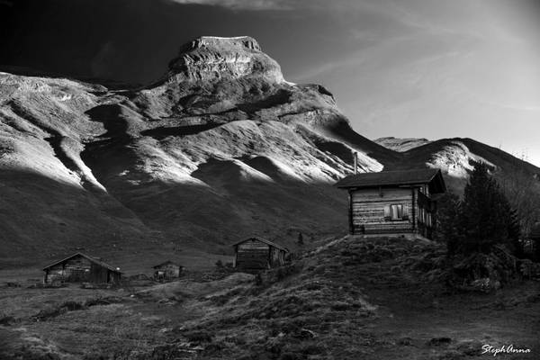
Pentax 645N, shot with a 35mm lens and Kodak T-Max 100 Film

SONY DSC
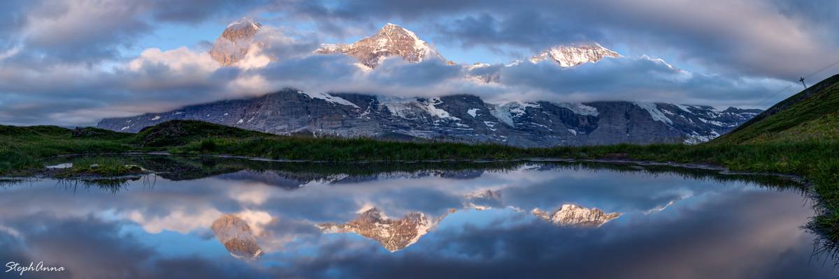
Panorama of Eiger, Mönch & Jungfrau, Fallbodensee, Jungfrau Eiger Walk, Berner Oberland, Switzerland
Pano de 5 images. Suite à vos avis je l'ai éclairci un chouja.
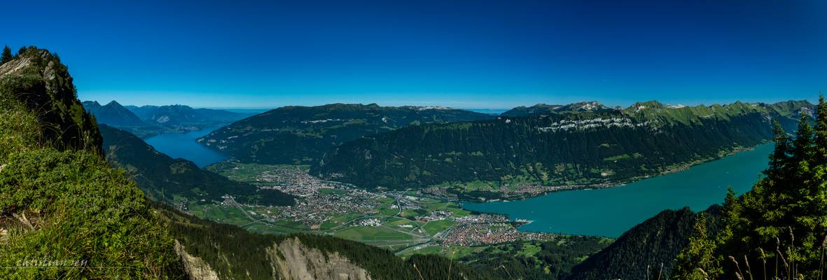
Panorama pris depuis le sentier panoramique de Schynige Platte: à gauche le Niesen (2362m.), le Thunersee et la vallée de l'Aar en direction de Berne, au centre le Niederhorn (1950m.), la ville d'Interlaken, et les villages de Goldswil, Bönigen et Ringgenberg, à droite le Brienzersee avec tout à droite le Brienzer Rothorn (2349.7m.). (Assemblage de 6 photos horizontales avec LR6, 24mm).
The Niederhorn is accessible with a cable car.
It offer a beautiful view on the Berner Alps and Lake of Thun.
Picture tacked at 28mm.
At evening, the ligth on the mountaisn is very beautiful.
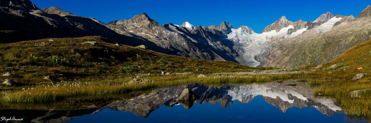
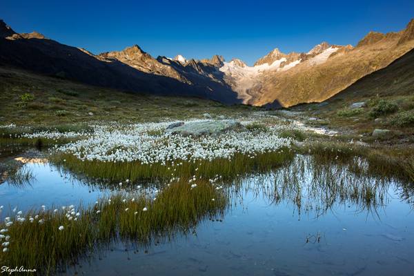
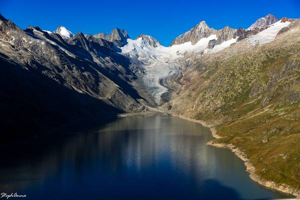
Glacier de l'Oberaar
Sony ILCE-6000 16mm 1/125sec. f: 9.5 ISO 100
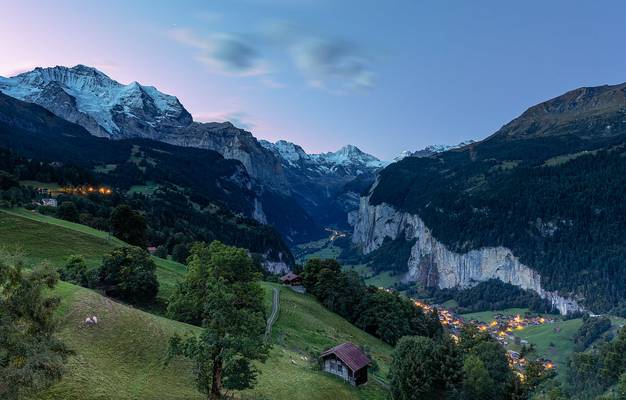
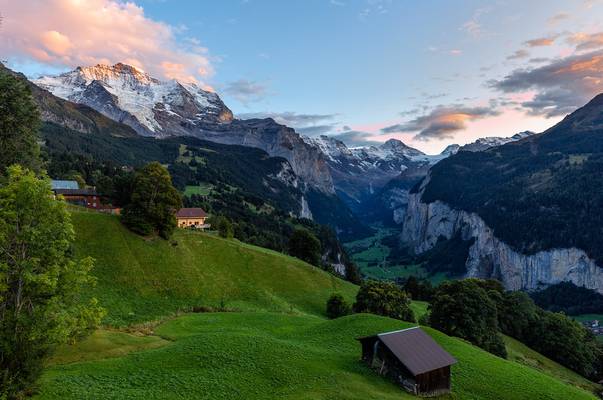
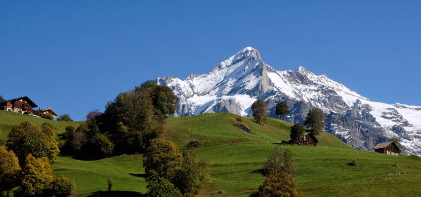
Dawn hour at Wengen
Pentax 645N, 35mm lens and T-Max 100 Film
Accès dpuis le Jaunpass (parking), puis à pied, un chemin goudronné mène jusqu^'à l'alpage de Oberenegg-Läger. Assemblage de photos.
Fishing allowed.
Sony ILCE-6000 1/100 sec. 16 mm f: 9.5 ISO 100
Summer time in Schynige Platte .Canton of Bern. Switzerland. izakigur 04.09.18, 16:04:44 no. 4493.
"The Schynige Platte (Scheinige Platte on the old Siegfried Map)] is a small mountain ridge and a viewpoint in the Bernese Highlands and belongs to the Schwarzhorn group. The mountain range consists of three peaks: Gumihorn (2,099 m (6,886 ft)), Tuba (2,076 m (6,811 ft)), and the closest summit next to the viewpoint, Geiss (2,067 metres (6,781 ft)). The viewpoint lies at an altitude of about 2,000 metres (7,000 ft), at the western end of a prominent ridge of the Schwarzhorn group, which separates the valley of the Schwarze Lütschine from Lake Brienz.
It is notable for its hotel and, since 1893, its mountain railway, one of the highest in Switzerland. In good weather conditions there are views to many surrounding mountains, including the Eiger, Mönch, Jungfrau, and others giants of the Bernese Alps. Also, the town of Interlaken and the two great lakes of Thun and Brienz are visible to the north, 1,500 metres (4,900 ft) lower.
The area is accessible via the Schynige Platte railway, which runs from Wilderswil, where connection is made with Bernese Oberland railway trains from Interlaken. The railway reaches a height of 1,967 metres (6,453 ft) at the terminus station, on the south-facing slopes of Geiss[citation needed] summit. Southwest of the station is a hotel and mountain restaurant, at a height of 1,983 metres (6,506 ft). Northeast of the station is the Schynige Platte alpine botanical garden, specialising in the display of, and research into, the high altitude flora of Switzerland.
A number of short loop trails extend north from the train station, reaching several view points, all within one kilometre from each other. Directly above the station and hotel, and overlooking the valleys of Lauterbrunnen and Grindelwald, is the Geiss summit (2,067 metres (6,781 ft))[citation needed]. Further north, and overlooking Interlaken and the two great lakes, are the Tuba (2,076 metres (6,811 ft)) and Oberberghorn (2,069 metres (6,788 ft)) summits. The highest summit in the Schynige Platte area, between the Daube and Geiss summits, the tower-like Gumihorn peak (2,099 metres (6,886 ft)), cannot be reached by pedestrians. The Schynige Platte is also the starting point for the popular hiking trails to Loucherhorn, Faulhorn or First which is connected to Grindelwald by a gondola lift."
Wikipédia.
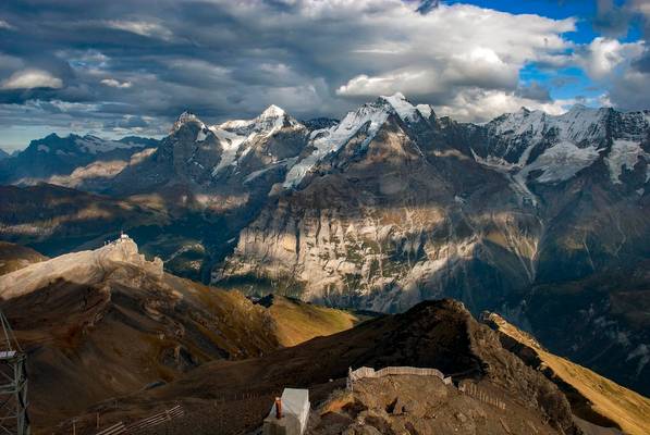
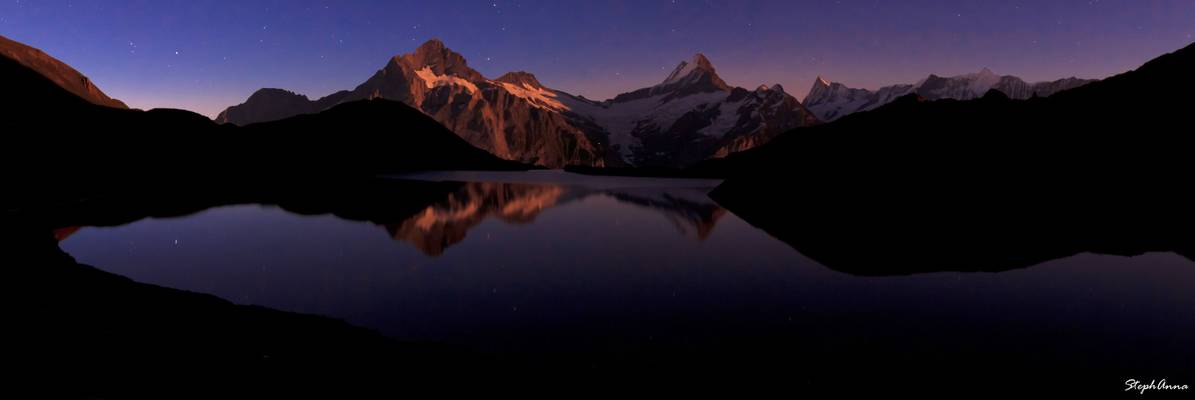
A view to Birg The Jungfrau The Eiger and The Mönch Mountains . A view from Piz Gloria (Schilthorn ) Canton Of Bern, Switzerland. October 7, 2009, Izakigur 2009:10:07 18:39:52 No. 6352.
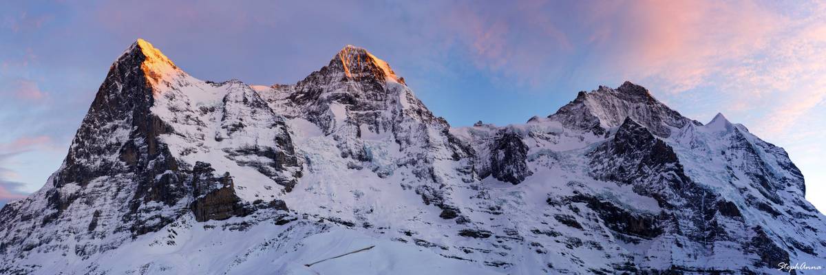
A view to"Eiger" (elevation 3970 m = 13025 ft), "Mönch" (4099 m = 13448 ft) and "Jungfrau" (4158 m = 13642 ft) - from left to right. "Mönch" is the german word for "monk", "Jungfrau" means young lady.
This image was taken from the Schilthorn(2970m) Mountain . Please don't use my images without my permission. They are all under my copyright.
Thank You my dear Flickr friends, for your inspiration ..!ü
Thanks to all Phoide contributors to Oberland administrative region!
Most notably Christian Rey, StephAnna Guertler, Andreas Karrer and Izakigur.