
Chile »
Patagonia
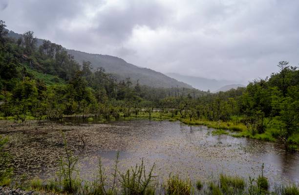
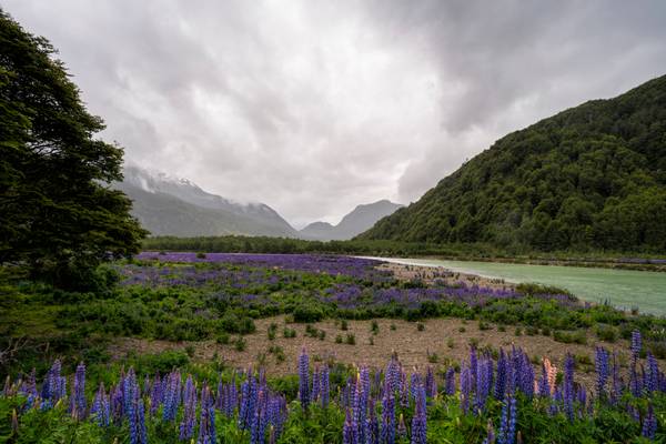
Patagonia is a vast and rugged region located in the southernmost part of Chile, known for its stunning natural beauty and diverse wildlife. This remote area is a paradise for photographers, offering a wealth of breathtaking landscapes and unique wildlife encounters. From the towering peaks of the Andes to the pristine glaciers and turquoise lakes, Patagonia is a photographer's dream destination. Some of the most popular photography locations in Patagonia include Torres del Paine National Park, the Perito Moreno Glacier, and the Tierra del Fuego National Park.
Photography regions of Patagonia
Photography of Patagonia
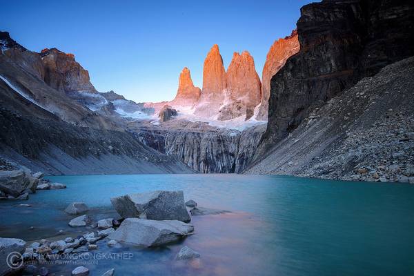
Having unpredictable weather in Patagonia, especially with strong winds, we were lucky enough to have a really calm morning. Looking at blue water and mountain reflections, I felt getting into a dreamland.
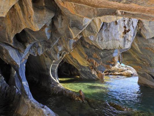
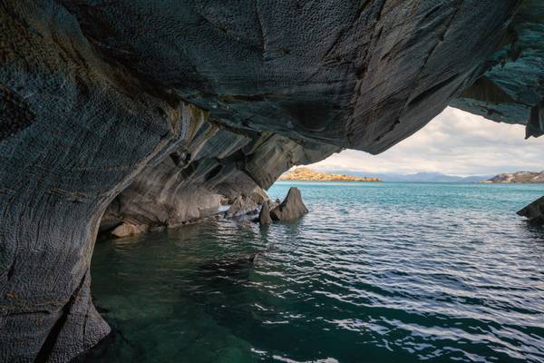
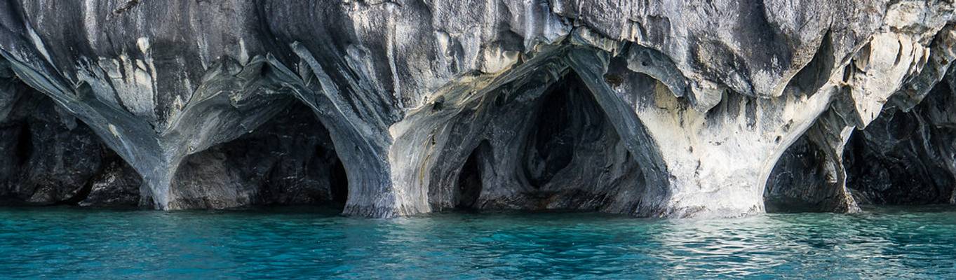
![The Marble Caves, Chile [6k/geo]](https://cdn.phoide.com/Thumbs/969ce61d-7927-4b59-8d53-1d2049a300c1.jpg)
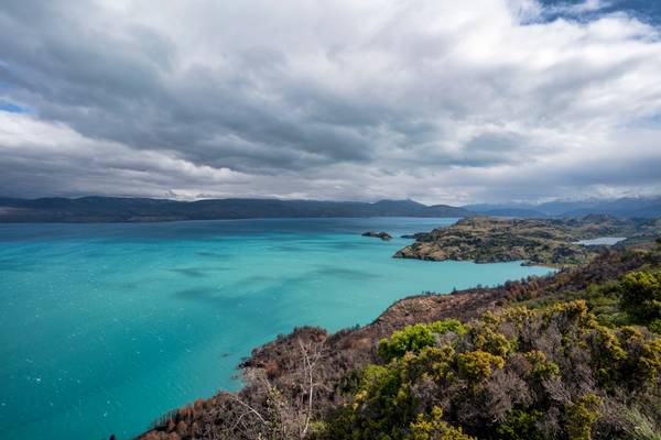
Lago Gral Carrera, Aysén, Chile
![Lago Gral Carrera, Chile [6k/geo]](https://cdn.phoide.com/Thumbs/e62a4fdd-195c-42d8-a0e0-5e5fa822c6de.jpg)
Aysén, Chile
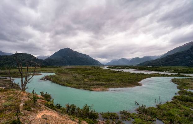
The Carretera Austral (CH-7, in english: Southern Way) is the name given to Chile's Route 7. The highway runs south for about 1,240 kilometers (770 mi) from Puerto Montt to Villa O'Higgins, passing through rural Patagonia.[1]
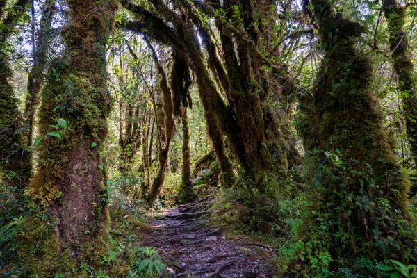
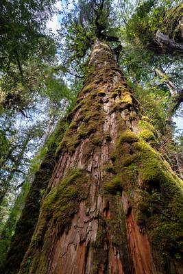
This area is characterized by thick forests, fjords, glaciers, canals and steep mountains.
Carretera Austral provides road access to Chile's Aysén Region and southern parts of Los Lagos Region. These areas are sparsely populated and despite its length, Carretera Austral provides access to only about 100,000 people. The largest city along the entire road is Coyhaique with a population of 44,850
![Lago Gral Carrera, Chile [6k/geo]](https://cdn.phoide.com/Thumbs/da1e5be1-dc8d-4b1c-8cb5-81be804bc726.jpg)
Aysén, Chile
![Lago Gral Carrera, Chile [6k/geo]](https://cdn.phoide.com/Thumbs/1a79ed6c-7123-4f19-8634-7d7dee19702c.jpg)
Aysén, Chile
The Carretera Austral (CH-7, in english: Southern Way) is the name given to Chile's Route 7. The highway runs south for about 1,240 kilometers (770 mi) from Puerto Montt to Villa O'Higgins, passing through rural Patagonia.[1]
This area is characterized by thick forests, fjords, glaciers, canals and steep mountains.
Carretera Austral provides road access to Chile's Aysén Region and southern parts of Los Lagos Region. These areas are sparsely populated and despite its length, Carretera Austral provides access to only about 100,000 people. The largest city along the entire road is Coyhaique with a population of 44,850
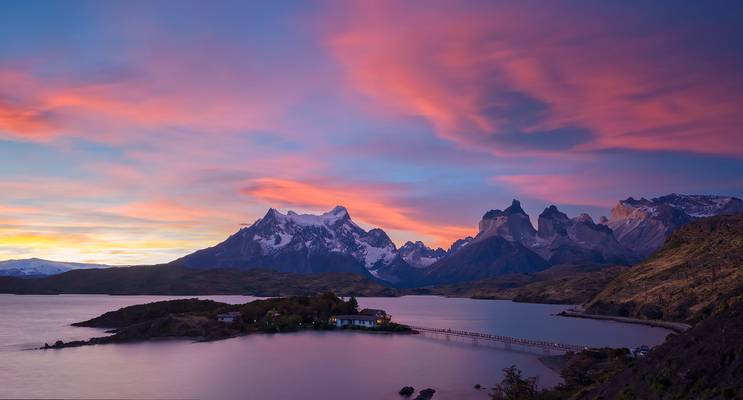
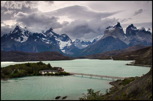
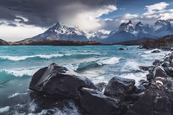
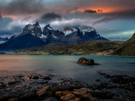
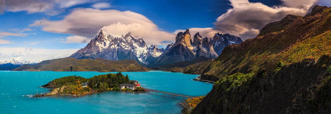
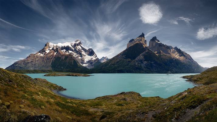
Cuernos mountain at Torres del Paine National Park. Taken from Hosteria Pehoe
Torres del Paine National Park, Patagonia, Chile.
This lodge has perhaps the best location of all lodges in the park and it is the cheapest. ...
Torres del Paine National Park, Patagonia, Chile.
SEE IT LARGE ON BLACK - PRESS "L"
Photo information: Nikon D7000 Nikkor AF-S 24-120mm f/4G VR...
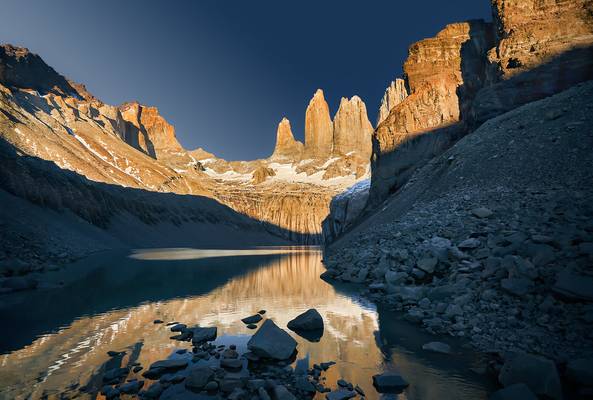
Torres del Paine - Chile
Frente a Puerto Sánchez en el Lago Carrera.
Región de Aysén, Patagonia, Chile,
Torres del Paine - Chile
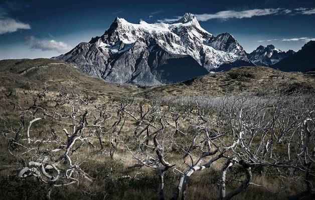
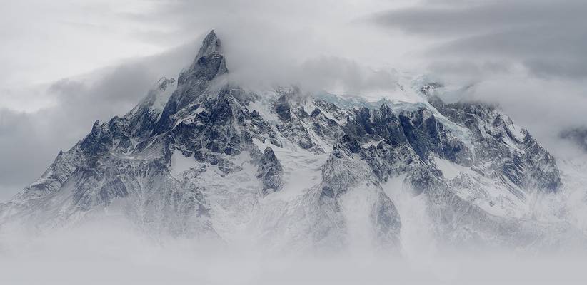
This is a part of Cerro Paine Grande, an iconic mountain at Torres del Paine National Park. The particular peak, I believe its name is Punta...
![Cerro Castillo, Chile [6k/geo]](https://cdn.phoide.com/Thumbs/a1684407-8660-4e09-9dc6-255b2d53d66f.jpg)
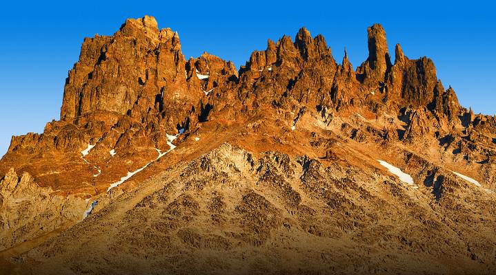
Cerro Castillo is a jagged rocky peak located in the Aysén del General Carlos Ibáñez del Campo Region of Chile, within the Cerro Castillo National Reserve. Castillo means castle in Spanish, and the steep basalt walls of the mountain indeed make it look like one. On its sides are a few small glaciers and lakes fed by them.
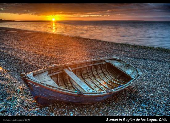
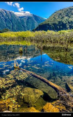
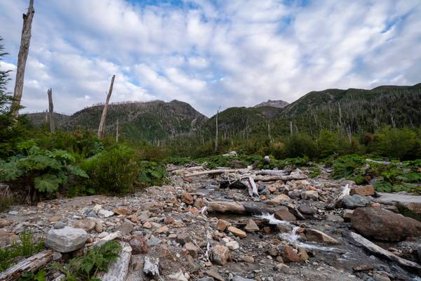
I recently had the opportunity to spend 3 weeks driving through the south of Chile in the Chilean Patagonia. The travel started in Puerto Montt (Región de los Lagos) and finished in Villa O'higgins (Aysen) the south most point of the famous and amazing Carretera Austral. This photo is the first one of the series I will publish from this travel. I hope you like them.
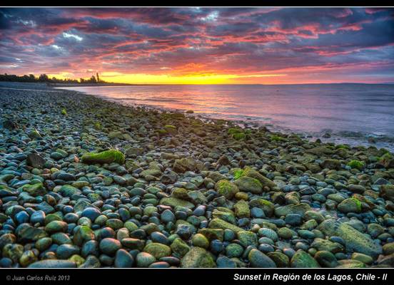
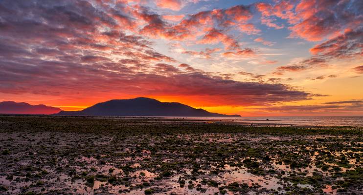
I took this photo near Puerto Montt, about 70 km south and after crossing the fiord from Caleta La Arena to Caleta Puelche in the boat (barcaza). The day was finishing and we had the opportunity to stop in this beach and take some photos of the sunset. This was the first day and it promised good opportunities for nice landscapes and photos.
HDR taken using 5 differently exposed shots.
Facebook: Juan Carlos Ruiz Photography
Puerto Sánchez
![Lago Gral Carrera, Chile [6k/geo]](https://cdn.phoide.com/Thumbs/f067dffd-41cf-4b57-b4de-aa198a5c4a71.jpg)
Aysén, Chile
The Carretera Austral (CH-7, in english: Southern Way) is the name given to Chile's Route 7. The highway runs south for about 1,240 kilometers (770 mi) from Puerto Montt to Villa O'Higgins, passing through rural Patagonia.[1]
This area is characterized by thick forests, fjords, glaciers, canals and steep mountains.
Carretera Austral provides road access to Chile's Aysén Region and southern parts of Los Lagos Region. These areas are sparsely populated and despite its length, Carretera Austral provides access to only about 100,000 people. The largest city along the entire road is Coyhaique with a population of 44,850
Aysén, Chile
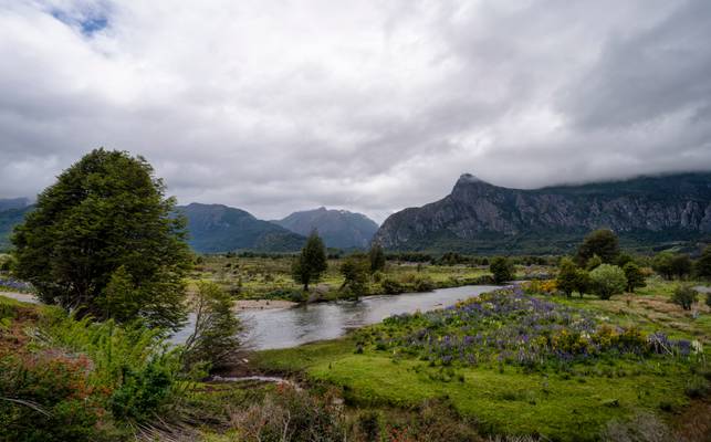
I took this photo in Chile, in the road to Futaleufú. This area is famous by its amazing landscapes and especially by the acuatic activities on its rivers such as rafting and others. Rivers, lakes and mountains are perfectly combined to create amazing landscapes as you can see in this photo.
If you like my photos, please like me on facebook: Juan Carlos Ruiz Photography
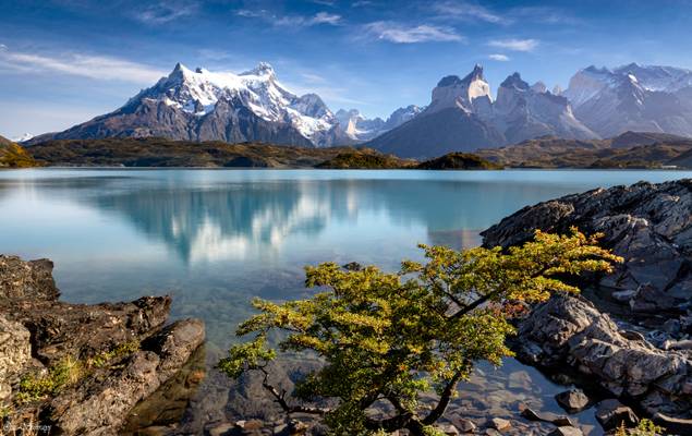
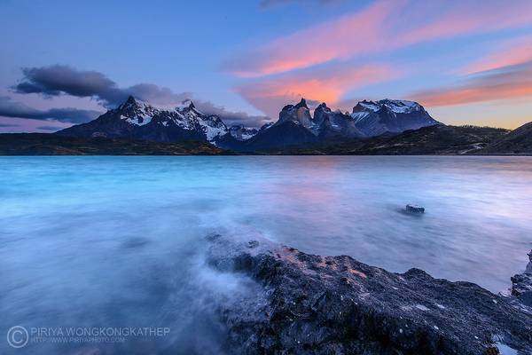
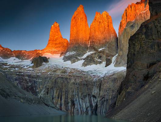
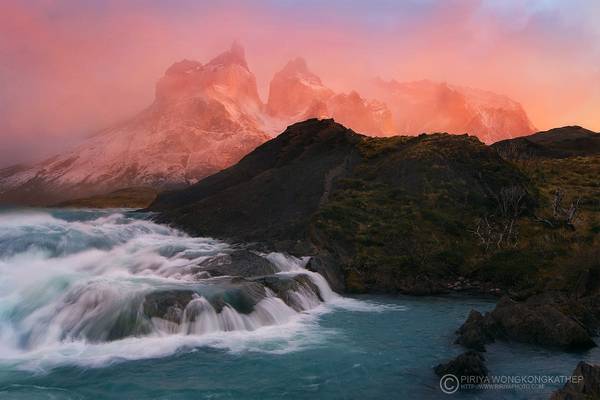
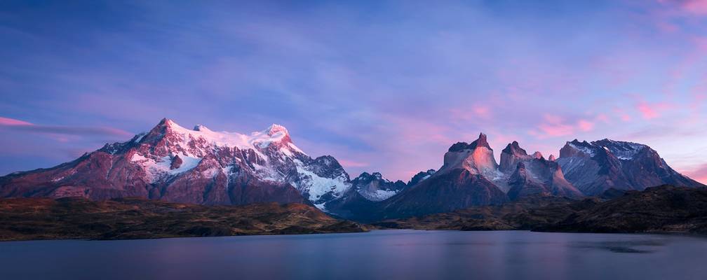
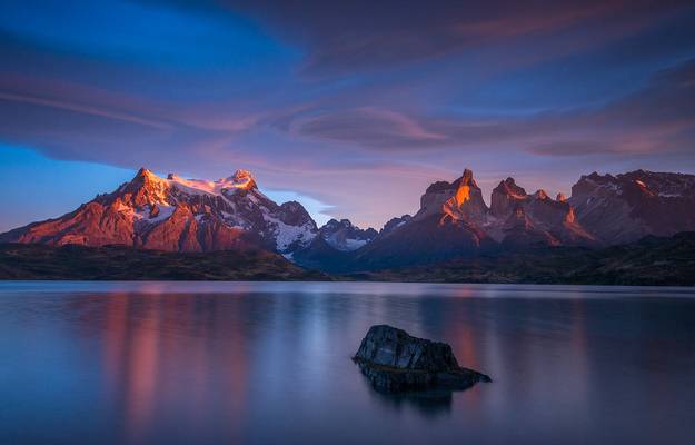
This sunrise view of Lake Pehoé in Torres del Paine National Park captures the essence of Patagonia's cruel beauty.
You can review more of my...
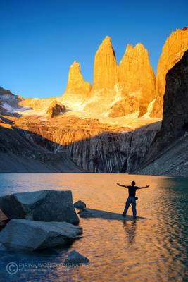
Torres del Paine - Chile
Paine Grande - Torres del Paine - Patagonia - Chile
Breathtaking Views Await You at the End of the World at Chilean Patagonia
Mirador Torres Chile
Chilean Patagonia
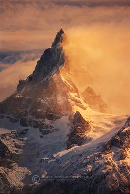
Sometime a good light condition came with a bad weather. I shot this under a strong wind gust of 60-70 km/hr. Such a brutal place but full of fun....
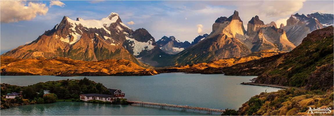
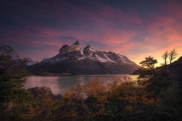
The beautiful Cuernos del Paine basking in the morning light. A stitch of 2 images.
![Lago Gral Carrera, Chile [6k/geo]](https://cdn.phoide.com/Thumbs/2f84c95a-9d60-4f45-8e6a-d581da072a14.jpg)
Aysén, Chile
Aysén, Chile
![Cerro Castillo, Chile [6k/geo]](https://cdn.phoide.com/Thumbs/d27d28d5-86c4-41e1-b5e5-e5e607a2ea15.jpg)
Cerro Castillo is a jagged rocky peak located in the Aysén del General Carlos Ibáñez del Campo Region of Chile, within the Cerro Castillo National Reserve. Castillo means castle in Spanish, and the steep basalt walls of the mountain indeed make it look like one. On its sides are a few small glaciers and lakes fed by them.
The base of the mountain can be approached from the road in one day along Estero Parada river.
The route followed an 800-meter-high, snow-and-ice couloir which had an angle of 55° in the upper part of the west face of Cerro Castillo.
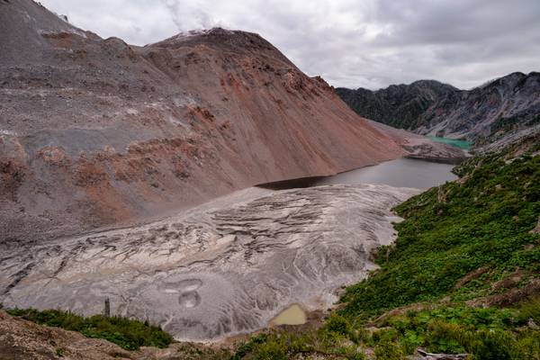
Chaitén is a volcanic caldera 3 kilometres in diameter, 17 kilometres west of the elongated ice-capped Michinmahuida volcano and 10 kilometres northeast of the town of Chaitén, near the Gulf of Corcovado in southern Chile. The most recent eruptive phase of the volcano erupted on 2008
![Lago Gral Carrera, Chile [6k/geo]](https://cdn.phoide.com/Thumbs/aa4e5bf0-6e52-4bc1-9bfb-d91d7c3dbff3.jpg)
Aysén, Chile
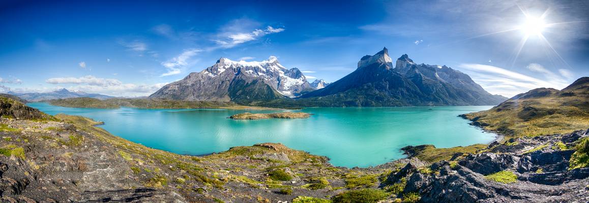
Torres del Paine, Patagonia, Chile
Panorama stitched from four overlapping images.
Thank you for your views, comments, and faves.
If you love my photos, check out my Instagram or my 500px and hit the follow button to subscribe!
Stunning sunrise from Lago Nordenskjold in the...
Torres del Paine National Park, Patagonia, Chile.
Los Cuernos (the Horns) is an iconic shape mountain in the Torres del Paine National Park in...
General Carrera Lake - Chile
We volgen een mooie route langs het meer naar Puerto Rio Tranquilo. Hier gaan we aan boord van een motorboot om de...
Torres del Paine - Patagonia - Chile - South America
Nouvelle année et nouveau boîtier Sony A7R3A... 2 semaines de tests photos aux Torres del Paine...
del Campo Neo-Zelandés - Chile
Thanks to all Phoide contributors to Patagonia!
Most notably StarCitizen, PZ Sunrays and Juan Carlos Ruiz San Millán.