
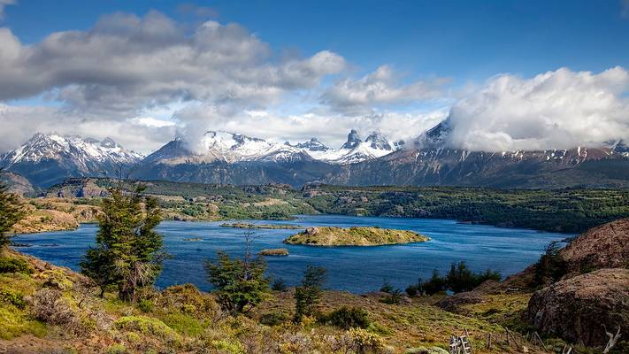
Río Ibáñez
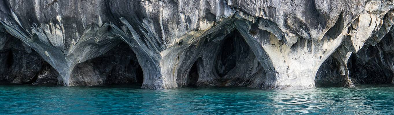
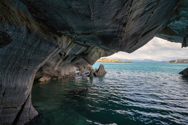
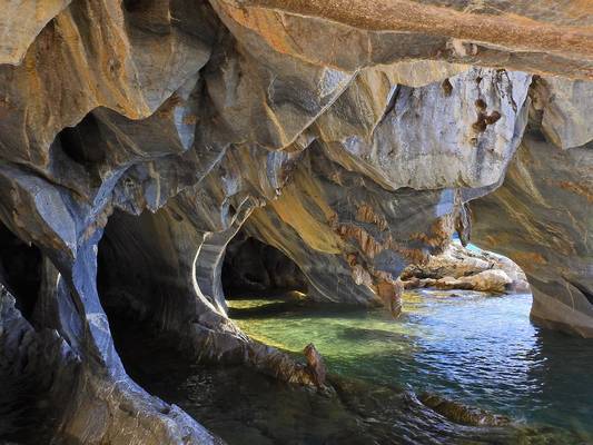
![The Marble Caves, Chile [6k/geo]](https://cdn.phoide.com/Thumbs/969ce61d-7927-4b59-8d53-1d2049a300c1.jpg)
Lago Gral Carrera, Aysén, Chile
![Lago Gral Carrera, Chile [6k/geo]](https://cdn.phoide.com/Thumbs/e62a4fdd-195c-42d8-a0e0-5e5fa822c6de.jpg)
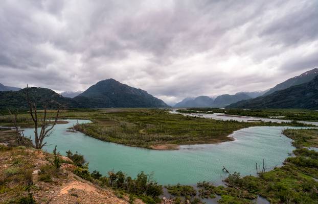
Aysén, Chile
Aysén, Chile
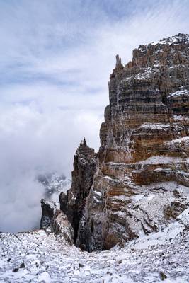
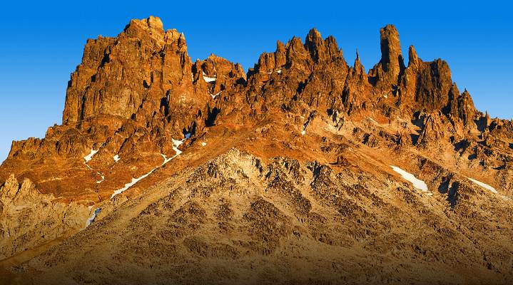
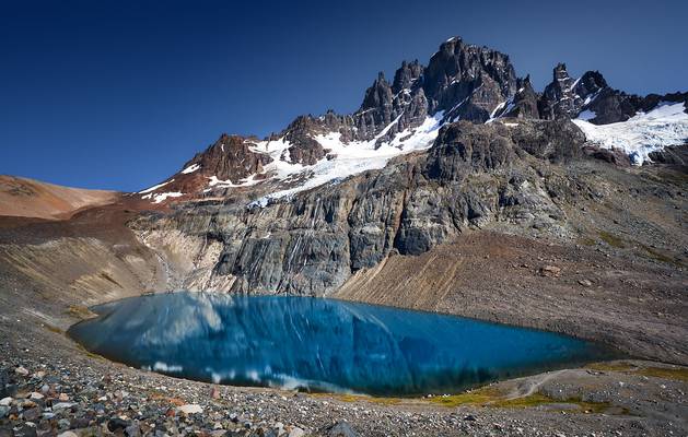
![Cerro Castillo, Chile [6k/geo]](https://cdn.phoide.com/Thumbs/d27d28d5-86c4-41e1-b5e5-e5e607a2ea15.jpg)
Cerro Castillo is a jagged rocky peak located in the Aysén del General Carlos Ibáñez del Campo Region of Chile, within the Cerro Castillo National Reserve. Castillo means castle in Spanish, and the steep basalt walls of the mountain indeed make it look like one. On its sides are a few small glaciers and lakes fed by them.
The base of the mountain can be approached from the road in one day along Estero Parada river.
The route followed an 800-meter-high, snow-and-ice couloir which had an angle of 55° in the upper part of the west face of Cerro Castillo.
del Campo Neo-Zelandés - Chile
![Cerro Castillo, Chile [6k/geo]](https://cdn.phoide.com/Thumbs/a1684407-8660-4e09-9dc6-255b2d53d66f.jpg)
Cerro Castillo is a jagged rocky peak located in the Aysén del General Carlos Ibáñez del Campo Region of Chile, within the Cerro Castillo National Reserve. Castillo means castle in Spanish, and the steep basalt walls of the mountain indeed make it look like one. On its sides are a few small glaciers and lakes fed by them.
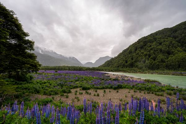
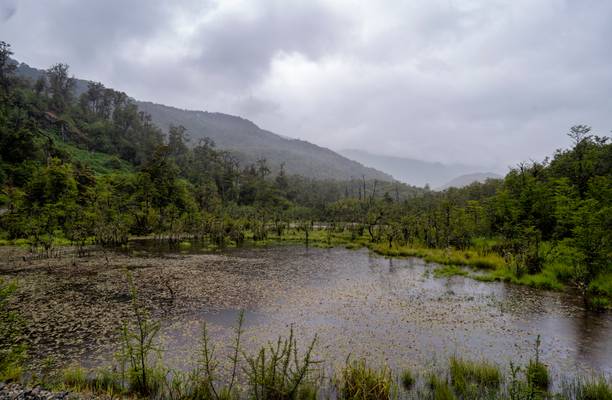
The Carretera Austral (CH-7, in english: Southern Way) is the name given to Chile's Route 7. The highway runs south for about 1,240 kilometers (770 mi) from Puerto Montt to Villa O'Higgins, passing through rural Patagonia.[1]
This area is characterized by thick forests, fjords, glaciers, canals and steep mountains.
Carretera Austral provides road access to Chile's Aysén Region and southern parts of Los Lagos Region. These areas are sparsely populated and despite its length, Carretera Austral provides access to only about 100,000 people. The largest city along the entire road is Coyhaique with a population of 44,850
![Lago Gral Carrera, Chile [6k/geo]](https://cdn.phoide.com/Thumbs/aa4e5bf0-6e52-4bc1-9bfb-d91d7c3dbff3.jpg)
Aysén, Chile
General Carrera Lake - Chile
We volgen een mooie route langs het meer naar Puerto Rio Tranquilo. Hier gaan we aan boord van een motorboot om de...
From ruta X-723 near the Carretera Austral with a nice view over Lago Tamango (also called Lago Central) to the Castillo Range. Cerro Palo in the...
Puerto Sánchez
The Carretera Austral (CH-7, in english: Southern Way) is the name given to Chile's Route 7. The highway runs south for about 1,240 kilometers (770 mi) from Puerto Montt to Villa O'Higgins, passing through rural Patagonia.[1]
This area is characterized by thick forests, fjords, glaciers, canals and steep mountains.
Carretera Austral provides road access to Chile's Aysén Region and southern parts of Los Lagos Region. These areas are sparsely populated and despite its length, Carretera Austral provides access to only about 100,000 people. The largest city along the entire road is Coyhaique with a population of 44,850
Frente a Puerto Sánchez en el Lago Carrera.
Región de Aysén, Patagonia, Chile,
Trek Cerro Castillo - Patagonia - Chile - South America
Thanks to all Phoide contributors to Río Ibáñez!
Most notably StarCitizen.