United States of America
by Sandeep Thomas
- John Locke.
| facebook | 500px | ferpectshotz |
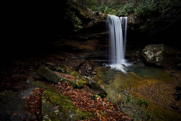
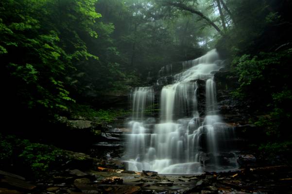
Upper Latourell falls trail is a pretty easy 2 miles hike in the Columbia River Gorge which take you to two of the most stunning waterfalls I have ever seen. I spend a quite a bit of time to get a clear shot of the waterfall from this angle as there were many people enjoying this stunning waterfall. When I started out in landscape photography, I would grow completely impatient when people walked into the shot. But now I have learned to enjoy spending my time there witnessing the moment and do a bit of people watching.
Lighting for this was particularly challenging as sun was directly above use and there were super bright spots created by the sunlight filtering through tree foliage. I got away from it by shooting multiple images and creating a mini composite image as time was a bit limited.
by Sandeep Thomas
- Elizabeth Bowen.
| facebook | 500px | ferpectshotz |
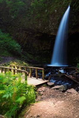
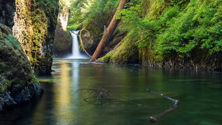
Punch bowl falls, located at Columbia River gorge, Oregon. This was the second shot I made at the location after our extensive hike. Compared to the drought ridden California, Oregon’s rivers had good water flow so I had to settle for a shot from far away. A bunch of kids actually swam across to the closer vantage point but one of the unfortunately could not swing back due to hypothermia and had to be evacuated that day. So I am quite glad that I didn’t try to get deep into the water.
Thanks for visiting and have a great day..
by Sandeep Thomas
- Charles R. Swindoll.
| facebook | 500px | ferpectshotz | buy |
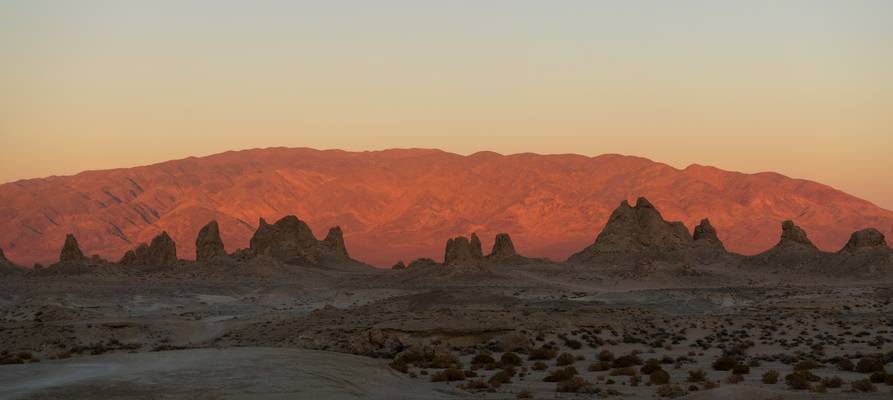
Todays shot is of the wonderful pinnacle tufas of Trona Pinnacles at sunset. This photo was taken just when we reached the location as the light on the hills was just perfect. I originally didn’t plan on a sunset shoot that day and was hoping to just scout for a suitable milky way photo spot. But once I saw the light that was happening in front of us, I forgot all restraint and ran out with my camera and tripod for a nice sunset shot. What I liked about this composition was that the tufa pinnacles were in the shadows while the hills in the background were lit perfectly by the setting sun giving the whole scenes a nice depth.
When I started photography, I had lots of trouble correctly exposing images with dark shadows and bright sunlight. I used to rely heavily on my ND grad filters to balance the light and it was not unusual for me to take images with all three of my ND grad filters in use. This was a habit from my film days when recovering clipped dark tones was not an easy task. But as I spend more time with DSLR cameras, I learned that they are far more forgiving on recovering dark parts than recovering clipped highlights. So now when I meter a scene, I make sure that I am exposing for the brightest part of the image and then use the live histogram along with the exposure compensation dial to avoid any clipping. I would also like to add that the D800 I had earlier didn’t accurately show histograms but the D850 has a perfectly accurate histogram.
So this image which would have otherwise required at least a 3 stop nd grad filter is made without any filters by just exposing for the strengths of the modern digital sensor.
by Sandeep Thomas
- Sun Tzu.
| facebook | 500px | ferpectshotz |
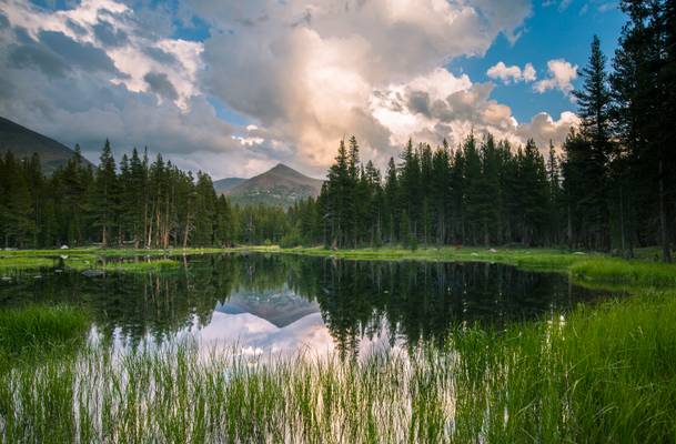
This is one my absolute pictures of the trip. I saw this little swatch of meadows purely by accident, I have a strong hunch that this is the Dana-Gibbs view but I am not sure as there was no one else and I drove past it and had to return. I had all the time in the world to set up my tripod and compose my shot. Half way through setting up my picture my wife started pulling my shirt and we saw that there was a doe Mule deer carefully watching us. She slowly walked across the meadow from us and kept on grazing. This was almost a shot out of my dreams and I was just so happy. The only thing that would have been better is if I could take the shot before the deer walked far away but I am very satisfied with the results on this shot.
by Yi Jiang
Big Sur
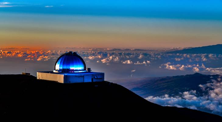
by Dominic Nessi
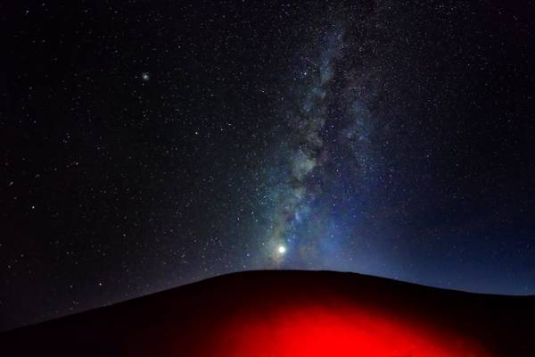
- The Mauna Kea Observatories (MKO) are a number of independent astronomical research facilities and large telescope observatories that are located at the summit of Mauna Kea on the Big Island of Hawaiʻi, United States.
The facilities are located in a 525-acre (212 ha) special land use zone known as the "Astronomy Precinct", which is located within the 11,228-acre (4,544 ha) Mauna Kea Science Reserve.
The Astronomy Precinct was established in 1967 and is located on land protected by the Historical Preservation Act for its significance to Hawaiian culture. The presence and continued construction of telescopes is highly controversial due to Mauna Kea's centrality in native Hawaiian religion and culture, as well as for a variety of environmental reasons.
The location is near ideal because of its dark skies from lack of light pollution, good astronomical seeing, low humidity, high elevation of 4,205 meters (13,796 ft), position above most of the water vapor in the atmosphere, clean air, good weather and low latitude location.
The peak on the far right is Mauna Loa which is only slightly shorter than Mauna Kea.
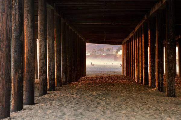
by Joao Eduardo Figueiredo
_DSC6380
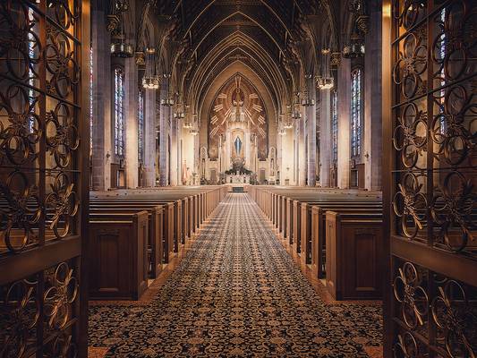
by Nenad Spasojevic
Another interior shot, only this time in color. This basilica is one of my latest accidental discoveries. It is located just outside the downtown area and it is a perfect place for taking some interior shot for those who like doing that. Since the temperatures are sky high I like taking some indoors location a killing time time during the day. What do you think?
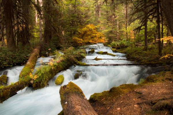
by Bonnie Moreland
I actually had stopped to check my map, I looked up from my parking spot and saw this steam just tucked back up in the woods. A short walk and I found this vantage point. A completely unexpected find and now one of my favorite images of the year.
Olallie Creek is located in the midsection of the Cascades mountain range in western Oregon. The area is nicely shaded by Douglas fir, maple and alder. The Willamette National Forest stretches for 110 miles with varied landscapes of high mountains, narrow canyons, cascading streams, and wooded slopes. This creek sits right beside the McKenzie River and the McKenzie River Trail.
Olallie is a very popular name in Oregon. There are several Olallie areas, from this creek, to a nice lake, not associated with this creek to a nice hiking trail, not associated with creek or lake.
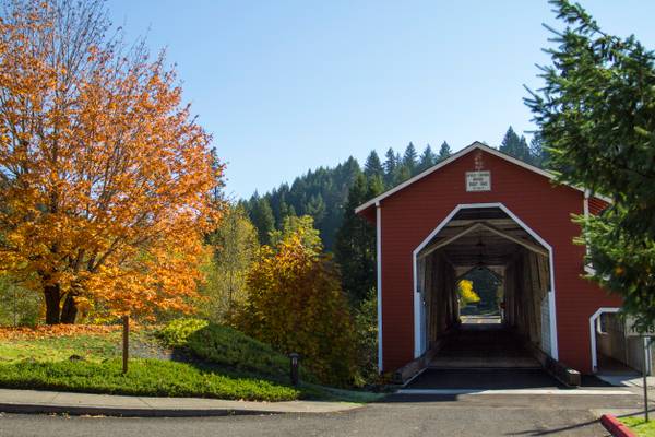
by Bonnie Moreland
The Office Bridge (also called Westfir Covered Bridge) is a covered bridge in Westfir, Lane County, Oregon, U.S. crossing the North Fork Middle Fork Willamette River at the south end of the Aufderheide National Scenic Byway and edge of the Willamette National Forest. It is Oregon's longest covered bridge at 180 ft (55 m), and is one of only two in the state using triple Howe truss construction. It is the only covered bridge west of the Mississippi River which has a separate pedestrian walkway. Each Christmas season, the town decorates the bridge with lights. A firetruck driven by Santa turns the lights on the first week after Thanksgiving.
by Sandeep Thomas
- Arthur Young.
| facebook | 500px | ferpectshotz |
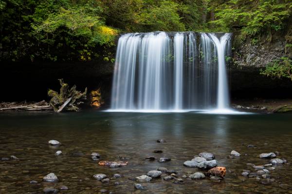
Here is another shot of the Upper Butte falls from our Oregon trip. This shot was taker directly from in front of the falls as I wanted to show the beautiful curtain form of the fall. This is one of the most memorable locations on our Oregon road trip and riding through a bone jarring stretch of forest road was totally worth it.
Hope everyone likes it..
by Nenad Spasojevic
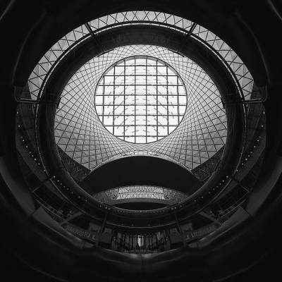
I really enjoyed shooting this location. This is a Fulton St. metro station in New York. It is in the same neighborhood as the World Trade Center and for anyone interested in shooting architecture it is one of the most interesting spots, in my opinion, on Manhattan. A ton of new structures, reflections, patterns mixed with a few interesting old NY spots, it was an afternoon well spent. For this post I choose this abstract shot, taken all the way from the bottom floor, looking up. What do you think?
by Sandeep Thomas
- Salvador Dali.
| facebook | 500px | ferpectshotz |
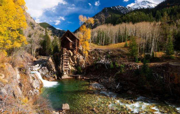
Today's photo is one of the most iconic scenes of the Rocky Mountains of Colorado. This is the famous Crystal Mill which also goes by the name Old Mill and is an abandoned wooden power mill built in 1892. The mill is located on an outcrop over a waterfall on the Crystal River. As fall peaks, this mill provides visiting photographers with one of the most iconic scenes of America’s western mountains.
While this is a famous location and we visited during the popular fall season, due to the remoteness of the location we were actually the only people here for about 2 hours and on our way back we met another couple who were hiking to the mill. So, its safe to say that it's not a tourist haunt like the Maroon Bells. By the time we reached the mills, the sun was out in full force but thanks to the location being in a Canyon and this being Colorado, there was no shortage of clouds that came in to block out the sun so that I could make my long exposure shot of the waterfall.
Technically this was a challenging location to shoot as being an iconic location finding unique compositions I almost an impossible task. Another difficulty is caused by the fact that the owner of the property has installed fences to discourage people from taking shots by the edge of the cliffs making limiting many compositions. Then comes the need to prioritize the various aspects in the scene regarding lighting, generally fall colors look better under diffused lighting while waterfall look better in the shade and dark wooden structures don’t look good in shade. So, I had to wait for the correct lighting and manage the rest with my filters. As you can see even after my best efforts, the mill is still in its own shadows which were something that I could not avoid due to the time of the day. But I paid special attention not to overblow the waterfall and still get good light on the fall colors.
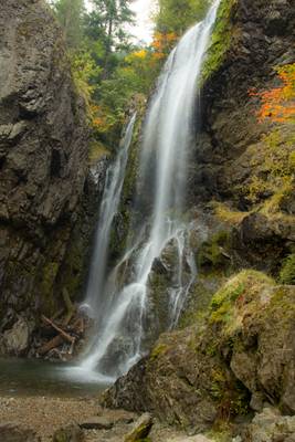
by Bonnie Moreland
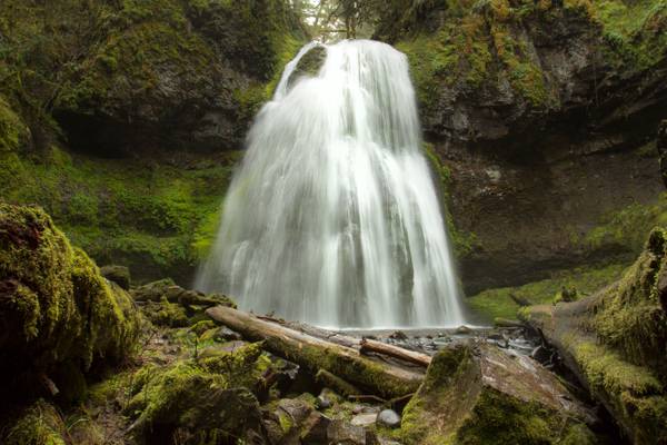
Taken on a misty day, the water is low at this time of the year, but come Spring it will be very full and lovely.
Henline Falls is a broad curtain type fall, dropping 126 feet over the side of a narrow alcove. During periods of lower water levels Henline Creek will split into two or three more distinct channels of water and spray into the cove in multiple distinct sheets of droplets.
Henline Falls was named after the creek, which was in turn named for a settler of the area who had come in search of the rich prospecting in the area. Immediately to the right of the base of the falls is the Silver King Mine. Remnants of a tramway leading from the mine are visible as the trail near the falls. The adit itself is dry, so exploration is possible, but do not enter the mine alone.
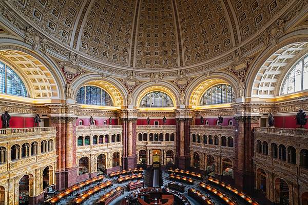
by Nenad Spasojevic
Past week I was able to travel a little bit and revisit the DC on that trip. this time I actually took some time to explore the city. I did a bit of planing prior to the trip and even it was getting pretty cold I went for it. The trip was a great success! I might say. And I came back home with a ton of architectural, landmark and urban photos. This particular shot is from the inside of the Library of Congress. Really great photographer friendly place. What do you think?
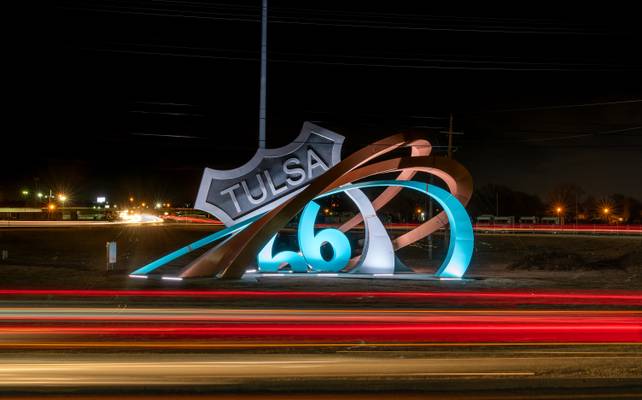
by Patrick Clancy
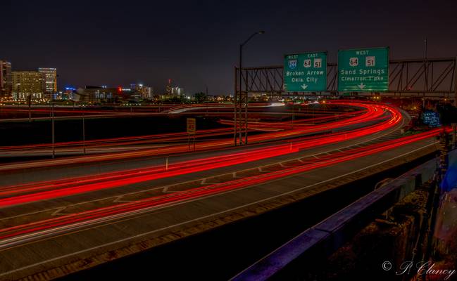
Could not decade if I like it better with or without the car trails, so I put both on
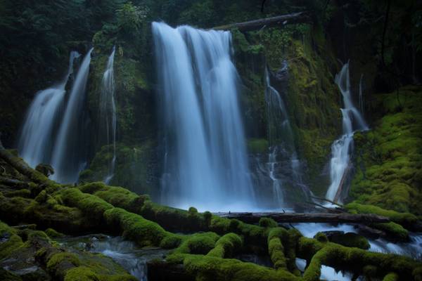
by Bonnie Moreland
I took over 80 shots of this waterfall today. I narrowed it down to two I like. If you viewers would let me know your opinion as to the strongest I would be grateful.
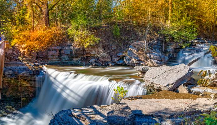
Downing Creek Falls is the second of at least three significant waterfalls known to occur along the stout length of spring-fueled Downing Creek. The falls drop 32 feet over a distinctly cube-shaped outcrop of basalt, pouring in three to four side-by-side channels (depending on how much extra snow melt water is present), with as many as a dozen small streams of water dribbling out of the adjacent cliff and falling parallel to the falls in tandem. Though the falls aren't terribly tall, the creek is large enough to produced a consistent cloud of mist at the base of the falls, which helps ensure the forest and cliffs all around the falls are liberally covered head to toe in a thick blanket of moss.
Downing Creek is a remarkably consistent stream with a deceivingly small drainage basin. The majority of the creek emerges from springs about one quarter mile upstream from the falls, and flows all year long with very little fluctuation as a result. Further upstream along the drainage is another waterfall which only flows during periods of prolonged snow melt in the spring months, but the upper section of the creek otherwise sinks into the porous ground and the upper falls dries out as a result.
by Nenad Spasojevic
Is winter here? Less than a week ago we were still enjoying some nice weather from the previous season and it felt great. You know that wonter is here when IG nation rushes in to posting snow images. I personally like my seasons to transition slowly. What do you think?
by Sandeep Thomas
- Voltaire.
| facebook | 500px | [ferpectshotz](http://ferp ectshotz.com/) |
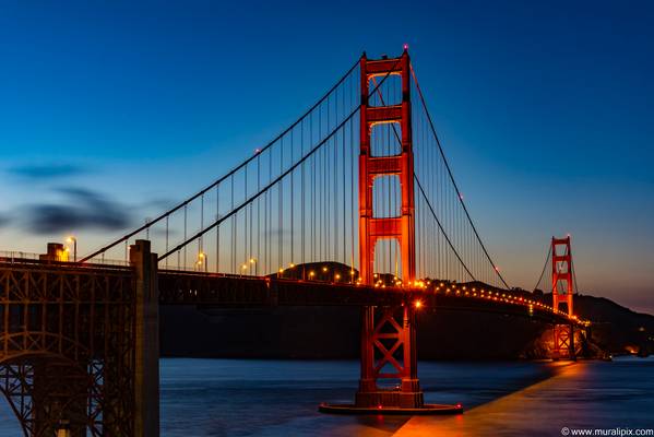
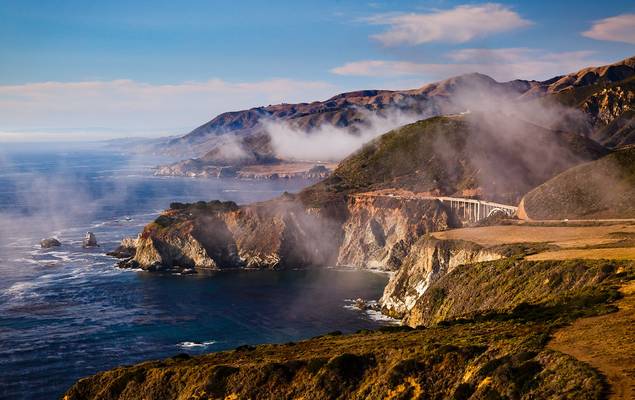
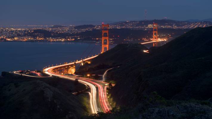
This shot was taken from the Pacific coast trail/Slackers hill trail on our way back after taking the shot that I posted earlier. By the time we reached the viewpoint, the blue hour was almost ending and we could see the sky turning way darker than it was before. I also wanted to get a nice streak of light trails to use as leading line to the bridge. For some reason traffic was unusually light at this time of the day and we had to try many more shots than normal to the trails that I liked.
I think this was the best one of the bunch when also considering the fact that how many airplanes and helicopters are also present in these skies. Personally, I would have preferred to take this shot a bit earlier but I like the way it turned out.
by Nenad Spasojevic
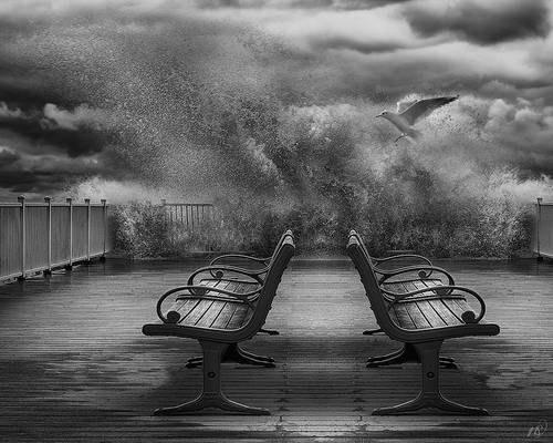
I think that the most important thing about any art is the sense of escape. What do you think?

by Eduard Wichner
The Welcome to Fabulous Las Vegas sign is a Las Vegas landmark funded in May 1959 and erected soon after by Western Neon. Address: 5200 Las Vegas Blvd S, Las Vegas, NV 89119, United States
by Joao Eduardo Figueiredo
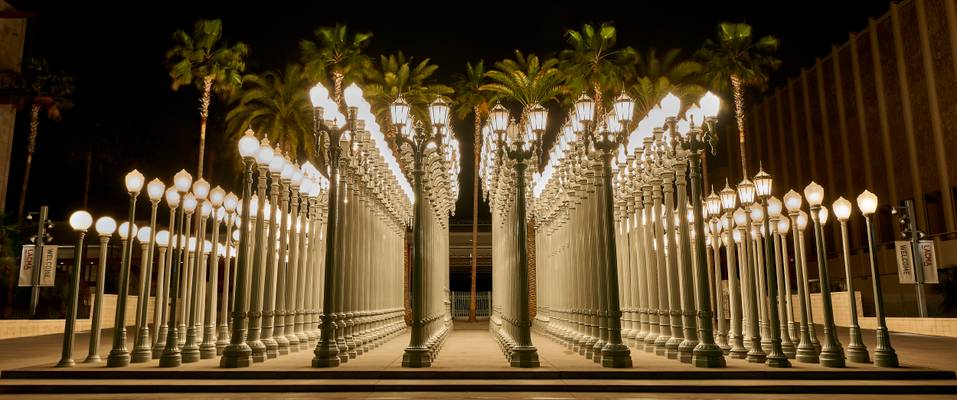
Urban Light is a 2008 large-scale assemblage sculpture by Chris Burden that stands in front of the Los Angeles County Museum of Art. The installation consists of 202 restored street lamps from the 1920s and 1930s. Most of them once lit the streets of Southern California. The cast iron street lamps are of 17 styles, which vary depending on the municipality that commissioned them. They range from about 20 to 30 feet (6 to 9 meters), are painted a uniform grey and placed, forest-like, in a near grid. The lights are solar powered and switched on at dusk. Writing in the Los Angeles Times, Susan Freudenheim described the restored lamps as displaying "elaborate floral and geometric patterns" at the base, with "fluted shafts and glass globes that cap them...meticulously cleaned, painted and refurbished to create an exuberant glow. (From Wikipedia)
_DSC6249
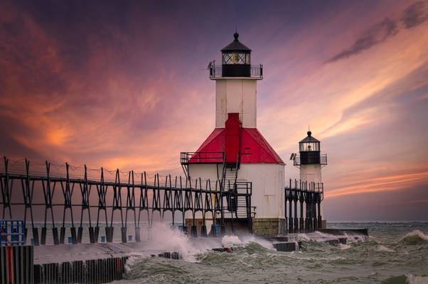
by David Hamments
.... aka St. Joseph North and South Pier Lighthouses (and a beautiful Lake Michigan sunset)
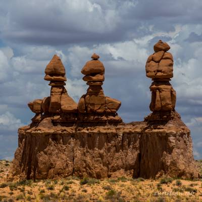
by Christian Rey
Tele: 180mm
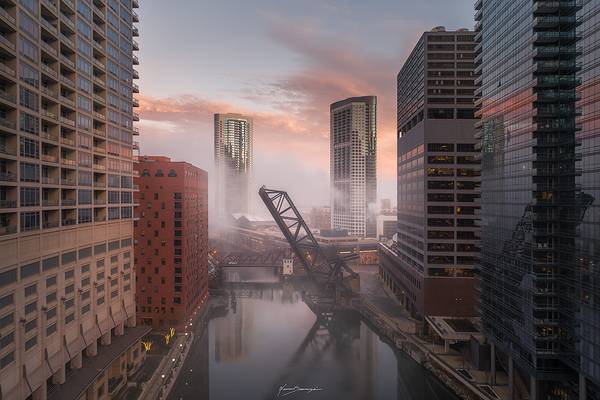
by Nenad Spasojevic
“You can become blind by seeing each day as a similar one. Each day is a different one, each day brings a miracle of its own. It’s just a matter of paying attention to this miracle.” – Paulo Coelho
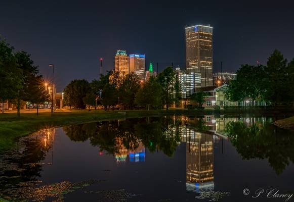
by Patrick Clancy
Green light on the tower on smaller building in the center is how they use to forecast the weather. Tower in green was clear, red light was for stormy weather
by Sandeep Thomas
-Wilma Rudolph.
| facebook | 500px | ferpectshotz |
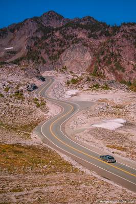
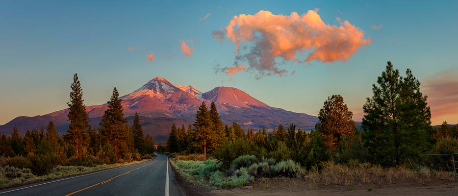
Here is another old shot from our Oregon road trip. This one is a Panorama shot of the mighty Mt Shasta with a road lading up to the mountain while it is illuminated by the last rays of the sun. I love the this road where we took this shot as every turn and curve has awesome views of the mountain. I had almost forgot about this shot until couple of days ago when I was backing up my data files and saw this one.
This one is a pano stitch image of about 15 shots and was taken just seconds before the last light of the day was gone. I had seen a barn on this road the last time we were there and was driving around to find it but couldn't and my wife was yelling at me not to waste the sunset. so finally I gave in and pulled to the side to take this shot.
Hope you all like it, and Happy new Year!!
by Patrick Clancy
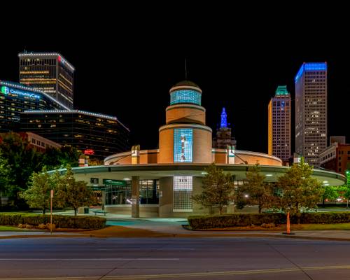
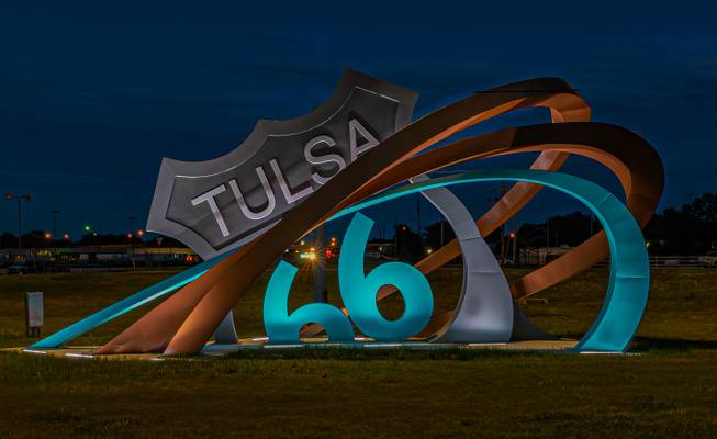
Tulsa's new sculpture to recognize the mother road
by Nenad Spasojevic
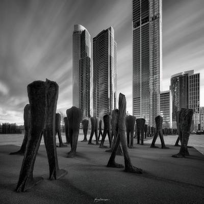
“No one saves us but ourselves. No one can and no one may. We ourselves must walk the path.” - Buddha
by MURALI NARAYANAN
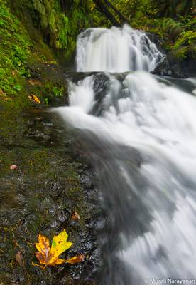
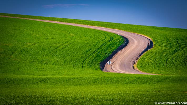
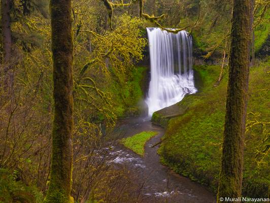
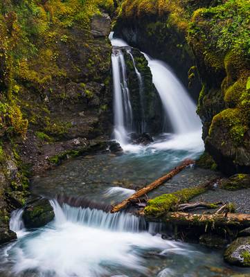
A short hike from the Virgin Creek Falls Trailhead in the town of Girdwood, AK.
by Sandeep Thomas
- Mother Teresa.
Please view this on black.
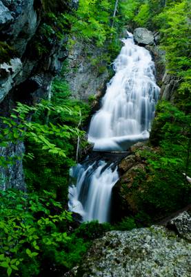
Crystal cascade is rated as one of the best waterfalls in NH and I wanted to visit the falls before I left for New York. Most of the directions posted online for the falls state that its located just a short walk from the Appalachian Mountain Club Pinkham Notch Visitor Center on the way to White mountain auto road. So naturally, on my way back from there I went to the falls.
The nice lady behind the information counter told me that it's just a short distance from the parking lot, the distance was indeed short but was a little steep. I was really tired from a whole day of driving especially the nerve-racking Mt Washington drive and was in no condition for a climb. It took me almost 40 minutes to cover what other people were covering in 10 minutes but the waterfall was worth the effort, there is a nice viewpoint but getting to the base of the fall requires some skills and is impossible with a DSLR and a hefty tripod.
The Glen Ellis Falls is quite close to this one and is equally majestic. you will have to stop at the parking lot and take a tunnel to cross the highway and there is a beautiful pathway that will help you make it to the bottom of the falls.
Thanks to all Phoide contributors to United States of America!
Most notably Sandeep Thomas, Bonnie Moreland, Patrick Clancy, Nenad Spasojevic, MURALI NARAYANAN, Andrey Sulitskiy, Yi Jiang and Joao Eduardo Figueiredo.
