
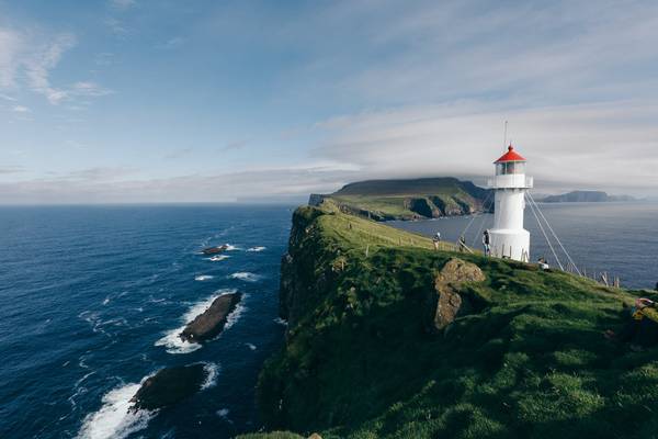
Vágar region
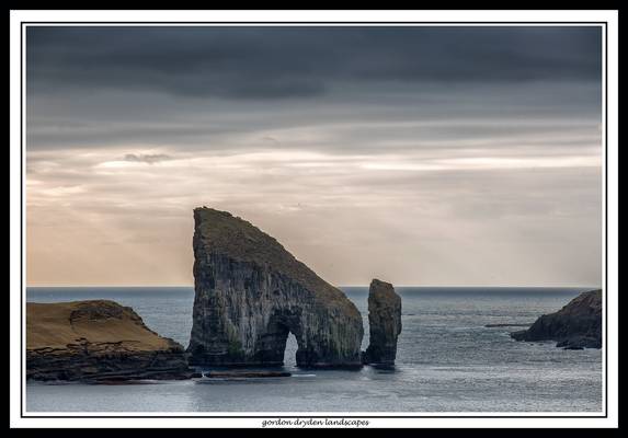
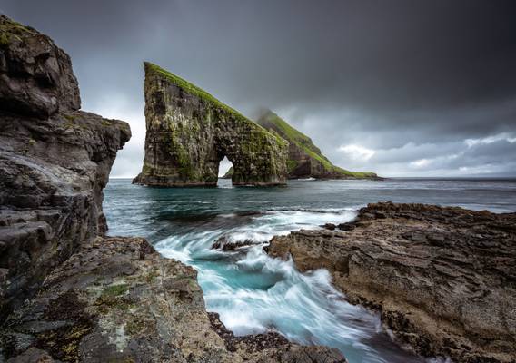
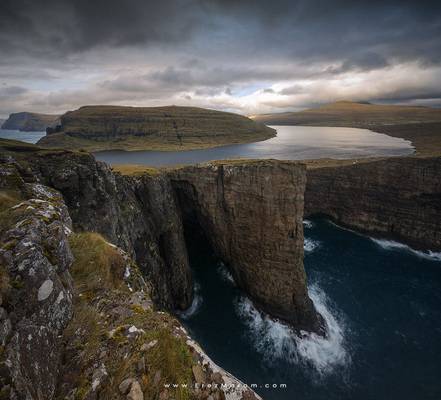
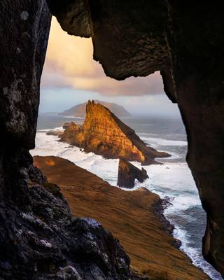
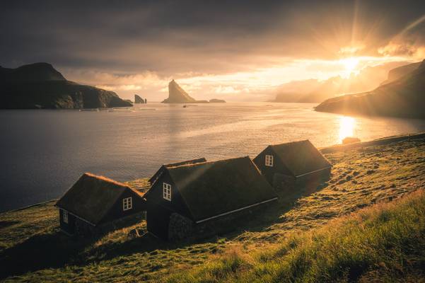
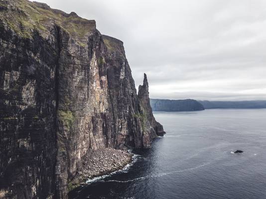
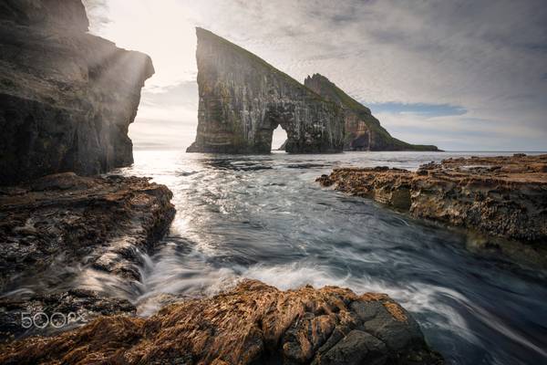
A longer and more demanding hike takes you to Drangarnir (which translates to sea stacks). The large sea stack occludes the smaller one. In the back, you can see Tindholmur disappearing in the cloudes. It was an amazing trip out here, and the scenery is well worth the hassle. Note: you have to get a guide as this is private land.
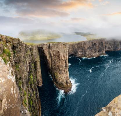
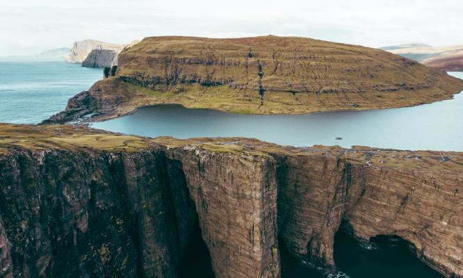
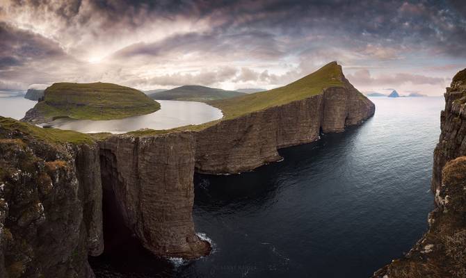
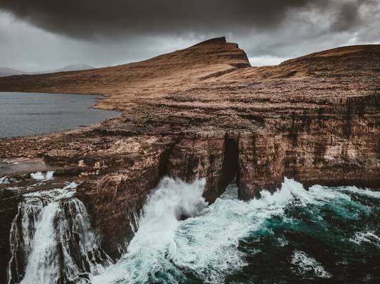
Crazy place, the lake above the ocean.
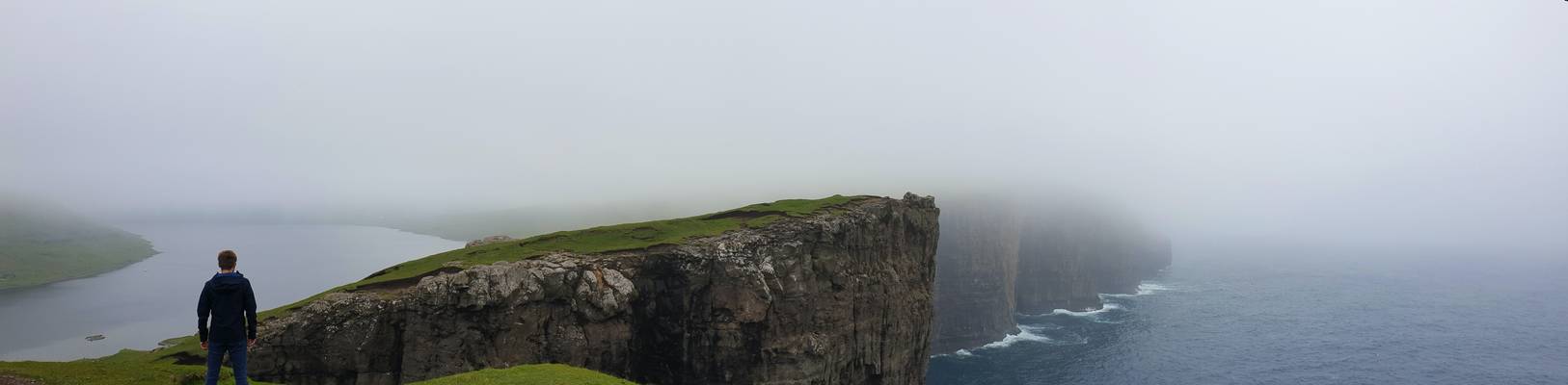
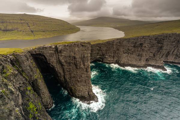
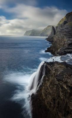
A nice hike of about 3 kilometers brings you to this magnificent sight: the floating lake “Sørvágsvatn”, which seems to hover above the sea. In fact, further left, there is a waterfall where it crashes into the North Atlantic Ocean. It is simply an epic site … no more, no less.
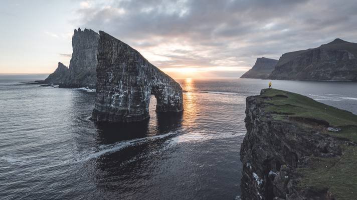
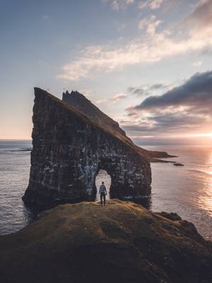
Panorama of Drangarnir one of the most scenic spots on the Faroe Islands
The village land consists of eighteen fields of enclosed and open land, most of it being owned by the king (and is now national property). Another...
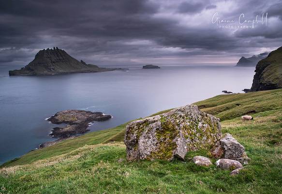
Sunset at Bøur looking towards the end of the Sørvágsfjørður, Faroe Islands.
** Join me on Facebook | Google+ | Twitter | 500px | Instagram **
Vágar, together with Mykines, is geographically the...
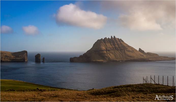
Tindhólmur is an islet on the southside of Sørvágsfjørður, west of Vágar in the Faroe Islands. It has its name from the five peaks, which are named...
‘I’m glad I will not be young in a future without wilderness’
—Aldo Leopold
The ultimate home location I feel, imagine living in that house, with that view. I literally gasp just daydreaming about it.
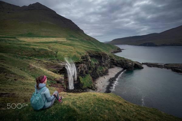
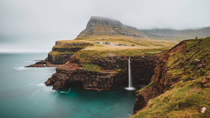
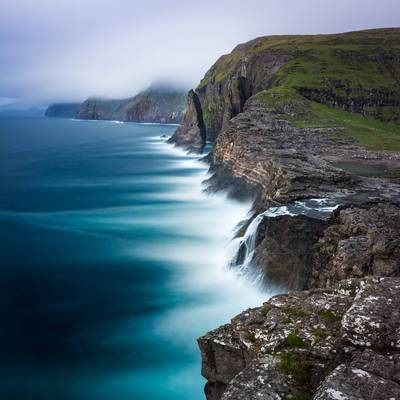
A short walk off the road takes you to this beautiful waterfall: and if you’re really lucky, you get a sunset (I heard it doesn’t show that often here). Go there, enjoy, and take in the sound of crashing waves.
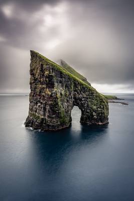
This was actually the first shot I got of Drangarnir (or the big sea stack of the two). The small sea stack hides behind this magnificent rock formation. In the back rises Tindholmur, yet another fantastic rock formation/island. The pease here is amazing, we were only a small group of hikers/photographers that went there. It was truly amazing.
Note: you will need a guide to get here, not only because it’s private land, but there are some sketchy parts in the path (or no path at all). When you visit the Faroe Islands, make sure not to miss this.
One of the wow places on the Faroe Islands.
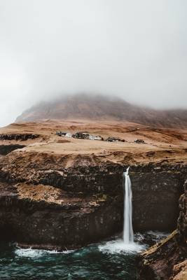
Gásadalur is located on the edge of Mykinesfjørður, on the Faroese island of Vágar.
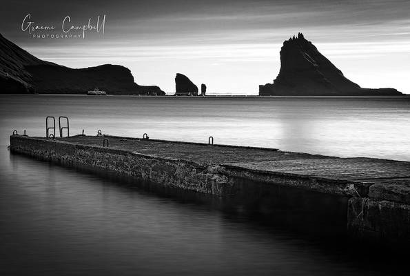
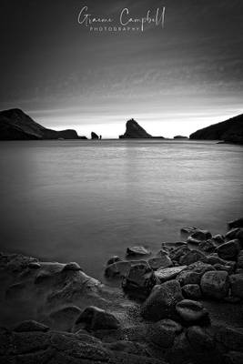
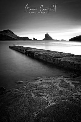
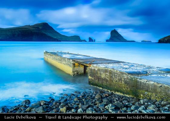
Bøur Pier post sunset with a silhouetted Tindhólmur island in the distance.
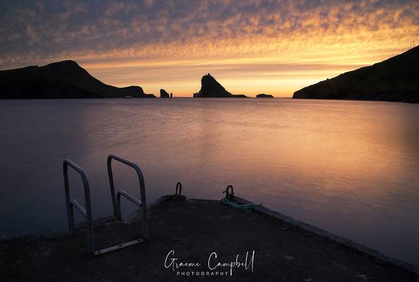
An Atlantic view from the small Faroese village of Bøur.
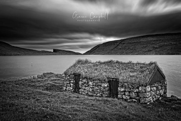
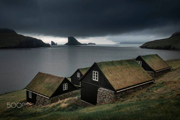
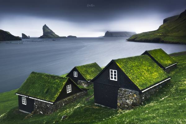
A grass roofed fishing hut at a gusty, chilly evening at Sørvágsvatn on the Faroeses island of Vágar.
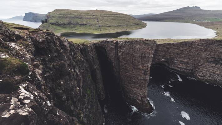
After hiking along the “flying lake”, I got to this amazing location, and even in summertime, I got it all to myself. This is where said lake flows into the North Atlantic Ocean. The weather was not as windy as I had hoped for, yet the waves were crashing on the rocky sides here … and that was the only thing one could hear.
Didn't expect much from this cloudy afternoon, but then sun got through the cloud cover.
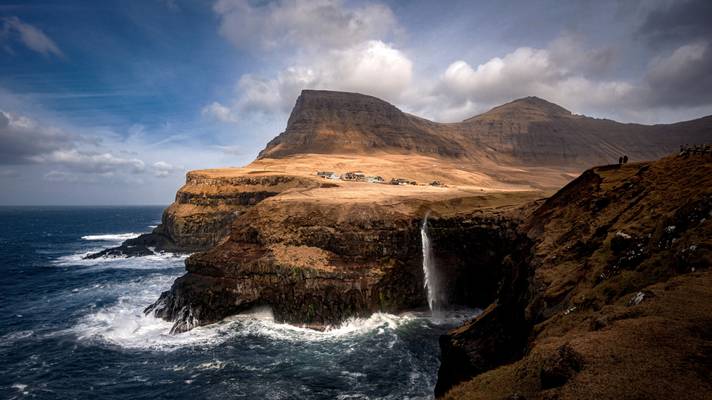
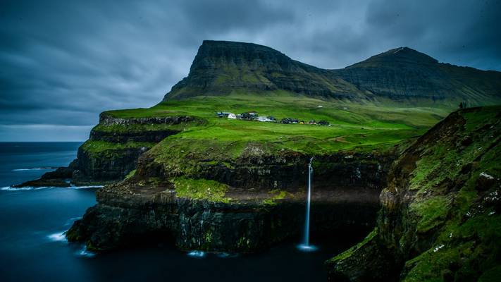
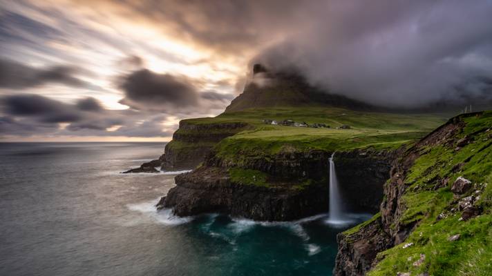
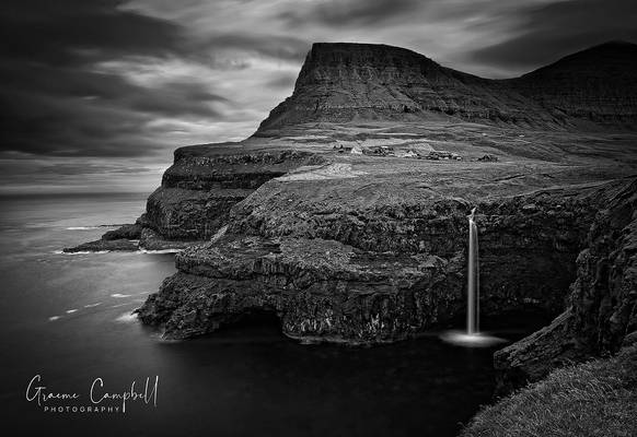
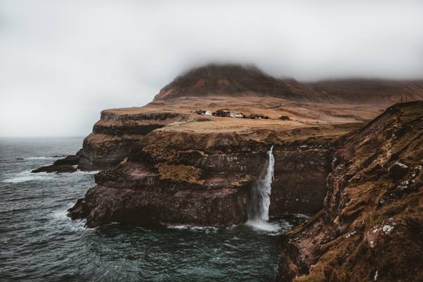
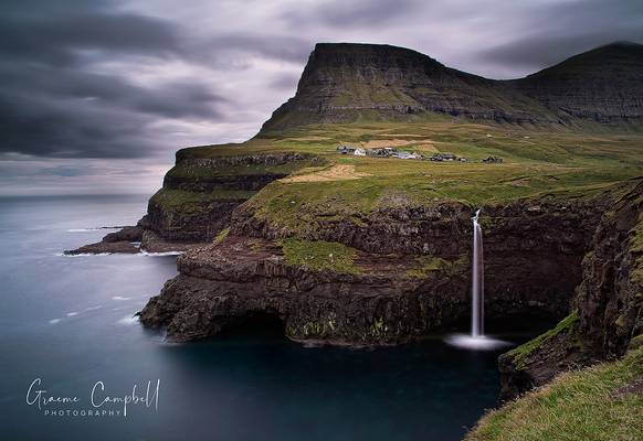
The famous Múlafossur waterfall, Faroe Islands.
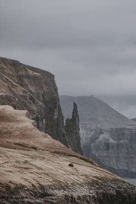
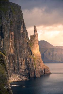
This freestanding rock is called Trøllkonufingur, which means Witch’s finger.
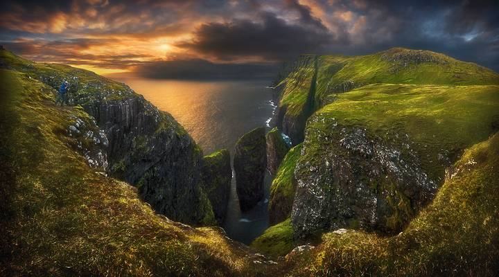
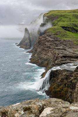
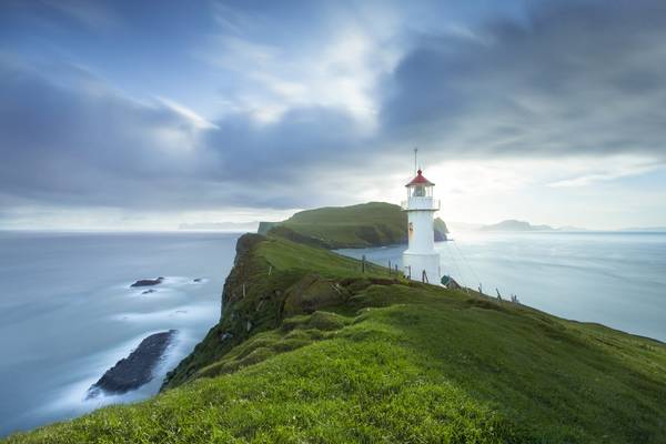
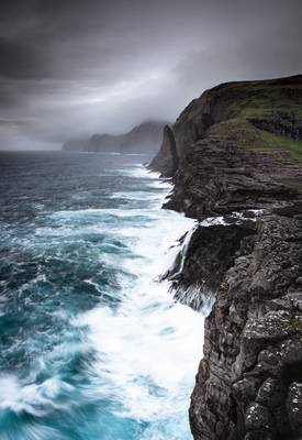
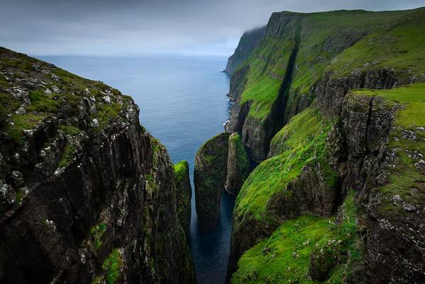
Most of my time visiting the Faeroe Islands was spent waiting for good weather. Here finally I could see the fog lifting and offering some visions in blue.
[#11 on explore 13/8/16]
Gásadalur is located on the edge of Mykinesfjørður, on the Faroese island of Vágar.
Sunset at the tiny village of Bøur on the western side of the Faroese island of Vágar.
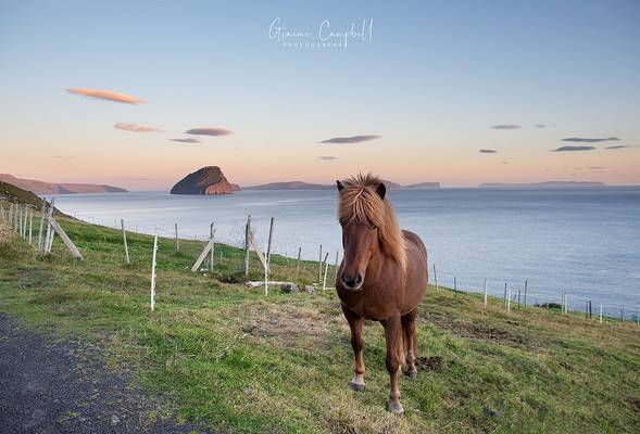
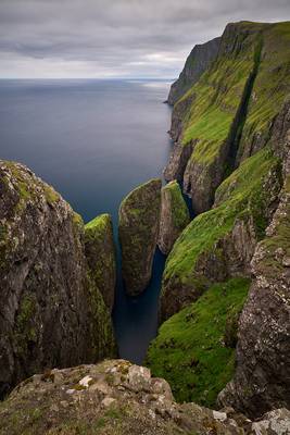
The small Faroese island of Koltur and a Faroese Horse at sunset. Taken from the Dunnagjógv cliffs near the small village of Sandavágur. ...
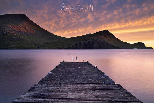
Sunset at the tiny village of Bøur on the western side of the Faroese island of Vágar.
Thanks to all Phoide contributors to Vágar region!
Most notably Jiri Hajek and Adelheid Smitt.