Wasco County

by Bonnie Moreland
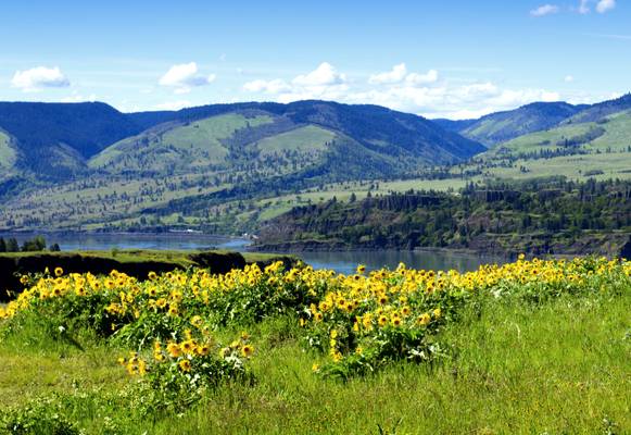
Wild balsamroot flowers, overlooking the Columbia River.
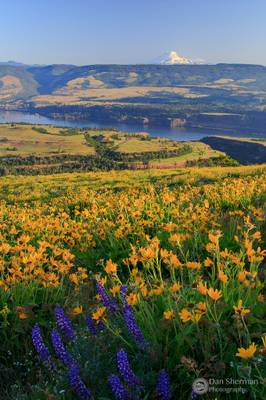
Rowena Crest, once known as "Rowena Bluffs", is the high point on the Oregon side of the Rowena Gap, and is located along the Historic Columbia River Highway at Columbia River Mile (RM) 180.5. Rowena Crest is part of Oregon's Mayer State Park. Downstream is Tom McCall Nature Preserve. Parking at the top of the crest provides spectacular views of the Columbia River, Mayer State Park, and across to Lyle, Washington and the mouth of the Klickitat River.
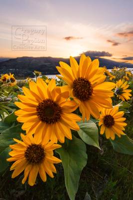
The 271 acres is located on the Rowena Plateau high above the Rowena Dell, which leads directly into the Columbia River Gorge. The plateau is covered in wildflowers, including lupine and balsamroot. There are even varieties of wildflowers here that are unique to the Gorge!
The wildflowers appear from late February to June, although they are in their prime in April and May.
by Bonnie Moreland
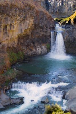
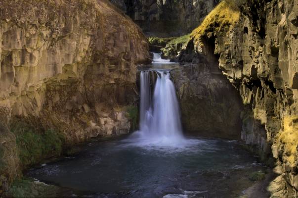
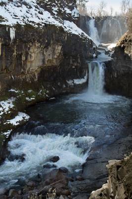
Celestial Falls is the second step of the major falls of the White River, and was formerly considered to be part of White River Falls itself. The falls drop 41 feet over a uniform ledge, plunging into a large pool at the base of the formation, with White River Falls visible just 180 linear feet upstream. The falls feel oddly out of place in the gently undulating foothills on the east side of the Cascades near the town of Maupin. The White River originates on Mount Hood some 40 miles upstream, gathering lots of smaller tributaries as it rolls downhill towards its confluence with the Deschutes River. By the time it reaches the Tygh Valley its a fairly substantial river.
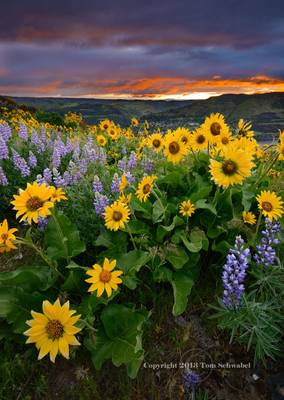
Springtime balsamroot and lupine blooms, Rowena Crest, Columbia River Gorge, Oregon.
A 5-exposure blend for depth-of-field and dynamic range...
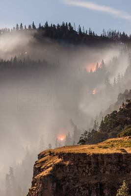
*This image is copyright, all rights reserved, and not part of the public domain. Any use, linking to, or posting of this image is prohibited without...
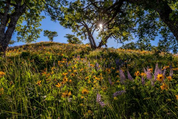
Balsamroot and lupine wildflowers blooming under oak trees on the Rowena Plateau in the Columbia River Gorge.
Photo taken near Mosier, OR (USA).
by Bonnie Moreland
Celestial Falls is the second step of the major falls of the White River, and was formerly considered to be part of White River Falls itself. The falls drop 41 feet over a uniform ledge, plunging into a large pool at the base of the formation, with White River Falls visible just 180 linear feet upstream. The falls feel oddly out of place in the gently undulating foothills on the east side of the Cascades near the town of Maupin. The White River originates on Mount Hood some 40 miles upstream, gathering lots of smaller tributaries as it rolls downhill towards its confluence with the Deschutes River. By the time it reaches the Tygh Valley its a fairly substantial river.
by Bonnie Moreland
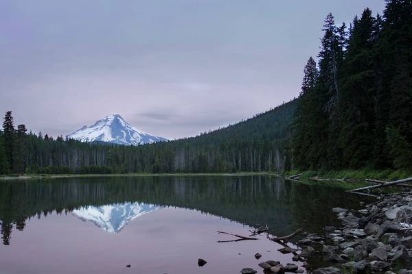
Frog Lake Campground is located east of Government Camp on Mount Hood just off of Highway 26. While it is not far from the highway it is shielded well from engine noise and is named after the many, many frogs that make this area their home. The southside of the lake has a nice little picnic day use area that delivers amazing views of Mount Hood. Frog Lake provides several activities including fishing, hiking and swimming. The lake sits at an elevation of 3800 feet.
It's a mystery to me just how that lavender became so pronounced when I posted it here on Flickr. On my regular photo program on my computer the lavender is more pale.
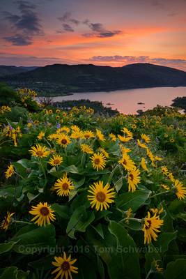
Sunrise glow at Rowena Crest, Tom McCall Preserve, Oregon, USA.
**This is a copyrighted image with all rights reserved. Please don't use this image...
*This image is copyright, all rights reserved, and not part of the public domain. Any use, linking to, or posting of this image is prohibited without...
From a few weeks ago when the flowers on Rowena crest were erupting.
by Bonnie Moreland
The White Falls is the upper cascade and the Celestial Falls is the second one. They are both fed by the White River and are not that far apart. So you may well ask why they have their own separate names. Good question, I found a few different answers, and many believe they should be the same name. But currently that is how they are identified.
by Bonnie Moreland
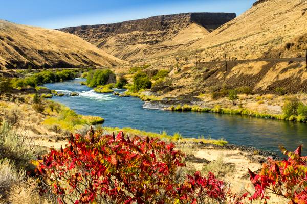
The Deschutes (deh-Shoots) River is a major tributary of the Columbia River. The river provides much of the drainage on the eastern side of the Cascade Range in Oregon, gathering many of the tributaries that descend from the drier, eastern flank of the mountains. The Deschutes provided an important route to and from the Columbia for Native Americans for thousands of years, and then in the 19th century for pioneers on the Oregon Trail. The river flows mostly through rugged and arid country, and its valley provides a cultural heart for central Oregon.
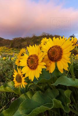
*This image is copyright, all rights reserved, and not part of the public domain. Any use, linking to, or posting of this image is prohibited without...
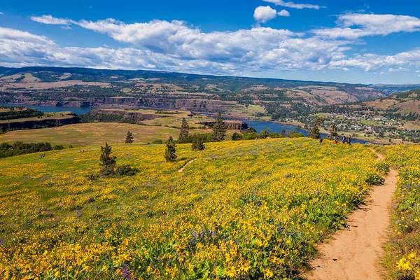
Balsamroot, lupine and other wildflowers cover Rowena Plateau in the Columbia River Gorge.
Photo taken near Mosier, OR (USA).
Thanks to all Phoide contributors to Wasco County!
Most notably Bonnie Moreland.