
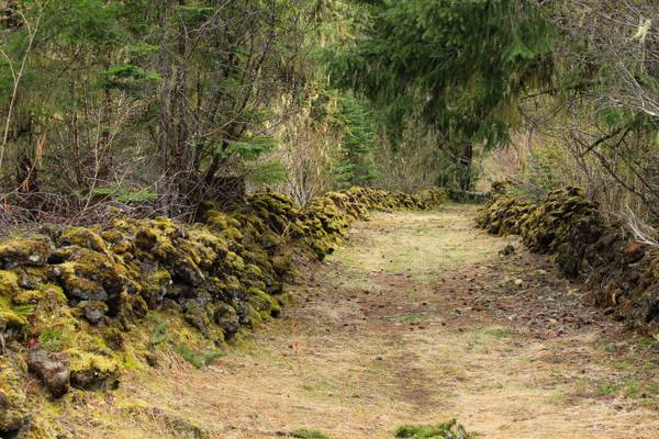
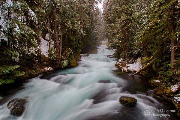
Willamette National Forest
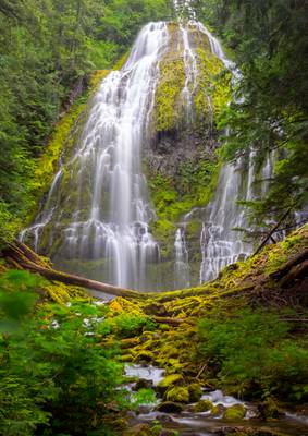
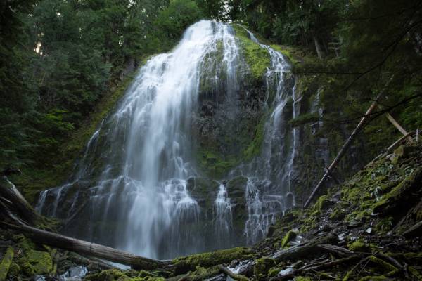
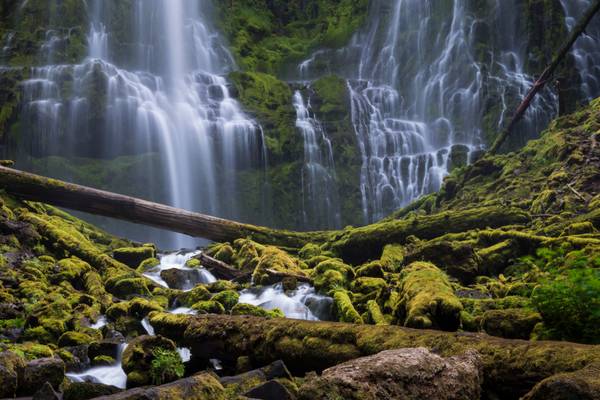
- Samuel Johnson | facebook | 500px | ferpectshotz | One more shot of the beautiful and massive Lower Proxy falls. For this shot I had this plan to get as close to some of the foreground cascades and to use them as foreground interest for framing the big waterfall. Unfortunately the water flow was simply too high and I was constantly getting sprayed by the mist. I am truly glad my gear is water resistant but trust me constantly having to wipe off your filter while taking a long exposure shot is not fun. This was not the composition I had in mind but this was the closest I got to what I initially planned. Hope you all enjoy the image.
- Johann Wolfgang von Goethe.
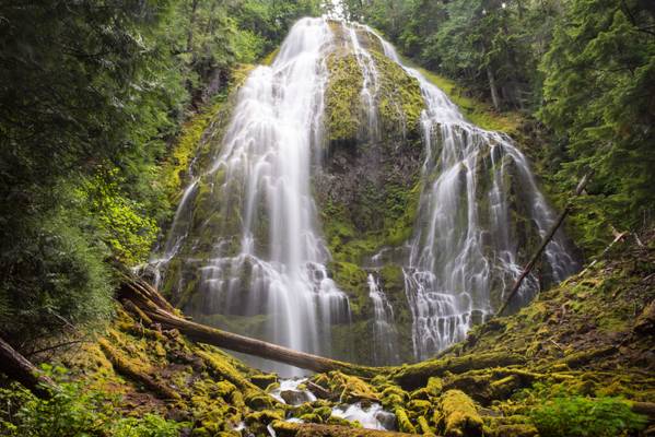
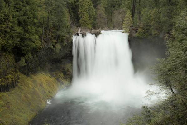
When I first saw an image of the stunning lower proxy falls, I did not fully understand its size. I knew it was a giant waterfall but was not prepared for the size of it. We also visited a waterfall called fairy falls on that trip, which has a similar form, near Portland, which was way smaller than I imagined at around 20 feet. So I think visiting the fairy falls might have biased my sense of scale.
Once we reached the base of lower proxy falls, we realized its massiveness at 226 feet. The water spray from the falls was quite intense that day, and I had trouble keeping my front element and filters clean. I had forgotten to pack the little microfiber wipes in my haste and learned that they are indeed worth their weight in gold, especially near a waterfall. While we had some technical challenges, what a refreshing break this hike and waterfall turned out to be. We reached the trailhead around noon after some much-needed sleeping in and a pretty heavy breakfast. The 2-mile-long trail along lava fields and dense woodland was the perfect way to enjoy a beautiful day.
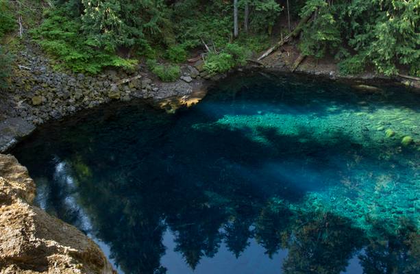
My husband is holding on to a tree with one hand and my backpack with the other as I am leaning out over the edge to get this shot. All the information about this pool is in the following image.
Blue Pool, also known as Tamolitch Pool, is where the McKenzie River seeps to the surface through underground lava fields that flowed across the landscape eons ago.
I have a photo of the Tamolitch waterfall in my waterfalls album. You only get to see the falls at certain times of the years. It was worth slogging through slush and snow to see the waterfall dropping into the pool.
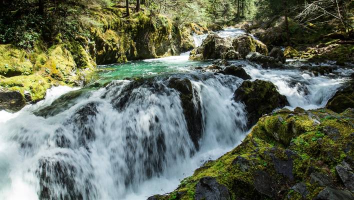
These falls run into the Opal Pool, a favorite swimming hole in the area.

This summertime swimming hole is a favorite for those in the know. Be forewarned it is always cold.
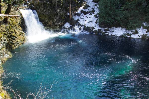
Once a majestic waterfall, the McKenzie River has changed course and gone underground a few miles up stream. The river only flows over the falls a few times a year, the rest of the time the water emerges from the rocks underwater in the basin of waterfall pool.
I took over 80 shots of this waterfall today. I narrowed it down to two I like. If you viewers would let me know your opinion as to the strongest I would be grateful.
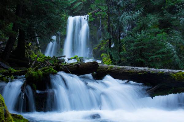
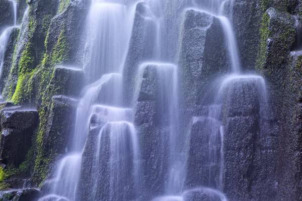
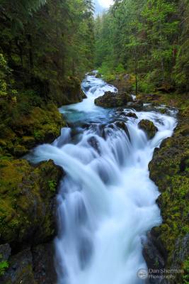
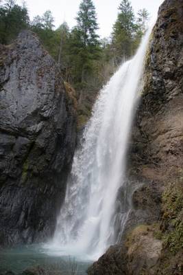
Downing Creek Falls is the second of at least three significant waterfalls known to occur along the stout length of spring-fueled Downing Creek. The falls drop 32 feet over a distinctly cube-shaped outcrop of basalt, pouring in three to four side-by-side channels (depending on how much extra snow melt water is present), with as many as a dozen small streams of water dribbling out of the adjacent cliff and falling parallel to the falls in tandem. Though the falls aren't terribly tall, the creek is large enough to produced a consistent cloud of mist at the base of the falls, which helps ensure the forest and cliffs all around the falls are liberally covered head to toe in a thick blanket of moss.
Downing Creek is a remarkably consistent stream with a deceivingly small drainage basin. The majority of the creek emerges from springs about one quarter mile upstream from the falls, and flows all year long with very little fluctuation as a result. Further upstream along the drainage is another waterfall which only flows during periods of prolonged snow melt in the spring months, but the upper section of the creek otherwise sinks into the porous ground and the upper falls dries out as a result.
This fall is pretty in the summer but much more dramatic in the winter with the 3 - 4 different cascades of water coming down. In the summer you can easily wade into the pool for a nice dip.
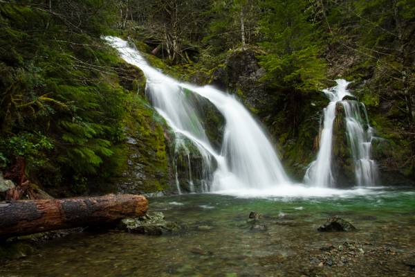
Sullivan Creek is the largest tributary of Cedar Creek, itself one of the larger feeders of the Little North Santiam River. As the creek drops to it's confluence with Cedar Creek, it cascades down this series of pretty and rather impressive falls. Some published accounts suggest the falls are between 40 and 60 feet tall, however on a more recent survey the measurement of the falls was 162 feet tall. This is likely not an accurate measurement of the entire falls either, as there are at least two more tiers just upstream which are not visible from the road, and this may bring the total height of the falls to over 200 feet.
Though the entire falls are not visible from below, absolutely zero effort is needed to enjoy this waterfall. The stream crashes down the final steps of the series of cascades into a pool immediately adjacent to the road, which offers a nice opportunity for wading and cooling off in the summer.
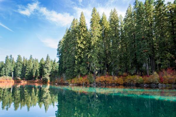
Clear Lake is the headwaters of the McKenzie River. The lake is primarily fed by snow runoff from nearby Mount Washington and the surrounding areas. The runoff filters through underground caverns for more than 20 years before emptying into Clear Lake. The lake is also fed by two small creeks, which may dry up seasonally, along with Great Spring, the source of the McKenzie River. Clear Lake is reported to be one of the most exceptional freshwater dive spots in Oregon. Submerged 100 feet (30 m) deep in the lake is a stand of upright trees that were killed approximately 3,000 years ago when volcanic activity created the lake. The trees are remarkably preserved due to the cold year-round water temperatures of between 35–43 °F (1.6–6 °C).
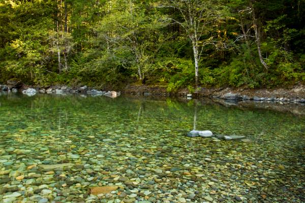
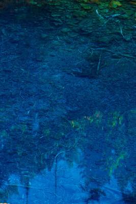
It is a shame that this image can't show you just how clear the water is, you can see the bottom clearly.
I got to spend 5 days here in the nearby community of Jawbone Flats - a forestry education center. I took a wilderness first responder course....
I was scrambling all over Russell Lake to find the ideal composition before the skies really lit up. The reflection was perfect! Espeially here at...
This is what Alan, Jeff, and I were met with the morning after an amazing sky. I opted to leave camp in the dark of early dawn to hike Park Ridge in...
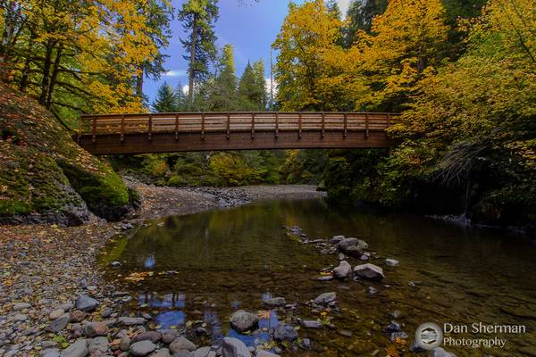
A footbridge on the trail to House Rock Falls in the foothills of the Cascade Mountains. This scene was just begging to have a shot made of it. The...
- Lucius Annaeus Seneca.
| facebook | 500px | ferpectshotz |
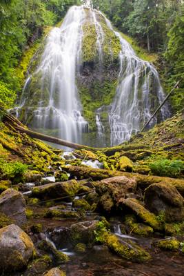
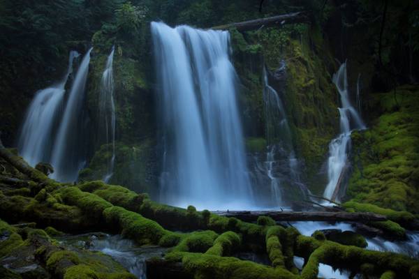
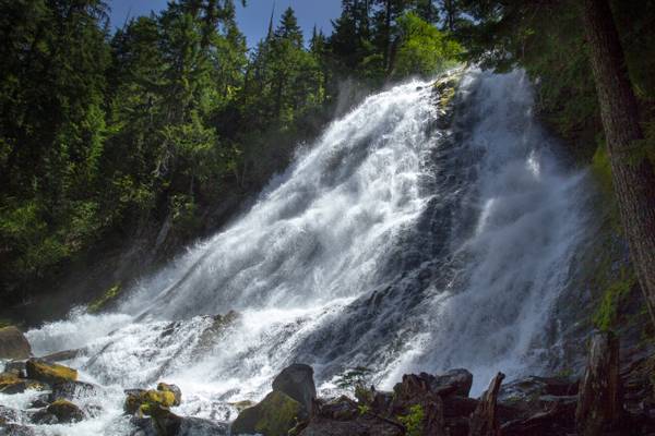
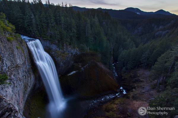
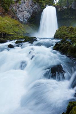
After visiting Smith Rock for sunrise we headed back to the Three Sisters wilderness to see Lower Proxy Falls. This waterfall is often regarded as one of the most picturesque in Oregon. The hike to the falls is quite long and leads up to a view point through a very narrow path. But the elevation gain is only slight and most part of the hike is covered. Once you reach the viewpoint you will have to scramble through a steep slope to get to the base of the falls. Once you get to the base of the falls it’s difficult not to get impressed by the sheer size of this beautiful waterfall with its 226 ft vertical drop.
We spent quite a bit of time here enjoying the amazing falls and vivid greens of the forest. This is another must visit location for any waterfall lover.
Taken on a misty day, the water is low at this time of the year, but come Spring it will be very full and lovely.
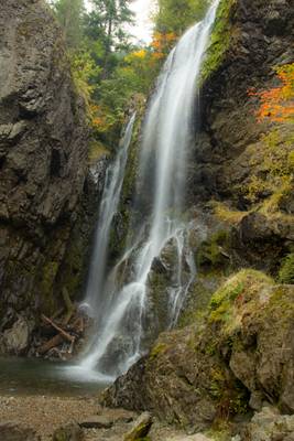
Henline Falls is a broad curtain type fall, dropping 126 feet over the side of a narrow alcove. During periods of lower water levels Henline Creek will split into two or three more distinct channels of water and spray into the cove in multiple distinct sheets of droplets.
Henline Falls was named after the creek, which was in turn named for a settler of the area who had come in search of the rich prospecting in the area. Immediately to the right of the base of the falls is the Silver King Mine. Remnants of a tramway leading from the mine are visible as the trail near the falls. The adit itself is dry, so exploration is possible, but do not enter the mine alone.
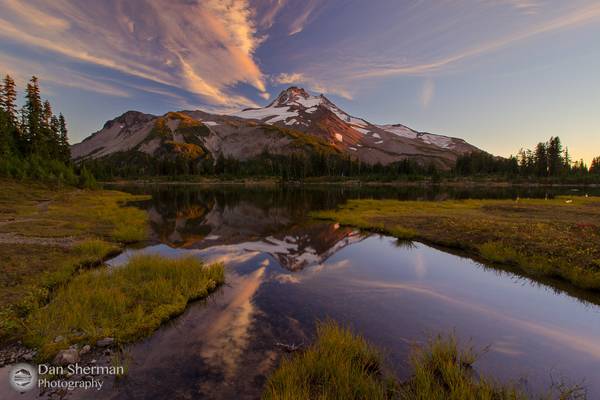
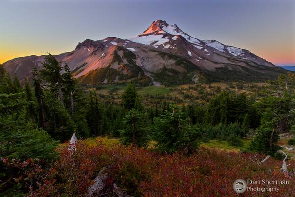
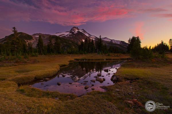
Haystack Butte in the background.
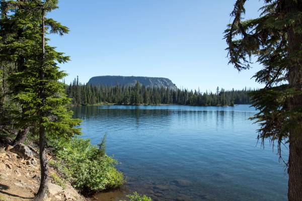
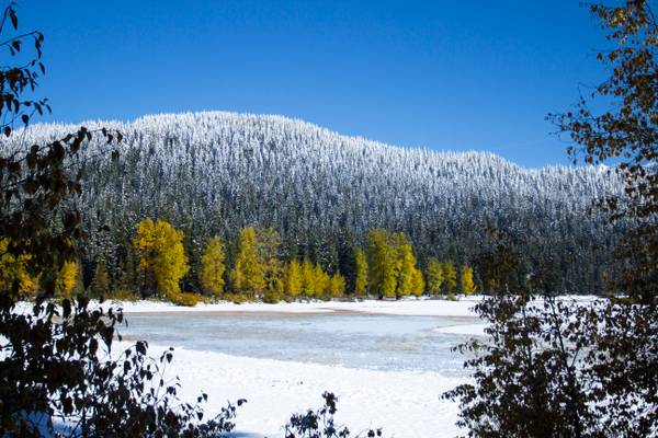
Nestled in the Willamette National Forest is a beautiful alpine lake simply known as “Big Lake”. About 47 miles northwest of Bend, this scenic lake is a popular recreational area for locals and visitors alike. During the summer you can enjoy camping, fishing, swimming, ATV riding, and water skiing at the lake. Hikers can explore the nearby Pacific Crest Trail from late spring to early fall. Winter recreation in the area includes skiing, snowmobiling, and snowshoeing. Big Lake boasts views of several peaks, including Mt. Washington, Hoodoo Butte, and Three Fingered Jack.
Clear Lake (Linn county) is the headwaters of the McKenzie River. The lake is primarily fed by snow runoff from nearby Mount Washington and the surrounding areas. The runoff filters through underground caverns for more than 20 years before emptying into Clear Lake. The lake is also fed by two small creeks, which may dry up seasonally, along with Great Spring, the source of the McKenzie River. Clear Lake is reported to be one of the most exceptional freshwater dive spots in Oregon. Submerged 100 feet (30 m) deep in the lake is a stand of upright trees that were killed approximately 3,000 years ago when volcanic activity created the lake. The trees are remarkably preserved due to the cold year-round water temperatures of between 35–43 °F (1.6–6 °C).
I took over 80 shots of this waterfall today. I narrowed it down to two I like. If you viewers would let me know your opinion as to the strongest I would be grateful.
Downing Creek Falls is the second of at least three significant waterfalls known to occur along the stout length of spring-fueled Downing Creek. The falls drop 32 feet over a distinctly cube-shaped outcrop of basalt, pouring in three to four side-by-side channels (depending on how much extra snow melt water is present), with as many as a dozen small streams of water dribbling out of the adjacent cliff and falling parallel to the falls in tandem. Though the falls aren't terribly tall, the creek is large enough to produced a consistent cloud of mist at the base of the falls, which helps ensure the forest and cliffs all around the falls are liberally covered head to toe in a thick blanket of moss.
Downing Creek is a remarkably consistent stream with a deceivingly small drainage basin. The majority of the creek emerges from springs about one quarter mile upstream from the falls, and flows all year long with very little fluctuation as a result. Further upstream along the drainage is another waterfall which only flows during periods of prolonged snow melt in the spring months, but the upper section of the creek otherwise sinks into the porous ground and the upper falls dries out as a result.
I actually had stopped to check my map, I looked up from my parking spot and saw this steam just tucked back up in the woods. A short walk and I found this vantage point. A completely unexpected find and now one of my favorite images of the year.
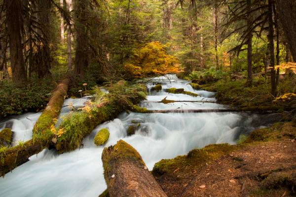
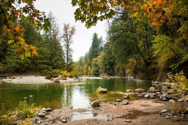
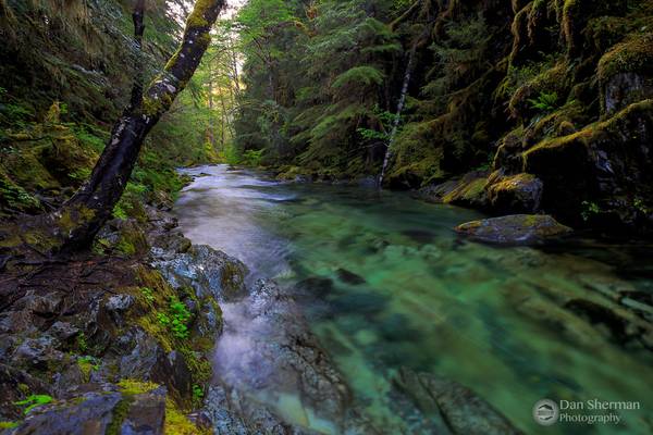
Olallie Creek is located in the midsection of the Cascades mountain range in western Oregon. The area is nicely shaded by Douglas fir, maple and alder. The Willamette National Forest stretches for 110 miles with varied landscapes of high mountains, narrow canyons, cascading streams, and wooded slopes. This creek sits right beside the McKenzie River and the McKenzie River Trail.
Olallie is a very popular name in Oregon. There are several Olallie areas, from this creek, to a nice lake, not associated with this creek to a nice hiking trail, not associated with creek or lake.
Sullivan Creek is the largest tributary of Cedar Creek, itself one of the larger feeders of the Little North Santiam River. As the creek drops to it's confluence with Cedar Creek, it cascades down this series of pretty and rather impressive falls. Some published accounts suggest the falls are between 40 and 60 feet tall, however on our most recent survey we measured the falls to stand 162 feet tall. This is likely not an accurate measurement of the entire falls either, as there are at least two more tiers just upstream which are not visible from the road, and this may bring the total height of the falls to over 200 feet.
Though the entire falls are not visible from below, absolutely zero effort is needed to enjoy this waterfall. The stream crashes down the final steps of the series of cascades into a pool immediately adjacent to the road, which offers a nice opportunity for wading and cooling off in the summer.
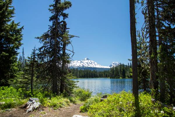
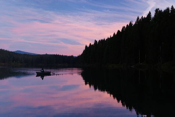
Scott Lake is truly a hidden gem off the McKenzie Pass Scenic Drive. Nestled right next to the Mt Washington Wilderness Area, the lake gives spectacular views over toward the Three Sisters to the South-East.
Catching the sunset and sunrise here is a must - the lake provides a perfect foreground for landscape photographs and it is by far the most beautiful time on the lake.
Lower section of the falls.
Just off U.S. Highway 20 in Central Oregon there is a lake with a curious fate. Every winter the aptly-named Lost Lake fills up, before slowly draining through a hole, drying up and making way for a meadow.
The hole has been there as long as anyone can remember, Jude McHugh, spokeswoman with the Willamette National Forest, told The Bulletin. And while the hole may appear to be one of those oddest of mysteries that nobody can quite figure out, the explanation is rather simple. The volcanic landscape of the area gives way to a number of quirky geologic traits – the one responsible for swallowing the lake is a lava tube. The tunnel-like structure is formed when flowing lava hardens near the surface but continues to flow downwards, and the inner lava escapes before hardening. The result, a tube that opens to the surface and leads to the mysterious depths below.
McHugh says it’s unclear exactly where the water goes, but it possibly seeps into the porous subsurface underground, refilling the expansive aquifer that feeds springs on both sides of the Cascades.
The water is very high and fast right now. Later in the year these falls become lazier.
It was surprisingly tough to shoot this falls. This scene from the viewpoint above is just so all-encompassing. This was my first time visiting this...
Clear Lake, Willamette National Forest, Linn County, Oregon
I had a fun adventure this weekend with my Sis and Zman. We went non stop from...
I love my home and I wouldn't trade it for the sunny skies of Southern California. This shot is from a backpacking trip I took in early Fall with a...
My first shot of 2016! I was finally able to get my snowshoes on after 2 years and take a short walk to this vista overlooking Willamette National...
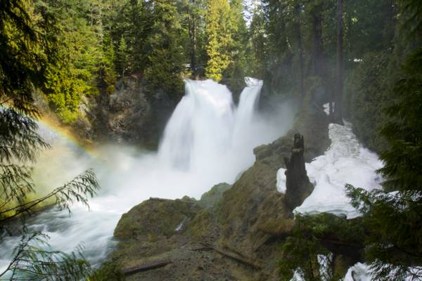
Sahalie Falls, McKenzie River, Willamette National Forest, Washington
The first stop of the morning with Sis and Zman was at the powerful 73...
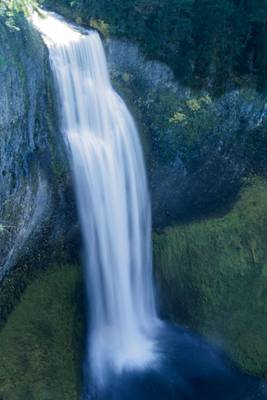
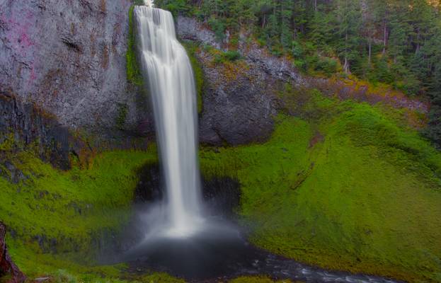
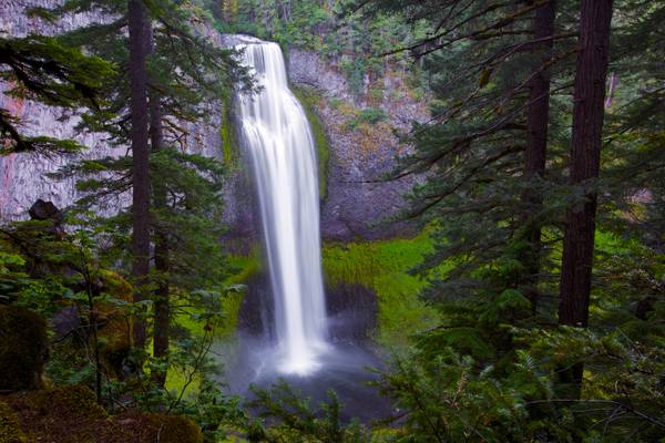
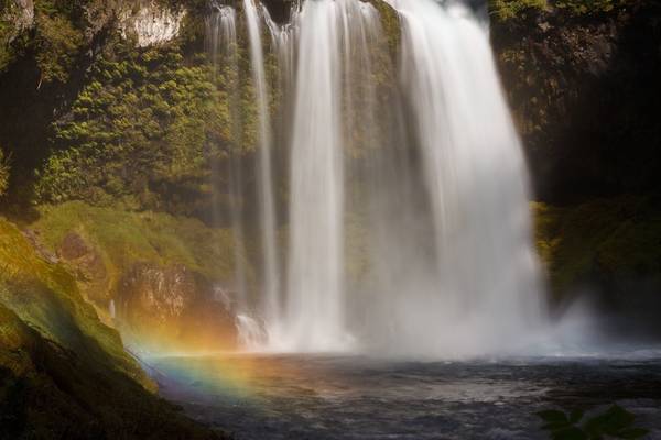
Salt Creek creates one of the most impressive waterfalls in Oregon as it hurtles 286 feet into a gaping canyon near Willamette Pass. The size of the falls isn't terribly notable in the area, but rather the process by which the falls were formed. Glaciers scoured the valley out during the last Ice Age, then following their retreat, lava flows filled in a portion of the valley, creating the narrow canyon walls composed of columnar basalt that are now seen at the falls. Views are afforded all along the canyon rim, from the brink of the falls to the base of the falls.
I know there are a thousand and one shots of this waterfall, and now I can add mine. To get the shot of the entire falls, you literally need to stand in the water. But that was okay because after the hike I was hot and it was refreshing.
Proxy Falls, also known as Lower Proxy Falls, is a cascade and plunge waterfall from a collection of springs on the shoulder of North Sister, that plunges into a gaping canyon near McKenzie Pass in the Willamette National Forest, near Belknap Springs, Oregon. The waterfall is notable for its main drop of 226 feet (69 m) which makes it one of the highest plunge waterfalls in Oregon.
- Jules Verne.
| facebook | 500px | ferpectshotz |
This one was taken during our last summer road trip to Oregon. This is the base of the beautiful Lower Proxy falls in the three sister wilderness area. The hike up to this fall is pretty easy but long and you will have to scramble over some fallen trees and walkthrough some old lava beds and the last few feet to this falls is extremely hard to get to the bottom of a steep hillside. It would be wise to take some time and chart out a path down the hillside before venturing down.
I wanted really to get down and include some smaller cascades as a foreground interest but the wind was quite heavy and there was a lot of water spray ruining those shots. So stayed back and zoomed in to get this shot. Thanks for visiting hope you all like it.
Now that the Spring snow has started to melt, if you can get to these falls, the cascades are impressive. These are one of the falls located in the Opal Creek Wilderness area. This image was one of several, I had to clean off my lens after each shot, so much spray!
Henline Falls is a broad curtain type fall, dropping 126 feet over the side of a narrow alcove. During periods of lower water levels Henline Creek will split into two or three more distinct channels of water and spray into the cove in multiple distinct sheets of droplets. This disconnect between the powerful falls seen during the wet season and the lacy, delicate falls encountered in the dry season will determine whether the entire falls can be viewed by visitors - at high water so much spray blasts out from the falls that attempting to cross the creek to where all-encompassing views are possible is treacherous (and photography is pretty much impossible).
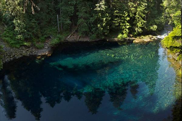
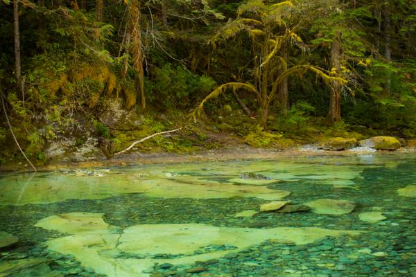
Blue Pool, also known as Tamolitch Pool, is where the McKenzie River seeps to the surface through underground lava fields that flowed across the landscape eons ago.
The water is so pure that it’s eerily deceptive. When water is that pure, the depth is often misjudged. For anyone who has visited Blue Pool will agree that the water only appears to be, at most, five feet deep. The rocks that rest on the bottom of the pool’s earthen floor seem to be so close that you can almost touch them by merely sticking your arm into the water. The true depth of Blue Pool is 30 feet!
The water from Blue Pool comes from underground where it has been purified by the rocks and sediment underneath the surface of the Earth. It’s constantly in circulation from its underground source. This also explains why the water is so cold; it comes fresh from underground. When water is that cold, it makes it difficult for organisms to survive.
The Tamolitch Falls, now a seasonal waterfall, once had a constant flow on the McKenzie River. In the 1960s, water was diverted for hydroelectric use from the stream above the falls; that section of the stream, as well as the falls, ceased to flow except during periods of heavy runoff or when water was diverted from the dams upstream. When this is not the case, the stream goes underground and now emerges below the falls. At the base of the former falls is the Tamolitch Blue Pool.
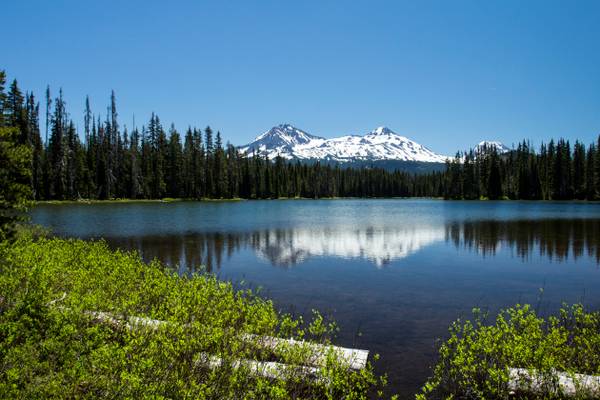
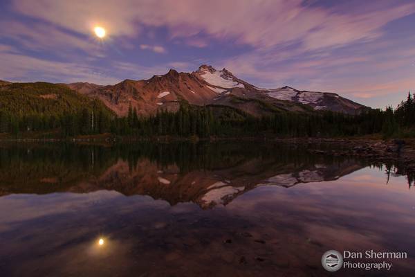
The Three Sisters Mountains in the background.
Scott Lake is truly a hidden gem off the McKenzie Pass Scenic Drive. Nestled right next to the Mt Washington Wilderness Area, the lake gives spectacular views over toward the Three Sisters to the South-East.
Catching the sunset and sunrise here is a must - the lake provides a perfect foreground for landscape photographs and it is by far the most beautiful time on the lake.
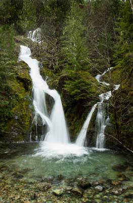
The Opal Creek Wilderness area has several phenomenal sights within its boundaries. Three Pools are an easily accessible swimming holes on the north fork of the Santiam River. There is the possibility to cliff jump from multiple locations.
The quieter side of Three Pools is the south bank of the Little North Santiam. Which is what I have photographed here. Because the water is more shallow and runs slower you will find smaller children here during the summer months.
Nine months of the year, you can hike this trail and enjoy a pleasant experience. There's a craggy rock pillar in the middle of the river, and a marvelous grotto with two mouths in the cliffs near the pillar north of this spot.
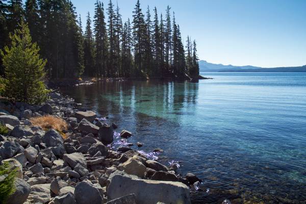
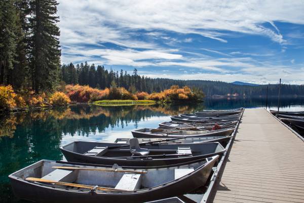
Waldo Lake is a natural alpine lake in the Cascade Mountains of Oregon. It is the second largest natural non-alkali lake in Oregon with just under 10 square miles (26 km2) of water surface and a maximum depth of 420 feet (130 m). The lake is named after Oregon politician, judge, and conservationist John B. Waldo.
The Breitenbush River is a tributary of the North Santiam River in western Oregon in the United States. It drains a rugged, forested area of the Cascade Range east of Salem. The North and South forks flow west, joining 0.25 miles (400 m) east of the small community of Breitenbush. The combined stream flows generally west-southwest through the Willamette National Forest. It joins the North Santiam at Detroit.
The Opal Creek Wilderness is a wilderness area located in the Willamette National Forest, on the border of the Mount Hood National Forest. It has the largest uncut watershed in Oregon.
Opal Creek and nearby Opal Lake were named for Opal Elliott, wife of early Forest Service ranger Roy Elliott.
Tamolitch Pool, Tamolitch Falls, Willamette National Forest, Linn County, Oregon
This is the color of the deep pool in shade. Unfortunately, we...
This creek is well named. Its vibrant green color resembles that of an Opal, and no where is it more vibrant than Opal Pool, which this is just down...
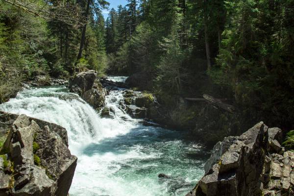
Koosah Falls, McKenzie River, Willamette National Forest, Linn County, Oregon
Just down the road from Sahalie Falls, is the mighty Koosah Falls....
This sky was one of the most spectacular skies I had ever seen, and it was so unexpected! Jeff Barnhart, Alan Howe, my little brother and I all took...
Took a semi-impromptu day to myself Monday and drove up to Hoodoo for some skiing, but first I had to stop here and take some shots. I love this...
Thanks to all Phoide contributors to Willamette National Forest!
Most notably Bonnie Moreland and Sandeep Thomas.