Head In the Clouds

0
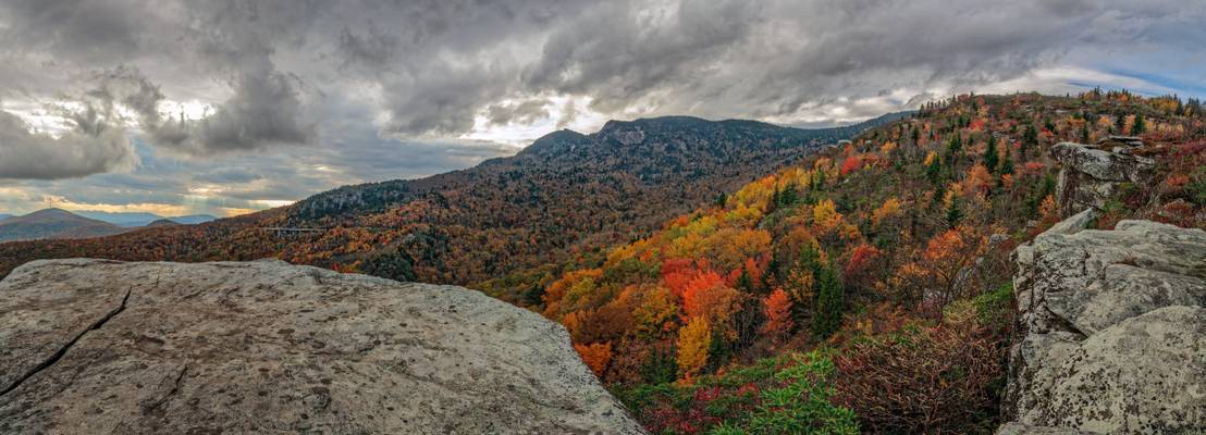
It’s a rough and rocky trail that leads to such a beautiful place… the hike up is a little steep to begin with through what seems more trough than trail. You have to hoist yourself over larger rocks through a tunnel of rhododendron for a good way, but then the trail opens up to a large rock shelf… and to this view of aptly named Rough Ridge and Grandfather Mountain beyond.
This is a very popular overlook along the Blue Ridge Parkway. You can find it at Milepost 302.8, in North Carolina. It’s an access for the Tanawha Trail that originates at Beacon Heights and ends at Price Lake. To me, it also provides one of the better views of the Linn Cove Viaduct, which can be seen in the distance on the left side of Grandfather. While all you may notice is a bridge, the viaduct is no less than an engineering marvel… its span connects two ends of the Blue Ridge Parkway with minimal impact on the mountain.
Autumn foliage is a huge draw here throughout North Carolina, and no less in this spot… like many others who find this the perfect place to set up a tripod, I know of ways to beat the crowd. One way is to be prepared for any kind of weather, such as you see here… rough, which seems fitting. This is also toward sunset… you can see light pouring through clouds in the distance, which was as good as sunset was going to be on this evening. Yet, I don’t really see how it could have been better, as this light made the colors pop... in this place, rough is no doubt redefined.

0
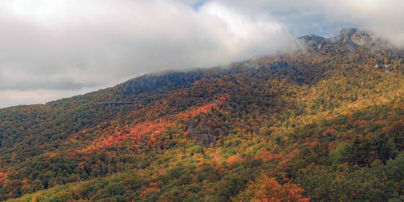
Whose head’s in the clouds? Grandfather’s is… literally! At over a mile up, the prominences of Grandfather Mountain often reach into the clouds. This mountain was named “Grandfather” by pioneers who imagined the face of an old man among its cliffs. The original Cherokee name for the mountain was “Tanawha,” meaning “a fabulous hawk or eagle.” The Tanawha Trail, which follows along the slopes of the mountain, and connects portions of the Mountains-To-Sea Trail, is marked by a feather. Here, Grandfather is all decked out in his finery… there are few places in this world that show autumn off as well.
This image also highlights one of the most famous stretches of road anywhere, the Linn Cove Viaduct. Until the viaduct was completed in 1987, the Blue Ridge Parkway was effectively unfinished. Hugh Morton, who owned the mountain at that time, would not allow cutting into the side of the mountain to complete the road… you had a rather long detour to reconnect going either north or south along the parkway. The Linn Cove Viaduct was the answer to that problem, as it was minimally invasive to the mountain causing no damage whatsoever to the ecosystem of the mountain wilderness. At his death, Hugh Morton willed the mountain to North Carolina. It is now a state park.
That colorful crest just below the viaduct is Yonahlossee Ridge. Starting at the topmost rock outcropping near the Blue Ridge Parkway and working its way down the ridge, this is the area of the first fall color to show up anywhere within this region… that’s why it’s so lit up now. The trees along there are mostly maples, though a close view reveals a stand of scarlet sourwood as well. I used to climb out over those rocks years ago, but they’re closed off now due to “endangered” plants. “Yonahlossee” is another Cherokee word meaning “trail of the black bear”… must have been something to that, as I saw one in that area this year.
No one is certain of an “official” profile of the mountain, as witnessed by those who first saw the prone image of an old bearded man among the crags of the mountain. However, the most popular profile can be seen from the community of Foscoe, seven miles north of Linville and 10 miles south of Boone on N.C. 105.
This is a composite image from 5 vertical images stitched in Photoshop ACR, yielding an output image of 72"x36". Sunlight, finding its way through the clouds, lights up the steep ridges, highlighting the ruggedness of Grandfather's wilderness.