
United States » Hawaii »
Hawaiian Islands
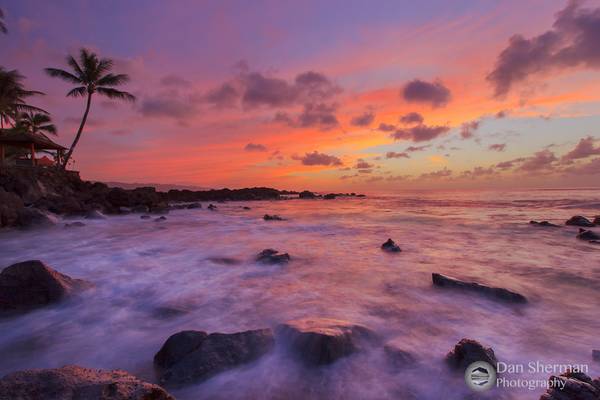
The Hawaiian Islands are a tropical paradise located in the Pacific Ocean. Known for their stunning beaches, lush rainforests, and active volcanoes, these islands offer a wealth of photographic opportunities for both amateur and professional photographers. From the rugged coastline of Kauai to the colorful sunsets of Maui, there are countless locations to capture the beauty of Hawaii.
- The Kohala Volcano last erupted about 120.000 years ago and is the oldest of 5 volcanoes that make up the Big Island.
Between 250.000 and 300.000 years ago the Kohala volcano experienced a truly massive landslide in which a part of the volcano fell into the ocean.
This landslide is responsible for the now famous sea cliffs on the windward Kohala shoreline but also triggered a giant tsunami that left marine deposits multiple 100 ft high on the other islands. Remnants from this landslide can still be found under water 81 miles (130 km) from the current coastline.
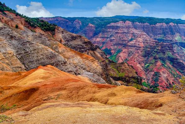
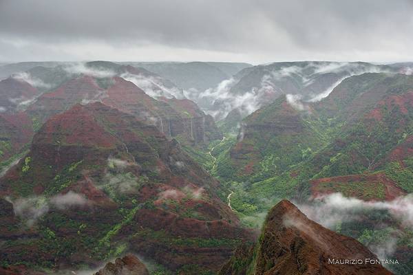
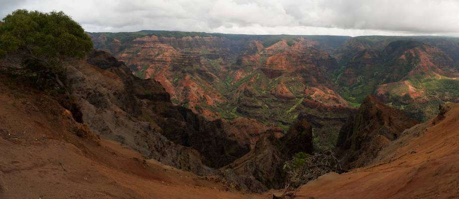
Kauai's iconic tourist attraction as seen from one of the many lookouts along the canyon's rim...
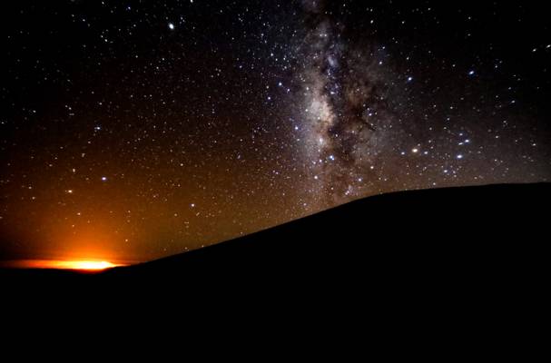
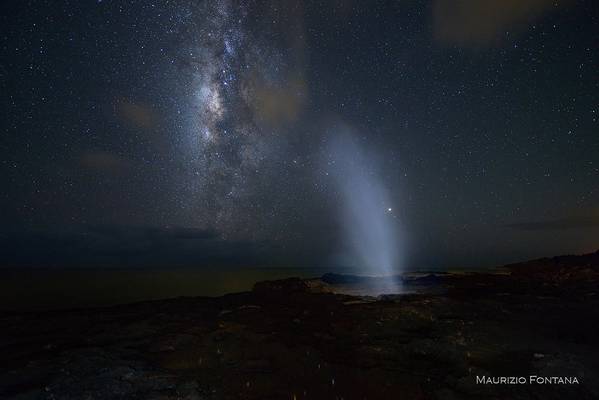
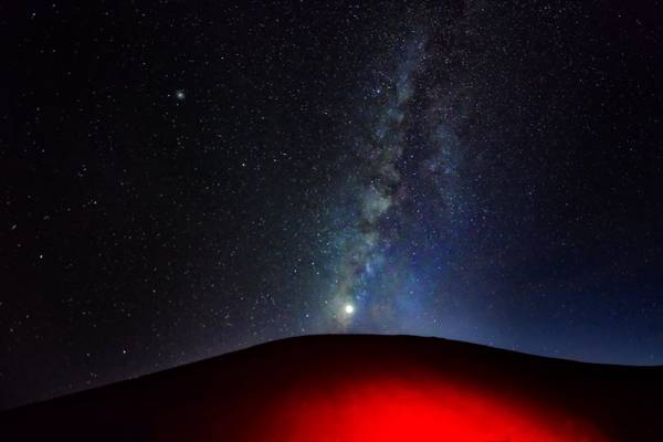
- This photo combines two interesting elements. The Milky Way on Moana Kea is so bright and clear, it feels like you can reach out and touch it.
And when you have Kilauea erupting in the distance about 90 miles away, it is a very interesting photo.
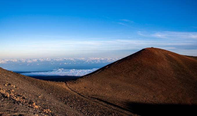
- Mauna Kea is unusually topographically prominent for its height, with a wet prominence fifteenth in the world among mountains, and a dry prominence second in the world, after only Mount Everest.
Because the Hawaiian Islands slope deep into the sea, Mauna Kea has a dry prominence of 9,330 m (30,610 ft).[8] This dry prominence is taller than Mount Everest's height above sea level of 8,848.86 m (29,032 ft), so Everest would have to include whole continents in its foothills to exceed Mauna Kea's dry prominence.
Given how much Mauna Kea protrudes from the Hawaiian Trough, some authorities have called it the tallest (as opposed to highest) mountain in the world, as measured from base to peak.
Mauna Kea's summit is one of the best sites in the world for astronomical observation due to favorable observing conditions.
The summit is above the inversion layer, keeping most cloud cover below the summit and ensuring the air on the summit is dry, and free of atmospheric pollution. The summit atmosphere is exceptionally stable, lacking turbulence for some of the world's best astronomical seeing.
The very dark skies resulting from Mauna Kea's distance from city lights are preserved by legislation that minimizes light pollution from the surrounding area; the darkness level allows the observation of faint astronomical objects. These factors historically made Mauna Kea an excellent spot for stargazing
Kauai Island - Hawaii
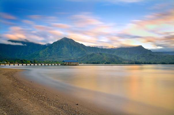
Hanalei Bay – Kauai
This is my third image to post of beautiful Hanalei Bay. This shot was taken from the east side of Hanalei Pier, to include more...
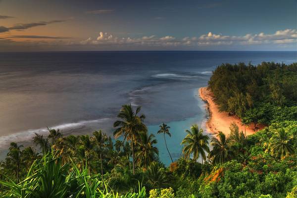
Ke'e Beach is the end of the road along the north coast of Kauai island, which gives way to the infamous Kalalu trail along the steep cliffs of the...
After Maui I joined my sister's family in Honolulu. While Waikiki was beautiful, it unfortunately had the tendency that week for rain to roll in...
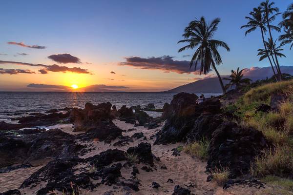
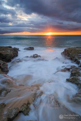
While waiting for the sunset, a couple of girls decided to jump off the rocks and swim into shore a few times. They had the right idea.
Buy Prints...
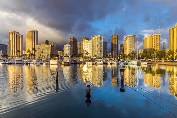
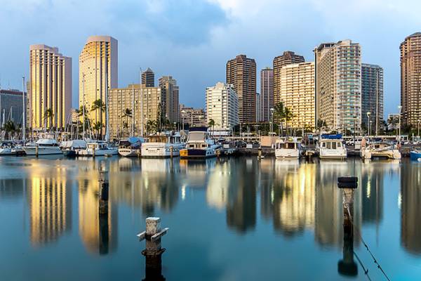
Waikiki Marina with rain clouds moving in.
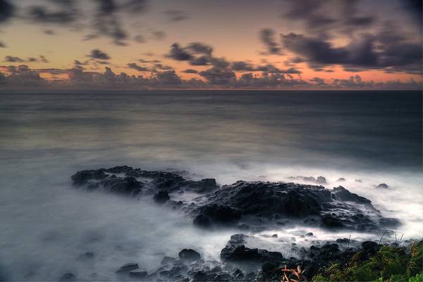
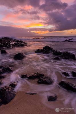
Hawaiian sunrise over a bunch of nothing rocks, uploading because of the nice tropical skies and the fact that I had to drag my ass out of bed in a...
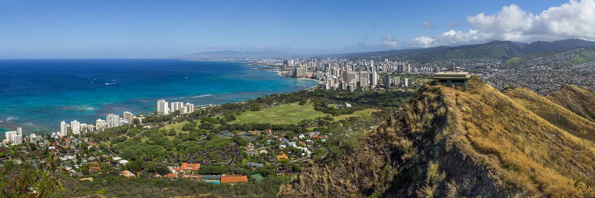
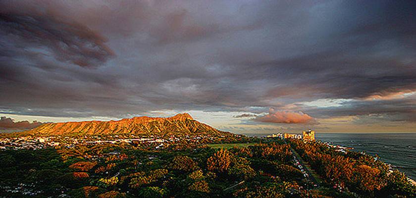
The last time I was in Honolulu I never made it to Diamond Head, so I made sure I did this time. If you go sometime, get there early. The parking...
This sky ranks up with some of the most awesome skies I have gotten to shoot. Things lined up pretty well for this shoot, too. All afternoon it was...
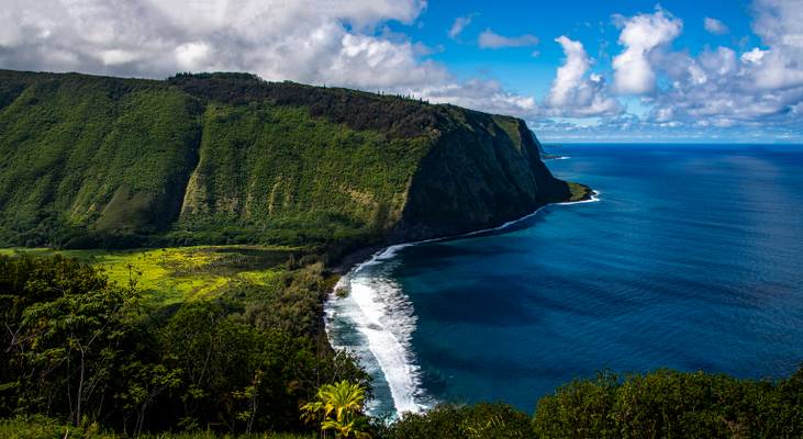
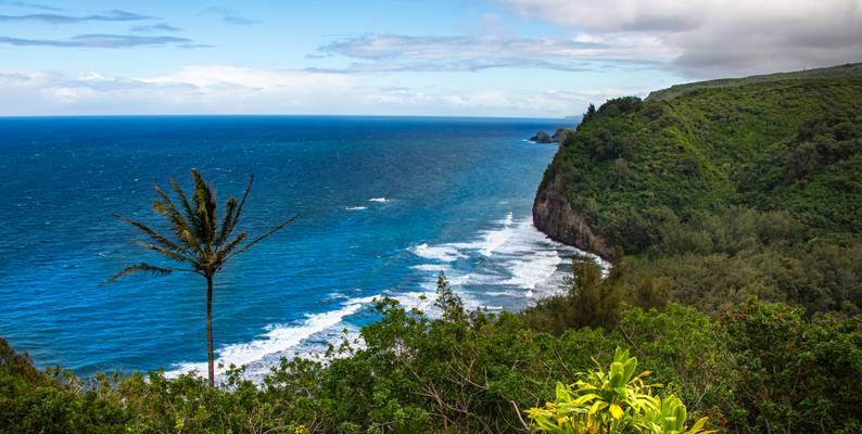
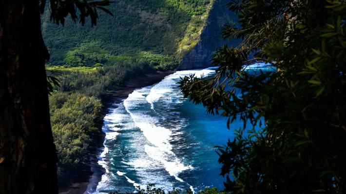
- Waipi‘o valley was home to old Hawaiian kings and once upon a time was densely populated. Now however, Waipi‘o valley is mostly wilderness interspersed with taro fields (Taro is a traditional Hawaiian staple food) and a couple of dozens of inhabitants.
Waipi‘o (or Waipio) Valley is named after the river that runs through the valley (wai-piʻo means curved water in the Hawaiian language) and is about one mile wide and six miles deep. Towards the back the valley splits into many ‘fingers’, each one with its own waterfall. The valley meets the ocean towards the north with a beautiful black sand beach that is cut in two by the river.
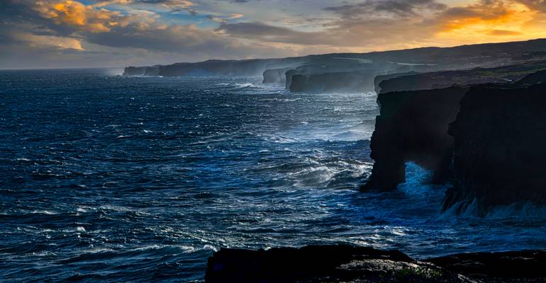
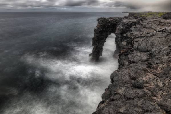
- At the end of Chain of Craters road, walk a short distance along the road to see Hōlei Sea Arch.
This stark lava rock formation is about 90 ft. (27.4 meters) high and extends from the steep sea cliffs into the Pacific Ocean.
This formation is beautiful, but temporary, and has a limited life span. The sea arch will eventually crumble into the sea. However, others will replace it as the cliff slowly migrates inland.
This impressive sea arch was cut into the cliff of an ancient lava flow from about 550 years ago due to "differential erosion", referring the difference in the hardness of various layers of lava.
Layer upon layer, and hundreds of seaside cliffs form the shoreline stretching out into the rugged Pacific Ocean. All of the cliffs along the stretch of the National Park are formed from lava flows that have taken place over the past 700 years, the most recent being in 2018.
Music Trivia - the music video from Chris Isaak's Wicked Game was filmed here.
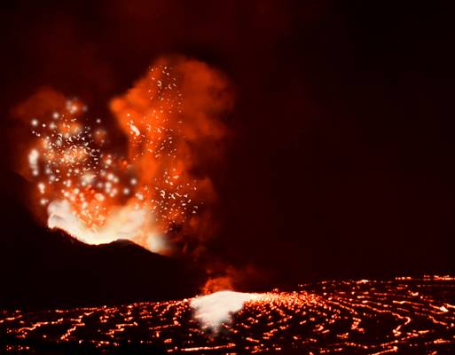
From a distance, one can see that this volcano on Hawaii's Big Island is still active, although it hasn't erupted since May of 2018....
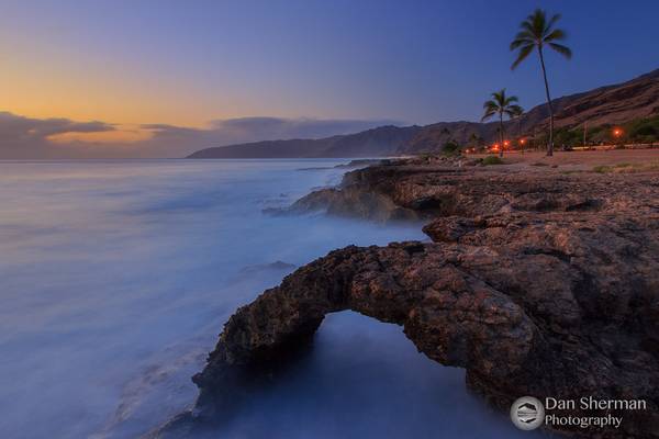
Kauai Island - Hawaii
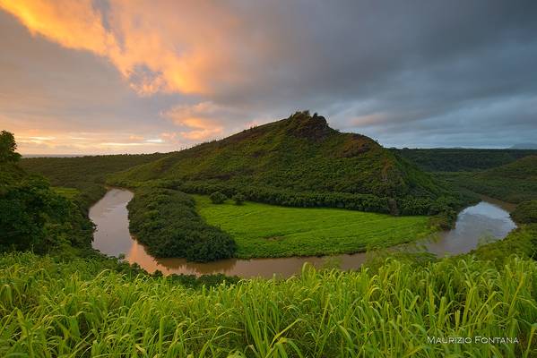
Kauai Island - Hawaii
Kauai Island - Hawaii
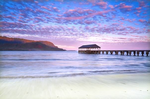
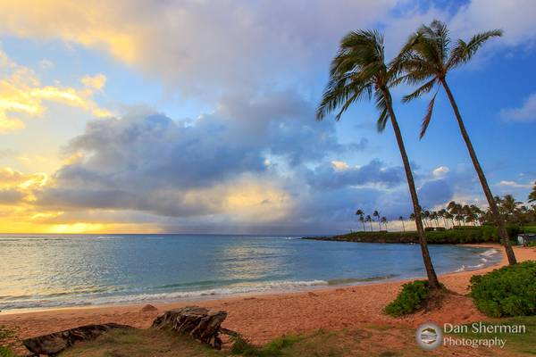
Hanalei Bay - Kauai
I took this shot during sunrise. Once again it was raining just before dawn; however the storm was now passing, leaving...
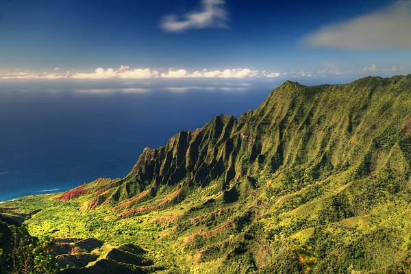
Short and long exposure versions of the Kalalau valley viewpoint, late afternoon, Kauai island, Hawaii, USA.
This sky was changing so quickly. Rain clouds kept pouring over the mountains of West Maui and fell from the sky intermittently. The light was...
After walking the Pipiawai Trail, I drove back up the coast and across the island to Kihei where I rented a condo for rest of my stay. Luckily there...
Short and long exposure versions of the Kalalau valley viewpoint, late afternoon, Kauai island, Hawaii, USA.
Our last sunset on Maui during our vacation in May. We spent the afternoon snorkeling here. It rained intermittently all day into this sunset. Clouds...
The rain that dogged me on the drive to Hana continued through the next morning, ruining the sunrise. Thankfully the rain broke just before I made...
I'd like to write about how amazing and beautiful this place is. I know it looks beautiufl but, right behind me and just down the beach were several...

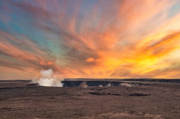
- Kīlauea volcano began erupting on September 29, 2021, at approximately 3:21 p.m. HST in Halema‘uma‘u crater. Lava continues to erupt from a vent in the western wall of Halemaʻumaʻu crater. All lava activity is confined within Halemaʻumaʻu crater in Hawai‘i Volcanoes National Park. Seismicity and volcanic gas emission rates remain elevated.
This view of the volcano is available from Devastation Trail, about a 1.75 mile hike from the outer parking lot.
In August 2021, increased earthquake activity and patterns of ground deformation indicated that an intrusion was occurring and magma was moving into an area south of Kīlauea caldera.
However, no eruption occurred, and the shallow Halemaʻumaʻu magma reservoir continued to measure inflation. On September 29, 2021, earthquake activity increased abruptly beneath Halemaʻumaʻu around 2 p.m. HST, and at 3:21 p.m. a series of vents opened in the floor and walls of Halemaʻumaʻu crater, generating a lava lake.
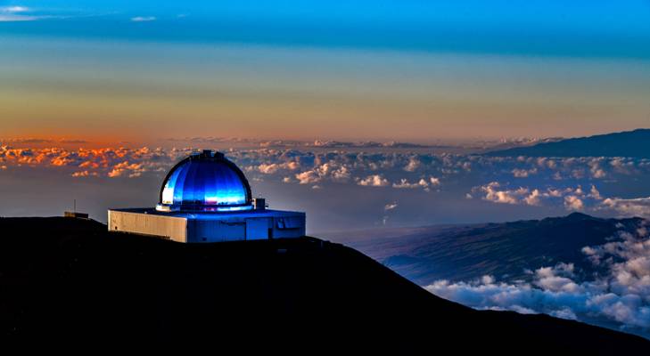
- The Mauna Kea Observatories (MKO) are a number of independent astronomical research facilities and large telescope observatories that are located at the summit of Mauna Kea on the Big Island of Hawaiʻi, United States.
The facilities are located in a 525-acre (212 ha) special land use zone known as the "Astronomy Precinct", which is located within the 11,228-acre (4,544 ha) Mauna Kea Science Reserve.
The Astronomy Precinct was established in 1967 and is located on land protected by the Historical Preservation Act for its significance to Hawaiian culture. The presence and continued construction of telescopes is highly controversial due to Mauna Kea's centrality in native Hawaiian religion and culture, as well as for a variety of environmental reasons.
The location is near ideal because of its dark skies from lack of light pollution, good astronomical seeing, low humidity, high elevation of 4,205 meters (13,796 ft), position above most of the water vapor in the atmosphere, clean air, good weather and low latitude location.
The peak on the far right is Mauna Loa which is only slightly shorter than Mauna Kea.
- William Shakespeare.
| facebook | 500px | ferpectshotz |
Growing up in India, my wife’s family was not big on travel. She grew up in one of the largest cities on the planet and pretty much lived her entire young adult life just around her neighborhood. Then she made a huge move all the way to Boston for her master’s and met me, a guy from one of the tiniest villages in India. My family, as I was growing up, was big on travel and my dad has infused that desire to travel to both his children. So, I still think my crazy travel plans is what attracted her to me. My ideas of travelling were pretty simple, and initially it was on a motorcycle in India, then I graduated to a tiny little car, but the planning part remained piss poor. It was mostly going till I was tired and then hoping that I can find some sleeping arrangement.
After marriage, once my wife started to accompany me on our trips, I went the other way, and now I over plan every trip we take. Now this annoys my wife a bit as her suggestions and explorations days are usually mercilessly shot down. Finally, after she grew tired and demanded that we stick to an agreement we made before our wedding that for every adventure trip we will do a relaxation trip. Which according to her would be going to a fancy hotel and relaxing and the exploring the town or city we are in. Now I find this very boring but agreed to her ultimatum under the condition that she would plan it out and she did just that. So, we found ourselves in the beautiful island of Kauai in a wonderful resort enjoying the ocean and beautiful weather.
The first two days were beautiful, and we had a lot of fun on the beach, but I soon noticed my lovely bride getting restless and after a bit of probing she confessed that it is getting boring for her. So we looked up some interesting places for us to visit and something named the grand canyon of the Pacific caught both our eyes. This stunning canyon is called the Waimea Canyon and it had tons of hiking and photo potential. Unfortunately, I had only bought a Fuji x-pro and a 35mm lens which I was testing to the trip and that meant that no serious photo ops. But we had an amazing time exploring some of the viewpoints and trails before flying back home. This is a handheld panorama shot from a pretty popular observation point.
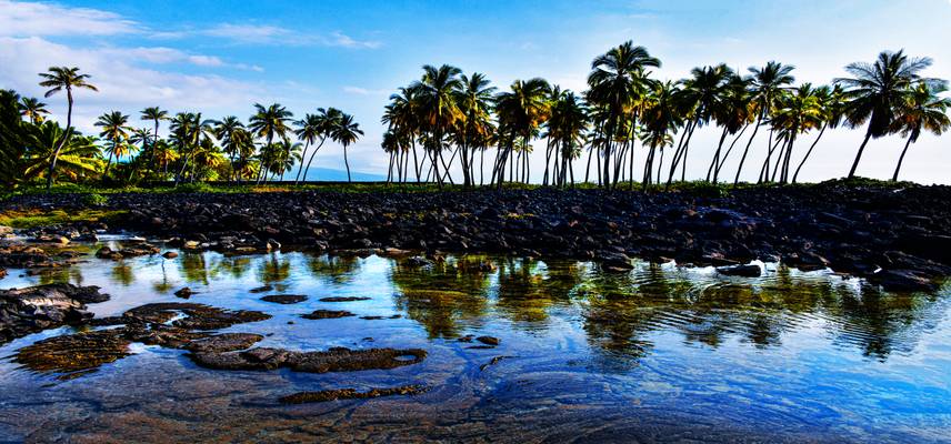
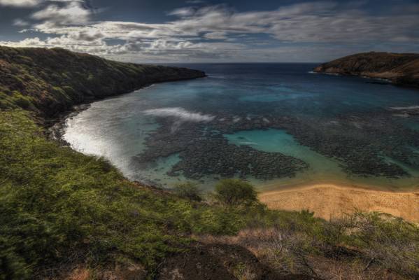
- Hawaiians are often said to have been the first Pacific Islanders to have undertaken nearshore aquaculture on a truly large scale. Many, if not most, natural embayments were enclosed with rock walls and utilized to raise ʻamaʻama (mullet), awa (milkfish) and other nearshore schooling fishes. Time, tsunamis and neglect have disintegrated many of these fishpond walls, but at Kaloko-Honokōhau National Historical Park it is possible to see a restored, massive wall and imagine the pulse of the productive community that once lived here. Two enormous fishponds and a fish trap remain. Petroglyphs depicting the rhythms of daily life—birth, death, travel, fishing, sailing—are found throughout the park.
Wetland birds such as the aeʻo (Hawaiian stilt) and the ʻaukuʻu (black-crowned night heron) forage and breed in the calm, flooded areas inside the fishpond walls, and the park offers sanctuary and forage for migrating shorebirds such as ʻakekeke (ruddy turnstone) and kōlea (Pacific golden plover). Basking honu (Hawaiian green sea turtles), resting on the hot sand, delight and fascinate. Federal law protects them from harassment, in and out of the water.
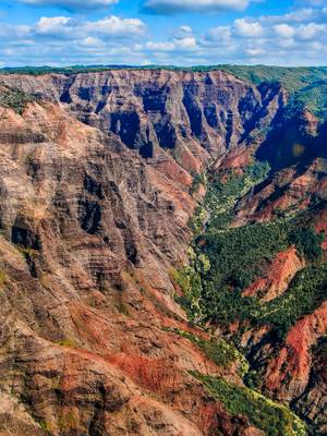
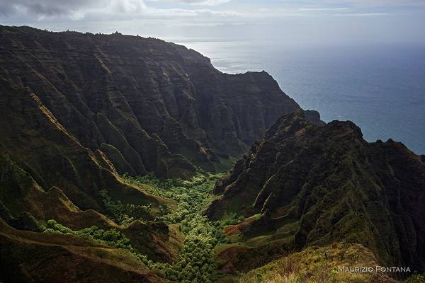
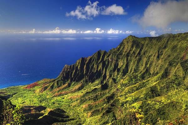
... a.k.a. "The Grand Canyon of Hawaii" as seen from one of the many helicopters touring the Napali Coastline
I returned to the Secret Beach that night for the sunset. It was not too busy, no one was getting married on the beach. There was a couple doing...
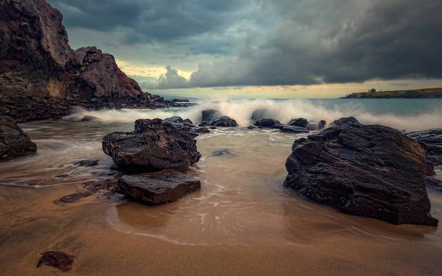
Hawaiian sunrise over a bunch of nothing rocks, uploading because of the nice tropical skies and the fact that I had to drag my ass out of bed in a...
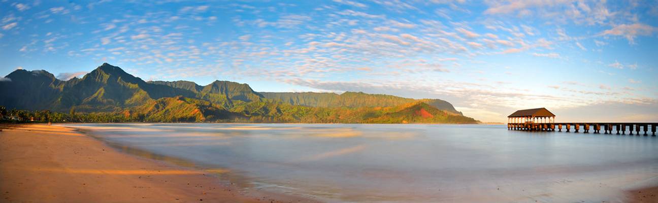
Hanalei Bay – Kauai – Hawaii
www.davidshieldphotography.com/
Even though this was not a photography shooting trip, I was able to find time to go...
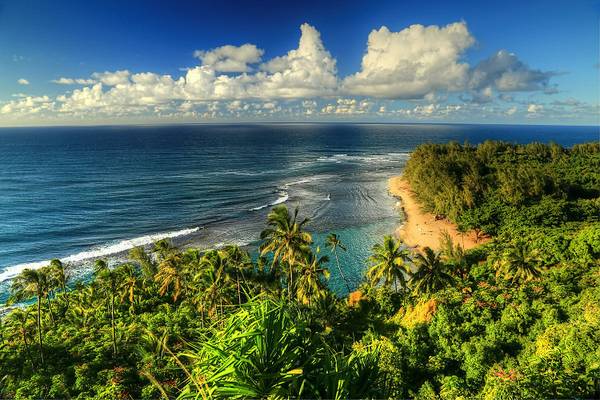
Ke'e Beach is the end of the road along the north coast of Kauai island, which gives way to the infamous Kalalu trail along the steep cliffs of the...
This was the second time I had shot this exact scene. The first time, 4 years prior on our first visit to Hawaii to see my Aunt & Uncle. It was our...
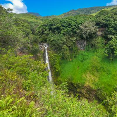
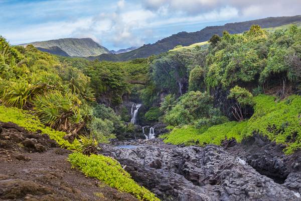
The Makahiku Falls, with a drop of 180 feet, is the first of the huge waterfalls on the Pipiwai Trail. The even taller Waimoku Falls ends the trail,...
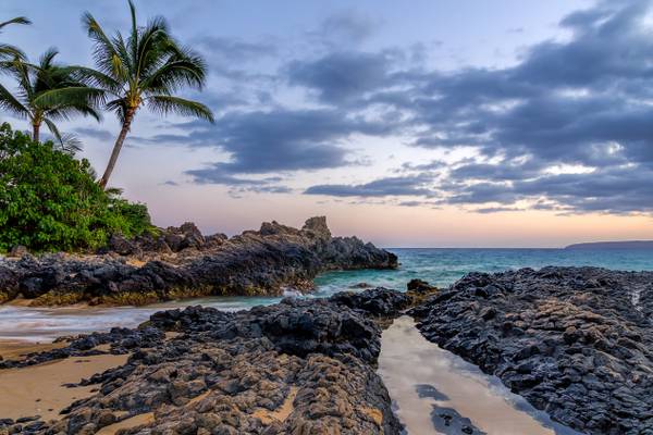
What an unfortunate name. This is near Honolua Bay, Maui, HI. Also known as Mokule'ia Beach and was named for the Honolua Ranch slaughterhouse that...
Thanks to all Phoide contributors to Hawaiian Islands!
Most notably Dominic Nessi, Maurizio Fontana and David Hamments.