
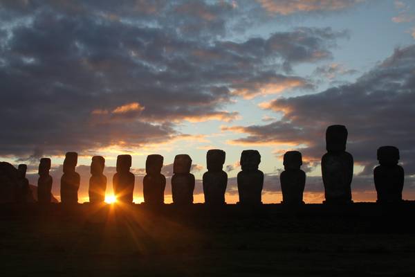
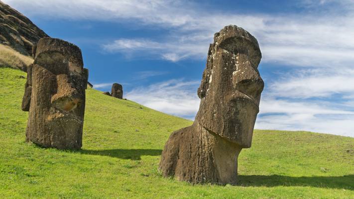
Chile
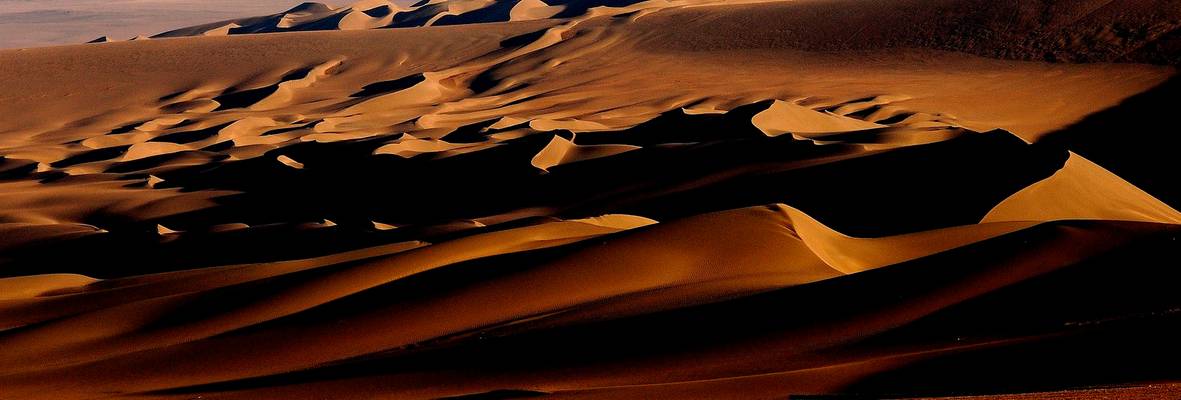
Chile is a country located in South America, known for its diverse landscapes, ranging from the Atacama Desert in the north to the glaciers and fjords of Patagonia in the south. With its stunning natural beauty, Chile offers a plethora of photography locations for both amateur and professional photographers. From the colorful streets of Valparaiso to the towering peaks of the Andes, Chile has something for everyone. The Atacama Desert, with its otherworldly landscapes and clear skies, is a popular destination for astrophotography. The Torres del Paine National Park in Patagonia is a paradise for landscape photographers, with its rugged mountains, glaciers, and turquoise lakes. The colorful architecture and street art of Valparaiso make it a favorite among street photographers. Overall, Chile is a photographer's dream destination, offering a wide range of stunning locations to capture unforgettable images.
Photography regions of Chile
Photography of Chile
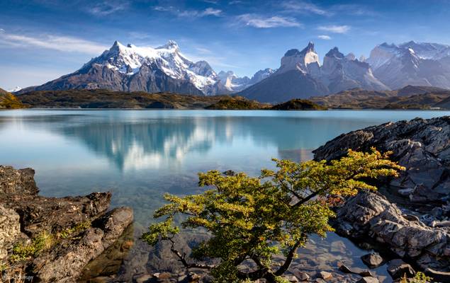
Having unpredictable weather in Patagonia, especially with strong winds, we were lucky enough to have a really calm morning. Looking at blue water and mountain reflections, I felt getting into a dreamland.
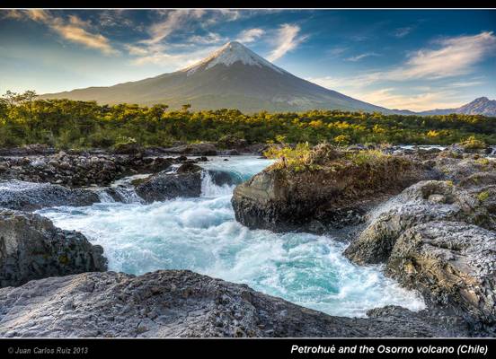
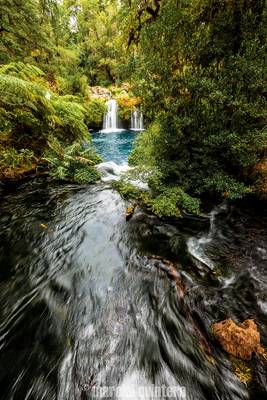
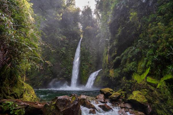
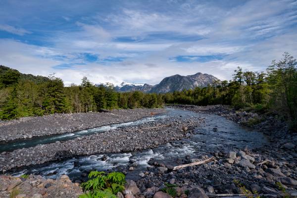
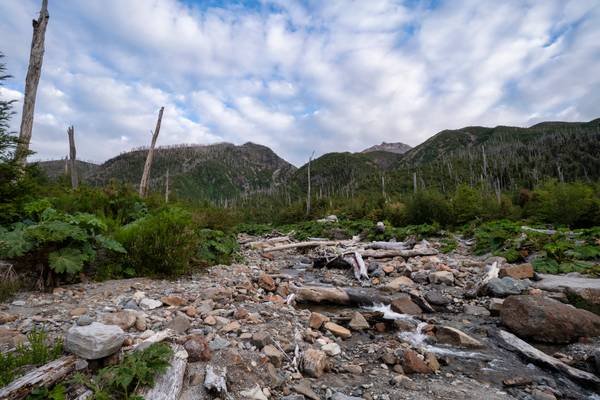
I took this photo in the area of the Petrohué cascades, an amazing place in Chile very close to the Llanquihué lake and Puerto Montt
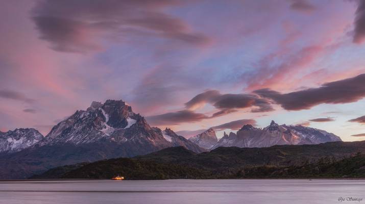
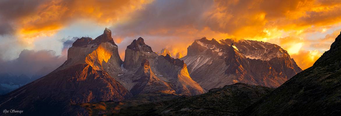
The beautiful Cuernos del Paine basking in the morning light. A stitch of 2 images.
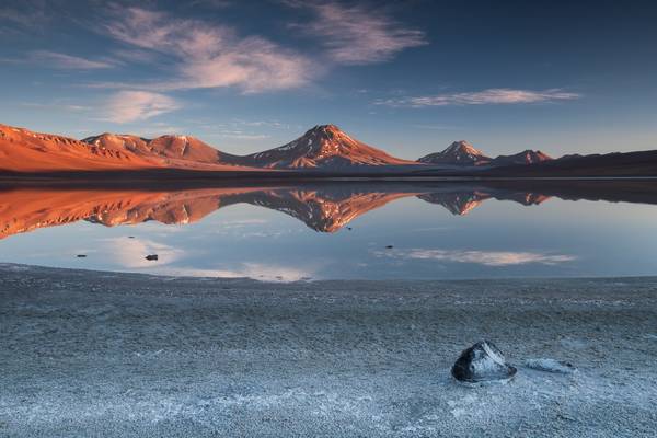
Dawn at Laguna Verge brough amazing colors, what a lovely location to spend a night at!
Photography tips: Sunrise and sunset are obviously great times to photograph any landscape, but in this case daylight is also a great time to consider, since full sunlight makes the beautiful color of the lake shine.
Getting there: It's just of the Ch31 road, close to the San Francisco pass. Note that there aren't any services for hundreds kilometers around, so bring enough gas and everything you might need to be self-sufficient.
I like the dusk atmosphere of this photo. Taken quite a long time after sunset, a long exposure was needed (4 minutes), but it resulted in nice smooth colors of both the Yareta plants and volcanoes.
At dawn, the boat was waiting for passangers riding on Lago Grey to Glacier.
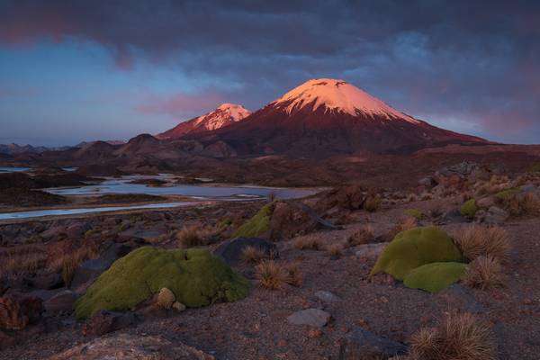
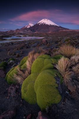
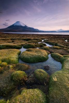
Two volcanoes at Bolivia-Chile borders got red by the setting Sun. Quite a view together with the wonderful landscape of Lauca National Park!
![Lago Gral Carrera, Chile [6k/geo]](https://cdn.phoide.com/Thumbs/e62a4fdd-195c-42d8-a0e0-5e5fa822c6de.jpg)
Aysén, Chile
Early morning above Salar de Tara, patches of the grass are backlighted by raising Sun, thousands of flamingos in the lake. Anything more to ask for? ;-)
Aysén, Chile
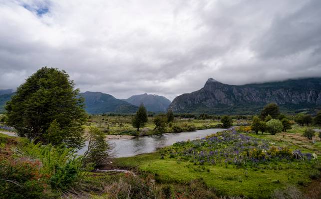
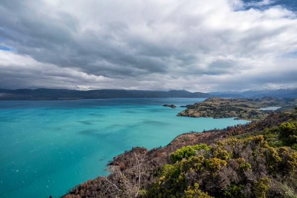
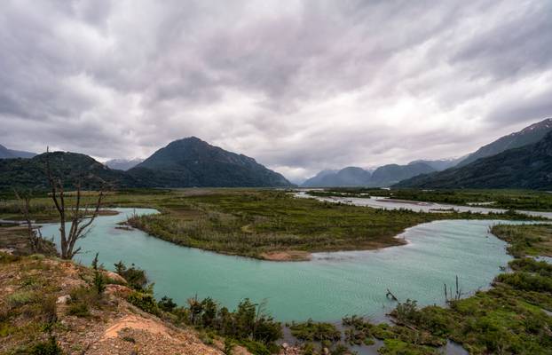
The Carretera Austral (CH-7, in english: Southern Way) is the name given to Chile's Route 7. The highway runs south for about 1,240 kilometers (770 mi) from Puerto Montt to Villa O'Higgins, passing through rural Patagonia.[1]
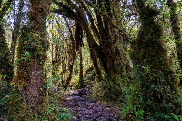
This area is characterized by thick forests, fjords, glaciers, canals and steep mountains.
Carretera Austral provides road access to Chile's Aysén Region and southern parts of Los Lagos Region. These areas are sparsely populated and despite its length, Carretera Austral provides access to only about 100,000 people. The largest city along the entire road is Coyhaique with a population of 44,850
![Lago Gral Carrera, Chile [6k/geo]](https://cdn.phoide.com/Thumbs/1a79ed6c-7123-4f19-8634-7d7dee19702c.jpg)
Aysén, Chile
Aysén, Chile
The Carretera Austral (CH-7, in english: Southern Way) is the name given to Chile's Route 7. The highway runs south for about 1,240 kilometers (770 mi) from Puerto Montt to Villa O'Higgins, passing through rural Patagonia.[1]
This area is characterized by thick forests, fjords, glaciers, canals and steep mountains.
Carretera Austral provides road access to Chile's Aysén Region and southern parts of Los Lagos Region. These areas are sparsely populated and despite its length, Carretera Austral provides access to only about 100,000 people. The largest city along the entire road is Coyhaique with a population of 44,850
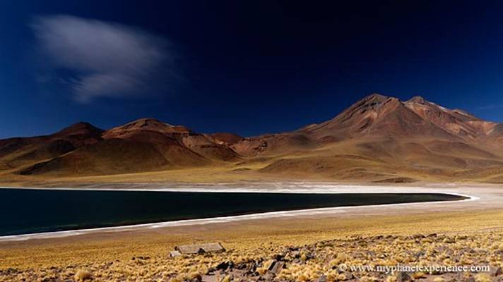
Laguna Lejía is a beautiful lake high in the Atacama Plateau. It is surrounded by several volcanoes, namely Chiliques, Lascar, Aguas Calientes and Acamarachi.
Photo tips: The salt deposits all around the lake make an interesting foreground.
Getting there: Expect about 1-2 hours drive from San Pedro de Atacama, the later part on a rough bumpy track that doesn't request any special 4x4 driving skills though.
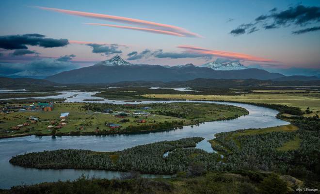
The Rio Serrano community is located right in front of the Torres del Paine and surrounded by the Serrano River. Overlooking it in the early morning felt like at a fairyland.
Seeing the starry sky at dawn, we knew it would be lit up by sunrise. But no one expected to see such a fiery scene. Everybody in our group started screaming loud, then quickly bury themselves in recording this unforgettable moment. The glory only lasted a few minutes.
The panorama view was stitched with five images.
![Cerro Castillo, Chile [6k/geo]](https://cdn.phoide.com/Thumbs/a1684407-8660-4e09-9dc6-255b2d53d66f.jpg)
Cerro Castillo is a jagged rocky peak located in the Aysén del General Carlos Ibáñez del Campo Region of Chile, within the Cerro Castillo National Reserve. Castillo means castle in Spanish, and the steep basalt walls of the mountain indeed make it look like one. On its sides are a few small glaciers and lakes fed by them.
viaggio fotografico atacama
I recently had the opportunity to spend 3 weeks driving through the south of Chile in the Chilean Patagonia. The travel started in Puerto Montt (Región de los Lagos) and finished in Villa O'higgins (Aysen) the south most point of the famous and amazing Carretera Austral. This photo is the first one of the series I will publish from this travel. I hope you like them.
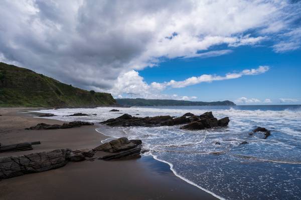
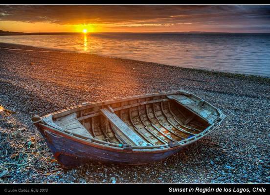
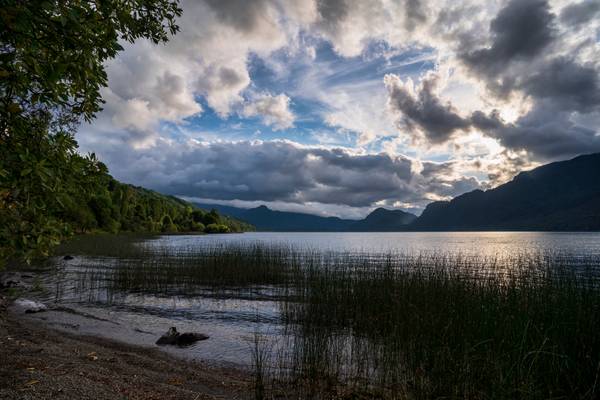
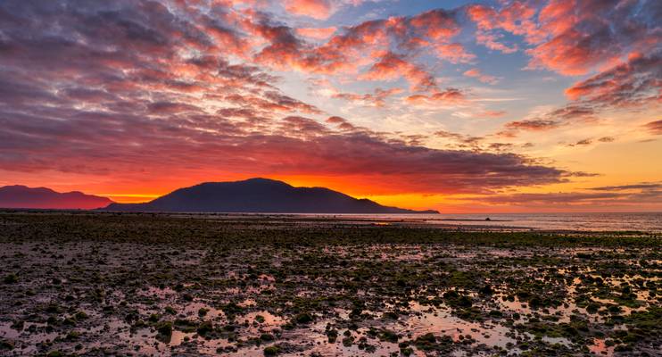
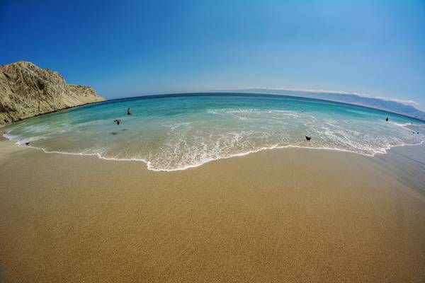
I took this photo near Puerto Montt, about 70 km south and after crossing the fiord from Caleta La Arena to Caleta Puelche in the boat (barcaza). The day was finishing and we had the opportunity to stop in this beach and take some photos of the sunset. This was the first day and it promised good opportunities for nice landscapes and photos.
HDR taken using 5 differently exposed shots.
Facebook: Juan Carlos Ruiz Photography
![Lago Gral Carrera, Chile [6k/geo]](https://cdn.phoide.com/Thumbs/f067dffd-41cf-4b57-b4de-aa198a5c4a71.jpg)
Aysén, Chile
![Lago Gral Carrera, Chile [6k/geo]](https://cdn.phoide.com/Thumbs/da1e5be1-dc8d-4b1c-8cb5-81be804bc726.jpg)
Aysén, Chile
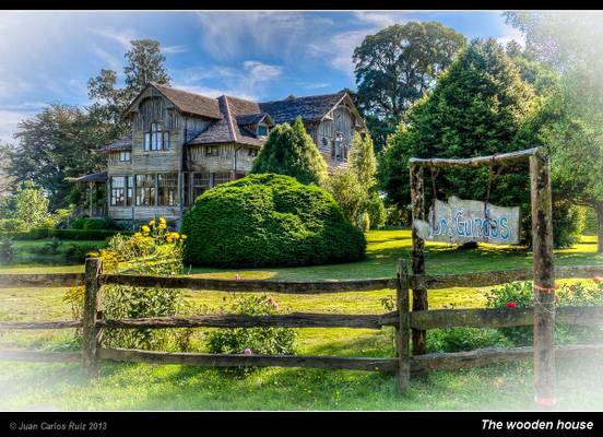
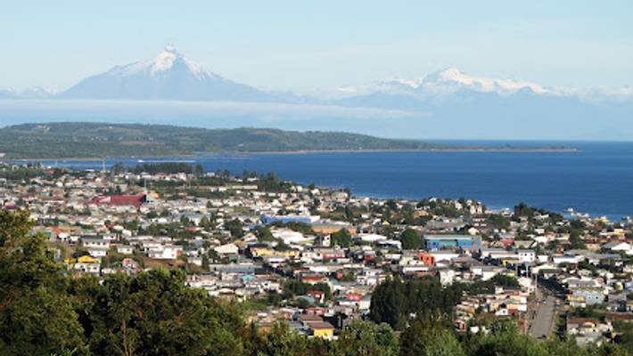
I took this photo in Chile in the Región de Los Lagos, near the Llanquihue Lake. The house was really impressive and the light in the late afternoon contributed to increase the beauty of the house and the garden. In this area of Chile there was an important immigration of german people at the end of the nineteenth century and it can be easily found signs of them, such as arquitecture, gastronomy, names and others. Hope you enjoy.
If you like my photos, please like me on facebook: Juan Carlos Ruiz Photography
The Carretera Austral (CH-7, in english: Southern Way) is the name given to Chile's Route 7. The highway runs south for about 1,240 kilometers (770 mi) from Puerto Montt to Villa O'Higgins, passing through rural Patagonia.[1]
This area is characterized by thick forests, fjords, glaciers, canals and steep mountains.
Carretera Austral provides road access to Chile's Aysén Region and southern parts of Los Lagos Region. These areas are sparsely populated and despite its length, Carretera Austral provides access to only about 100,000 people. The largest city along the entire road is Coyhaique with a population of 44,850
Taken shortly after sunrise along the shores of Lago Chungara.
I was hoping for a colorful sunrise, but it was blocked by some clouds in the East. I like the result anyway, it's just different than expected. ;-)
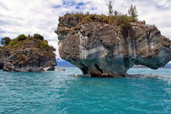
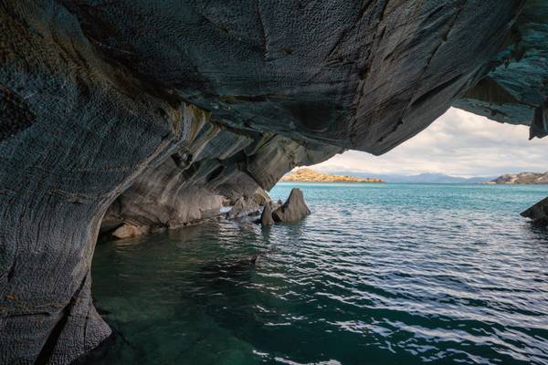
![The Marble Caves, Chile [6k/geo]](https://cdn.phoide.com/Thumbs/969ce61d-7927-4b59-8d53-1d2049a300c1.jpg)
Lago Gral Carrera, Aysén, Chile
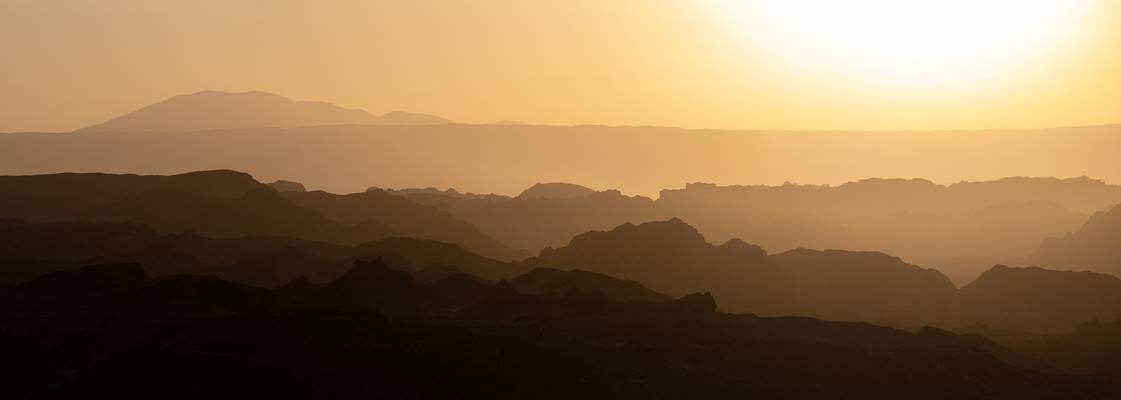
Right before Sunset, the backlit terrain of Valle da la Luna near San Pedro de Atacama looks particularly otherworldly.
This one was taken as a panorama of 3 pictures.
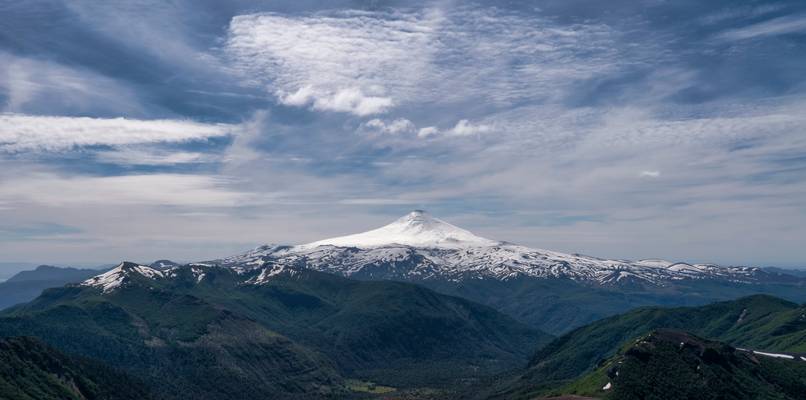
Villarrica Volcano is one of Chile's most active volcanoes, rising above the lake and town of the same name, 750 km (470 mi) south of Santiago. It is also known as Rucapillán, a Mapuche word meaning "devil's house".
Villarrica is one of Chile's most active volcanoes; eruptions have been recorded since the conquest of Chile and the founding of the city of Villarrica in 1552.
The volcano resumed eruptive activity in March 8, 1963. On March 12 a flank vent some 250 metres below the summit begun to pour lava that ended up making a 1000 m long and 150-meter broad lava flow.
On March 3, 2015 eruption exceeded the height of the volcano, causing a loud explosion that woke the neighbors, and forcing the evacuation of 3,385 people in nearby communities.
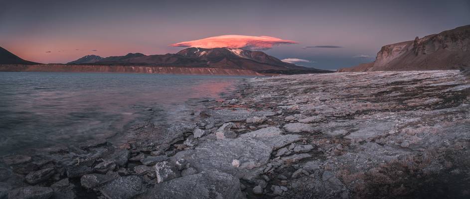
Lenticular clouds (slightly irregular, I guess) created amazing show during sunset at Laguna Verde.
![Lago Gral Carrera, Chile [6k/geo]](https://cdn.phoide.com/Thumbs/2f84c95a-9d60-4f45-8e6a-d581da072a14.jpg)
Aysén, Chile
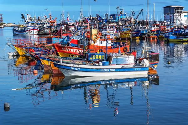
Puerto Sánchez
![Cerro Castillo, Chile [6k/geo]](https://cdn.phoide.com/Thumbs/d27d28d5-86c4-41e1-b5e5-e5e607a2ea15.jpg)
Cerro Castillo is a jagged rocky peak located in the Aysén del General Carlos Ibáñez del Campo Region of Chile, within the Cerro Castillo National Reserve. Castillo means castle in Spanish, and the steep basalt walls of the mountain indeed make it look like one. On its sides are a few small glaciers and lakes fed by them.
The base of the mountain can be approached from the road in one day along Estero Parada river.
The route followed an 800-meter-high, snow-and-ice couloir which had an angle of 55° in the upper part of the west face of Cerro Castillo.
The Carretera Austral (CH-7, in english: Southern Way) is the name given to Chile's Route 7. The highway runs south for about 1,240 kilometers (770 mi) from Puerto Montt to Villa O'Higgins, passing through rural Patagonia.[1]
This area is characterized by thick forests, fjords, glaciers, canals and steep mountains.
Carretera Austral provides road access to Chile's Aysén Region and southern parts of Los Lagos Region. These areas are sparsely populated and despite its length, Carretera Austral provides access to only about 100,000 people. The largest city along the entire road is Coyhaique with a population of 44,850
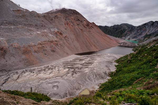
Chaitén is a volcanic caldera 3 kilometres in diameter, 17 kilometres west of the elongated ice-capped Michinmahuida volcano and 10 kilometres northeast of the town of Chaitén, near the Gulf of Corcovado in southern Chile. The most recent eruptive phase of the volcano erupted on 2008
Thanks to all Phoide contributors to Chile!
Most notably Jiri Hajek, StarCitizen, Marco Carotenuto, PZ Sunrays and Juan Carlos Ruiz San Millán.