
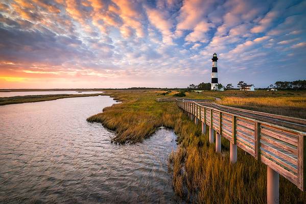
Dare County
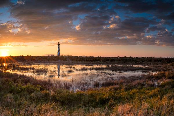
- Dangerously close to the Diamond Shoals off North Carolina’s Outer Banks, the sloop Thunderbolt, battered by a fierce storm and rough sea, catches fire from an overturned cook stove. All aboard scramble to put out the flames while trying to keep from being tossed overboard. The shoals, sand dunes just below the water’s surface, reach out some 18 miles past Hatteras Point. Hundreds of ships have run aground here, miles from shore, to be pulverized by the relentless waves... and often, all aboard drown.
On this day, a terrified 17-year old orphaned boy from St. Croix, on his way to an American education, is among those fighting to save the ship... he is Alexander Hamilton, who would get that education and become the first U. S. Secretary of the Treasury under President George Washington. Resting against the rails of the saved ship, he watches as the shoals recede away... and vows to one day do something so that others would not know such fear.
There was a reason ships were drawn near the shoals... wind-driven ships also relied on ocean current, which at times can move better than 40 mph. The Labrador Current sweeps down from the north and hugs this coast to about two miles off the beach. Beyond that is the Gulf Stream that moves up from the south toward the upper tier states. Often, it was faster for ships coming to Boston or New York from Europe to actually work their way south to catch the Gulf Stream than it was to come straight across the Atlantic. Even back in the day, folks in the shipping business knew that time is money. The confluence of the cold Labrador Current and the warm Gulf Stream also set up perfect conditions for violent storms and ocean swells. Add to that the shoals, which extended beyond sight of land in the midst of that confluence, and many an unwary ship’s captain left “money” to shift among the sands of these underwater dunes. Only jetsam and flotsam found on the beaches along the Outer Banks gave evidence of the fate of the ship.
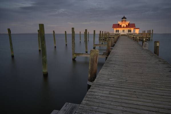
As Secretary of the Treasury, Hamilton finally has the power to make good on his vows, and the U. S. Lighthouse Service, and eventually the U. S. Coast Guard fall under the auspices of the Treasury Department. The first lighthouses along the east coast were functional, if just barely, and were not constructed to the exacting standards you see here... there’s something to be said of building your house on shifting sand, as many of the early lighthouses here in North Carolina actually toppled shortly after construction. Under the supervision of Dexter Stetson, Hatteras Lighthouse rose up 210 feet from a foundation of granite, rubble, and entire lengths of pine pushed to the bedrock... and stayed up, as it has since 1870. With a focal plane at 187 feet, its light could be seen for 28 miles, well before a ship reached the shoals at night. Its conical tower with black and white spiral bands is visible by day on the horizon.
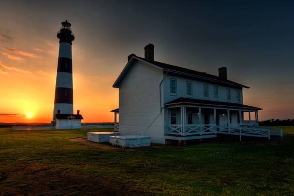
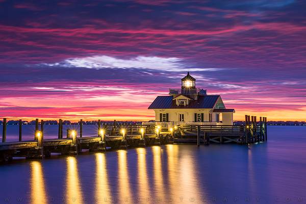
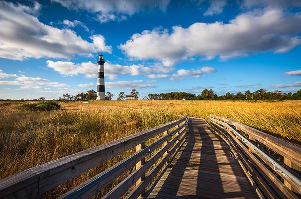
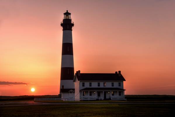
After his success at Hatteras, Stetson turned his attention here at Bodie Island. The name of the island is at contention, largely due to revisionist historians... the name is pronounced “body”, and is an archaic form of that word. Legend has it the name comes as a result of bodies washing ashore after some ship found its resting place in the of the Graveyard of the Atlantic. According to some historians, however, the name comes from a family that once lived here, though that has never been proven... the legend may not be so legendary, as such things did happen. A lighthouse would save lives here too.
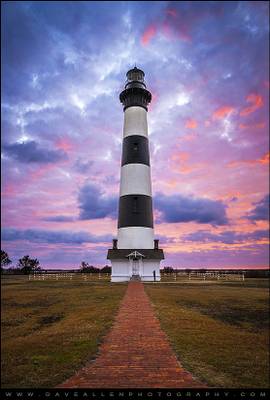
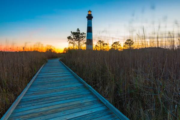
There were two lighthouses located here previous to the one you see here. The first one leaned toward the sea shortly after it was built. That was in the day before electrical power, so the lighthouse had to be tended to every day... could you imagine having to climb up a structure so unstable that it might topple any second, at least twice a day? Me neither. It failed and was replaced, but Confederate troops blew the second one up in 1861 during a series of skirmishes as Yankee troops descended on Fort Fisher. The third installment of Bodie Island Lighthouse projected light from its first order Fresnel lens for the first time in 1872. At a height of 165 feet, its beam can still be seen 21 miles out to sea.
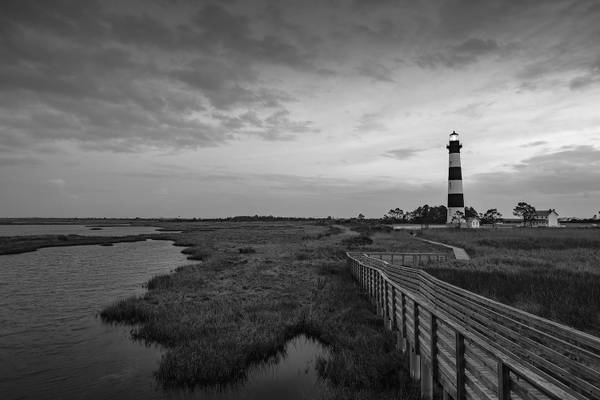
Though built on a land that shifts with the wind and tide, Bodie Island Lighthouse has withstood hurricanes, nor’easters, floods, lightning, heat, and humidity, but 148 years of such conditions had taken its toll. After much determination, restoration of the lighthouse began in 2010. The last of the project was the installation of the refurbished Fresnel lens early last year... after a re-lighting ceremony, the lighthouse was returned to service April 18, 2013. Seen here in morning light after 152 years, Bodie Island Lighthouse is every bit the historical standout in its new-paint splendor.

- Dangerously close to the Diamond Shoals off North Carolina’s Outer Banks, the sloop Thunderbolt, battered by a fierce storm and rough sea, catches fire from an overturned cook stove. All aboard scramble to put out the flames while trying to keep from being tossed overboard. The shoals, sand dunes just below the water’s surface, reach out some 18 miles past Hatteras Point. Hundreds of ships have run aground here, miles from shore, to be pulverized by the relentless waves... and often, all aboard drown.
On this day, a terrified 17-year old orphaned boy from St. Croix, on his way to an American education, is among those fighting to save the ship... he is Alexander Hamilton, who would get that education and become the first U. S. Secretary of the Treasury under President George Washington. Resting against the rails of the saved ship, he watches as the shoals recede away... and vows to one day do something so that others would not know such fear.
There was a reason ships were drawn near the shoals... wind-driven ships also relied on ocean current, which at times can move better than 40 mph. The Labrador Current sweeps down from the north and hugs this coast to about two miles off the beach. Beyond that is the Gulf Stream that moves up from the south toward the upper tier states. Often, it was faster for ships coming to Boston or New York from Europe to actually work their way south to catch the Gulf Stream than it was to come straight across the Atlantic. Even back in the day, folks in the shipping business knew that time is money. The confluence of the cold Labrador Current and the warm Gulf Stream also set up perfect conditions for violent storms and ocean swells. Add to that the shoals, which extended beyond sight of land in the midst of that confluence, and many an unwary ship’s captain left “money” to shift among the sands of these underwater dunes. Only jetsam and flotsam found on the beaches along the Outer Banks gave evidence of the fate of the ship.
As Secretary of the Treasury, Hamilton finally has the power to make good on his vows, and the U. S. Lighthouse Service, and eventually the U. S. Coast Guard fall under the auspices of the Treasury Department. The first lighthouses along the east coast were functional, if just barely, and were not constructed to the exacting standards you see here... there’s something to be said of building your house on shifting sand, as many of the early lighthouses here in North Carolina actually toppled shortly after construction. Under the supervision of Dexter Stetson, Hatteras Lighthouse rose up 210 feet from a foundation of granite, rubble, and entire lengths of pine pushed to the bedrock... and stayed up, as it has since 1870. With a focal plane at 187 feet, its light could be seen for 28 miles, well before a ship reached the shoals at night. Its conical tower with black and white spiral bands is visible by day on the horizon.
After his success at Hatteras, Stetson turned his attention here at Bodie Island. The name of the island is at contention, largely due to revisionist historians... the name is pronounced “body”, and is an archaic form of that word. Legend has it the name comes as a result of bodies washing ashore after some ship found its resting place in the of the Graveyard of the Atlantic. According to some historians, however, the name comes from a family that once lived here, though that has never been proven... the legend may not be so legendary, as such things did happen. A lighthouse would save lives here too.
There were two lighthouses located here previous to the one you see here. The first one leaned toward the sea shortly after it was built. That was in the day before electrical power, so the lighthouse had to be tended to every day... could you imagine having to climb up a structure so unstable that it might topple any second, at least twice a day? Me neither. It failed and was replaced, but Confederate troops blew the second one up in 1861 during a series of skirmishes as Yankee troops descended on Fort Fisher. The third installment of Bodie Island Lighthouse projected light from its first order Fresnel lens for the first time in 1872. At a height of 165 feet, its beam can still be seen 21 miles out to sea.
Though built on a land that shifts with the wind and tide, Bodie Island Lighthouse has withstood hurricanes, nor’easters, floods, lightning, heat, and humidity, but 148 years of such conditions had taken its toll. After much determination, restoration of the lighthouse began in 2010. The last of the project was the installation of the refurbished Fresnel lens early last year... after a re-lighting ceremony, the lighthouse was returned to service April 18, 2013. Seen here in morning light after 152 years, Bodie Island Lighthouse is every bit the historical standout in its new-paint splendor.
I had an especially good time these past few days at North Carolina's Outer Banks. As per usual at the coast, the weather was iffy with wind, rain, and cold temps over much of the trip... just the kind of reality to make landscape photography always interesting. I was excited to meet one of my contacts, Gregg Southard, at Bodie Island Lighthouse for some night photography last Thursday evening. Gregg's an easy fella to like from the get-go... I spent some time over the next couple of days with him, shooting in some of his favorite haunts, as well as shooting the breeze. He invited me along with his camera club to the Elizabethan Gardens at Manteo on Saturday morning, where I met (in order of appearance) Deborah, Sharon, Joyce, Elaine, Jay, and Dan... an amiable and creative bunch! Oh, and I almost forgot Bob and Glenn (inside joke!). Tell them I said hello, Gregg.
Bodie Island Lighthouse is always a favorite subject for the camera when I'm at the Outer Banks. It's not positioned well for an easy shot of either sunrise or sunset. For this image, I parked along NC Highway 12 and bushwhacked through marsh, high grass, and briars... fortunately, due to the cold, snakes weren't on that list. There are a number of dangerous snakes here, including cottonmouth and canebrake rattlesnakes, both of which I've seen in these marshes. What you may think of as geese here are actually cormorants. Their diet consists entirely of fish, which explains why I've never seen them anywhere but at the coast. My last stop today was at the North Carolina Aquarium on Roanoke Island, so my return trip took me across the Croatan Sound Bridge... I noticed a cormorant off to my left, also crossing the sound in frantic flight, perhaps just a foot above the water. I dropped my speed to match that of the cormorant... 52 mph! Not bad for so big a bird, but it may have had a tailwind. My hair definitely did at the beach!
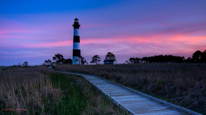
Mind, Bodie, and Spirit - Bodie Island Lighthouse Outer Banks North Carolina OBX NC
A beautiful Saturday morning sunrise with my landscape workshop...
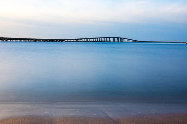
A Spectacular Sunrise at Bodie Island Lighthouse Dare County, Coastal North Carolina Accessed via NC-12 (Outer Banks Scenic Byway) Date taken: ...
Sunset/twilight at the Bodie Island Lighthouse in the Outer Banks, North Carolina on a recent short trip to the coast with Kevin Benedict. As we...
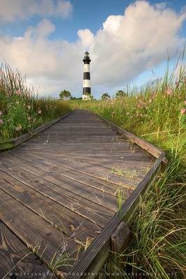
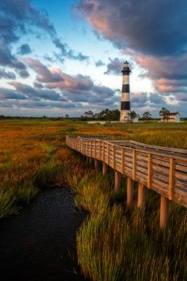
Pink Seashore Mallow Lines the Wooden Boardwalk at Bodie Island Lighthouse on Cape Hatteras National Seashore Dare County, Coastal North Carolina...
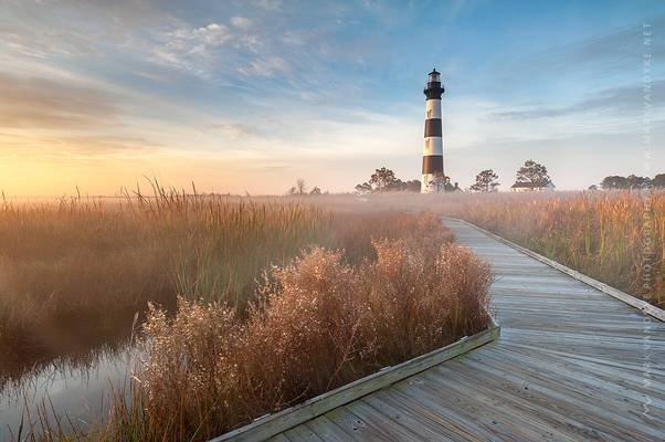
Radiant Fog at Sunrise along the Boardwalk at Bodie Island Lighthouse Dare County, Coastal North Carolina Accessed via the Outer Banks Scenic Byway...
After a lackluster photograph of Cape Hatteras Light, i headed towards the old lighthouse spot to check any interesting compositions. Tried but could...
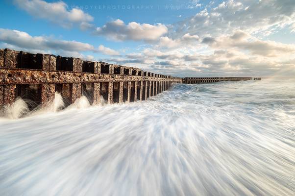
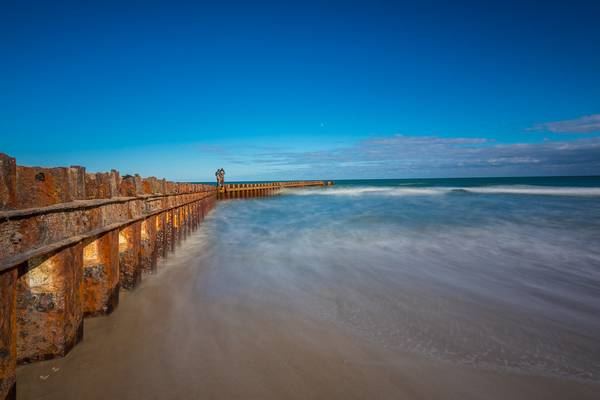
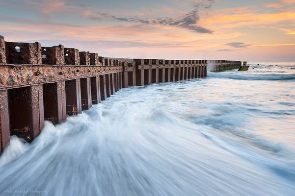
A Coastal Seawall Deflects the Ocean's Energy Dare County, Coastal North Carolina Accessed via the Outer Banks Coastal Byway (NC-12) Date taken: ...
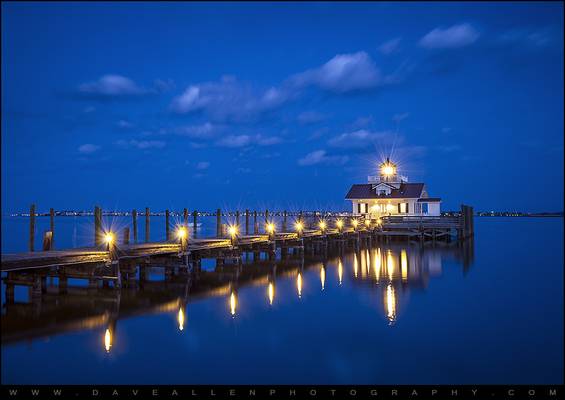
The Roanoke Marshes Lighthouse in Manteo NC near the Outer Banks during blue hour. Shot during our trip to the Outer Banks of NC last spring, I...
First Light Catches Shadows On Shifting Sands at Jockey's Ridge Dare County, Coastal North Carolina Accessed via Highway 158 (Croatan Highway) Date...
Memories of Manteo - North Carolina Outer Banks Lighthouse Manteo NC
Sunrise over the Roanoke Marshes Lighthouse on Shallowbag Bay in Manteo, NC....
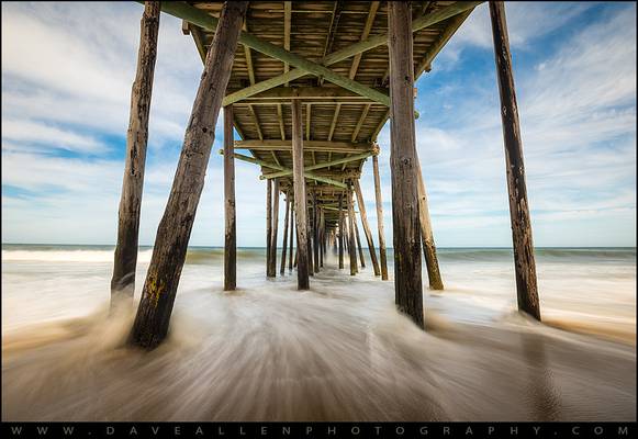
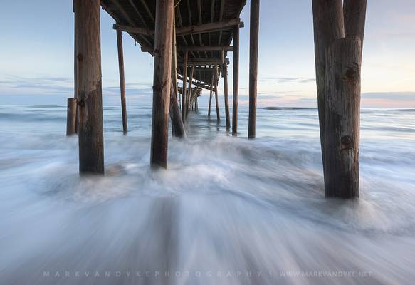
The Power of Three - Outer Banks NC Seascape Nags Head North Carolina OBX
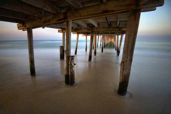
Evening light and a 1 minute long exposure under the Nags Head Pier just...
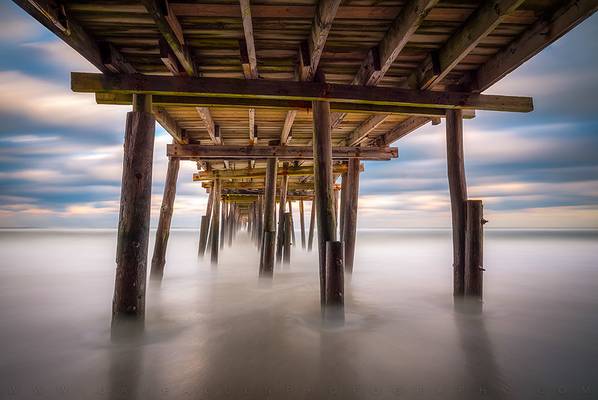
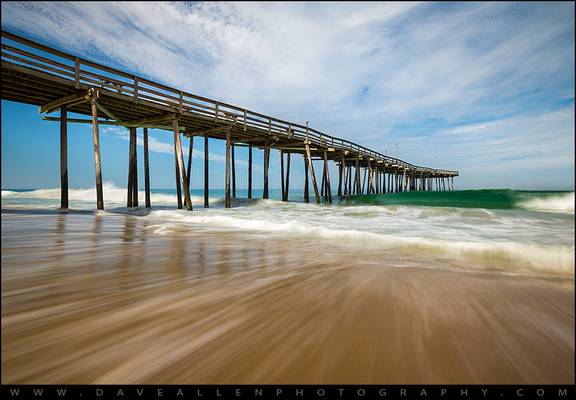
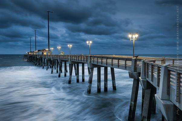
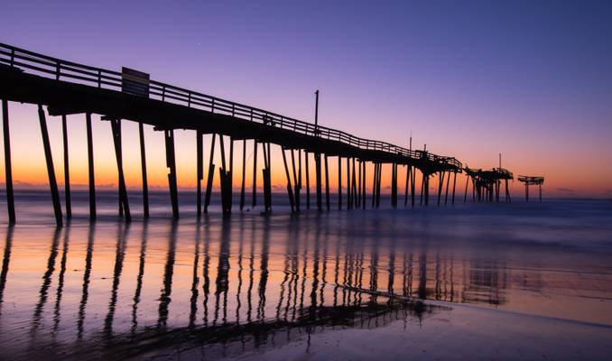
The US Army Corps of Engineers Field Research Facility, aka "Research Pier" - an 1840 foot-long pier at Duck, Outer Banks NC. "the FRF is an...
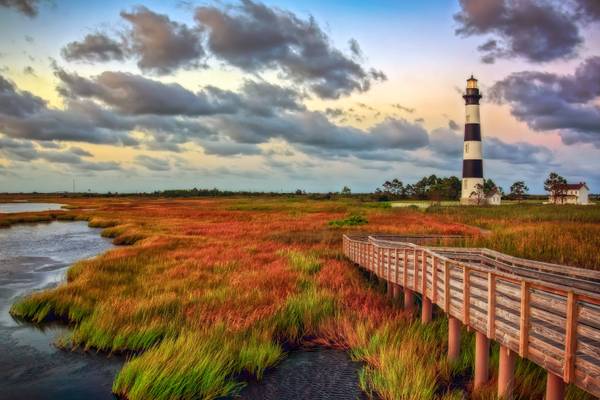
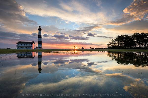
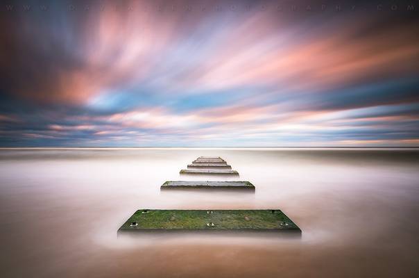
A windy and pastel morning belies a turbulent history here on the Outer Banks. Though the rising sun was somewhat occluded behind me as I shot this, it offered a beautiful contrastive sky against this iconic structure.
Though built on a land that shifts with the wind and tide, Bodie Island Lighthouse has withstood hurricanes, nor’easters, floods, lightning, heat, and humidity, but 148 years of such conditions had taken its toll. After much determination, restoration of the lighthouse began in 2010. The last of the project was the installation of the refurbished Fresnel lens early last year... after a re-lighting ceremony, the lighthouse was returned to service April 18, 2013. Seen here in morning light after 152 years, Bodie Island Lighthouse is every bit the historical standout in its new-paint splendor.
I've been going through some older images and this one struck me as quite nice. I need to get back here sometime this spring... if any of you would like to get together for a shoot, let me know.
The Lone Ranger and Tonto were hot on the trail of a band of desperados. Riding in the desert for many days, the need for rest overcame them. They decided to set up camp and were soon asleep in their tent.
Some hours into the night, the Lone Ranger says, “Tonto, look up and tell me what you see.”
Tonto stirs and replies, “I see a million stars.”
“What does that tell you?”
Tonto ponders for a moment, then says, “Astronomically speaking, it tells me there are many stars spread out from our own galaxy, amid those of countless other galaxies, and potentially billions of planets. Astrologically, it tells me that Saturn is in Leo. Time wise, it appears to be approximately a quarter past three in the morning. Theologically, it tells that we are small and insignificant, but the Lord is all-powerful, and it is in Him that we find significance. Meteorologically, it seems we will have a beautiful day tomorrow. What does it tell you, Ke-mo Sah-bee?”
The Lone Ranger replies, “It tells me that someone stole our tent!”
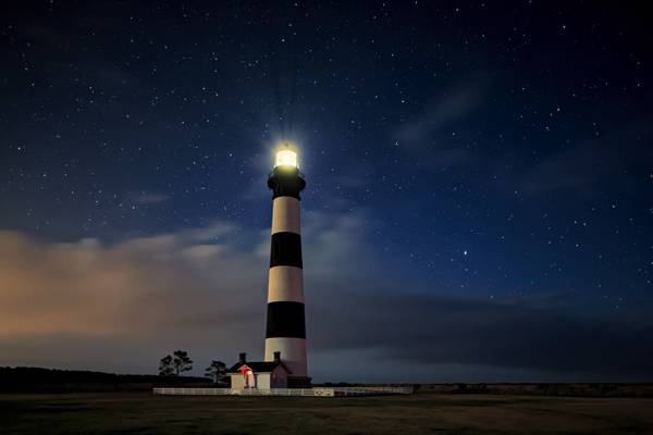
A good rule of thumb for landscape photography is to find a strong foreground element to work with. A waxing quarter-moon setting low in the west lit up Bodie Island Lighthouse pretty solid against the backdrop of a decent portion of the Universe… I believe it fits the bill for a strong foreground.
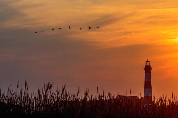
It’s too early in the year for a good shot of the hub of the Milky Way, but this starfield is quite beautiful without it. This is one of the darkest places in North Carolina… Tonto may not have appreciated having his tent stolen here either, though he likely would have been quite happy with these stars. Since 1872, the light from this first-order Fresnel lens has been no less a star than those that surround it here. At 156-feet in height, it is a fixed navigational point reaching some nineteen miles out to sea, beyond the unseen shoals... and, historically, it has saved many a ship and crew from facing the fate of the Graveyard of the Atlantic off the shores of North Carolina’s Outer Banks.
Before the inception of this nation, young Alexander Hamilton was traveling aboard the Thunderbolt from his birthplace in the British Leeward Islands to New York for an education. Along the way, the ship encountered a storm off the coast of North Carolina in an area known as the Graveyard of the Atlantic. Without navigational aids, the ship was driven into the Diamond Shoals, sand dunes just below the ocean’s surface stretching 12 miles off Cape Hatteras. The Thunderbolt caught fire from the cook’s stove, yet through the storm, the crew was able to contain it. Many ships had been pulverized by relentless surf at the shoals, drowning hapless crew and passengers often within sight of land. The Thunderbolt managed to break loose, however, and continued its journey… but not before a thoroughly terrorized Alexander Hamilton vowed to one day do something about making these waters safer for travel.
Navigation in the days of wind-driven ships involved more than just shooting the sun and stars to determine location… knowledge of weather and ocean current was necessary to move those ships from one place to another in a timely manner. What wasn’t military was commercial… the faster the ships moved, the more profit they made. Ships coming to the colonies north of here from Europe would navigate further south off our Outer Banks to catch the Gulf Stream… they would pick up about 35 mph headed north in the Gulf Stream just off the coast, far faster than going directly port-to-port, but without precise navigation, many a ship found itself squarely in the path of the Diamond Shoals. Thankfully, Hamilton made good on his vow. He became the first Secretary of the Treasury under President George Washington. In that position, he established the Revenue Cutter Service, which would eventually become the U.S. Coast Guard… the Revenue Cutter Service was tasked with building lighthouses to safeguard the traffic at sea along the American coast. These navigational aids were identified by their blink rate at night and by their paint scheme by day. Any lost seafarer would recognize each lighthouse and the dangers it stood over.
In light of the world today, this is also quite symbolic to me. I’m reminded of an interview I saw of the late Chuck Colson (www.colsoncenter.org/) by Ted Koppel on Nightline some years ago. "Believing in absolutes doesn't make one an absolutist," wrote Colson about that TV interview where the Koppel accused him of being an absolutist.
Colson said, "When Ted asked me why Christians always try to cram our views down people's throats, I was getting nowhere. After all, he was the one who admonished the graduating class at Duke University in his commencement speech that the Ten Commandments were not the Ten Suggestions. Then I remembered he loved to sail.
'Have you ever sailed at night, navigating by the stars?' I asked. 'Yes,' he replied.
'Could you use those stars to navigate if they appeared in different, random positions every night?'
'Of course not,' he said slowly.
I think he got it. Christians are not intolerant absolutists. We just don't want our culture to be lost at sea, unaware of the stars above that could so quickly right our course."
I believe Tonto got his "Theologically" pertinent point just right.
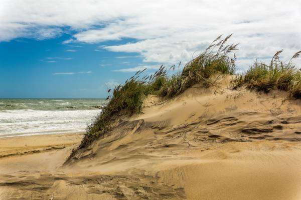
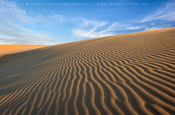
The wind at North Carolina's Outer Banks is relentless, as you can see on this dune. The area where I'm standing is a breach. High surf, likely from a nor'easter or hurricane, broke through the dune, leaving it exposed to the wind. On this day, sand was lifted along at high speed... it felt as though I was standing in a sand blaster well above head height... stand here long enough and it will exfoliate down to the bone. As you can see, there's nobody on the beach... well, except for some dummy with a camera.
As I explained in the previous posts of Bodie Island Lighthouse, these islands were a danger to ships at sea. This was taken just across from the Pea Island Preserve. In this place, just left of this picture is where the federal steamer Oriental sank in 1862... the ship's boiler can be seen at low tide.
Our barrier islands have a history of shifting with the wind and tide, but in this modern age, we prefer they stay where they are because there are roads on them now. That's one reason why the dunes are protected. The sea oats along the dune were planted there to prevent just what you're seeing here, as some of the drifting sand is visible. It's a tentative ecology at best, though it does help. Also take note here of the flat sandy beach that's indicative of every beach in the state. I much prefer this to rocky beaches, as it makes for better traction to run out of that surf when things are trying to eat you. Just saying...
A Warm Welcome - Outer Banks NC Bodie Island Lighthouse Scenic Landscape
Warm sunlight just after sunrise at the Bodie Island Lighthouse in the...
![Bodie Island Lighthouse-[EXPLORED]](https://cdn.phoide.com/Thumbs/26049779545.jpg)
Sunset at Bodie Island Lighthouse in the Outer Banks.
A colorless sunset at Bodie Island Lighthouse.

Summer Grasses Bathe in the Last Light of Evening Dare County, Coastal North Carolina Accessed via NC-12 (Outer Banks Scenic Byway) Date taken: ...
![Cosmic Frisco [EXPLORED]](https://cdn.phoide.com/Thumbs/26301301350.jpg)
The Milky Way in the night sky over Frisco Pier in the Outer Banks of North Carolina. The final image is made up of 9 portrait orientation images,...
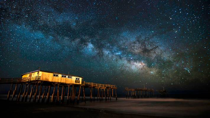
The Milky Way rises in the sky over Frisco Pier on Hatteras Island in the Outer Banks of North Carolina.
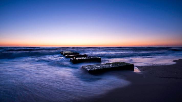
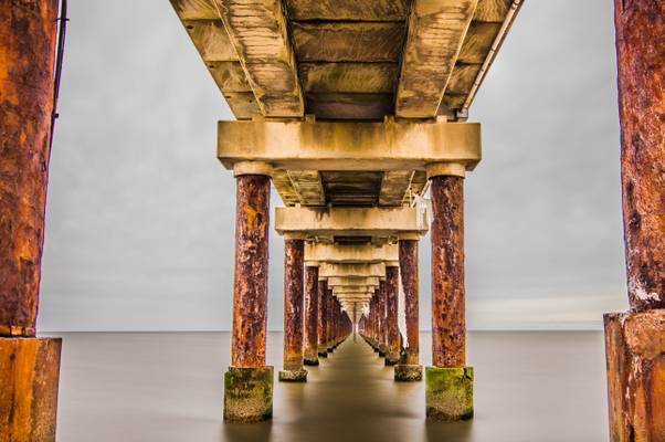
An odd beach erosion control structure just south of Nags Head Pier in the Outer Banks of North Carolina.
Sunset from the Dunes to the east of Cape Hatteras Lighthouse. Recent rains left behind standing water in the marshlands, providing a great place to...
Atlantic Motion - Outer Banks NC Beach Seascape OBX North Carolina
I had a great time shooting this daytime fishing pier image with my good friend...
The Buxton Jetties at Sunrise - Cape Hatteras National Seashore Dare County, Coastal North Carolina Accessed via the Outer Banks Scenic Byway (NC-12)...
It was a worthy trip to Outer banks in terms of Photography. With less crowds around due to winter, it was a different experience to have most of the...
Outer Banks NC Nags Head Fishing Pier OBX - Resolute
Glad to be home after a couple weeks on the road shooting in the Outer Banks NC and Charleston...
Blue Hour Stormy Sunrise at Jennette's Pier in Nags Head Dare County, Coastal North Carolina Accessed via Old Oregon Inlet Road Date taken: ...
According to AccuWeather and two others prognosticators, this is apparently what 80% humidity and heavy overcast tending toward showers looks like. That's what was predicted for the entire area every hour, on the hour, while I was at the Outer Banks a couple of weekends ago. Being a "lemons to lemonade" kind of guy, I decided to go for it anyway... glad I did. Likely, the folks under those distant cumulus clouds can't make that statement. Anywho, this all makes me wonder what a good day looks like here.
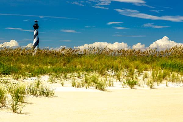
I rarely go to the beach in the summer... it's just way too crowded. I had a reason to visit, though... I'm searching out some iconic North Carolina dark sky places to shoot comet ISON later this year. It won't work here with the Cape Hatteras Lighthouse, as its light, which swings into view every 7.5 seconds, will be blown out in a 22 second exposure. Of course, you can block the lens for all but one blink, but you'd have to add that time back into the exposure and the stars would become dots and dashes... not good. For now, however, it makes for a nice contrastive daylight image of one of this state's true icons. Folks were touring the lighthouse... you can see them on the balcony around the light.
What you see growing here, for the most part, are sea oats... it's what they make Cap'n Crunch kid's cereal from (who am I kidding... I haven't had it in years, but I like it too! What's not to like? It's mostly sugar... and sea oats, of course). Actually, it's against the law to mess with them... they help to keep the dunes intact during windy conditions, which is to say they keep the island intact. The Atlantic Ocean is about 100-feet behind me here... the sun was reflecting off both that and this brilliant sand, which seemingly focused directly on me the whole time I was out there... even with sunblock, I had a little trouble sleeping that night, not so much because I was burned, but because I glowed in the dark. Things are back to a less radioactive condition now.
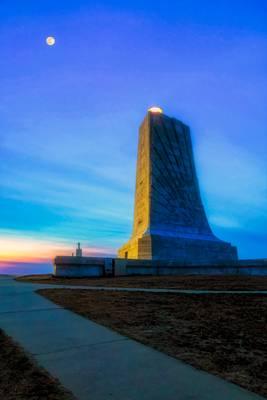
Wright Brothers National Memorial, located in Kill Devil Hills in North Carolina, commemorates the first successful, sustained, powered flights in a heavier-than-air machine by the Wright Brothers on December 17, 1903. It was dedicated November 14, 1932, on a day not much unlike the conditions during their famous flight tests here... stormy and windy. Orville Wright was the main guest of honor at the ceremony (Wilbur died 20 years earlier from typhoid fever).
On July 20, 1969, a scant 65 years after that first flight, mankind first stepped on that moon up there. While that was achieved with rockets, it could not have been done without a thorough knowledge of controlled flight... I wonder what Orville and Wilbur would have thought of that?
My mom's dad and my dad both worked for NASA. Dad repaired computers at NASA's Langley Research Center in Hampton, Virginia, back in that day. Before Neil Armstrong took that "one small step" on the moon, he was walking around that facility suspended on a system of slings and cables to experience how the Moon's gravity might affect him. The Apollo astronauts also practiced what it might be like to land on the Moon there using the 240 foot-tall Lunar Lander Research Facility... a lunar lander simulator. Of course, actually landing on the Moon presented problems that engineers never dreamed of for the simulator... Apollo 11's landing of the Eagle nearly wasn't. A switch that had a piece of tin/lead solder floating around within it in zero gravity kept shorting contacts that lit an indicator to abort the landing... after a terse discussion with Mission Control concerning Eagle's flightworthiness, Buzz Aldrin continued descent, and manned flight history was made yet again. Aboard the Eagle that day, along with the astronauts, was a piece of wood and some fabric from the original Wright Flyer... from Kittyhawk to Tranquility Base and back again, and you can see it here at the Visitor's Center.
On the 21st of this month, I'll enjoy what the Wright's creativity brought to this world on a flight aboard a restored vintage World War II B-25 Mitchell bomber at the Winston-Salem Air Show... I might even get a picture or two! Hope to see you there.
Bodie Island Lighthouse at sunrise on the Outer Banks of North Carolina. OBX as the Outer Banks are frequently called is an amazing place to visit,...
This is definitely one of the most beautiful lighthouses i have have ever seen. Green lawns, boardwalk and viewing stand, all helps to capture a...
Wooden Fishing Pier Broken But Standing Cape Hatteras National Seashore, North Carolina Date taken: November 11, 2016
Just a heads up for those who...
![Catching Rays on the Outer Banks [explored]](https://cdn.phoide.com/Thumbs/17125262637.jpg)
After shooting some wide angle of the storm-damaged and very broken Frisco Pier, I pulled out the zoom lens to hone in on the sunrise colors. There...
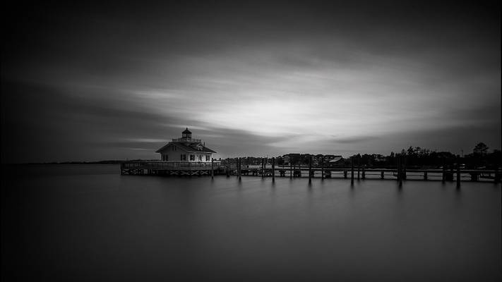
The light of day fades over Roanoke Marshes Lighthouse in Manteo, NC.
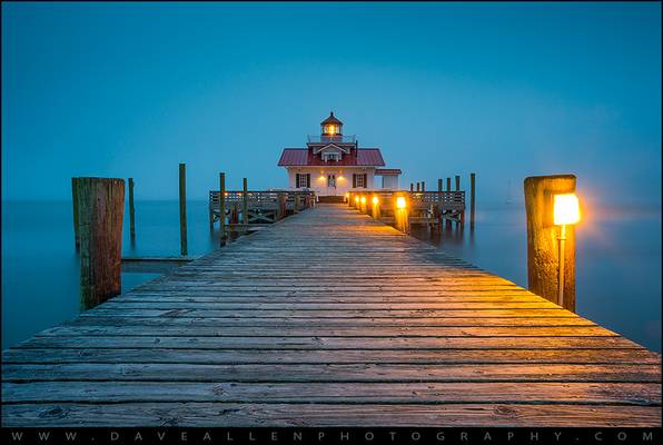
Roanoke Marshes Lighthouse North Carolina Outer Banks Manteo NC
Heavy fog during blue hour at the Roanoke Marshes Lighthouse in Manteo, NC. I'm not...
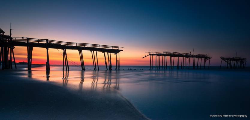
The Frisco pier on Hatteras Island in the Outer Banks North Carolina. A beautiful sunrise glow rising from behind illuminates the broken shadow of...
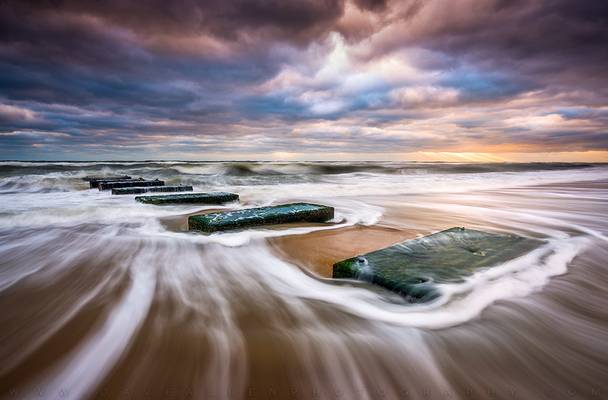
A Greater Foundation - Outer Banks North Carolina Beach Sunrise Seascape Photography Nags Head NC
Sunrise on the beach during our annual Autumn at...
The fishing pier at Frisco North Carolina in the Outer Banks was extensively damaged by 3 consecutive hurricanes. Hurricane Earl in 2010 landed the...
The Path Less Traveled - Outer Banks North Carolina Seascape Nags Head NC
I spent some time at the coast last week leading this year's photography...
![Shooting Hatteras [EXPLORED]](https://cdn.phoide.com/Thumbs/26132247300.jpg)
The Milky Way rises in the night sky behind Cape Hatteras Lighthouse. During the exposure a shooting star went through the frame, just to the right...
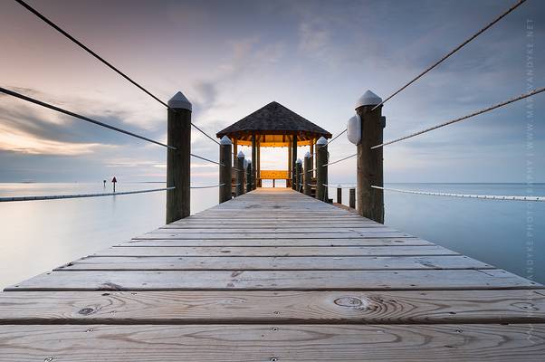
Hatteras Island Gazebo Over Pamlico Sound Dare County, Coastal North Carolina Accessed via the Outer Banks Scenic Byway (NC-12) Date taken: October...
Thanks to all Phoide contributors to Dare County!
Most notably Michael Kight and George Kurzik.