
Hawaiʻi County
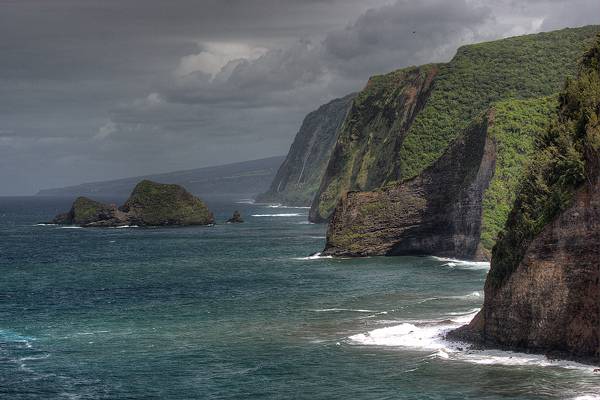
- The Kohala Volcano last erupted about 120.000 years ago and is the oldest of 5 volcanoes that make up the Big Island.
Between 250.000 and 300.000 years ago the Kohala volcano experienced a truly massive landslide in which a part of the volcano fell into the ocean.
This landslide is responsible for the now famous sea cliffs on the windward Kohala shoreline but also triggered a giant tsunami that left marine deposits multiple 100 ft high on the other islands. Remnants from this landslide can still be found under water 81 miles (130 km) from the current coastline.
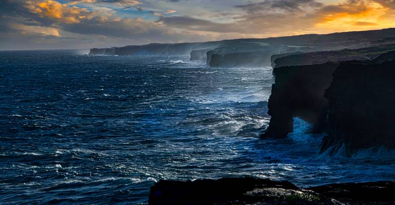
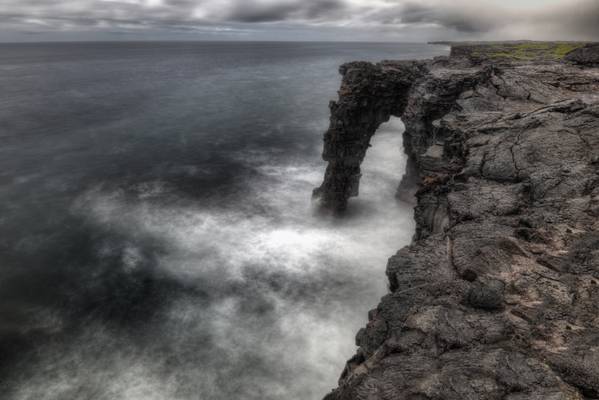
- At the end of Chain of Craters road, walk a short distance along the road to see Hōlei Sea Arch.
This stark lava rock formation is about 90 ft. (27.4 meters) high and extends from the steep sea cliffs into the Pacific Ocean.
This formation is beautiful, but temporary, and has a limited life span. The sea arch will eventually crumble into the sea. However, others will replace it as the cliff slowly migrates inland.
This impressive sea arch was cut into the cliff of an ancient lava flow from about 550 years ago due to "differential erosion", referring the difference in the hardness of various layers of lava.
Layer upon layer, and hundreds of seaside cliffs form the shoreline stretching out into the rugged Pacific Ocean. All of the cliffs along the stretch of the National Park are formed from lava flows that have taken place over the past 700 years, the most recent being in 2018.
Music Trivia - the music video from Chris Isaak's Wicked Game was filmed here.
From a distance, one can see that this volcano on Hawaii's Big Island is still active, although it hasn't erupted since May of 2018....
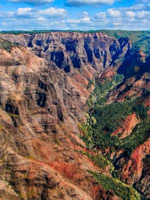
... a.k.a. "The Grand Canyon of Hawaii" as seen from one of the many helicopters touring the Napali Coastline
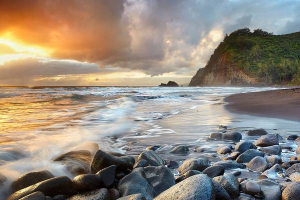
The cliffs and black sand beach at Pololu valley, the Big Island of Hawaii, taken from midway down the trail from the end of the road down to the...
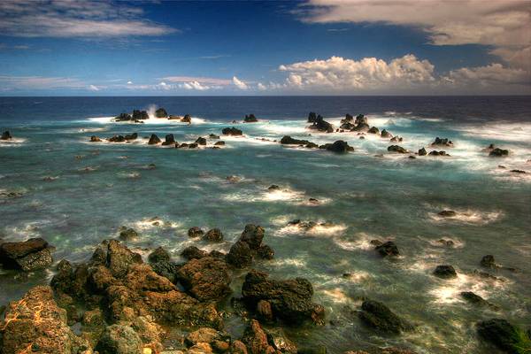
The sun sets on a remote cove near Laupahoehoe on the Hamakua coast of the Big Island of Hawaii. No HDR.
Free wallpaper for over 100 of my images...
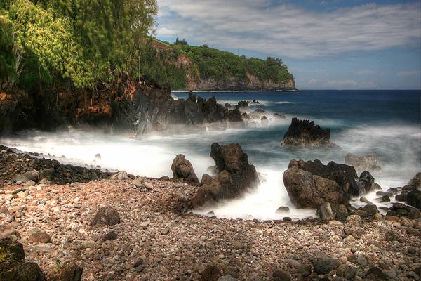
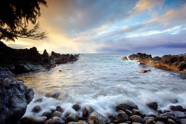
Daytime long exposure of waves at Laupahoehoe Point, on the windward coast of the Big Island of Hawaii.
Daytime long exposure of waves at Laupahoehoe Point, on the windward coast of the Big Island of Hawaii.
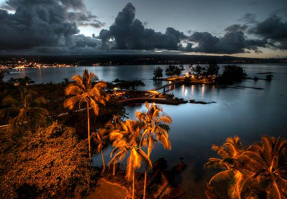
Taken from the top (8th floor) of the Hilo Hawaiian hotel balcony. Hilo city lights at left, Coconut island park at right, Mauna Kea summit is...
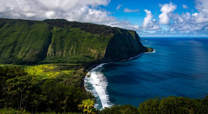
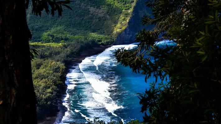
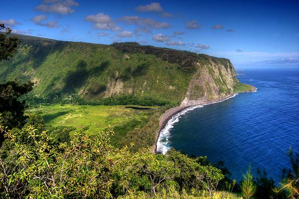
- Waipi‘o valley was home to old Hawaiian kings and once upon a time was densely populated. Now however, Waipi‘o valley is mostly wilderness interspersed with taro fields (Taro is a traditional Hawaiian staple food) and a couple of dozens of inhabitants.
Waipi‘o (or Waipio) Valley is named after the river that runs through the valley (wai-piʻo means curved water in the Hawaiian language) and is about one mile wide and six miles deep. Towards the back the valley splits into many ‘fingers’, each one with its own waterfall. The valley meets the ocean towards the north with a beautiful black sand beach that is cut in two by the river.
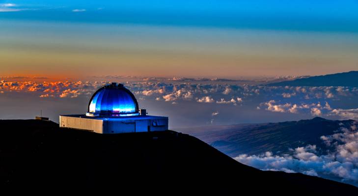
- The Mauna Kea Observatories (MKO) are a number of independent astronomical research facilities and large telescope observatories that are located at the summit of Mauna Kea on the Big Island of Hawaiʻi, United States.
The facilities are located in a 525-acre (212 ha) special land use zone known as the "Astronomy Precinct", which is located within the 11,228-acre (4,544 ha) Mauna Kea Science Reserve.
The Astronomy Precinct was established in 1967 and is located on land protected by the Historical Preservation Act for its significance to Hawaiian culture. The presence and continued construction of telescopes is highly controversial due to Mauna Kea's centrality in native Hawaiian religion and culture, as well as for a variety of environmental reasons.
The location is near ideal because of its dark skies from lack of light pollution, good astronomical seeing, low humidity, high elevation of 4,205 meters (13,796 ft), position above most of the water vapor in the atmosphere, clean air, good weather and low latitude location.
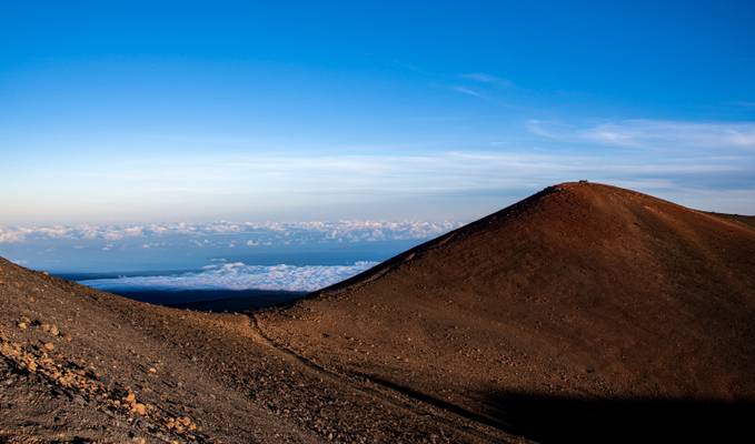
The peak on the far right is Mauna Loa which is only slightly shorter than Mauna Kea.
- Hawaiians are often said to have been the first Pacific Islanders to have undertaken nearshore aquaculture on a truly large scale. Many, if not most, natural embayments were enclosed with rock walls and utilized to raise ʻamaʻama (mullet), awa (milkfish) and other nearshore schooling fishes. Time, tsunamis and neglect have disintegrated many of these fishpond walls, but at Kaloko-Honokōhau National Historical Park it is possible to see a restored, massive wall and imagine the pulse of the productive community that once lived here. Two enormous fishponds and a fish trap remain. Petroglyphs depicting the rhythms of daily life—birth, death, travel, fishing, sailing—are found throughout the park.
Wetland birds such as the aeʻo (Hawaiian stilt) and the ʻaukuʻu (black-crowned night heron) forage and breed in the calm, flooded areas inside the fishpond walls, and the park offers sanctuary and forage for migrating shorebirds such as ʻakekeke (ruddy turnstone) and kōlea (Pacific golden plover). Basking honu (Hawaiian green sea turtles), resting on the hot sand, delight and fascinate. Federal law protects them from harassment, in and out of the water.
It's been 13.5 years since I last stood on this spot! The condition and views were pretty similar, but now the summit (pictured) is out-of-bounds, as...
The cliffs and black sand beach at Pololu valley, the Big Island of Hawaii, taken from midway down the trail from the end of the road down to the...
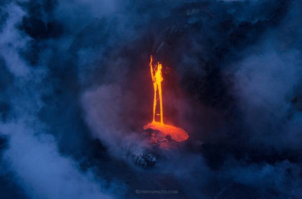
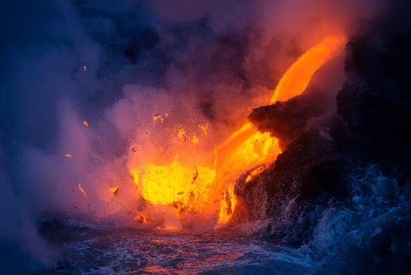
Lava ocean entry at Big Island, Hawaii
Ok, next installment of a set of photos from recent visit to Hawaii. As I mentioned in the first photo, I took a day trip to the big island of Hawaii...
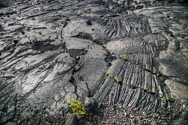
New life growing out of volcanic devastation, Big Island, Hawaii.
My deepest condolences to the families affected by todays horrific shootings in...
Sometimes you don't need to drive long to get to a certain spot. You step out of your hotel en put your tripod 50 meters from the entrance and you...

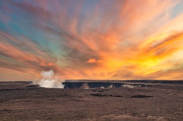
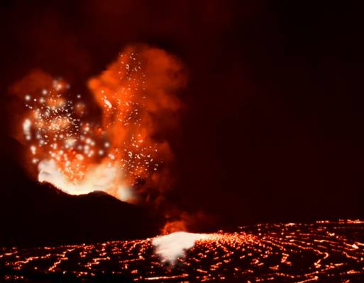
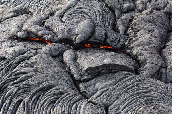
- Kīlauea volcano began erupting on September 29, 2021, at approximately 3:21 p.m. HST in Halema‘uma‘u crater. Lava continues to erupt from a vent in the western wall of Halemaʻumaʻu crater. All lava activity is confined within Halemaʻumaʻu crater in Hawai‘i Volcanoes National Park. Seismicity and volcanic gas emission rates remain elevated.
This view of the volcano is available from Devastation Trail, about a 1.75 mile hike from the outer parking lot.
In August 2021, increased earthquake activity and patterns of ground deformation indicated that an intrusion was occurring and magma was moving into an area south of Kīlauea caldera.
However, no eruption occurred, and the shallow Halemaʻumaʻu magma reservoir continued to measure inflation. On September 29, 2021, earthquake activity increased abruptly beneath Halemaʻumaʻu around 2 p.m. HST, and at 3:21 p.m. a series of vents opened in the floor and walls of Halemaʻumaʻu crater, generating a lava lake.
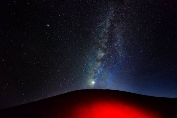
- This photo combines two interesting elements. The Milky Way on Moana Kea is so bright and clear, it feels like you can reach out and touch it.
And when you have Kilauea erupting in the distance about 90 miles away, it is a very interesting photo.
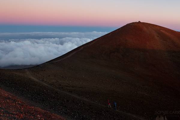
- Mauna Kea is unusually topographically prominent for its height, with a wet prominence fifteenth in the world among mountains, and a dry prominence second in the world, after only Mount Everest.
Because the Hawaiian Islands slope deep into the sea, Mauna Kea has a dry prominence of 9,330 m (30,610 ft).[8] This dry prominence is taller than Mount Everest's height above sea level of 8,848.86 m (29,032 ft), so Everest would have to include whole continents in its foothills to exceed Mauna Kea's dry prominence.
Given how much Mauna Kea protrudes from the Hawaiian Trough, some authorities have called it the tallest (as opposed to highest) mountain in the world, as measured from base to peak.
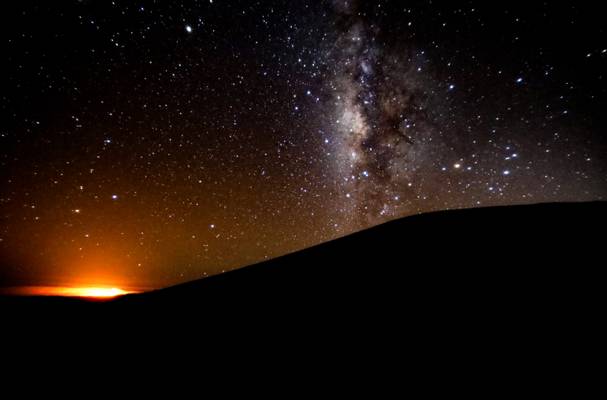
Mauna Kea's summit is one of the best sites in the world for astronomical observation due to favorable observing conditions.
The summit is above the inversion layer, keeping most cloud cover below the summit and ensuring the air on the summit is dry, and free of atmospheric pollution. The summit atmosphere is exceptionally stable, lacking turbulence for some of the world's best astronomical seeing.
The very dark skies resulting from Mauna Kea's distance from city lights are preserved by legislation that minimizes light pollution from the surrounding area; the darkness level allows the observation of faint astronomical objects. These factors historically made Mauna Kea an excellent spot for stargazing
![Pele's Breath [explored]](https://cdn.phoide.com/Thumbs/28300241856.jpg)
Going back to Hawaii for this shot from the crater of Mt Kilauea on a foggy night. It was a very surreal experience up here alone at night surrounded...
Waipi'o Valley from the end of the 2WD road, Big Island, Hawaii. The road into the valley, though paved, has a 25% grade and only one lane. 25% is...
The cliffs and black sand beach at Pololu valley, the Big Island of Hawaii, taken from midway down the trail from the end of the road down to the...
Big Island, Hawaii
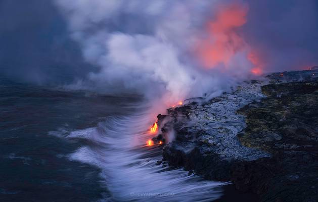
The 61G lava flow has reached the ocean about a month now. It took about 4 miles one way hike from the road to reach this point. The hike is fairly...
I just returned from a 2-week trip to the Big Island of Hawaii with so many new favorite photos that it will take a while to sort them out! So here...
Thanks to all Phoide contributors to Hawaiʻi County!
Most notably Dominic Nessi, David Hamments and George Kurzik.