
Macdonnell Region
SONY DSC
SONY DSC
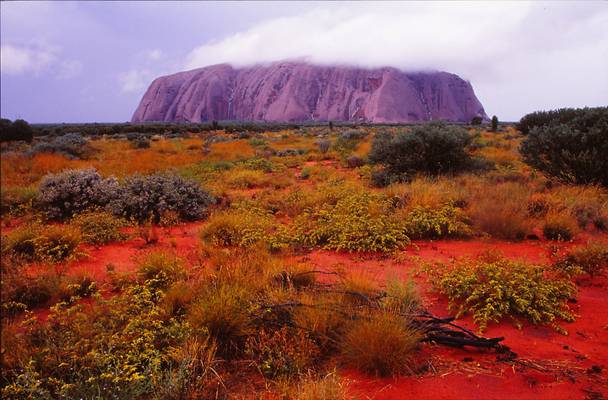
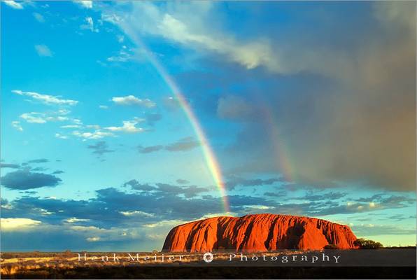
Ayers Rock (Uluru) on a rainy morning. Original on Kodachrome 64 2002
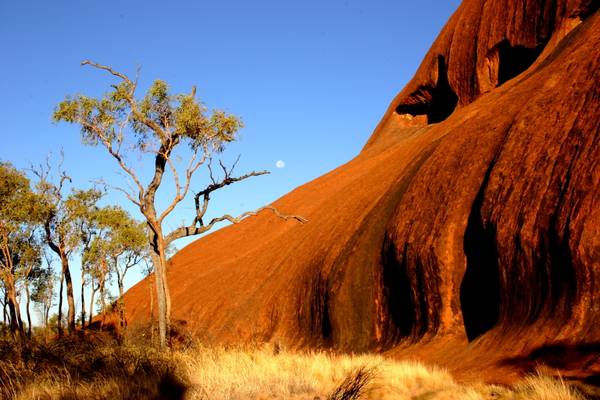
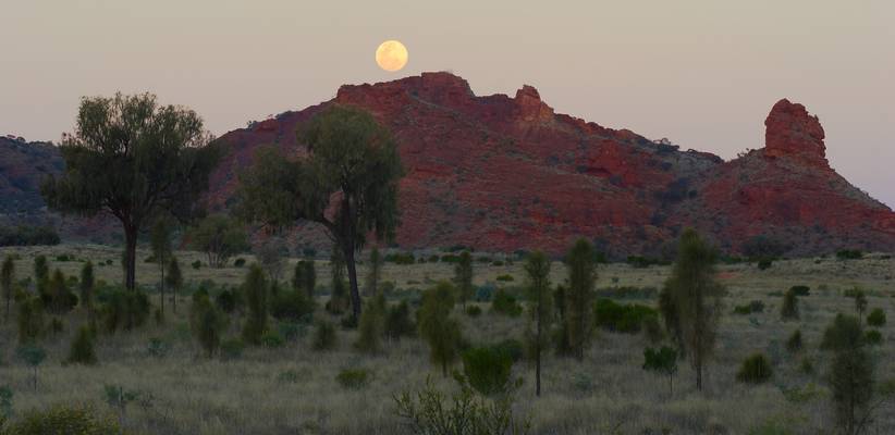
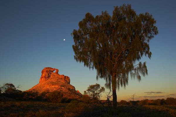
A full moon setting behind Uluru (Ayers Rock)
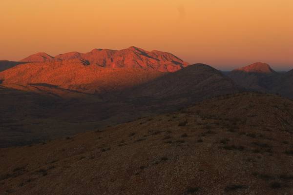
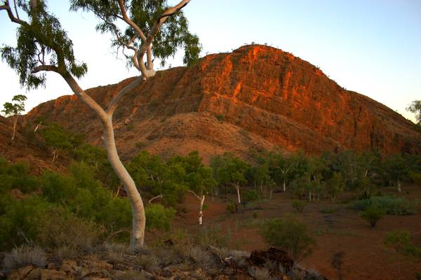
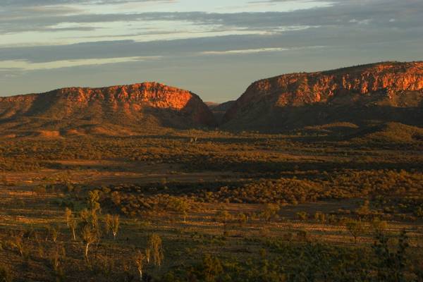
Sunset on the top of Mt Winter, West of Alice Springs
On a stormy morning, the low cloud accentuates the strong colours of the slanting light.
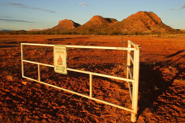
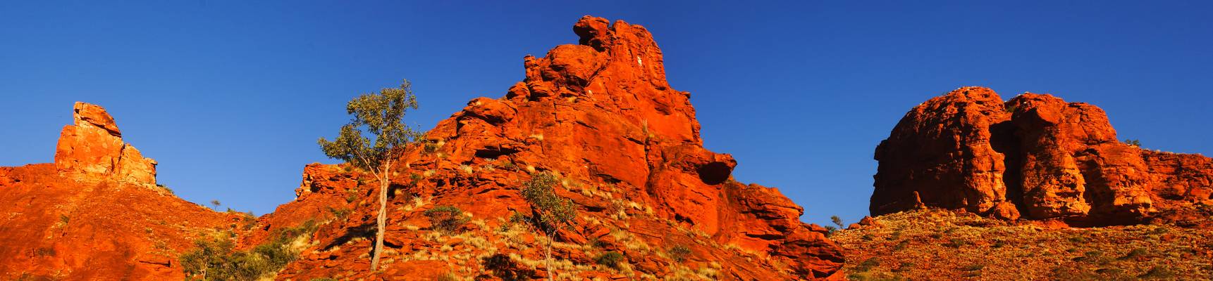
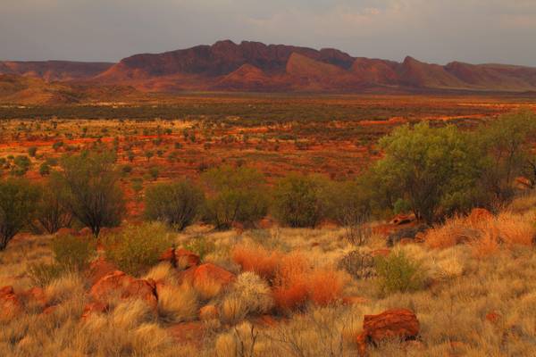
With Mount Undoolya in the background
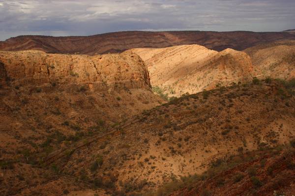
I've been going through my archives and discovering shots I had originally overlooked. This is a shot of the East MacDonnell Ranges behind Ross River...
A view from the summit ridge of Mount Ooraminna, with the endless desert plains in the background.
A spectacular gap in the East MacDonnell Ranges just east of Alice Springs.
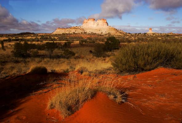
It's easy to see how Rainbow Valley got its name at sunset.
On Stage 2 of the Larapinta Trail, West MacDonnell Ranges, NT
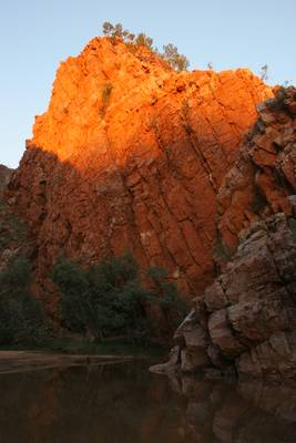
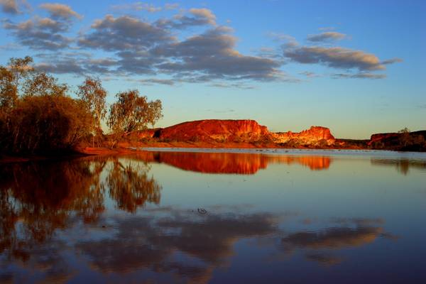
The walls of Ruby Gap at sunset glow red and orange with the setting sun.
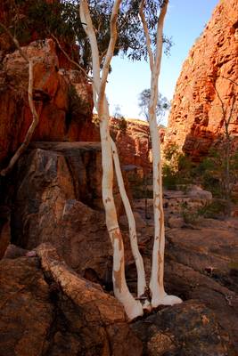
An unusual triple-trunked ghost gum in Glen Annie Gorge, Central Australia
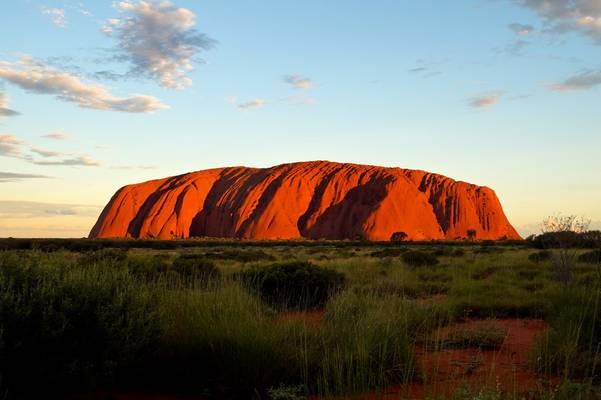
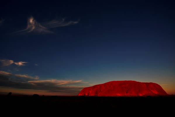
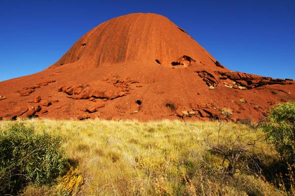
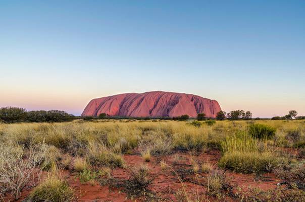
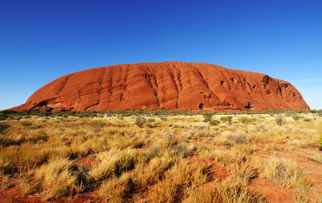
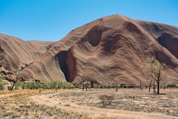
Uluru / Ayer's rock is a large sandstone rock formation in the southern part of the Northern Territory in central Australia. Uluru is sacred to the Pitjantjatjara Anangu, the Aboriginal people of the area. The area around the formation is home to an abundance of springs, waterholes, rock caves and ancient paintings. Uluru is listed as a UNESCO World Heritage Site. Uluru and Kata Tjuta, also known as the Olgas, are the two major features of the Uluṟu-Kata Tjuṯa National Park (Wikipedia).
... iconic rock in the center of Australia
SONY DSC
SONY DSC
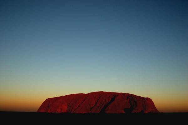
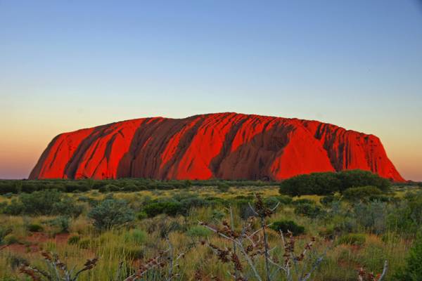
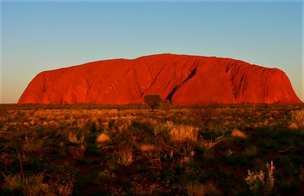
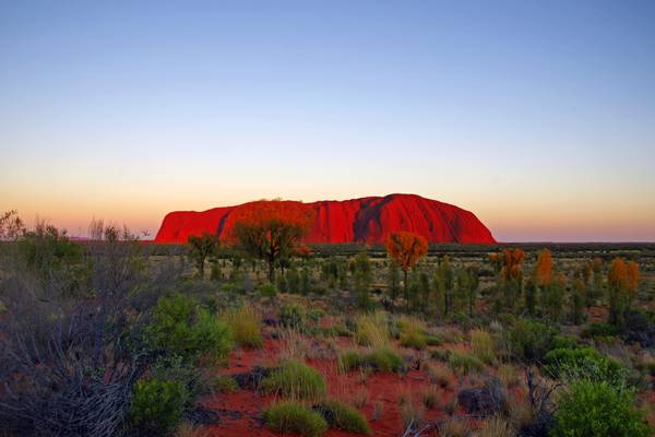
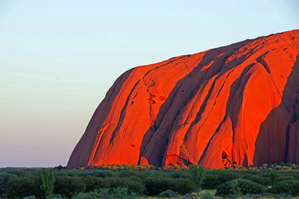
Ayers Rock (Uluru) at sunset
Possibly the most remote place I have ever been, West of Alice Springs
Dolerite Rock Formation near Ross River, East MacDonnell Ranges
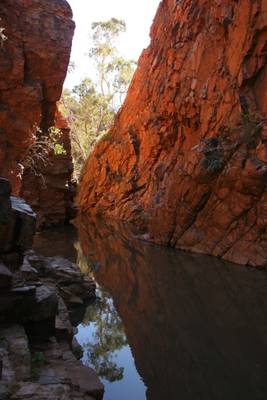
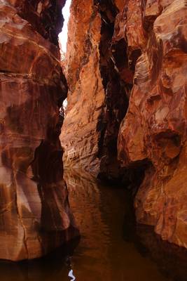
The second chasm after a scramble up the creek from the main chasm.
Central Australia. Another rediscovery from the archives
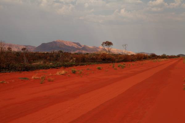
About 30 kms out of Alice Springs, on the Old South Road.
Another rediscovered gem from my archives.
At 1389m the third highest mountain in the Northern Territory. Taken from the campsite on stage 11 of the Larapinta Trail
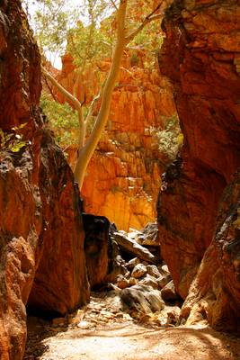
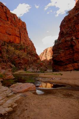
A narrow, spectacular chasm in the West MacDonnell Ranges. The rocks have been polished over the millennia by flood waters rushing through the gorge.
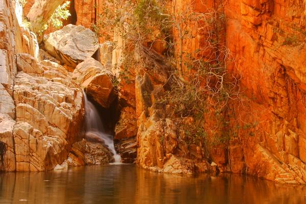
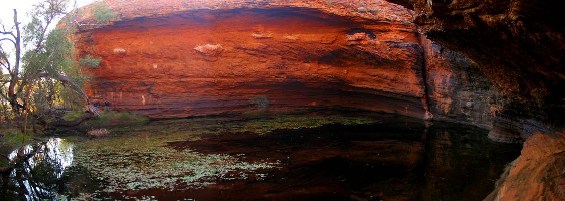
A beautiful cascade and waterhole in Standley Chasm, a popular tourist attraction in Central Australia. To get to this spot requires a bit of rock...
Near Ross River, East MacDonnell Ranges. The row of ghost gums leading into the picture is what caught my eye.
Bloomfield Bluff makes a great backdrop to this gorge on Ross River, East MacDonnell Ranges
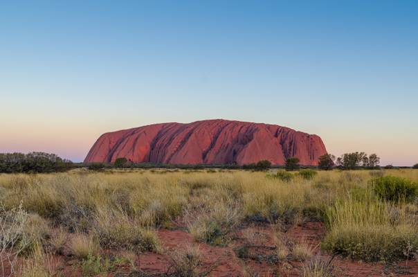
Ayer's Rock changes colour every evening during the "golden hour"....
SONY DSC
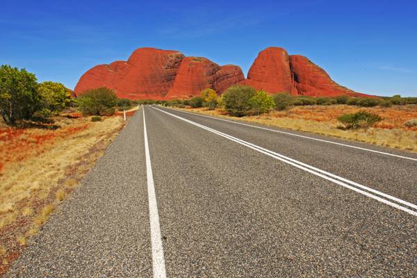
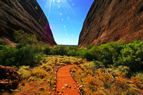
... the fabulous "Valley of the Winds" track is typical of the terrain and vegetation found in Australia's Northern Territory. This lesser known site is about 40 km from the iconic "Ayer's Rock"
SONY DSC
A whole day with rain and i started to get in a very depressive mood. Did i travel 20.000km to see some rain at this famous location? Around 4 it...
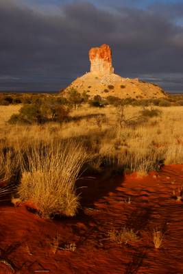
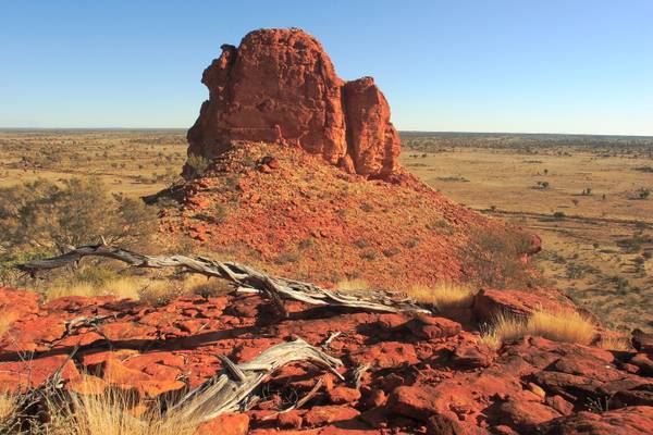
Window Rock is another spectacular rock formation located in the Chambers Pillar Conservation Park.
Early morning sun lights up a hillside near Mount Liebig in Central Australia
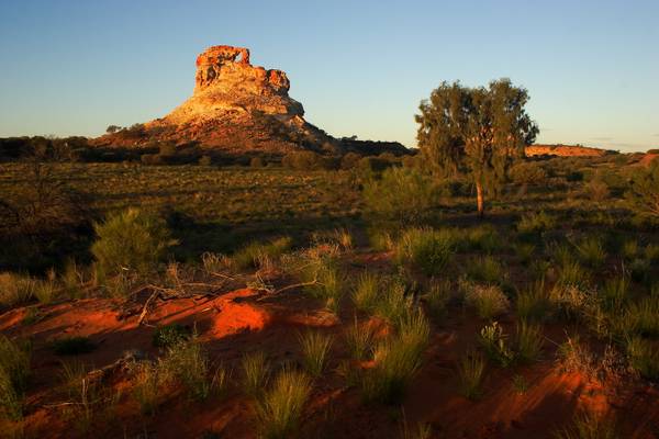
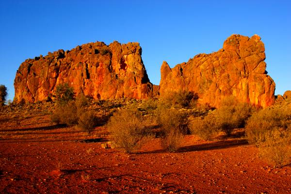
Located in the Chambers Pillar Reserve, another spectacular rock formation at this location.
A rediscovered gem from my archives.
Near Deep Well Station, south of Alice Springs
The Kintore Road winds past Mount Liebig on its route through the Western Desert
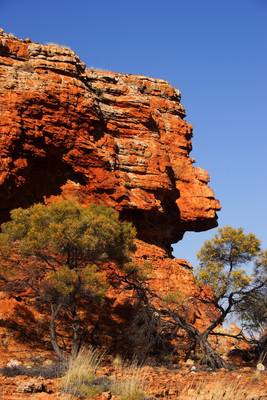
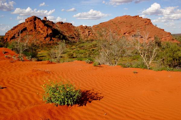
Rock formation in the Cleland Hills, NT
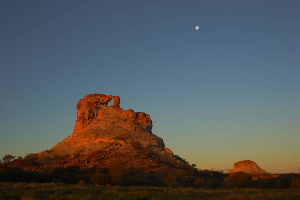
Located in the Chambers Pillar Conservation Reserve, south of Alice Springs
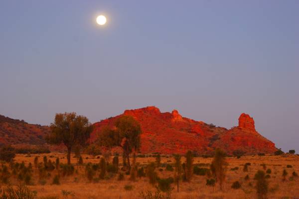
Taken at dusk. Located south of Alice Springs
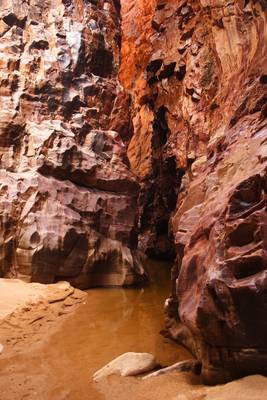
Another view inside this spectacular chasm
Taken from a nearby ridge.
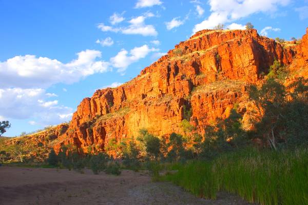
Located in the East MacDonnell Ranges approx 200 kms east of Alice Springs. This gorge is well worth the long drive and walk.
Thanks to all Phoide contributors to Macdonnell Region!
Most notably Andrey Sulitskiy, David Hamments, Romain Pontida and George Kurzik.