
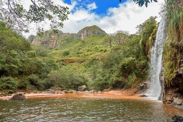
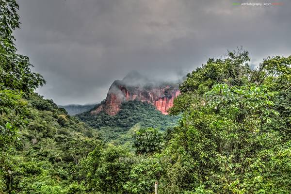
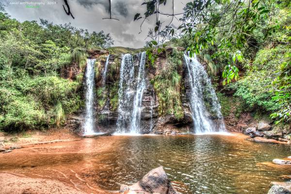
Provincia Florida
Runa Photography, Daniel © 2019 © Some rights reserved, don´t use this image without my permission
Runa Photography, Daniel © 2019 © All rights reserved, don´t use this image without my permission
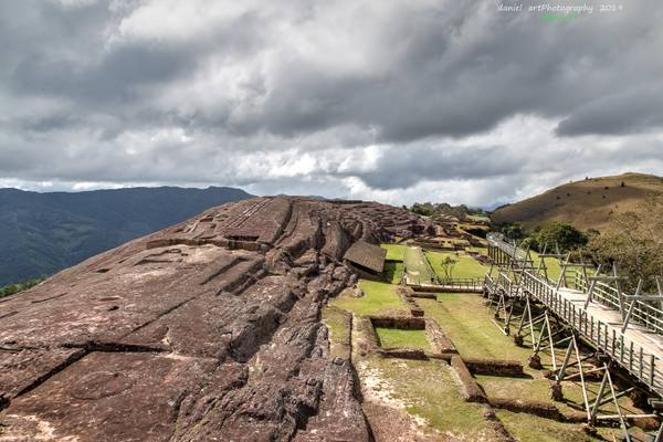
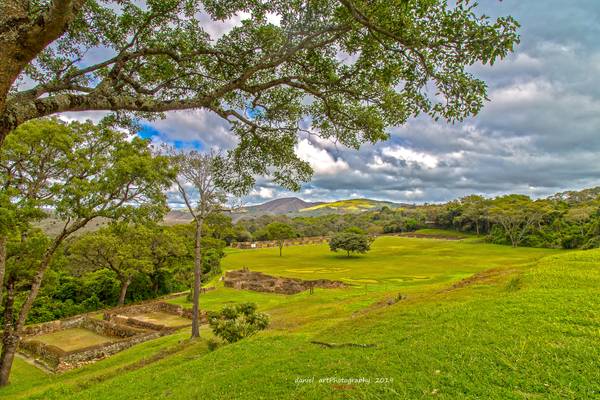
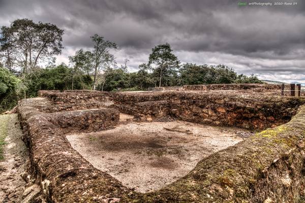
El sitio arqueológico de Samaipata conocido popularmente como El Fuerte (nombre proveniente del período colonial) es un complejo ceremonial y administrativo, de gran valor único y excepcional que data del periodo prehispánico.
Se levanta como el prototipo de arte rupestre de mayor impacto en el mundo, su emplazamiento está localizado es las primeras estribaciones de la cordillera en la región de los valles mesotérmicos cruceños.
Es declarado Patrimonio Cultural de la Humanidad el 2 de diciembre de 1998.
Fuente: El Fuerte de Samaipata, H.Alcaldia
The archaeological site of Samaipata popularly known as El Fuerte (name from the colonial period) is a ceremonial and administrative complex, of great unique and exceptional value dating from the pre-Hispanic period.
It stands as the prototype of rock art with the greatest impact in the world, its location is located is the first foothills of the mountain range in the region of the Mesothermal valleys of Santa Cruz.
It is declared Cultural Heritage of Humanity on December 2, 1998.
Source: El Fuerte de Samaipata, H. Alcaldia
Runa Photography, Daniel © 2020 © Some rights reserved, don´t use this image without my permission
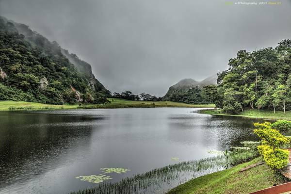
Bofedal es un humedal de altura y se considera una pradera nativa poco extensa con permanente humedad. Los vegetales o plantas que habitan el bofedal reciben el nombre de vegetales hidrofíticos.
Los bofedales se forman en zonas como las de las mesetas andinas ubicadas sobre los 3800 metros de altura, en donde las planicies almacenan aguas provenientes de precipitaciones pluviales, deshielo de glaciares y principalmente afloramientos superficiales de aguas subterráneas.
Fuente: wikipedia
Runa Photography, Daniel © 2019 © Some rights reserved, don´t use this image without my permission
Runa Photography, Daniel © 2019 © Some rights reserved, don´t use this image without my permission
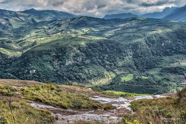
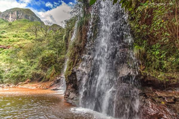
A menudo se dice que las montañas son las torres de agua de la naturaleza, porque interceptan el aire que circula por el planeta y lo obligan a subir, donde se condensa formando nubes que producen lluvia y nieve.
Las montañas también almacenan agua, en forma de nieve y hielo, que posteriormente se derriten cuando suben las temperaturas, que suelen ser cuando llueve menos.
No es sorprendente, entonces, que en las regiones áridas y semiáridas, del 70 por ciento al 90 por ciento del caudal de los ríos baje de las montañas. Pero incluso en las zonas templadas, del 30 por ciento al 60 por ciento del agua dulce suele llegar de las cuencas hidrográficas de las tierras altas. En la cuenca del Rin, por ejemplo, los Alpes proporcionan el 31 por ciento de la corriente anual, que en verano es más del 50 por ciento, aunque sólo constituyen el 11 por ciento de la superficie territorial de la cuenca.
En efecto, todos los principales ríos del mundo –desde el río Grande hasta el Nilo- nacen en las montañas, y una de cada dos personas del planeta depende de una forma u otra del agua de las montañas: para beber, para obtener energía o ingresos, para producir alimentos.
Fuente: FAO
Runa Photography, Daniel © 2019 © Some rights reserved, don´t use this image without my permission
Runa Photography, Daniel © 2019 © Some rights reserved, don´t use this image without my permission
Runa Photography, Daniel © 2020 © Some rights reserved, don´t use this image without my permission
Runa Photography, Daniel © 2020 © Some rights reserved, don´t use this image without my permission
The site of Samaipata was occupied as a ritual and residential area about 300 CE by the Chané of the Mojocoyas period (200 to 800 CE). They began shaping the great rock that is the ceremonial center of the Samaipata ruin.
According to a 17th-century Spanish chronicler, Diego Felipe de Alcaya, the Incas, probably late in the reign of Tupac Yupanqui (ruled 1471-1493), began the incorporation of the Samaipata area into the empire. A relative of Yupanqui's named Guacane led an Inca army to the area and with elaborate gifts persuaded the local leader, whose title was Grigota, and his 50,000 subjects to submit to Inca rule. Guacane established his capital at Samaipata or Sabay Pata on a mountain top at an elevation of 1,900 metres (6,200 ft). Samaipata means "the heights of rest" in the Quechua language spoken by the Inca.
Samaipata was an Inca administrative, ceremonial, and religious center. As with other Inca administrative centers on the frontiers of the empire (such as Oroncota), Samaipata was protected by outlying fortresses. One has been located about 50 kilometres (31 mi) to the east called La Fortaleza. The ruins of the fort are on a mountaintop overlooking the lowlands around the present-day city of Santa Cruz. Another fortress. location unknown, called Guanacopampa protected a mine at Saypurú or Caypurum, location also unknown.[8] The Samaipata area was one of the most isolated and easternmost areas of the Inca Empire.
According to Alcaya's account, Guacane and Grigota were killed in an attack by the Eastern Bolivian Guaraní people called Chiriguanos by the Spanish. The Chiriguanos were advancing from the lowlands into the Andes foothills. A counterattack by the Incas failed to dispossess the Chiriguanos who remained to settle in Samaipata and its vicinity. An Inca building destroyed by fire at Samaipata gives credence to this story.[9] The date of the war is uncertain, although many authorities date the beginning of Chiriguano attacks on the Inca's eastern frontiers to the 1520s.
The Spanish, along with Inca supporters, may have used Samaipata as a fortress and base camp as early as the 1570s, but formal Spanish settlement began in 1615 while the Chiriguanos were still threatening. A Spanish house is among the ruins.
Source: wikipedia
Runa Photography, Daniel © 2019 © Some rights reserved, don´t use this image without my permission
No te rindas, aún estás a tiempo De alcanzar y comenzar de nuevo, Aceptar tus sombras, Enterrar tus miedos, Liberar el lastre, Retomar el vuelo.
No te rindas que la vida es eso, Continuar el viaje, Perseguir tus sueños, Destrabar el tiempo, Correr los escombros, Y destapar el cielo.
No te rindas, por favor no cedas, Aunque el frío queme, Aunque el miedo muerda, Aunque el sol se esconda, Y se calle el viento, Aún hay fuego en tu alma Aún hay vida en tus sueños.
Porque la vida es tuya y tuyo también el deseo Porque lo has querido y porque te quiero Porque existe el vino y el amor, es cierto. Porque no hay heridas que no cure el tiempo.
Abrir las puertas, Quitar los cerrojos, Abandonar las murallas que te protegieron, Vivir la vida y aceptar el reto, Recuperar la risa, Ensayar un canto, Bajar la guardia y extender las manos Desplegar las alas E intentar de nuevo, Celebrar la vida y retomar los cielos.
No te rindas, por favor no cedas, Aunque el frío queme, Aunque el miedo muerda, Aunque el sol se ponga y se calle el viento, Aún hay fuego en tu alma, Aún hay vida en tus sueños
Porque cada día es un comienzo nuevo, Porque esta es la hora y el mejor momento. Porque no estás solo, porque yo te quiero.
Mario Benedetti
Thanks to all Phoide contributors to Provincia Florida!
Most notably Runa 59.