Grassy Ridge At Peak

0
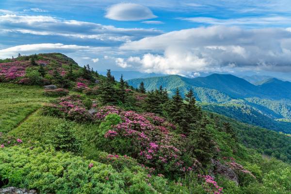
This is the 'go-to' destination for many photographers in the Roan Highlands, Grassy Ridge. It's a stout 3-mile hike with a lot of 'up' involved. I started the trail at just a little before 4:00 am. I had to "push it up", as former fighter pilot friend Rob Waldo Waldman is fond of expressing, so I could be here before sunrise. A 3-mile hike in the flatlands is one thing; here, about a mile up, and carrying about 40 pounds of gear on steeply rising terrain, this hike takes about two hours. I had to hurry to catch that sunrise, so I hoofed it nonstop from Carver's Gap all the way to this spot in under two hours... if only the sun would cooperate.
Prior to this image, the area was socked with clouds... shortly after this shot, they returned for the duration of my time there, along with a howling wind... and cold. I had an excellent raincoat/windbreaker on to retain some heat, as usually this time of year, it can start off cold here, then warm up exponentially as the sun rises... not on this day, however. After about an hour of it, having worked my way over to the peak of the ridge, that wind had hauled off with a good bit of my body heat... my teeth were chattering uncontrollably! Having worked the area as best I could with the camera, I reluctantly had to seek some warmer climes back down the trail. Certainly, sunset back on Jane Bald would make up for what I missed here.
Did I say "certainly"? Later that evening, all clouds gave way to clear blue skies, not exactly what I expected, but just as I've experienced here so many times in these mountains. Don't feel sorry for me though, as that provides so many reasons to come back. I'm back there in the area from tomorrow until Tuesday evening. Who's with me?
Of particular note on the hike back down, by the way, I ran across two kids, apparently brother and sister jabbering away with each other, near the high point of Grassy Knob, who were wearing short-sleeved shirts, no shoes, and were wet as I had been having been in contact with the wet foliage along the trail... and absolutely oblivious to the cold! Their parents, appearing every bit as old hippies, followed about two minutes behind them, dressed nearly the same, though wearing sandals... that's better than barefoot, though totally inappropriate for the steep rocky tails here. I found out later (as they had aroused the curiosity of many from these parts) that they were from Michigan. Apparently, they drink antifreeze up there.

0
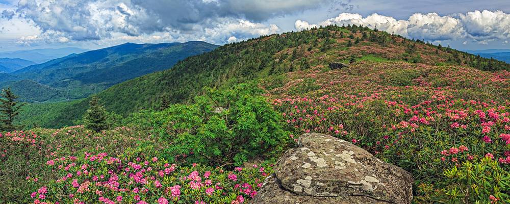
Having posted the cloudy version of Grassy Ridge two posts back (titled "Rhododendron Hells"), it occurred to me I had never posted this image from 5 years ago. The original is a composite image of 9 vertical shots that is 72”x24”, though with detail that could make it larger if necessary… I’ve pared it down using the same aspect ratio to 60”x20” that drops the printing costs of an exhibition metal float print somewhat exponentially.
Grassy Ridge Bald is the longest stretch of grassy bald in the Roan Highlands area of the Appalachian Mountains. You will never see this roadside… seeing it requires a hike starting from Carver’s Gap, located on State Route TN-143 and NC-261, which connects the towns of Roan Mountain, Tennessee, and Bakersville, North Carolina... you park on the state line! The Appalachian Trail winds its way through Roan Mountain State Park… it is along this trail that you begin to work your way up until it intersects a spur trail at the boundary of Grassy Ridge Bald nearly 2 miles from Carver’s Gap
Roan Mountain has five sub-peaks that comprise the Highlands and is divided into two sections by Carvers Gap. To the west of Carvers Gap are Roan High Bluff and Roan High Knob that are easily accessed by road as well as trail… the world-famous Roan Rhododendron Gardens that are handicap-accessible. That’s a wonderful option for those who have a hard time getting around… but it’s hard to beat the view from Grassy Ridge. East of Carvers Gap, accessible only by hiking, is the area of Roan Mountain known as Grassy Ridge, which includes three peaks: Round Bald, Jane Bald, and Grassy Ridge Bald. At an elevation of 6,189 feet (1886 meters), Grassy Ridge Bald is one of the highest grassy balds in the Appalachian Mountains.
There’s a lot to see on the trail to this point and you get many different perspectives along the way… the hike takes a little over 5 miles straight up and back, with a total elevation gain of 1,150 feet (350 meters). My hikes there are never less than 8 miles round trip and often more as I move around for those perspectives to put in front of the lens… but this place is the jewel at the end of the trail. To get this image required scrambling up the huge rock you see in the foreground to get above it all. While this would make a wonderful print, I've not caught the quintessential shot I've had in mind of this place just yet... it's been too windy, or too cloudy/foggy, or the light's just not right, or I'm too early or too late for peak conditions... or worse, any combination of these conditions. I guess I'm just going to have to keep making my way up there until I get it. I'm just kidding myself... even if I did get what I think I want, I still would never be satisfied. Would you?

0
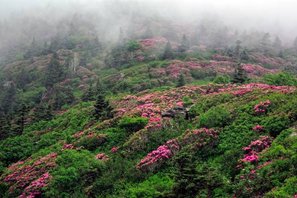
As I stated in the previous image, the Blue Ridge is covered in rhododendron… I wasn’t kidding! These are the showy magenta/pink Catawba that bloom from late May to early June, depending on the altitude of where they are located. Here along Grassy Ridge, they’re at nearly 6,000 feet (1,828.8 meters). That’s not fog up the ridge but rather clouds skirting the heights. It adds a sense of mystery to me, even though I'm very familiar with this place. The trail to this point leads through tunnels of interwoven branches of rhododendron, and it’s tight in a few places, especially if you’re carrying gear. The early colonial pioneers who first navigated these mountains referred to such thickets as “rhododendron hells” as it was easy to get lost among them. I wouldn’t suggest such a hike… but it’s amazing to see from above. Between the rhododendron are fir, mountain ash, and wild hydrangea for the most part. A note here to my UK-Irish friends... mountain ash here are what you refer to as Rowan trees. I've seen them growing at sea-level as I drove through Northern Ireland. Most of North Carolina's climate is of the humid subtropical variety, with the high Appalachians being the exception. We can use mountain ash as an altimeter here, as they're only found in elevations above 5,000 feet. The highest mountain east of the Mississippi River is Mount Mitchell at 6,680 feet here in North Carolina... which means the mountain ash will only be found on the highest ridges here, such as the one in this image.