
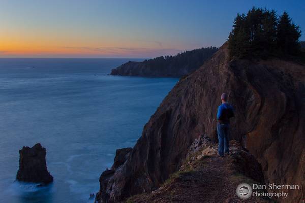
Oregon
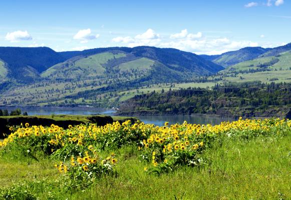
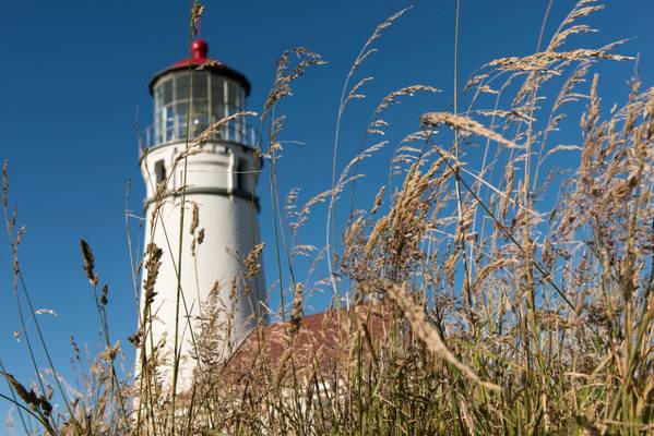
Oregon is a state located in the Pacific Northwest region of the United States. Known for its diverse landscapes, from the rugged coastline to the Cascade Mountains, Oregon offers a plethora of photography locations. The state is home to several national parks, including Crater Lake National Park, which boasts a stunning blue lake surrounded by towering cliffs. The Columbia River Gorge is another popular destination for photographers, with its waterfalls, scenic vistas, and hiking trails. The Oregon Coast is also a favorite spot, with its rocky shores, lighthouses, and picturesque sunsets.
Photography regions of Oregon


Photography of Oregon
- Cesare Pavese. | facebook | 500px | ferpectshotz |
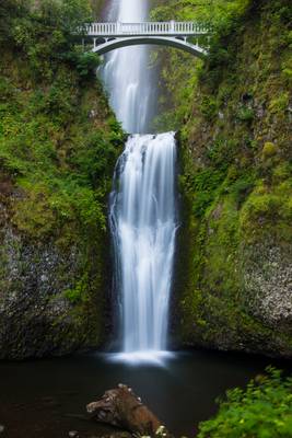
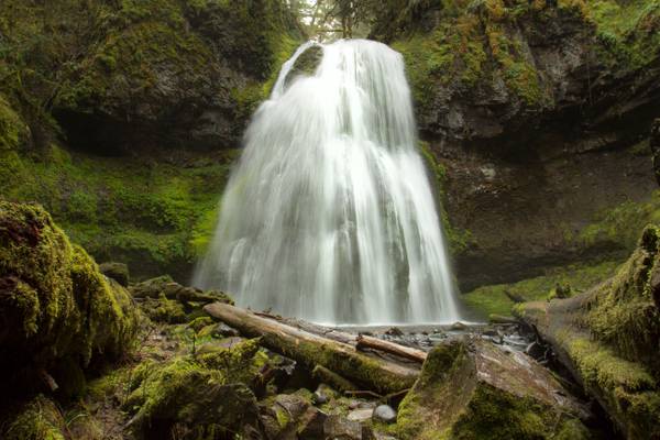
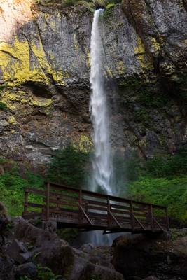
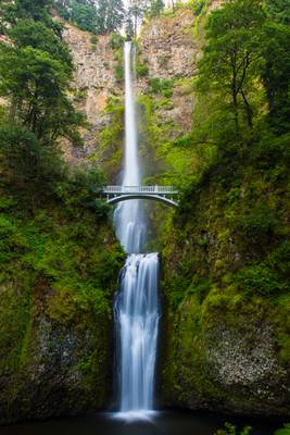
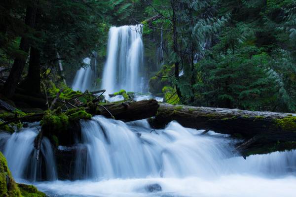
Lower part of the famous Multnomah Falls of Columbia river gorge, Oregon. Took this shot last summer when we visited the falls. This has to be arguably the most famous of all Oregon’s waterfalls as it took us two visits to get a lean photograph. The crowd here during the day time is unbelievable, we had to park a mile away and walk up to it. The second time we returned early in the morning just after sunrise and had the place all to ourselves and even managed to see some storks at the bottom pool.
On another note, due to my wife’s incredible networking skills, I will be having my images showcased in a gallery from the 7th of this month. The name of the Galley is A-Frame Hollywood and it’s located on Santa Monica Blvd, West Hollywood. If you are in the locality please do drop in and say hi. Thanks again for visiting, have a great Wednesday..
- Eugene Delacroix.
| facebook | 500px | ferpectshotz |
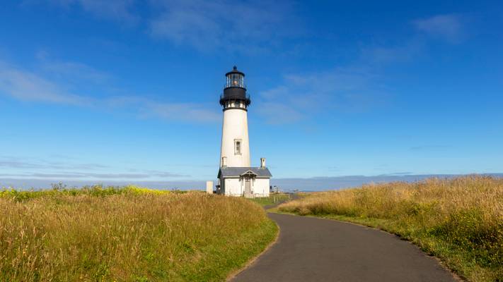
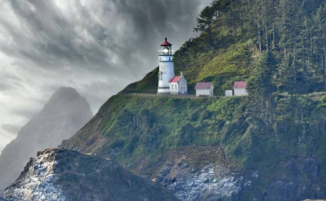
Another shot of the Yaquina head light. I am still amazed by the number of different compositions that were possible at this location. I took this shot while we were walking away from the lighthouse using the road as a leading line to the lighthouse.
Hope everyone like it..
- Helen Keller.
| facebook | 500px | ferpectshotz |
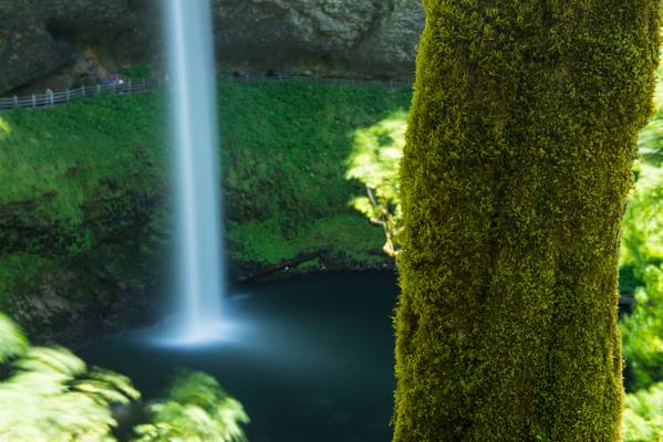
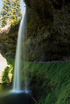
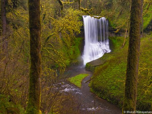
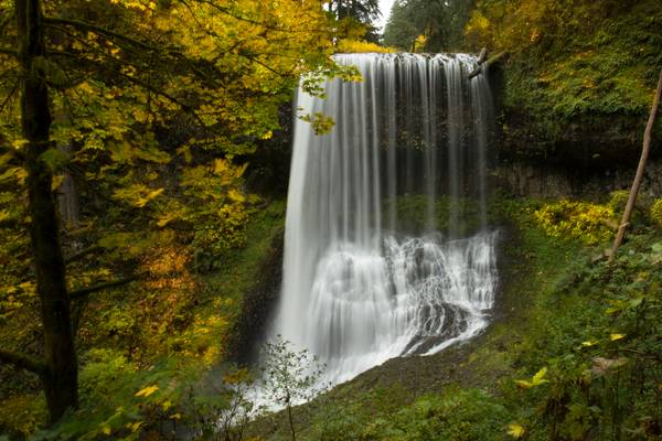
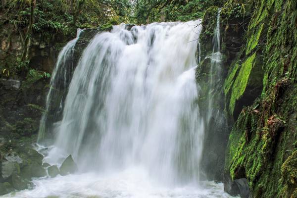
Another shot from the Silver Falls State Park located near Salem Oregon. This is one of those falls which is so huge you can walk underneath the falls completely dry if the wind is not messing with you. We did this short hike and left completely in awe of this stunning waterfall.
The trailhead said the whole trail contains more than 10 different waterfalls and I can’t wait to return to explore them all, hopefully one a less crowded day. Thanks for visiting and have a nice day.
- Arthur Young.
| facebook | 500px | ferpectshotz |
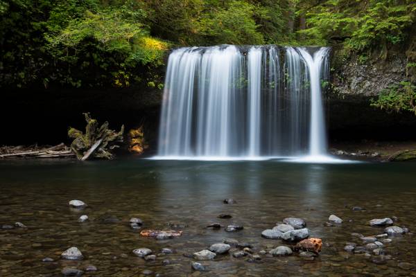
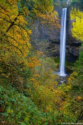
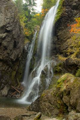
Here is another shot of the Upper Butte falls from our Oregon trip. This shot was taker directly from in front of the falls as I wanted to show the beautiful curtain form of the fall. This is one of the most memorable locations on our Oregon road trip and riding through a bone jarring stretch of forest road was totally worth it.
Hope everyone likes it..
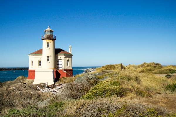
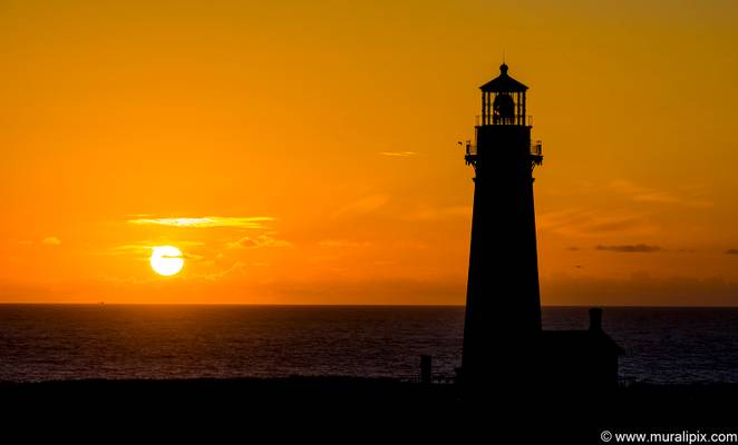
The Coquille River Lighthouse near Bandon, Oregon was built to mark the entrance to the Coquille River and to help mariners get past the ever-shifting sand bars. The light would also serve as a coast light for vessels heading up and down the Pacific Ocean.
Prior to 1850, the area around the Coquille River was primarily settled by the Coquille Indians. In 1851, gold was discovered at the nearby Whiskey Run Beach, but its discovery didn't have the same effect as the gold rush in California.
The first permanent settlers arrived in the area in 1853, no doubt attracted by gold, lumber, and fishing. By 1859, a small port was established on the Coquille River to allow access to all inland produce and resources. The town of Averille was established in 1873 by George Bennett and his sons, but was changed to Bandon a year later, named for Bandon, Ireland, which the Bennett Family hailed from.
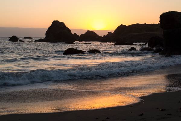
Golden orange sunset late summer.
- Elizabeth Bowen.
| facebook | 500px | ferpectshotz |
Punch bowl falls, located at Columbia River gorge, Oregon. This was the second shot I made at the location after our extensive hike. Compared to the drought ridden California, Oregon’s rivers had good water flow so I had to settle for a shot from far away. A bunch of kids actually swam across to the closer vantage point but one of the unfortunately could not swing back due to hypothermia and had to be evacuated that day. So I am quite glad that I didn’t try to get deep into the water.
Thanks for visiting and have a great day..
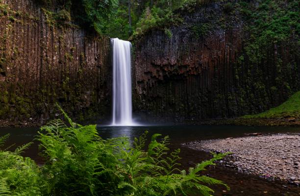
Tamanawas Falls is a popular waterfall on the east slope of Mount Hood, along Cold Spring Creek. The falls plunge a sheer 109 feet over a columnar basalt in a broad display that can stretch to 45 feet across at times. Tamanawas Falls was originally known as Giffords Falls, after photographer Benjamin A. Gifford, whose photos documented the falls in 1909 - whether he should be properly credited with discovery or first documentation of the falls is not known. The current name, derived from a Chinook word which means "friendly or guardian spirit" was officially adopted in 1971.
- William Wordsworth
| facebook | 500px | ferpectshotz |
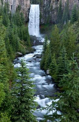
Another spot which we missed on our first trip to Oregon. The majestic Tumalo falls is a 97-foot (30 m) waterfall on Tumalo Creek, in the Cascade Range west of Bend. Unfortunately my wife fell sick on this day and was having an absolutely horrible morning, so we cut shot our plans to do the hike here and headed back to town.
This shot is actually a composite image made of two shots, I used a long exposure to get the Tumalo creek and a faster shot to capture the fall. And then blended images in photoshop.
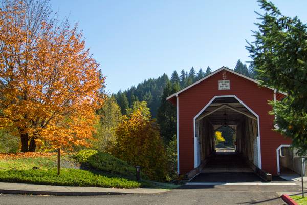
The Office Bridge (also called Westfir Covered Bridge) is a covered bridge in Westfir, Lane County, Oregon, U.S. crossing the North Fork Middle Fork Willamette River at the south end of the Aufderheide National Scenic Byway and edge of the Willamette National Forest. It is Oregon's longest covered bridge at 180 ft (55 m), and is one of only two in the state using triple Howe truss construction. It is the only covered bridge west of the Mississippi River which has a separate pedestrian walkway. Each Christmas season, the town decorates the bridge with lights. A firetruck driven by Santa turns the lights on the first week after Thanksgiving.
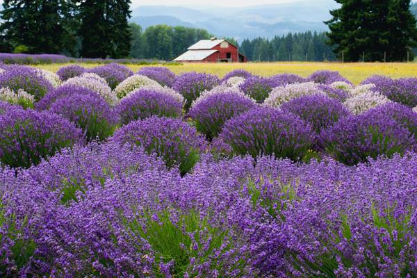
Lavender Valley, which is the name of this farm, is a beautiful 6 acre hidden gem just 30 minutes south of Hood River, Oregon. The farm is located in the beautiful Hood River Valley within view of the picturesque Mt. Hood, standing tall at over 11,000 feet. The farm has a 360 degree view of the surrounding landscape and farms. The farm is free to anyone who wants to walk through the beautiful lavender field or take some amazing photos. If you want to make an amazing bouquet of lavender to take home, it is only 4 dollars to pick your own.
On my own photo preview program this didn't seem as saturated with color. Not the first time my images' colors looked different after posting on this site.
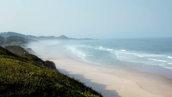
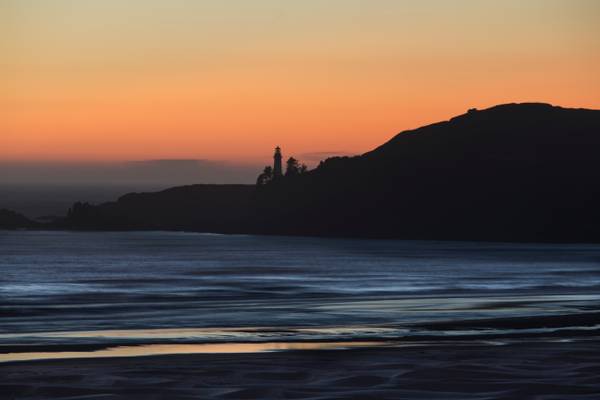
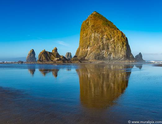
Early morning, low tide. Between the forest fire smoke and the coastal haze the light had a faint pink hue.
Whitehorse Falls is the smaller but arguably prettier of the two named waterfalls along the Clearwater River. The falls occur where the river sluices through a narrow trough in rhyolitic bedrock and suddenly crashes 14 feet over a wall into a large pool below. Though the falls are located several miles downstream of Clearwater Falls, there is often less water present in Whitehorse Falls due to the integration of the river in the North Umpqua Hydroelectric system. The flow is consistent all year long, just not in tune with its natural levels nearly as much as it should be.
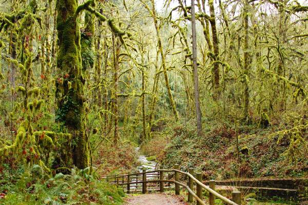
Access to the waterfall and its trail is only through U.S. Highway 138. The area around the waterfall is surrounded by moss-covered rocks and canopy of old growth Douglas-fir forest.

Owyhee (oh-WHY-hee) Reservoir or Owyhee Lake is a reservoir on the Owyhee River in Malheur County, Oregon, United States. Located in far Eastern Oregon near the Idaho border, the reservoir is Oregon's longest at 52 miles (84 km). The name of the lake is from the older spelling of "Hawaii." It was named for three Hawaiian trappers, in the employ of the North West Company, who were sent to explore the uncharted river. They failed to return to the rendezvous near the Boise River and were never seen again. Due to this, the lake and its region were named "Owyhee".
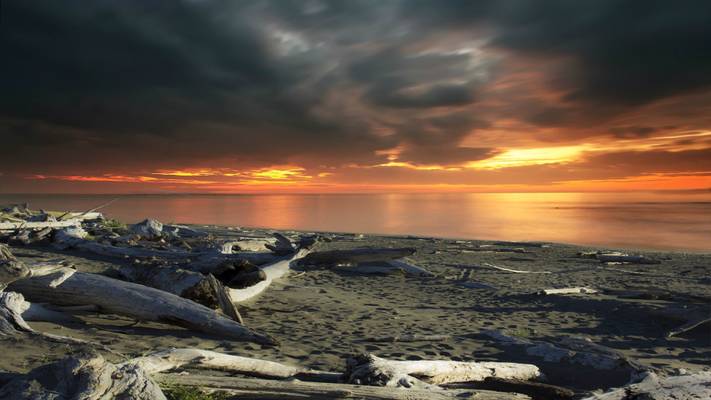
This is a combination of two images to get this effect. I just couldn't get the dramatic effect I wanted with what I had shot so I borrowed the sunset from another image and combined the two images.
Crissey is the surname of one William L., who owned the property in the middle part of the 20th century. The term Field has a dual meaning both for the flowers grown in his extensive flower fields and the airfield utilized on the land prior to being acquired by the state park system. Mr. Crissey moved to Brookings with his wife in 1928, at the time home to about 250 residents. Soon after, the Easter lily was added to his floral inventory. Crissey pioneered the commercial sale of this flower for which the small coastal community of Brookings was later renowned.
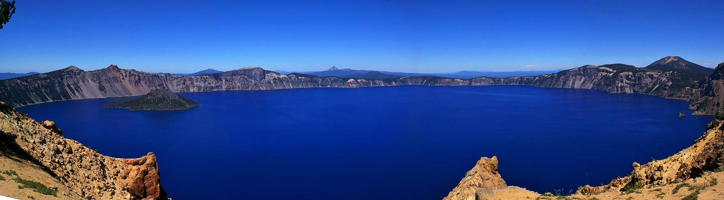
This picture has been stitched together from 8 individual pictures. The Crater Lake was formed ~ 7700 years ago in the caldera after the eruption and collapse of Mount Mazama. It has the cleanest water in the USA, almost free of suspended particles, it is also very deep, that´s why the color appears as dark blue. The volcanic cone shaped island on the left is Wizard Island (4400 years old), the small islet on the right is named as Phantom Ship island.
- Thomas Browne.
| facebook | 500px | ferpectshotz |
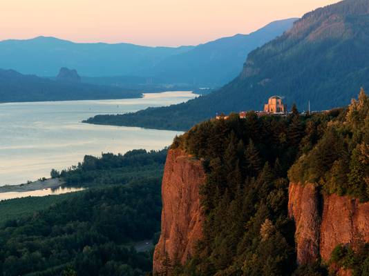
Another old shot from our trip toe the wonderful state of Oregon. This spot from the women’s forum park provides an iconic view of the beautiful Columbia River Gorge. Its almost impossible not to go for a wide-angle lens here. And that’s exactly what I did, but I noticed that there were a lot of finer details in the scene even on a day when we had pretty flat light at sunset without much drama in the sky.
So, I attempted a pano stitch as it was getting darker by the minute. Unfortunately, couple of pics from the pano turned out to have some vibration in them teaching me the valuable lesson to always check for sharpness and focus. But this one was pretty decent with the vista house bathed in absolutely gorgeous golden light along with the cliffside.
- John Locke.
| facebook | 500px | ferpectshotz |
Upper Latourell falls trail is a pretty easy 2 miles hike in the Columbia River Gorge which take you to two of the most stunning waterfalls I have ever seen. I spend a quite a bit of time to get a clear shot of the waterfall from this angle as there were many people enjoying this stunning waterfall. When I started out in landscape photography, I would grow completely impatient when people walked into the shot. But now I have learned to enjoy spending my time there witnessing the moment and do a bit of people watching.
Lighting for this was particularly challenging as sun was directly above use and there were super bright spots created by the sunlight filtering through tree foliage. I got away from it by shooting multiple images and creating a mini composite image as time was a bit limited.
- Mike May.
| facebook | 500px | ferpectshotz |
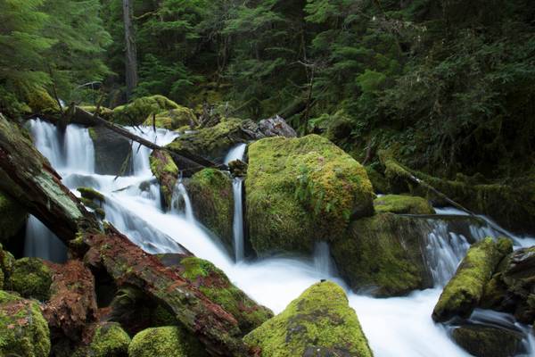
Elowah Falls, also called McCord Creek Falls, is a 213-foot waterfall on the Columbia River Gorge, Multnomah County, Oregon. The waterfall is formed as McCord Creek is forced into a narrow channel by sheer cliffs and shoots at high velocity into a natural amphitheater of layered basalt. Lichens and mosses are very common, covering up to eighty percent of the ground surface under and around the vascular plants (source: Wikipedia).
This was another waterfall which I had on my list when we visited Oregon the first time. Unfortunately, due to time constraints, we were not able to make the trip but this time we marked it as a must have and it was totally worth it. Plus we also got the falls all to ourselves as this is not as popular a hike as the waterfalls closer to Portland.
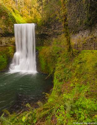
Like North Falls further upstream, Middle North Falls has certain characteristics which one could argue give it an edge when comparing it to the park's main attraction, South Falls. Despite being considerably shorter, Middle North Falls is a markedly amorphous waterfall which changes physical shape in a very dramatic way as the volume of water in North Silver Creek changes. The 106 foot tall falls take the form of a narrow column of water during the summer months, funneled to perhaps 5 feet wide at most by a narrow runnel in the bedrock. With greater stream flow in the winter and spring months however, North Silver Creek sheets out across the 60-foot wide creek bed and turns the falls into a broad curtain of water, with part of the falls impacting on a twisting chute of basalt which then slides to join the more volumnous half of the creek in the plunge pool.
Middle North Falls is one of four waterfalls in Silver Falls State Park which features a trail which traverses behind the falling water. Unlike the other three, the trail leading behind Middle North Falls is a dead-end, constructed purely to allow access to additional views of the falls.
- Edmund Burke.
| facebook | 500px | ferpectshotz |
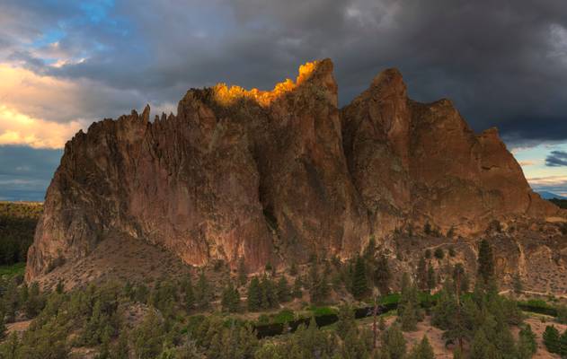
After a very cold and windy sunset at Sparks lake we decided to hit the landmark attraction of Bend, the Smith Rock State Park. The sheer cliffs of tuff and basalt are ideal for rock climbing of all difficulty levels. Smith Rock is generally considered the birthplace of modern American sport climbing and is host to cutting-edge climbing routes. It is popular for sport climbing, traditional climbing, multi-pitch climbing, and bouldering (source: wikipedia).
We had been here once before without much planning and got bamboozled by the morning light. It all has to do with the crooked river that snakes through the valley. During both sunset and sunrise, the sun will be behind massive rock formations and hence light can be tricky here. Last time we were here, the clouds were on the opposite side of the rock formations and all the color and texture were on the opposite side. Thankfully this time the cloud cover was much more uniform.
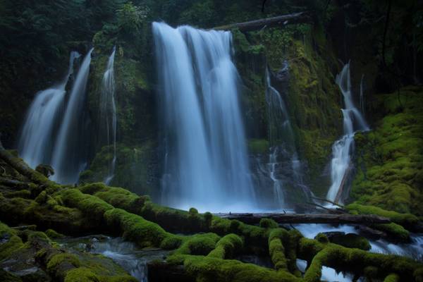
I took over 80 shots of this waterfall today. I narrowed it down to two I like. If you viewers would let me know your opinion as to the strongest I would be grateful.
Downing Creek Falls is the second of at least three significant waterfalls known to occur along the stout length of spring-fueled Downing Creek. The falls drop 32 feet over a distinctly cube-shaped outcrop of basalt, pouring in three to four side-by-side channels (depending on how much extra snow melt water is present), with as many as a dozen small streams of water dribbling out of the adjacent cliff and falling parallel to the falls in tandem. Though the falls aren't terribly tall, the creek is large enough to produced a consistent cloud of mist at the base of the falls, which helps ensure the forest and cliffs all around the falls are liberally covered head to toe in a thick blanket of moss.
Downing Creek is a remarkably consistent stream with a deceivingly small drainage basin. The majority of the creek emerges from springs about one quarter mile upstream from the falls, and flows all year long with very little fluctuation as a result. Further upstream along the drainage is another waterfall which only flows during periods of prolonged snow melt in the spring months, but the upper section of the creek otherwise sinks into the porous ground and the upper falls dries out as a result.
Love prefers twilight to daylight...
- Oliver Wendell Holmes, Sr.
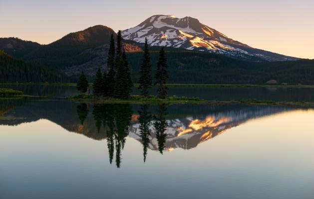
One of the best things I like about Oregon is how unassuming some of the most stunning locations are. The first time we visited Oregon, we spend a couple of days in Bend but completely missed the stunning Sparks lake. On our second visit, luckily I saw a billboard for Oregon tourism with sparks lake as the main attraction but in true Oregon fashion, they didn't name the location. Thankfully my google tracking skills were on point and I managed to find this lovely location and we spend a brilliant sunrise there.
This happened with Abiqua Falls as well and we in fact turned back about a mile away from one of the most famous waterfalls in the state because we couldn't figure out the turn to the parking lot. Yup, there was not a single sign, I figured it out a year later and returned to get my pics and was kicking myself for turning around while I was so close. While it was frustrating at the moment, as I look back I really appreciate how these spots still maintain their wildness by not being tourist traps.
View of the lower part of falls.
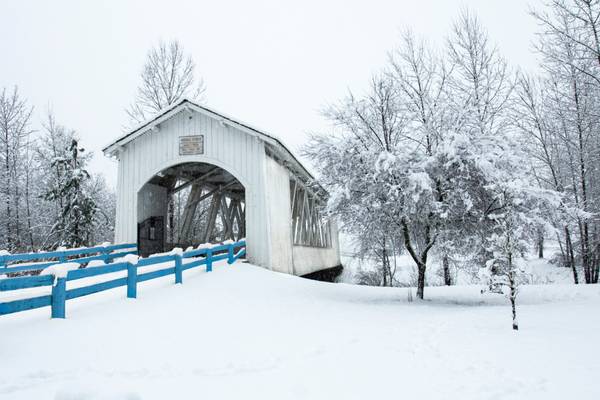
I added the blue to the fence because it was lost otherwise with white on white.
The Willamette Valley (will-AM-et) is a 150-mile (240 km) long valley in the Pacific Northwest region of the United States. The Willamette River flows the entire length of the valley, and it is surrounded by mountains on three sides – the Cascade Range to the east, the Oregon Coast Range to the west, and the Calapooya Mountains to the south. It forms the cultural and political heart of Oregon, and is home to approximately 70 percent of its population.
The valley's numerous waterways, particularly the Willamette River, are vital to the economy of Oregon, as they continuously deposit highly fertile alluvial soils across its broad, flat plain. A massively productive agricultural area, the valley was widely publicized in the 1820s as a "promised land of flowing milk and honey". Throughout the 19th century it was the destination of choice for the oxen-drawn wagon trains of emigrants who made the perilous journey along the Oregon Trail.
Today the valley is often considered synonymous with "Oregon Wine Country", as it contains more than 19,000 acres (7,700 ha) of vineyards and 500+ wineries.
The Molalla Indians used the trail in the early 1800's. It is now called the Table Rock Historic Trail. During the 1920's this same trail was utilized by Native Americans from the Warm Springs Reservation to reach traditional huckleberry picking areas near the Molalla River and Table Rock. Table Rock Fork of the Molalla River located near Molalla, Oregon. It is a 5 mile whitewater kayaking & canoeing trail. The Table Rock Fork is a great class three run, very continuous and entertaining. It is something of a mystery to me why this run hasn't gained popularity with local paddlers, but I think this will change as more people start venturing up there and word gets around. Let me say that this is all the information I could find on-line about this part of the river. The above are quotes taken from three different online sources.
Fall colors and leaves changing colors
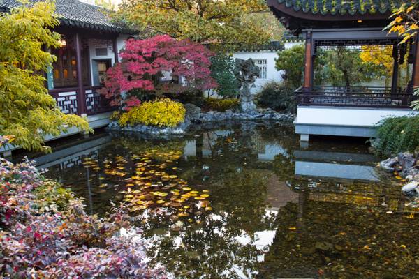
The Lu San Chines Garden is a walled Chinese garden enclosing a full city block, roughly 40,000 square feet (4,000 m2) in the Chinatown area of the Old Town Chinatown neighborhood of Portland, Oregon. The garden is influenced by many of the famous classical gardens in Suzhou.
In 1988 Suzhou, China and Portland became sister cities. The garden was designed by Kuang Zhen and built by 65 artisans from Suzhou on land donated by NW Natural on a 99-year lease; groundbreaking occurred in July 1999, and construction was completed 14 months later at a cost of about $12.8 million. 500 tons of rock, including Chinese scholar's rocks from Lake Tai (Taihu stone), were brought from China and used in the garden.
- Agnes Repplier.
| facebook | 500px | ferpectshotz |
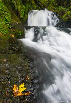
One more shot of the beautiful fairy falls. For this shot I got in real close and used a longer focal length. I am a big admirer of this particular type of falls as they come our really pretty in photographs and this one is one of my favorites. I wanted a shot emphasizing the details of the moss on the ricks and the flowing water.
Hope everyone likes it, Happy Tuesday!!
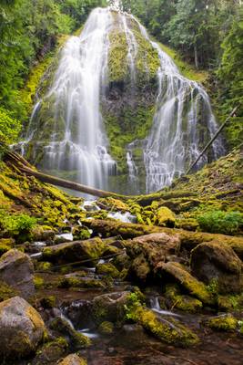
- Samuel Johnson | facebook | 500px | ferpectshotz | One more shot of the beautiful and massive Lower Proxy falls. For this shot I had this plan to get as close to some of the foreground cascades and to use them as foreground interest for framing the big waterfall. Unfortunately the water flow was simply too high and I was constantly getting sprayed by the mist. I am truly glad my gear is water resistant but trust me constantly having to wipe off your filter while taking a long exposure shot is not fun. This was not the composition I had in mind but this was the closest I got to what I initially planned. Hope you all enjoy the image.
If this be not love, it is madness, and then it is pardonable… -William Congreve
| facebook | 500px | ferpectshotz |
I first visited Oregon couple of years ago on a summer road trip along with my wife. We both enjoyed the state's natural beauty so much that we decided to head back up again this year when we had a chance. Last time we were there we spend a whole day searching for the illusive Abiqua falls but were unlucky in finding it. This time I was better prepared and had an idea about the approximate location of the trailhead. Plus we were lucky that we met some locals who directed us to the exact start point of the trail.
The trail is completely located within private property but the owners had allowed nature lovers to explore the area, which was totally awesome and I hope everyone to venture to this trail respect the instructions posted. You basically can drive up until you see a white metal fence blocking the road and the trail to the falls start to the left of the road. Once you start the hike, the trail immediately divides into three different paths and the left most one seems to be the shortest and the easiest. So that’s basically my tips for this hike, also make sure good hiking boots and some food as this hike is a bit hard without those.
- Saul Bellow.
| facebook | 500px | ferpectshotz |
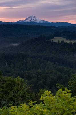
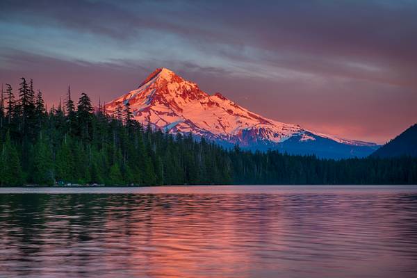
One of the most interesting things about nature photography is seeing nature’s wonders at its best possible lighting. This is one of those images I made of Mt Hood from Lost Lake, framing wise id did nothing just basically pointed the camera at the mountain at shot the image.
The interestingness in this image is the light and I had nothing to do with it other than capture it with a camera and my wife who shot the same image with an iPhone managed to get an exceptionally great picture too, so it’s not about the camera or post processing. It’s all about finding a good view and sticking with it until nature begins the show.
Hope you all like it have a nice day..
- Gilbert K. Chesterton.
| facebook | 500px | ferpectshotz |
Multnomah Falls, at about 627 ft in elevation this is one of the premier attraction of the Columbia River Gorge and attracts quite a number of visitors. It’s considered by many as the second tallest year round waterfall in the US. We passed alongside the falls on our fourth day but the parking area was packed with cars, so we decided to get back here on the fifth day after shooting sunrise at the Trillium Lake.
We reached here around 6:30 am and there was nobody around, so we took our time taking pics and enjoying a stroll to small bridge across the falls. It’s not the most photogenic of the falls in Columbia River Gorge but its stunning just to see the sheer size of this stunning waterfall.
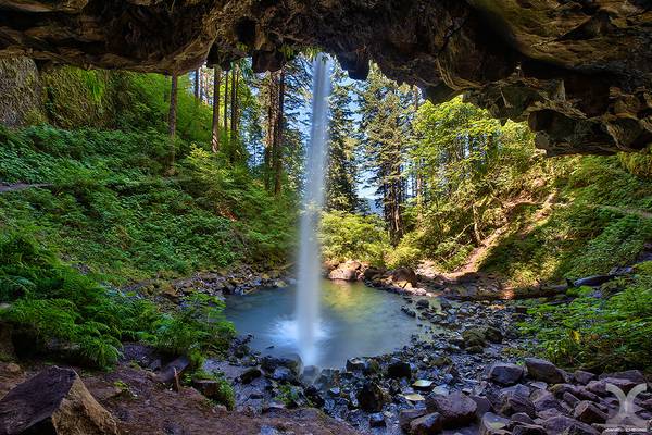
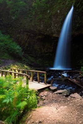
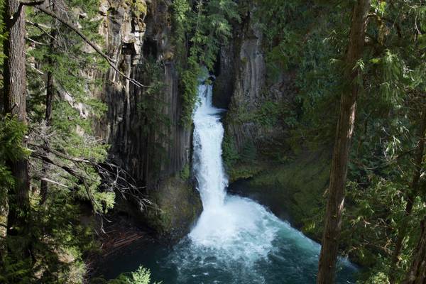
Also known as Ponytail Falls, in the Columbia river gorge, Oregon.
Many thanks to Gary Randall for taking me there.
My website: www.danielcheongphotography.com
Please visit my Facebook Page
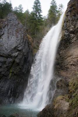
Taken on a misty day, the water is low at this time of the year, but come Spring it will be very full and lovely.
Henline Falls is a broad curtain type fall, dropping 126 feet over the side of a narrow alcove. During periods of lower water levels Henline Creek will split into two or three more distinct channels of water and spray into the cove in multiple distinct sheets of droplets.
Henline Falls was named after the creek, which was in turn named for a settler of the area who had come in search of the rich prospecting in the area. Immediately to the right of the base of the falls is the Silver King Mine. Remnants of a tramway leading from the mine are visible as the trail near the falls. The adit itself is dry, so exploration is possible, but do not enter the mine alone.
McDowell Creek Park
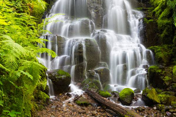
Now that the Spring snow has started to melt, if you can get to these falls, the cascades are impressive. These are one of the falls located in the Opal Creek Wilderness area. This image was one of several, I had to clean off my lens after each shot, so much spray!
Henline Falls is a broad curtain type fall, dropping 126 feet over the side of a narrow alcove. During periods of lower water levels Henline Creek will split into two or three more distinct channels of water and spray into the cove in multiple distinct sheets of droplets. This disconnect between the powerful falls seen during the wet season and the lacy, delicate falls encountered in the dry season will determine whether the entire falls can be viewed by visitors - at high water so much spray blasts out from the falls that attempting to cross the creek to where all-encompassing views are possible is treacherous (and photography is pretty much impossible).
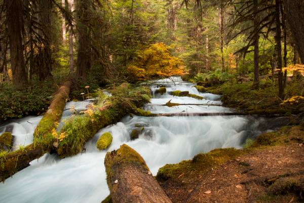
I actually had stopped to check my map, I looked up from my parking spot and saw this steam just tucked back up in the woods. A short walk and I found this vantage point. A completely unexpected find and now one of my favorite images of the year.
Olallie Creek is located in the midsection of the Cascades mountain range in western Oregon. The area is nicely shaded by Douglas fir, maple and alder. The Willamette National Forest stretches for 110 miles with varied landscapes of high mountains, narrow canyons, cascading streams, and wooded slopes. This creek sits right beside the McKenzie River and the McKenzie River Trail.
Olallie is a very popular name in Oregon. There are several Olallie areas, from this creek, to a nice lake, not associated with this creek to a nice hiking trail, not associated with creek or lake.
I took over 80 shots of this waterfall today. I narrowed it down to two I like. If you viewers would let me know your opinion as to the strongest I would be grateful.
Downing Creek Falls is the second of at least three significant waterfalls known to occur along the stout length of spring-fueled Downing Creek. The falls drop 32 feet over a distinctly cube-shaped outcrop of basalt, pouring in three to four side-by-side channels (depending on how much extra snow melt water is present), with as many as a dozen small streams of water dribbling out of the adjacent cliff and falling parallel to the falls in tandem. Though the falls aren't terribly tall, the creek is large enough to produced a consistent cloud of mist at the base of the falls, which helps ensure the forest and cliffs all around the falls are liberally covered head to toe in a thick blanket of moss.
Downing Creek is a remarkably consistent stream with a deceivingly small drainage basin. The majority of the creek emerges from springs about one quarter mile upstream from the falls, and flows all year long with very little fluctuation as a result. Further upstream along the drainage is another waterfall which only flows during periods of prolonged snow melt in the spring months, but the upper section of the creek otherwise sinks into the porous ground and the upper falls dries out as a result.
Lost Lake is a lake in Mount Hood National Forest. We have to identify it as the one in Hood River County because we have more than one Lost Lake here in Oregon.
The lake is bounded on the east by 4,468-foot (1,362 m) Lost Lake Butte and on the southwest by 4,556-foot (1,389 m) Preachers Peak. The lake is fed by three unnamed intermittent creeks from Lost Lake Butte, and Inlet Creek from Preachers Peak. The lake maintains a very consistent level via an outlet at the north tip, the source of Lake Branch Hood River, a tributary of West Fork Hood River. It is the second-deepest lake in Mount Hood National Forest after Wahtum Lake at 167 feet (51 m).
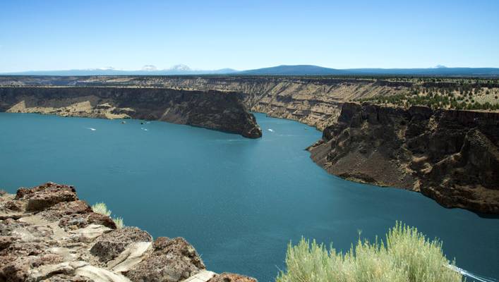
Lake Billy Chinook is a reservoir in Jefferson County, Oregon. Created by the Round Butte Dam in 1964, Lake Billy Chinook lies in a canyon at the confluence of the Crooked, Deschutes (da - SHOOTS) , and Metolius (ma TOLE ee us) rivers near Culver and Madras. It was named for Billy Chinook, a Native American of the Wasco tribe who traveled alongside American explorers John C. Frémont and Kit Carson in their expeditions of 1843 and 1844.
From this area you can see the prominent mountains of the Oregon Cascades in the distance.
Thanks to all Phoide contributors to Oregon!
Most notably Bonnie Moreland, Sandeep Thomas, MURALI NARAYANAN, Daniel Cheong, Michael, Dominic Nessi, Yi Jiang and Birgit M..