
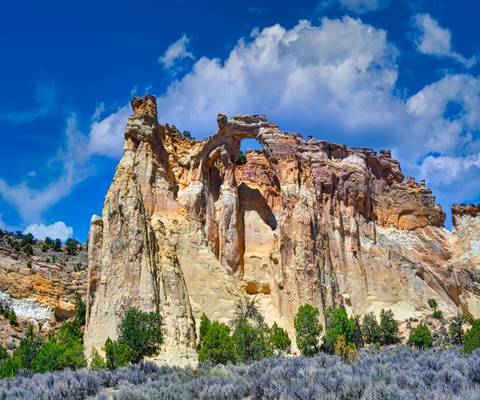
Utah
Utah, located in the western United States, is a state known for its stunning natural beauty and diverse landscapes. From the towering red rock formations of Zion National Park to the snow-capped peaks of the Wasatch Mountains, Utah offers a wealth of photographic opportunities for both amateur and professional photographers. The state is also home to several iconic landmarks, such as the Delicate Arch in Arches National Park and the Bonneville Salt Flats, which have been captured in countless photographs over the years.
Photography regions of Utah
Photography of Utah
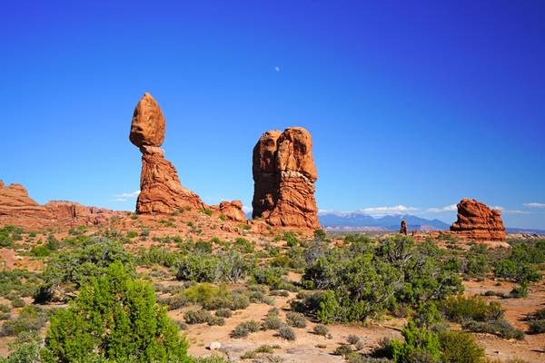
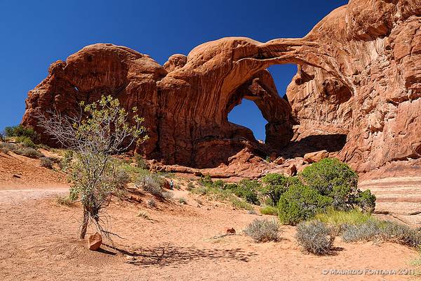
USA 2011 - Arches
- Douglas Adams.
| facebook | 500px | ferpectshotz |
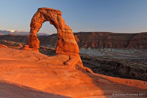
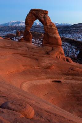
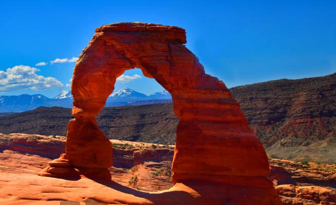
Today's picture is another old image from our trip to southern Utah’s beautiful Arches National Park. As a landscape icon, the delicate arch requires no introduction, it's usually featured in all its glory on almost all tourism-related documents created by Utah and even the United States travel brochures. The day we decided to hike up there, we had some beautiful light as the sun went down both on the arch and the snow-capped mountains in the background.
The hike to get to the location is a short but involves following a trail that mostly lays over a large flat rock which is devoid of many markers even in broad daylight. A thing to keep in mind if you plan to return after the sun goes down like we did. We were there in the middle of winter on a moonless night and my plan was to track my hike using the all trails app and then follow the path back to the car. We kept our iPhones charged and were completely confident that we will be able to get back as we stayed to take some beautiful star-filled nightscapes. Regrettably, we failed to account for the thinness obsession phone makers have these days that fails to give the phone batteries any cold protection. As soon as we took our phones out to check the paths, the phone battery went from mid 80% to zero and the phones died and became unresponsive. We were left to trace back our way in complete darkness without any way to identify the hiking trail and while wandering we met a couple of other hikers who were in the same predicament. Fortunately, we found a way to get off the rock soon and was able to get back to the marked trail to the parking lot. We learned a valuable lesson that day regarding preparedness in the desert and how quickly a situation can turn against you.
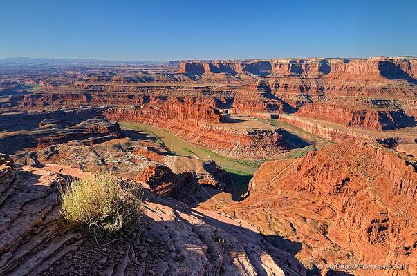
USA 2011 - Dead Horse Point
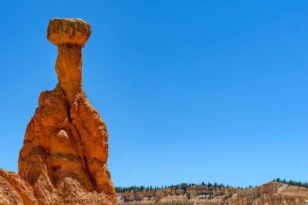
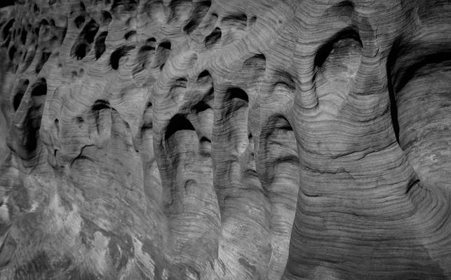
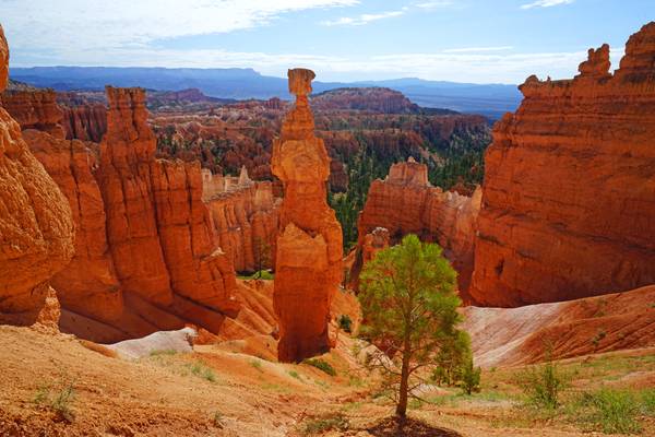
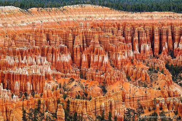
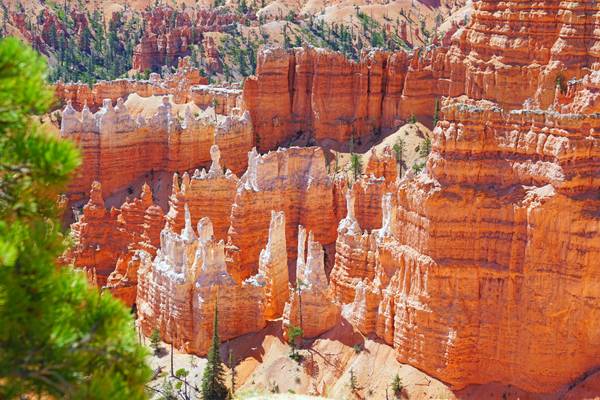
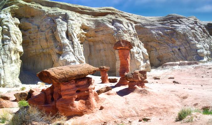
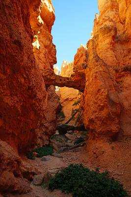
.... one of the many Hoodoos lining the Queen's Garden and Navajo Loop of Bryce Canyon National Park in Utah
This was the fourth time I visited Bryce Canyon. The trails up to the viewpoints were covered in snow, so I was hoping to see a lot of snow in the amphitheater. So it was slightly disappointing to see it like this when I arrived just after sunrise. Nonetheless, I like the view of the red rocks with the white specks between them.
- Ambrose Bierce.
| facebook | 500px | ferpectshotz |
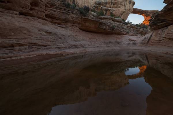
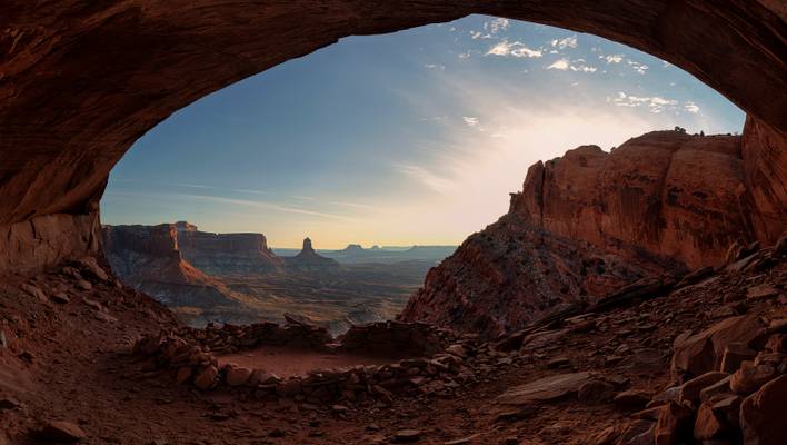
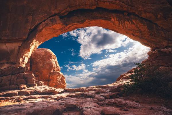
One of the locations I was keen to visit during our December trip to Utah was the stunningly beautiful False Kiva site. I read a bit about the hike and it seemed pretty manageable added to the fact that we will be doing the hike in winter and not under the searing hot summer sun. When I looked at maps, it looked like this location was not ideal place for sunset as the canyon walls to the right will block any light putting the whole location in shade. So we decided to head out there early evening and get back to the car while there is still some daylight out there.
Turns out, this was an excellent decision, as the hike turned out to be much harder than expected. First of all the snow on the ground have covered any previous tracks. Add to that the trail seems to disappear over a small cliff and then seem to resume at the bottom of the cliff. Guide books talked about looking for kairns to find a relatively easy path down the cliff, but the snow made them almost impossible to find. We even ran into a Japanese photographer who gave up and went back. But with a trusted trail map we persisted and scampered down to the bottom of the cliff. From where there was a casual stroll for a bit before we came across what looked like a field of fallen boulders. The next stage of the hike was climbing over a multitude of rocks and boulders to reach the bottom of the cave that is false kiva. Then we had to basically inch our way up and finally climb over a giant boulder to get to the location.
Once we reached, the view was absolutely phenomenal. I managed to get this shot while the sun was fairly high up in the sky but was lighting up the canyon wall in stunning light. So I sacrificed some highlights for a detailed shot of the awesome False Kiva.
- Lao Tzu.
| facebook | 500px | ferpectshotz |
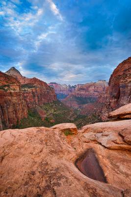
Another shot from the canyon overlook location just before sunrise. We were there almost 20 minutes before sunset and stayed there until about an hour after sunrise hoping for the clouds to clear and see some interesting colors. There were only a couple of other photographers there so we had the place to ourselves to shoot in comfort and I was able to change angles and use leading lines to compensate for the less than spectacular sky. While shooting around this small pool of water caught my eye and I believe this was the watering hole for the local chipmunks who were there in numbers begging for food being cute an all.
I took this shot while there was a small break in the clouds and the electric blue of the sky peeked through. I was hoping that the clouds will clear up somewhat but that was not the case. Even though the sky was less than spectacular than I expected this is one of the best locations in Zion to see the the canyon and its spectacular red rock formations in all their glory.
Thanks for visiting, Hope you all have a great weekend..
- Antoine de Saint-Exupery
| facebook | 500px | ferpectshotz |
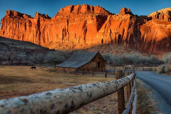
One of the most spectacular places we visited during our trip to southern Utah was the Capitol Reef National Park. I have been reading up about the parks in Utah and this one seems to be the park with least mentions by visitors. So naturally, we only planned a pass through as we wanted to venture into the more famous parks. So we decided to start early from Bryce and do a drive through of Capitol Reef en route to Moab, UT.
My thinking was that since I know least about the park it will be worth a quick visit and if it’s worth a stopover we will make a trip later next year. I didn’t have high hopes but the place completely blew us away. We only did a quick drive around of the scenic drive but the sheer number of stunning vistas were overwhelmingly high. To add to that we later learned from our friendly park rangers about the much more stunning back roads that are a must see. After browsing through some of the images displayed at the visitor center, I was tempted to stay and explore the park instead of heading out to Moab. But thankfully saner thoughts prevailed and we decided to keep our itinerary. But soon I will be back.
Today’s post is a photo of the barn at Gifford farm which lies in the heart of the Fruita valley, a desert oasis. Its appearance is quite sudden and it’s stunning to see the lush green patch among the vibrant red desert landscape. The farm is located at the beginning of the scenic drive and is one of the distinct landmarks of the Capitol reef National Park.
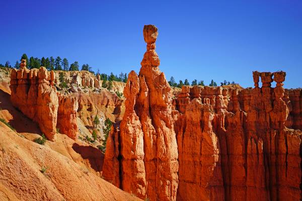
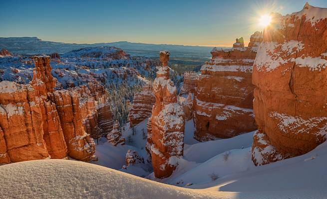
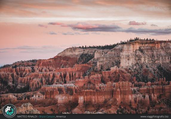
USA 2011 - Bryce Canyon
- Oscar Wilde.
| facebook | 500px | ferpectshotz |
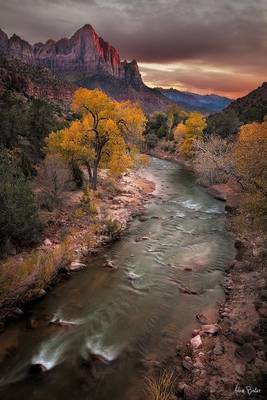
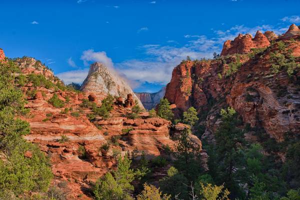
This shot was taken at the Zion National Park. I was actually trying to stitch a panorama shot which I posted earlier when I noticed this Peak far away getting assaulted by clouds. This was a quick shot I made after the Pano shot before getting back to the hotel. I wish I had the presence of mind to get the lee big stopper and get the motion of the clouds in this shot, may be next time.
Thanks for visiting and have a great weekend..
- Dennis Banks.
| facebook | 500px | ferpectshotz |
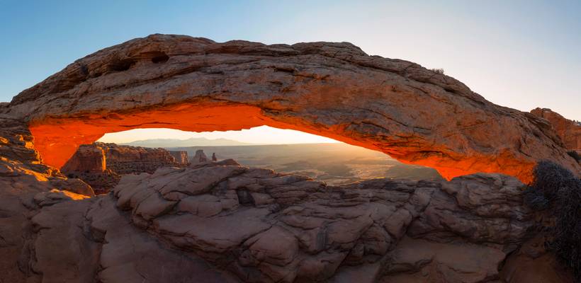
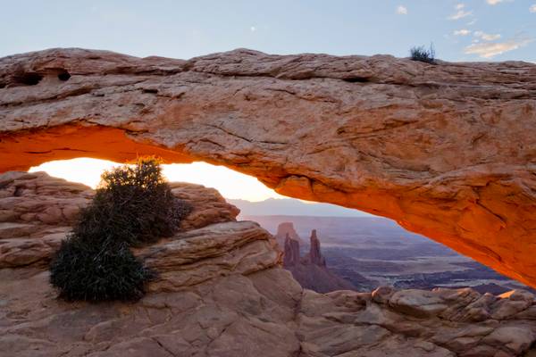
After Bryce Canyon exploration and our brief stint with the cold we went on to Moab, UT. The gateway town to both Arches and Canyonlands-Island in the sky National Parks. On our first day we decided to tackle the popular destinations and visited one of the most famous geological formations, the Mesa Arch of Canyonlands. There is a pretty short hike to get to the arch which is actually not as huge as I envisioned it but spectacular nonetheless. The only problem is the number of people at location, being one of the most photographed locations in Utah and perhaps southwest itself it's pretty popular even on a cold December morning. Thankfully I am early enough to get a decent spot, I heard some photographer to my left camped out in the location since 4 am for a sunset at 7am.
Anyways we had a nice time talking to fellow photographers about the locations and had a blast sharing tips regarding techniques. I made this pano shot once everyone started to leave after the sun burst through the horizon. This is a four shot panorama of the whole arch, with the early morning sun providing amazing light on the valley below.
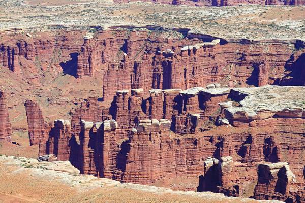
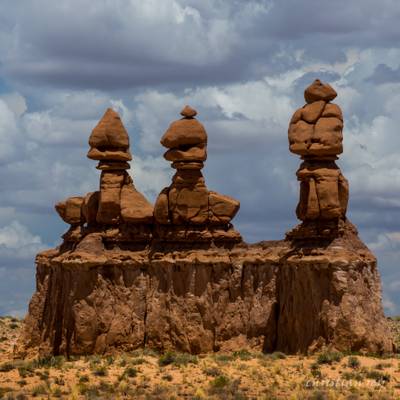
USA 2011 - Canyonlands
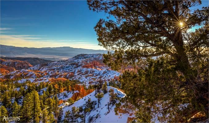
Another early Winter photo from the American West. Here the morning sun is peeping through the pine and casting some nice light on the Hoodoos in the park.
WESTWORLD es el nombre de una sensacional serie de HBO, catalogada como distópica: término opuesto a utopía.
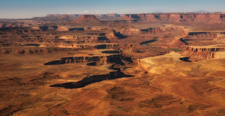
Fuera de términos literarios, este escenario es del parque nacional de Canyonlands, en Utah, Estados Unidos. Este escenario ha sido el marco de diferentes películas, como Thelma y Louise.
El parque nacional de Canyonlands está representado por un relieve lleno de color que se ha erosionado en incontables cañones, mesas y buttes (cuellos volcánicos) por el río Colorado y sus afluentes, como el río Verde. Los ríos dividen el parque en cuatro zonas: 'the Island in the Sky', 'the Needles', 'the Maze' y los ríos. Los cuatro comparten una atmósfera desértica, pero cada uno tiene sus propias características.
Esta imagen está hecha desde 'the Island in the Sky' y lo que vemos son los meandros del Río Verde. El escenario en conjunto me recuerda mucho a la serie 'WestWorld' por eso la he titulado así.
WESTWORLD is the name of a sensational HBO series, cataloged as dystopian: a term opposite to utopia.
Outside of literary terms, this landscape is from Canyonlands National Park in Utah, United States. This place has been the setting for different films, such as Thelma and Louise.
The park preserves a colorful landscape eroded into numerous canyons, mesas, and buttes by the Colorado River, the Green River, and their respective tributaries. The park is divided into four districts: the Island in the Sky, the Needles, the Maze, and the combined rivers.
This image is made from 'the Island in the Sky' and you can see the meanders of the Green River. The stage as a whole reminds me a lot of the series 'WestWorld' that's why I have titled it that way.
The Island in the Sky Canyonlands National Park, Moab, Utah, United States September 2016
- Samuel Butler.
| facebook | 500px | ferpectshotz |
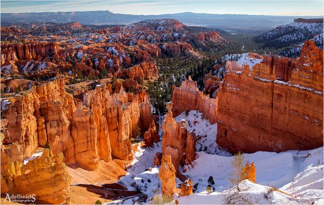
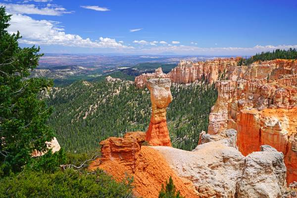
We spend the last days of 2016 enjoying a nice cold front that was moving into Bryce Canyon National Park. The whole park was shut down and other than some Asian tourists we had the whole park to ourselves. It was snowing pretty much the whole day for our first two days but on the third day as we got to sunset point in the morning we were greeted with crisp air and undisturbed layers and layers of snow over the beautiful geographic formations of the park. I made this shot of Thor’s hammer as the sun rose over the horizon, using one of the hoodoos to create a decent sun star.
Tele: 180mm
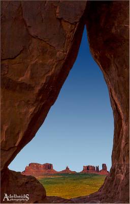
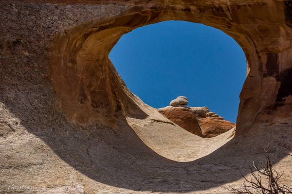
Being in Monument Valley in early December I was informed the sun doesn't hit Teardrop Arch at that time. I still wanted to see it though. Once there, I realised the next challenge was not being tall enough to peep through the hole, and not having a tripod that goes up so high. So this is a manual shot, with the camera held high above my head, and I'm quite pleased with how it turned out :-)
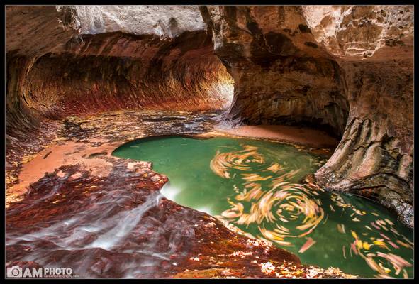
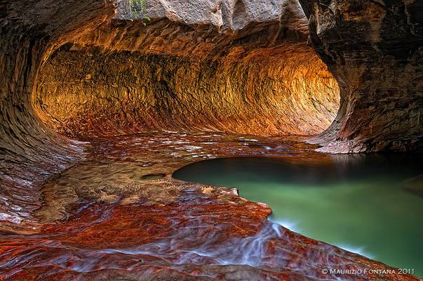
When I visited Zion National Park in 2011 one of the hikes that I absolutely loved was The Subway. In fact, I went so far as to call it my most...
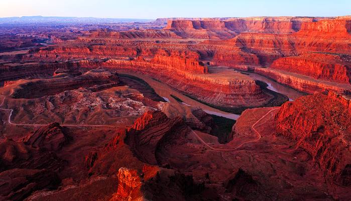
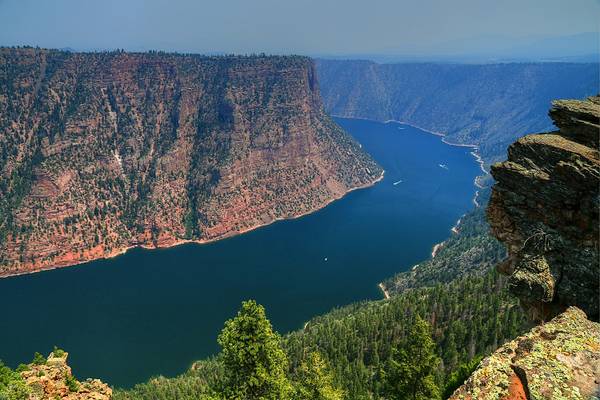
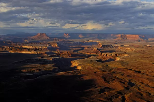
Dead Horse Point State Park is a state park of Utah in the United States, featuring a dramatic overlook of the Colorado River and Canyonlands National Park.
- Edward Hopper.
| facebook | 500px | ferpectshotz |
After our hike of antelope canyon we decided to try our luck and head back to monument valley, to get one more sunset shot. I had this location in mind for sunset but we slightly under estimated the distance and only reached here after sunset. When we reached at the famous 13 mile marker, it was almost completely dark with only a bit of light remaining in the far western sky.
It’s really hard to make sunset shots when it’s dark all around but you still have to use ND grad filters. This was the best shot of the bunch and it was a bit of work to get the foreground to brighten up. Thank you for visiting hope you enjoy the picture..
- Martin Luther.
| facebook | 500px | ferpectshotz |
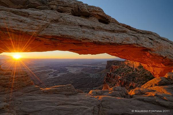
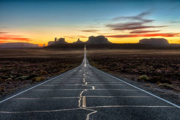
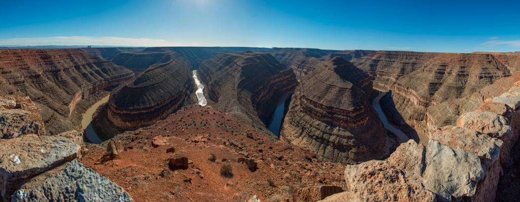
When we started our road trip to Utah, one of my missions was to see all the horseshoe bends which it was famous for. I had visited the original horseshoe bend in Arizona several times so wanted to see other locations in southwest where the river does the same thing. There are multiple locations within Utah where this happens actually. There is goosenecks overlook near Capitol Reef where Sulpher creek does a horse shoe bend. Then there is the Dead Horse Point state park where the Colorado river does some spectacular turns.
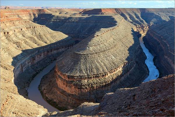
But the real stunner is the Goosenecks state park close to monument valley. Here the San Juan river is twisted around to roughly 25 horseshoe bends within a couple of miles (I counted by zooming into the location on google maps), even though only about 5 is visible from the view point. This is pano shot I created at the park, one of the rare moments I wished I had access to a drone.
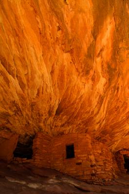
I just couldn't miss this location on my trip. A famous spot where morning sunlight gets reflected by sandstone to create an illusion of an house in red flames. Nice spot to enjoy, particularly if you're lucky and are alone here!
USA 2011 - Arches
USA 2011 - Zion Park
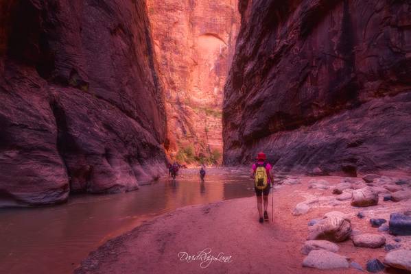
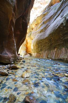
The "Narrows" are upstream from the main Zion Canyon, where the walls squeeze to slot canyon dimensions: 1,500 feet tall and as narrow as 30 feet wide in places. In these spots, the water flows from wall to wall so hiking it involves a lot of wading through the Virgin River
Zion National Park, Utah United States September 2016
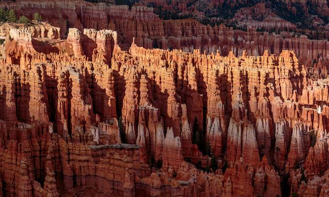
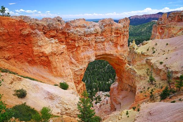
Bryce Canyon National Park
Arches National Park
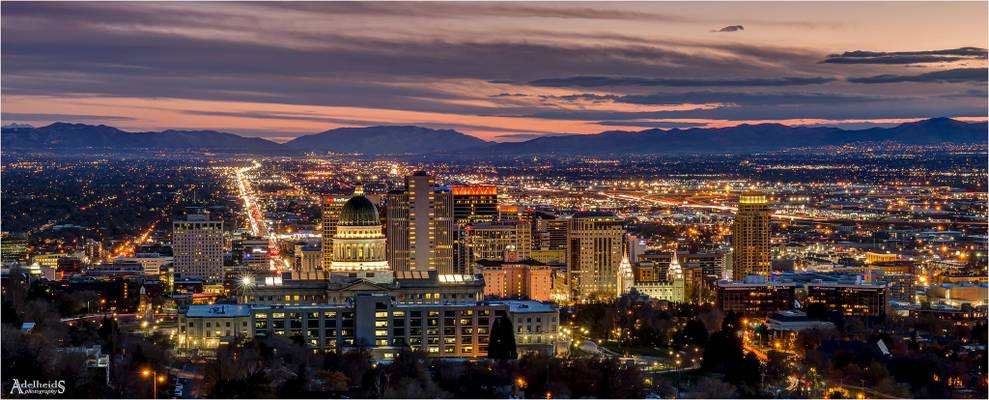
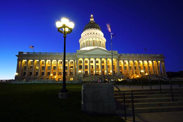
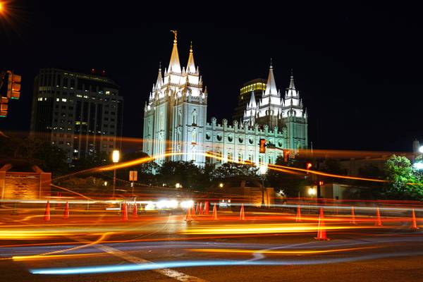
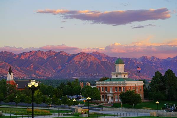
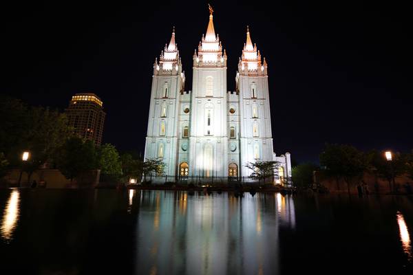
Starting a trip through Utah and Arizona by flying into SLC, gave me the opportunity to capture a blue hour there. There is an excellent spot, in a residential area where an empty plot gives you this view over the city.
Thanks to all Phoide contributors to Utah!
Most notably Andrey Sulitskiy, Sandeep Thomas, Maurizio Fontana, Yi Jiang, Adelheid Smitt, Matteo Rinaldi, David ruiz luna and Dominic Nessi.